Alvechurch

Settlement in Worcestershire Bromsgrove

England

Alvechurch

Lock Keeper's Reach, Withybed Green This small development of terraced houses beside the Worcester & Birmingham Canal is a gated community in the tiny hamlet of Withybed Green on the edge of Alvechurch. The name is a little odd - the nearest lock is at Tardebigge, a long reach indeed.
Lock Keeper's Reach, Withybed Green Credit: Stephen McKay

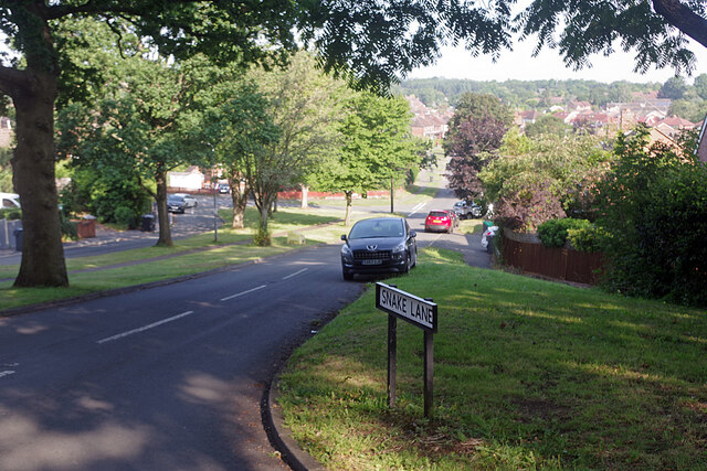
Alvechurch is a charming village located in the county of Worcestershire, England. Situated approximately 12 miles south of Birmingham, it rests in the beautiful Alvechurch Valley, surrounded by picturesque countryside and rolling hills. The village is part of the Bromsgrove district and has a population of around 4,600 residents.

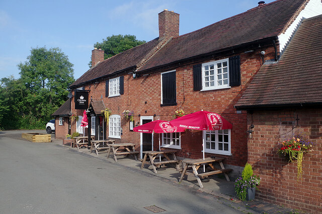
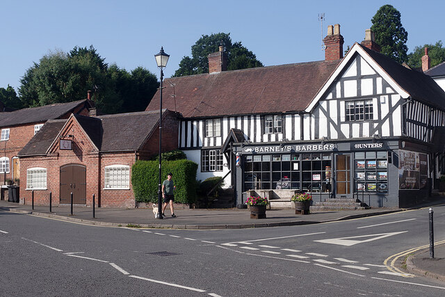
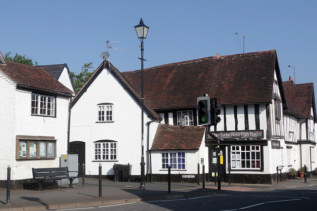
Alvechurch has a rich history that dates back to the 13th century, with many historic buildings still standing today. The St Laurence Church, a Grade I listed building, is an iconic landmark in the village and is known for its impressive architecture. The village also boasts several traditional thatched cottages and timber-framed houses, adding to its quaint and idyllic atmosphere.

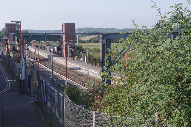
Despite its small size, Alvechurch offers a range of amenities and facilities for its residents. There are local shops, a post office, a primary school, and a medical practice, ensuring that the community's needs are well catered for. Additionally, the village has a railway station, providing easy access to Birmingham and other nearby towns.

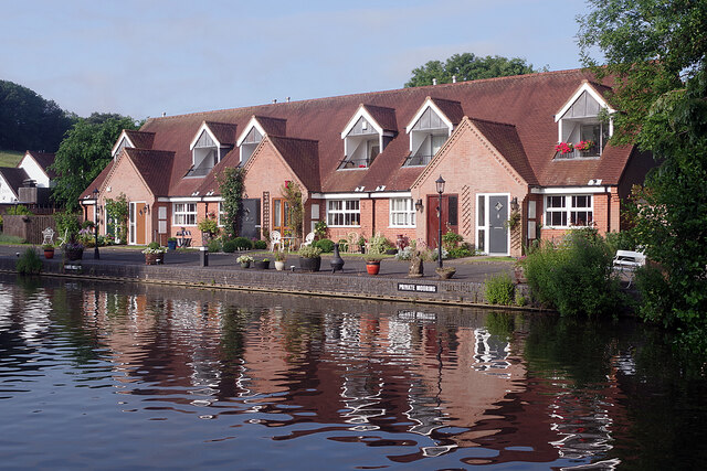
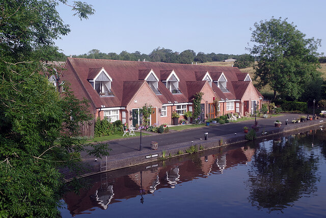
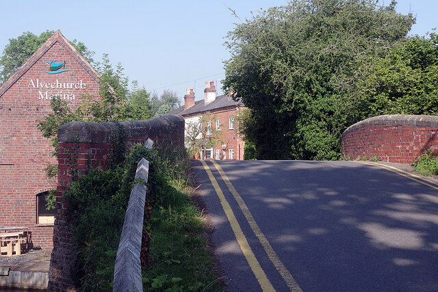
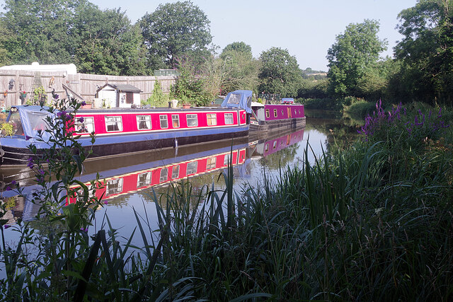
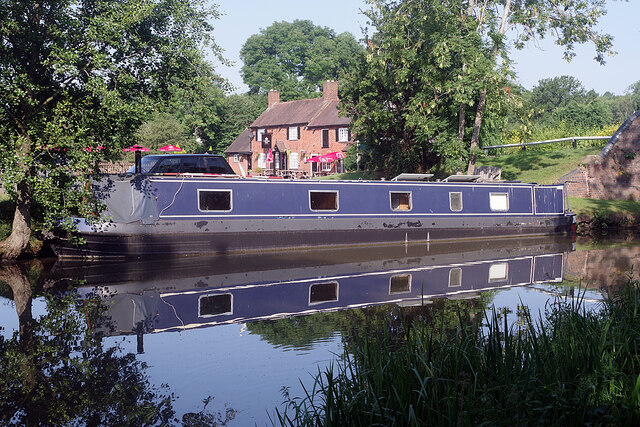
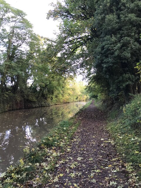
The surrounding countryside is a haven for nature lovers and outdoor enthusiasts. The Worcester and Birmingham Canal runs through the village, offering scenic walks and opportunities for boating and fishing. The Lickey Hills Country Park is also nearby, providing extensive trails for hiking, cycling, and horse riding.

Overall, Alvechurch is a delightful village that combines historical charm with modern conveniences. Its tranquil setting and close proximity to urban centers make it an appealing place to live for those seeking a balance between rural and urban lifestyles.

If you have any feedback on the listing, please let us know in the comments section below.
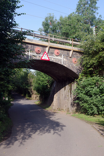
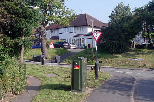
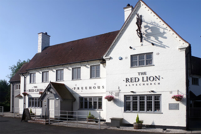
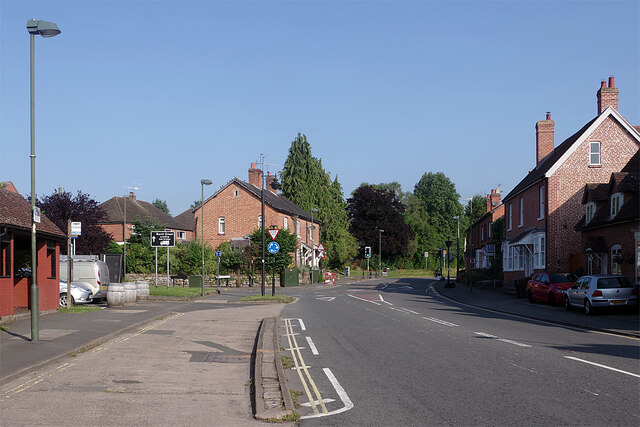
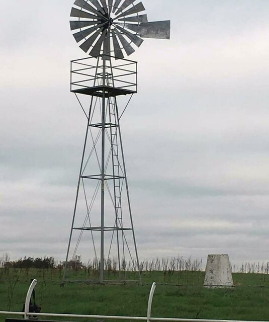
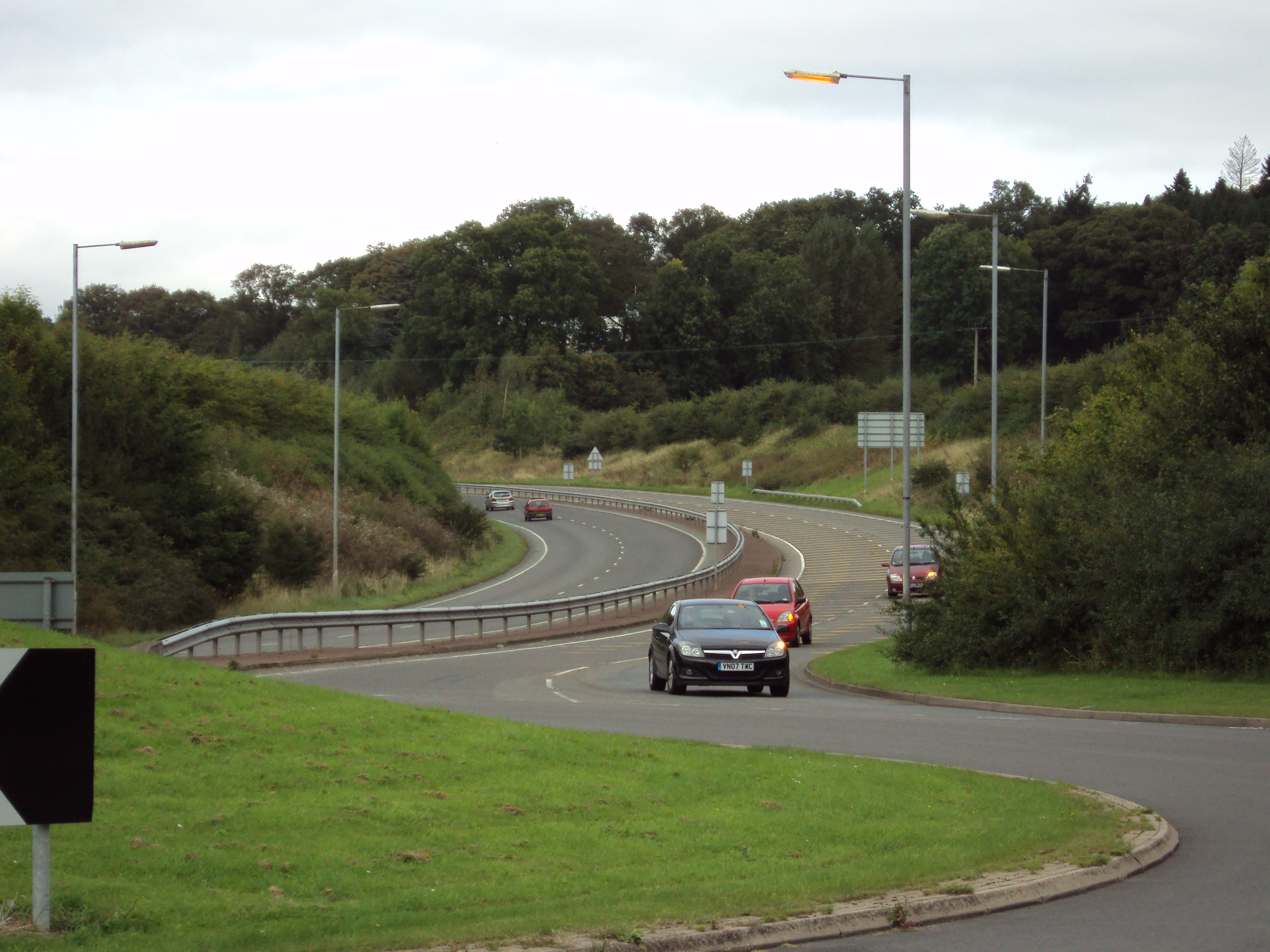
Alvechurch Images

Images are sourced within 2km of 52.351707/-1.959564 or Grid Reference SP0272. Thanks to Geograph Open Source API. All images are credited.

Lock Keeper's Reach, Withybed Green This small development of terraced houses beside the Worcester & Birmingham Canal is a gated community in the tiny hamlet of Withybed Green on the edge of Alvechurch. The name is a little odd - the nearest lock is at Tardebigge, a long reach indeed.
Lock Keeper's Reach, Withybed Green
This small development of terraced houses beside the Worcester & Birmingham Canal is a gated community in the tiny hamlet of Withybed Green on the edge of Alvechurch. The name is a little odd - the nearest lock is at Tardebigge, a long reach indeed.
Lock Keeper's Reach, Withybed Green This is the view from bridge 61 on the Worcester & Birmingham Canal of the same houses seen in this view: <a href="https://www.geograph.org.uk/photo/6927254">SP0172 : Lock Keeper's Reach, Withybed Green</a>.
Lock Keeper's Reach, Withybed Green
This is the view from bridge 61 on the Worcester & Birmingham Canal of the same houses seen in this view: SP0172 : Lock Keeper's Reach, Withybed Green.
The Crown Inn, Withybed Green The epitome of the country pub, the Crown is tucked away in Withybed Green, a hamlet on the edge of Alvechurch adjacent to the Worcester & Birmingham Canal. It was at one time a Mitchells & Butlers Ltd house.
The Crown Inn, Withybed Green
The epitome of the country pub, the Crown is tucked away in Withybed Green, a hamlet on the edge of Alvechurch adjacent to the Worcester & Birmingham Canal. It was at one time a Mitchells & Butlers Ltd house.
Withybed Lane, Alvechurch Withybed Lane leads to Withybed Green passing under the Redditch branch railway line.
Withybed Lane, Alvechurch
Withybed Lane leads to Withybed Green passing under the Redditch branch railway line.
Callow Hill Road, Alvechurch Seen from the junction with Tanyard Lane and Snake Lane, a substantial semi-detached house overlooks Callow Hill Road.
Callow Hill Road, Alvechurch
Seen from the junction with Tanyard Lane and Snake Lane, a substantial semi-detached house overlooks Callow Hill Road.
The Red Lion, Alvechurch Part of the Vintage Inns chain, the Red Lion is a substantial pub located on Red Lion Street.
The Red Lion, Alvechurch
Part of the Vintage Inns chain, the Red Lion is a substantial pub located on Red Lion Street.
Red Lion Street, Alvechurch This was once the main road between Redditch and Birmingham but Alvechurch is by-passed nowadays so things are much quieter. The bus stop on the left is outside the Red Lion pub.
Red Lion Street, Alvechurch
This was once the main road between Redditch and Birmingham but Alvechurch is by-passed nowadays so things are much quieter. The bus stop on the left is outside the Red Lion pub.
The Square, Alvechurch The Square forms the heart of this large Worcestershire village. The timber framed building, part of which is occupied by a barber's shop and an estate agent, is believed to be of 15th century origin, although much altered. To the left the Old Smithy dates from the mid-19th century. Both are grade II listed.
The Square, Alvechurch
The Square forms the heart of this large Worcestershire village. The timber framed building, part of which is occupied by a barber's shop and an estate agent, is believed to be of 15th century origin, although much altered. To the left the Old Smithy dates from the mid-19th century. Both are grade II listed.
The bottom of Bear Hill, Alvechurch The Tudor Rose Fish Bar occupies 2 Bear Hill at its junction with Red Lion Street. The timber framed building is of 15th century origin, underbuilt in the mid-19th century, and is grade II listed.
The bottom of Bear Hill, Alvechurch
The Tudor Rose Fish Bar occupies 2 Bear Hill at its junction with Red Lion Street. The timber framed building is of 15th century origin, underbuilt in the mid-19th century, and is grade II listed.
Snake Lane, Alvechurch The western part of Alvechurch was developed in the mid-20th century and Snake Lane, seen here from its junction with Bear Hill, forms the core of the area.
Snake Lane, Alvechurch
The western part of Alvechurch was developed in the mid-20th century and Snake Lane, seen here from its junction with Bear Hill, forms the core of the area.
Alvechurch Station Alvechurch is an intermediate stop on the branch between Barnt Green and Redditch. The station was originally opened in 1859 but came close to closure in the 1960s. In the end it remained open but with a minimal service and the ambience of a country halt. Later, services to Redditch were incorporated into Birmingham's cross-city line which brought about a significant improvement and the line was electrified in 1993 (when the station was re-sited slightly further north). Major change came about in 2014 when a passing loop was installed on the otherwise single track branch and an additional platform was built. This required the provision of a footbridge and lifts. Today trains run every 20 minutes in either direction - a frequency unimagineable at any other time in the station's history.
Alvechurch Station
Alvechurch is an intermediate stop on the branch between Barnt Green and Redditch. The station was originally opened in 1859 but came close to closure in the 1960s. In the end it remained open but with a minimal service and the ambience of a country halt. Later, services to Redditch were incorporated into Birmingham's cross-city line which brought about a significant improvement and the line was electrified in 1993 (when the station was re-sited slightly further north). Major change came about in 2014 when a passing loop was installed on the otherwise single track branch and an additional platform was built. This required the provision of a footbridge and lifts. Today trains run every 20 minutes in either direction - a frequency unimagineable at any other time in the station's history.
Scarfield Hill, Alvechurch Just beyond Alvechurch railway station Scarfield Hill crosses the Worcester & Birmingham canal by means of this bridge - numbered 60 on the canal system. This is the site of Alvechurch Marina, traditionally known as Scarfield Wharf, operated by ABC Leisure Group Ltd - one of the major names in canal boat hire and marina services (ABC originally stood for Alvechurch Boat Centres).
Scarfield Hill, Alvechurch
Just beyond Alvechurch railway station Scarfield Hill crosses the Worcester & Birmingham canal by means of this bridge - numbered 60 on the canal system. This is the site of Alvechurch Marina, traditionally known as Scarfield Wharf, operated by ABC Leisure Group Ltd - one of the major names in canal boat hire and marina services (ABC originally stood for Alvechurch Boat Centres).
Worcester & Birmingham Canal, Alvechurch Two moored narrowboats are reflected in the canal water between bridges 60 and 61.
Worcester & Birmingham Canal, Alvechurch
Two moored narrowboats are reflected in the canal water between bridges 60 and 61.
Worcester & Birmingham Canal, Withybed Green A narrowboat is reflected in the water by bridge 61 with a backdrop of the Crown Inn.
Worcester & Birmingham Canal, Withybed Green
A narrowboat is reflected in the water by bridge 61 with a backdrop of the Crown Inn.
Hopwood Park Service Area This is the location of a Tesla Supercharger Station, and two Model S's and Two Model 3 cars are being charged. There are 16 points, at 120/150Kw.
Hopwood Park Service Area
This is the location of a Tesla Supercharger Station, and two Model S's and Two Model 3 cars are being charged. There are 16 points, at 120/150Kw.
Hopwood Park Services
Worcester & Birmingham Canal
Cobley Hill trig
Cobley Hill trig
Show me another place!

Alvechurch is located at Grid Ref: SP0272 (Lat: 52.351707, Lng: -1.959564)

Administrative County: Worcestershire

District: Bromsgrove

Police Authority: West Mercia

What 3 Words

///second.inspector.hulk. Near Alvechurch, Worcestershire

Nearby Locations

Alvechurch

Related Wikis

Alvechurch

Alvechurch ( ALV-church) is a large village and civil parish in the Bromsgrove district in northeast Worcestershire, England, in the valley of the River...

Alvechurch Church of England Middle School

Alvechurch Church of England Middle School (formerly 'Alvechurch Church of England Primary School') is a coeducational Church of England middle school...

A441 road

A441 is an A-road in England which runs from central Birmingham to Cookhill, Worcestershire. == Route == The A441 starts on the A4540 The Middleway in...

Alvechurch F.C.

Alvechurch Football Club is a football club based in Alvechurch, Worcestershire, England. They are currently members of the Southern League Premier Division...

Nearby Amenities

Located within 500m of 52.351707,-1.959564
Mini Roundabout
Direction: clockwise
Lat/Long: 52.3531153/-1.9612276
Alvechurch
Place: village
Wikidata: Q1639867
Lat/Long: 52.3507123/-1.9579114
Crossing
Crossing: uncontrolled
Crossing Ref: zebra
Source: survey
Traffic Calming: table
Lat/Long: 52.3528744/-1.9638304
Post Box
Collection Times: Mo-Fr 17:00; Sa 10:15
Operator: Royal Mail
Operator Wikidata: Q638098
Post Box Type: pillar
Postal Code: B48
Ref: B48 223
Royal Cypher: EIIR
Royal Cypher Wikidata: Q33102113
Source: survey
Lat/Long: 52.3515955/-1.9600903
Telephone
Booth: K6
Covered: booth
Listed Status: Grade II
Operator: BT
Phone: +44 121 447 7635
Source: survey
Lat/Long: 52.3515822/-1.960053
Crossing
Crossing: traffic_signals
Source: survey
Lat/Long: 52.3519146/-1.9595881
Barrier: bollard
Foot: yes
Source: survey
Lat/Long: 52.3518714/-1.9597321
Fast Food
Tudor Rose Fish Bar
Cuisine: fish_and_chips
Source: survey
Lat/Long: 52.3519417/-1.9597276
Post Box
Postal Code: B48
Ref: B48 785
Source: survey
Lat/Long: 52.3522065/-1.9659398
Crossing
Crossing Island: yes
Crossing Ref: zebra
Source: survey
Lat/Long: 52.3533103/-1.961473
Addr City: Alvechurch
Addr Housenumber: 1
Addr Postcode: B48 7PF
Addr Street: Snake Terrace
Lat/Long: 52.3528632/-1.966103
Addr City: Alvechurch
Addr Housenumber: 6
Addr Postcode: B48 7PF
Addr Street: Snake Terrace
Lat/Long: 52.3527044/-1.965943
Bus Stop
Swan Street
Bus: yes
Naptan AtcoCode: 2000G013994
Naptan Bearing: NW
Naptan CommonName: Swan Street
Naptan Crossing: School Lane
Naptan Indicator: adj
Naptan NaptanCode: wocdtmat
Naptan Street: Swan Street
Public Transport: platform
Source: naptan_import
Lat/Long: 52.3492466/-1.9587316
Bus Stop
Red Lion
Bus: yes
Naptan AtcoCode: 2000G025800
Naptan Bearing: NW
Naptan CommonName: Red Lion
Naptan Indicator: Adj
Naptan Landmark: Red Lion Inn
Naptan NaptanCode: wocdwdmp
Naptan Street: Red Lion Street
Public Transport: platform
Route Ref: 146
Shelter: yes
Source: naptan_import
Lat/Long: 52.3528767/-1.9609985
Bus Stop
The Square
Bus: yes
Naptan AtcoCode: 2000G025801
Naptan Bearing: SE
Naptan CommonName: Square
Naptan Indicator: adj
Naptan NaptanCode: wocdwdmt
Naptan Street: Red Lion Street
Naptan Verified: no
Public Transport: platform
Source: naptan_import
Lat/Long: 52.3522621/-1.9596606
Bus Stop
Lye Meadows
Bus: yes
Naptan AtcoCode: 2000G502824
Naptan Bearing: N
Naptan CommonName: Lye Meadows
Naptan Indicator: opp
Naptan NaptanCode: wocgmtdj
Naptan Street: Redditch Road
Naptan Verified: no
Public Transport: platform
Source: naptan_import
Lat/Long: 52.347664/-1.9578669
Bus Stop
Swan Street
Bus: yes
Naptan AtcoCode: 2000G502825
Naptan Bearing: SE
Naptan CommonName: Swan Street
Naptan Crossing: School Lane
Naptan Indicator: opp
Naptan NaptanCode: wocgmtdm
Naptan Street: Swan Street
Naptan Verified: no
Public Transport: platform
Source: naptan_import
Lat/Long: 52.3487159/-1.9581008
Bus Stop
Lye Meadows
Bus: yes
Naptan AtcoCode: 2000G502827
Naptan Bearing: SW
Naptan CommonName: Lye Meadows
Naptan Indicator: adj
Naptan NaptanCode: wocdadga
Naptan Street: Redditch Road
Naptan Verified: no
Public Transport: platform
Source: naptan_import
Lat/Long: 52.3475896/-1.9577193
Bus Stop
Snake Lane
Bus: yes
Naptan AtcoCode: 2000G631004
Naptan Bearing: NW
Naptan CommonName: Snake Lane
Naptan Indicator: Adj
Naptan NaptanCode: wocdmgma
Naptan Street: Snake Lane
Naptan Verified: no
Public Transport: platform
Source: naptan_import
Lat/Long: 52.35182/-1.9653948
Atm
Operator: Link
Lat/Long: 52.3523032/-1.9592234
Toilets
Fee: no
Note: Radar
Wheelchair: yes
Lat/Long: 52.3521755/-1.96107
Gin and Pickles
Shop: alcohol
Lat/Long: 52.3521187/-1.9592894
Recycling
Recycling Glass: yes
Lat/Long: 52.3523354/-1.9612629
Heritage: 2
Heritage Operator: Historic England
Historic: memorial
Listed Status: Grade II
Source: visual survey;bing
Lat/Long: 52.3497652/-1.9624223
HE Ref: 1301009
Heritage: 2
Heritage Operator: Historic England
Historic: wayside_cross
Listed Status: Grade II
Source: visual survey;bing
Lat/Long: 52.349914/-1.9623608
Man Made: flagpole
Source: survey
Lat/Long: 52.3514374/-1.9605803
Shop: optician
Source: survey
Lat/Long: 52.3522053/-1.9591368
Cafe
Cafe Morso
Addr City: Alvechurch
Addr Housenumber: 9
Addr Postcode: B48 7LA
Addr Street: The Square
Fhrs Id: 738041
Lat/Long: 52.3515785/-1.9592618
Doctors
Medical Centre
Description: Medical Centre
Healthcare: doctor
Lat/Long: 52.3518469/-1.958854
Barber Daves
Shop: hairdresser
Lat/Long: 52.3513884/-1.959589
Dentist
Alvechurch Dental
Contact Facebook: https://www.facebook.com/alvechurchdental
Email: info@alvechurchdental.co.uk
Phone: +44 121 445 3600
Website: https://alvechurchdental.co.uk/
Lat/Long: 52.3518414/-1.9593951
Cafe
The Lounge/Youth Club
Lat/Long: 52.3521532/-1.9592132
Barrier: bollard
Lat/Long: 52.3539804/-1.9587674
Fixme: continues
Lat/Long: 52.3539811/-1.9583213
Fixme: continues
Lat/Long: 52.3541388/-1.9593926
Bench
Lat/Long: 52.3543167/-1.9582
Bench
Lat/Long: 52.3544073/-1.9579575
Floral Cheyne
Shop: florist
Lat/Long: 52.3515244/-1.9596581
Barneys Barbers
Shop: hairdresser
Lat/Long: 52.3516081/-1.9597393
Office: insurance
Lat/Long: 52.3515296/-1.9593668
Hunter's
Office: estate_agent
Lat/Long: 52.3516447/-1.9598428
Imanginations
Shop: hairdresser
Lat/Long: 52.3515036/-1.9602705
Lettings Agency
Office: estate_agent
Lat/Long: 52.3515283/-1.9602197
Roberts carpentry shop
Craft: carpenter
Lat/Long: 52.3513493/-1.9601572
Thomas's Funeral Director
Office: yes
Lat/Long: 52.3524941/-1.9597922
Red lion Garage
Shop: car
Lat/Long: 52.352734/-1.960154
Hopkin's car repairs
Shop: car_repair
Lat/Long: 52.3527948/-1.9599559
Clearcomm
Office: yes
Lat/Long: 52.3528386/-1.96033
C Fern Butchers
Shop: butcher
Lat/Long: 52.3530217/-1.9607584
Alvechurch Chiropractic Clinic
Lat/Long: 52.3530282/-1.960839
Village Green/Memorial Garden
Leisure: garden
Lat/Long: 52.3513557/-1.960755
Lloyds Chemist
Shop: chemist
Lat/Long: 52.3516164/-1.959119
Bus Stop
Snake Lane
Bus: yes
Public Transport: platform
Ref: wocdmgma
Lat/Long: 52.3504343/-1.9634301
Defibrillator
Emergency: defibrillator
Indoor: no
Note: on outside wall of village hall
Ref: 2919
Source: survey
Lat/Long: 52.3517435/-1.9601401
Bench
Backrest: yes
Source: survey
Lat/Long: 52.3517241/-1.9601767
Generator Method: photovoltaic
Generator Output Electricity: yes
Generator Source: solar
Generator Type: solar_photovoltaic_panel
Power: generator
Source: ESRI imagery
Lat/Long: 52.3485338/-1.9603032
Generator Method: photovoltaic
Generator Output Electricity: yes
Generator Source: solar
Generator Type: solar_photovoltaic_panel
Power: generator
Source: ESRI imagery
Lat/Long: 52.3513928/-1.9650708
Generator Method: photovoltaic
Generator Output Electricity: yes
Generator Source: solar
Generator Type: solar_photovoltaic_panel
Power: generator
Source: ESRI imagery
Lat/Long: 52.3514919/-1.9652505
Generator Method: photovoltaic
Generator Output Electricity: yes
Generator Source: solar
Generator Type: solar_photovoltaic_panel
Location: roof
Power: generator
Lat/Long: 52.3485682/-1.9627976
Generator Method: photovoltaic
Generator Output Electricity: yes
Generator Source: solar
Generator Type: solar_photovoltaic_panel
Location: roof
Power: generator
Lat/Long: 52.3499789/-1.9601235
Generator Method: photovoltaic
Generator Output Electricity: yes
Generator Source: solar
Generator Type: solar_photovoltaic_panel
Location: roof
Power: generator
Lat/Long: 52.3511585/-1.9639738
Generator Method: photovoltaic
Generator Output Electricity: yes
Generator Source: solar
Generator Type: solar_photovoltaic_panel
Location: roof
Power: generator
Lat/Long: 52.3509398/-1.9637203
Bench
Lat/Long: 52.3513739/-1.9606457
Bench
Lat/Long: 52.3517826/-1.9594575
Bench
Lat/Long: 52.3518339/-1.9596802
Bench
Lat/Long: 52.35158/-1.9594148
Power: pole
Ref: 776259
Transformer: distribution
Lat/Long: 52.3474991/-1.9591391
Power: pole
Ref: 720683
Source: wpd_opendata
Transformer: distribution
Lat/Long: 52.3545604/-1.9541998
Power: pole
Ref: 720427
Source: wpd_opendata
Transformer: distribution
Lat/Long: 52.352547/-1.9588307
Power: pole
Source: bing
Lat/Long: 52.353113/-1.9576505
Power: pole
Ref: 720684
Source: wpd_opendata
Transformer: distribution
Lat/Long: 52.3536061/-1.9565535
Power: pole
Source: bing
Lat/Long: 52.3542336/-1.9559124
Power: pole
Source: bing
Lat/Long: 52.3548807/-1.955274
Defibrillator
Access: yes
Defibrillator Location: On outside wall, facing the field
Emergency: defibrillator
Indoor: no
Lat/Long: 52.3544234/-1.9609461
Waterway: weir
Lat/Long: 52.3521807/-1.9631166
The data included in this document is from www.openstreetmap.org. The data is made available under ODbL.

Have you been to Alvechurch?

Leave your review of Alvechurch below (or comments, questions and feedback).