Alvaston

Settlement in Derbyshire

England

Alvaston

Fallen tree in the lake In the far western end of the Elveston Castle lake.  Taken through the balustrade of the concrete footbridge.
Fallen tree in the lake Credit: David Lally

Alvaston is a suburban area located in the city of Derby, in the county of Derbyshire, England. Situated on the eastern bank of the River Derwent, it is approximately three miles southeast of the city center. Alvaston is primarily a residential area, known for its quiet and family-friendly atmosphere.

The area has a rich history, with evidence of human habitation dating back to the Bronze Age. It was mentioned in the Domesday Book of 1086 and has since evolved into a thriving community. Alvaston Park, a large green space with a lake and playgrounds, is a popular recreational spot for residents and visitors alike. The park also hosts various events throughout the year, including music festivals and fairs.

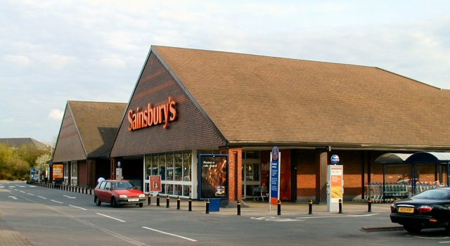
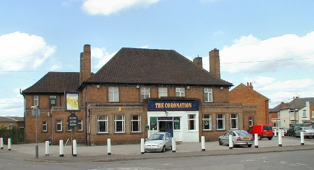
Alvaston is well-served by local amenities, including shops, supermarkets, and schools. The area benefits from good transport links, with regular bus services connecting it to Derby city center and other nearby towns. The A6 road, a major route in the region, passes through Alvaston, providing easy access to other parts of Derbyshire and beyond.

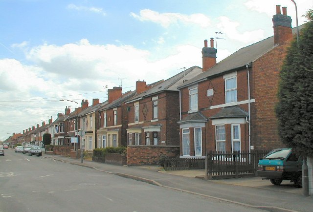
In terms of housing, Alvaston offers a mix of property types, ranging from Victorian and Edwardian homes to more modern developments. The area has seen significant growth in recent years, with new housing estates being built to meet the demand for housing.

Overall, Alvaston is a pleasant and convenient place to live, offering a peaceful residential environment with easy access to amenities and transport links.

If you have any feedback on the listing, please let us know in the comments section below.
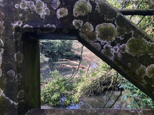
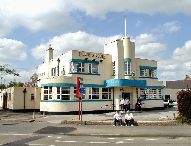
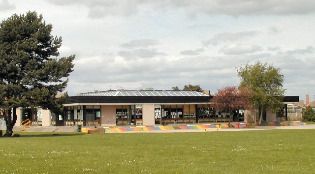
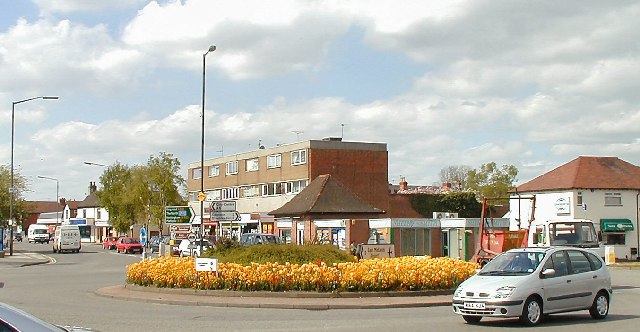
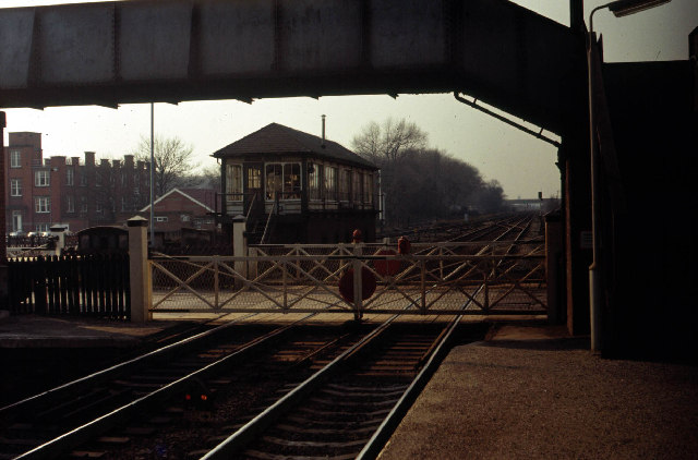
Alvaston Images

Images are sourced within 2km of 52.899772/-1.423896 or Grid Reference SK3833. Thanks to Geograph Open Source API. All images are credited.

Fallen tree in the lake In the far western end of the Elveston Castle lake.  Taken through the balustrade of the concrete footbridge.
Fallen tree in the lake
In the far western end of the Elveston Castle lake. Taken through the balustrade of the concrete footbridge.
Sainsbury's, Chaddesden, Derby Largest property in this square.  For those who like to know, circulation is anticlockwise.
Sainsbury's, Chaddesden, Derby
Largest property in this square. For those who like to know, circulation is anticlockwise.
Alvaston Park, Derby
Wilmorton College, Derby Seen from Alvaston Park
Wilmorton College, Derby
Seen from Alvaston Park
Factory Buildings Part of the industrial area alongside Raynesway, Derby, seen here from across the River Derwent, looking East.
Factory Buildings
Part of the industrial area alongside Raynesway, Derby, seen here from across the River Derwent, looking East.
The Coronation, Crewton, Derby
Baker Street, Crewton, Derby Looking from in front of "The Coronation"
Baker Street, Crewton, Derby
Looking from in front of "The Coronation"
Blue Peter An interesting 30's style building, which gives its name to the adjacent roundabout on Derby's ring road.
Blue Peter
An interesting 30's style building, which gives its name to the adjacent roundabout on Derby's ring road.
Footbridge on Alvaston Bypass According to the Highways Agency, this is supposed to represent a gateway to Derby
Footbridge on Alvaston Bypass
According to the Highways Agency, this is supposed to represent a gateway to Derby
Textile Factory In Spondon, Derby, seen from the South.
Textile Factory
In Spondon, Derby, seen from the South.
Oakwood Infant School, Derby
Newsagent & The Needles Looking N along Bembridge Drive, Derby
Newsagent & The Needles
Looking N along Bembridge Drive, Derby
"County Battery" island On Derby ring road, looking N.  Sponsor the planting and the roundabout can be yours ;-)
"County Battery" island
On Derby ring road, looking N. Sponsor the planting and the roundabout can be yours ;-)
Spondon Station Signal Box and Level Crossing View is looking west towards Derby.
Spondon Station Signal Box and Level Crossing
View is looking west towards Derby.
Spondon level crossing South of the village where an unnamed road crosses the Derby-Nottingham line next to the railway station and the entrance to the Acordis chemical plant. Taken from the passenger overbridge looking due west. The gates and signal box from an earlier photo on this site have now been replaced by these full barriers monitored by CCTV.
Spondon level crossing
South of the village where an unnamed road crosses the Derby-Nottingham line next to the railway station and the entrance to the Acordis chemical plant. Taken from the passenger overbridge looking due west. The gates and signal box from an earlier photo on this site have now been replaced by these full barriers monitored by CCTV.
Spondon Station Spondon station on Christmas Day 2006.  The station buildings have recently been refurbished for private business and residential use.  Whilst sad that they are no longer used for the railway they are certainly a big improvement on the dilapidated state they were in previously.  No chance of any trains today - the flashing 'stop' lights attached to the rails behind the photographer indicate a maintenance track possession over the holiday period.
Spondon Station
Spondon station on Christmas Day 2006. The station buildings have recently been refurbished for private business and residential use. Whilst sad that they are no longer used for the railway they are certainly a big improvement on the dilapidated state they were in previously. No chance of any trains today - the flashing 'stop' lights attached to the rails behind the photographer indicate a maintenance track possession over the holiday period.
Southgate Youth Club, Brighton Rd, Alvaston Originally a boarding school, this has been a youth club since at least the early seventies.
Southgate Youth Club, Brighton Rd, Alvaston
Originally a boarding school, this has been a youth club since at least the early seventies.
Alvaston Methodist Church, Brighton Road, Alvaston Don't really know much about this church only that it's always been there. The only striking feature is that it's in the middle of a row of terraced houses; the houses were probably there first, which begs the question, "What was there before the church?"
Alvaston Methodist Church, Brighton Road, Alvaston
Don't really know much about this church only that it's always been there. The only striking feature is that it's in the middle of a row of terraced houses; the houses were probably there first, which begs the question, "What was there before the church?"
Show me another place!

Alvaston is located at Grid Ref: SK3833 (Lat: 52.899772, Lng: -1.423896)

Unitary Authority: Derby

Police Authority: Derbyshire

What 3 Words

///serve.firm.book. Near Borrowash, Derbyshire

Nearby Locations

Alvaston

Related Wikis

Alvaston

Alvaston (/ˈɒlvəstən/ or /ˈælvəstən/) is a village and ward of Derby, England. Alvaston is on the A6 three miles south-east of Derby city centre and probably...

Boulton, Derby

Boulton is a suburb and former local government ward of the city of Derby, England, and is located about four miles to the south-east of Derby city centre...

British Celanese

British Celanese was a chemical company based in England. Formed in 1916, it survived as an independent company until 1957 when it became a subsidiary...
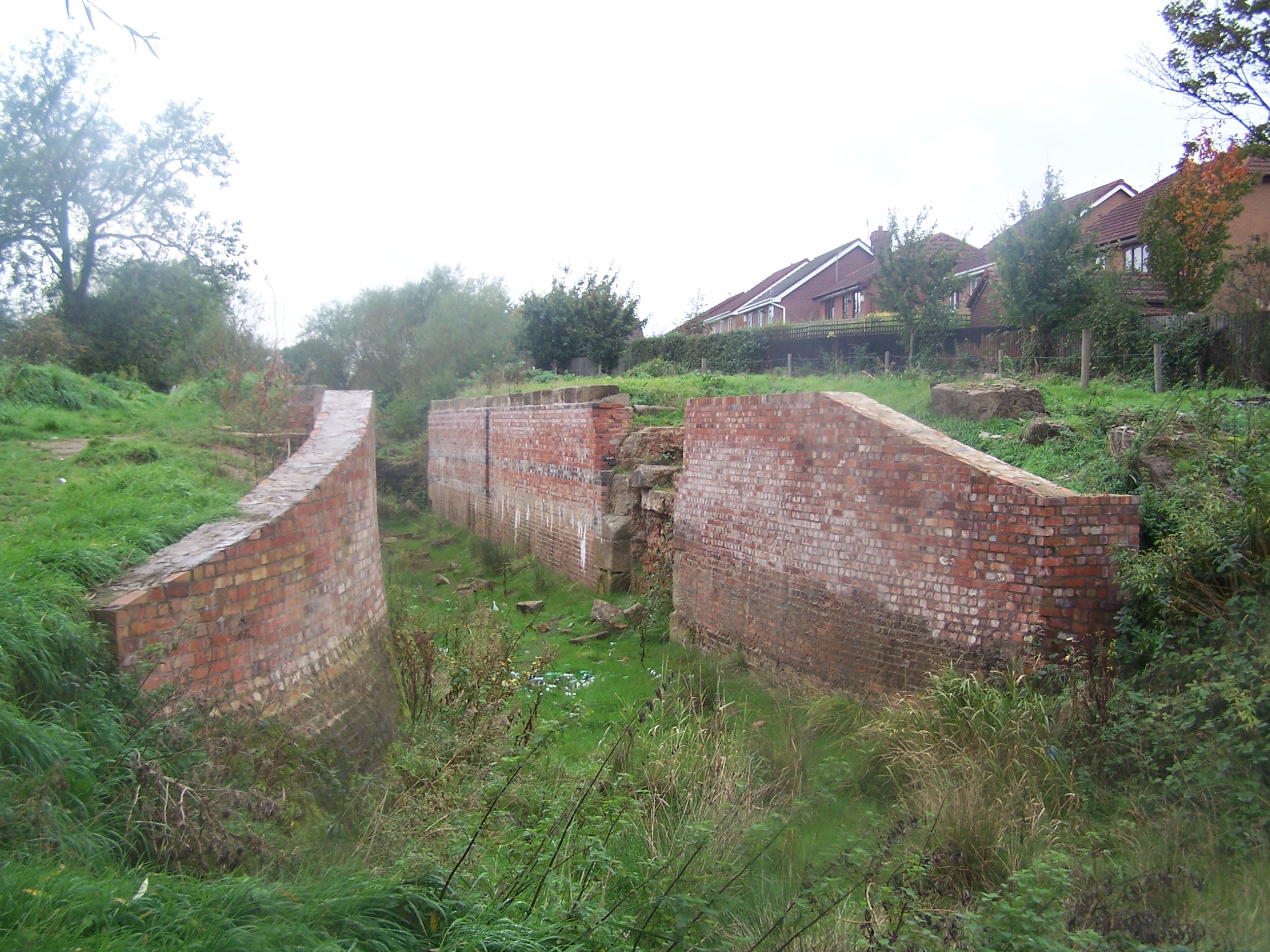
Derby Canal

The Derby Canal ran 14 miles (23 km) from the Trent and Mersey Canal at Swarkestone to Derby and Little Eaton, and to the Erewash Canal at Sandiacre, in...

Nearby Amenities

Located within 500m of 52.899772,-1.423896
Motorway Junction
Raynesway Park
Lat/Long: 52.9018324/-1.4277419
Exit To: Ring road A5111;Littleover;Allenton;Moorways Centre
Lat/Long: 52.8970556/-1.4284583
Vape HQ
Addr City: Derby
Addr Country: GB
Addr Postcode: DE24 0JG
Addr Street: Shardlow Road
Addr Suburb: Alvaston
Shop: e-cigarette
Lat/Long: 52.8968861/-1.4280682
Alvaston
Place: suburb
Wikidata: Q4737923
Wikipedia: en:Alvaston
Lat/Long: 52.8973823/-1.4275731
Raynesway Park
Place: locality
Lat/Long: 52.9025946/-1.4271444
Traffic Signals
Crossing: traffic_signals
Crossing Ref: pelican
Lat/Long: 52.8965138/-1.4283203
Motorway Junction
Raynesway Park
Lat/Long: 52.9003525/-1.4220288
Addr City: Derby
Addr Housenumber: 1270
Addr Postcode: DE24 8QP
Addr Street: London Road
Old Brand: The Co-operative Food
Old Brand Wikidata: Q3277439
Old Brand Wikipedia: en:Co-op Food
Old Fhrs Id: 695888
Old Name: The Co-operative Food
Old Name 2: Simply Local
Shop: vacant
Was Brand: Simply Local
Lat/Long: 52.8970837/-1.4293869
Pharmacy
Boots
Addr City: Derby
Addr Country: GB
Addr Postcode: DE24 0JH
Addr Street: Shardlow Road
Addr Suburb: Alvaston
Brand: Boots
Brand Wikidata: Q6123139
Brand Wikipedia: en:Boots (company)
Fhrs Id: 712456
Healthcare: pharmacy
Website: https://www.boots.com/stores/1805-derby-alvaston-shardlow-de24-0jg
Lat/Long: 52.8968278/-1.4280052
Library
Alvaston Library
Lat/Long: 52.8971678/-1.4299662
Bus Stop
Blue Peter
Bus: yes
Naptan AtcoCode: 1090DASB3619
Naptan NaptanCode: dbyadapt
Public Transport: platform
Lat/Long: 52.8963163/-1.4278641
Exit To: City Centre A6
Lat/Long: 52.8970977/-1.4288361
Crossing
Crossing: traffic_signals
Crossing Ref: pelican
Lat/Long: 52.8974736/-1.4283808
Traffic Signals
Crossing: traffic_signals
Lat/Long: 52.9002151/-1.4265431
Traffic Signals
Crossing: traffic_signals
Lat/Long: 52.9003176/-1.4264981
Traffic Signals
Lat/Long: 52.8998731/-1.426453
Turning Circle
Lat/Long: 52.896882/-1.4225876
Barrier: cycle_barrier
Maxwidth Physical: 1.3
Lat/Long: 52.899594/-1.4205679
Turning Circle
Lat/Long: 52.8974002/-1.4270595
Turning Circle
Lat/Long: 52.8978074/-1.426729
Post Box
Brand: Royal Mail
Brand Wikidata: Q638098
Operator: Royal Mail
Operator Wikidata: Q638098
Ref: DE24 253
Lat/Long: 52.8967846/-1.4280924
Crossing
Crossing: traffic_signals
Crossing Ref: pelican
Lat/Long: 52.8974734/-1.428569
Ele: 34.0000000
Lat/Long: 52.900018/-1.4272883
Fast Food
Alvaston Fast Food Curry Takeaway
Addr City: Derby
Addr Housenumber: 1285
Addr Postcode: DE24 8QN
Addr Street: London Road
Ele: 35
Fhrs Id: 1154605
Old Fhrs Id: 352222
Takeaway: yes
Lat/Long: 52.8975528/-1.4298755
Traffic Signals
Crossing: traffic_signals
Crossing Ref: toucan
Lat/Long: 52.8996441/-1.4262915
Traffic Signals
Crossing: traffic_signals
Crossing Ref: toucan
Lat/Long: 52.9021823/-1.425644
Traffic Signals
Crossing: traffic_signals
Crossing Ref: toucan
Lat/Long: 52.8997467/-1.4265257
Traffic Signals
Crossing: traffic_signals
Crossing Ref: toucan
Lat/Long: 52.9002252/-1.4261194
Traffic Signals
Crossing: traffic_signals
Crossing Ref: toucan
Lat/Long: 52.9022212/-1.4258261
Post Box
Collection Times: Mo-Fr 09:00; Sa 07:00
Operator: Royal Mail
Operator Wikidata: Q638098
Post Box Type: lamp
Ref: DE24 178D
Lat/Long: 52.8976502/-1.4217897
Give Way
Direction: forward
Lat/Long: 52.8989546/-1.4266176
Lighthouse
Shop: charity
Source: survey
Lat/Long: 52.8975202/-1.4293964
Euro Plus
Addr City: Derby
Addr Housenumber: 1289
Addr Postcode: DE24 8QN
Addr Street: London Road
Old Name: Alvaston Booze
Shop: alcohol
Source: survey
Lat/Long: 52.897535/-1.4295006
Post Office
Alvaston Post Office
Addr City: Derby
Addr Country: GB
Addr Housenumber: 19
Addr Postcode: DE24 0JG
Addr Street: Shardlow Road
Addr Suburb: Alvaston
Atm: yes
Brand: Post Office
Brand Wikidata: Q1783168
Ref Pol Id: 123265
Website: https://www.postoffice.co.uk/branch-finder/4632079/alvaston
Lat/Long: 52.8965244/-1.4277109
Bicycle Parking
Capacity: 4
Lat/Long: 52.9015522/-1.4249338
Bicycle Parking
Bicycle Parking: stands
Capacity: 2
Lat/Long: 52.896936/-1.4282842
Vivid Ink
Addr City: Derby
Addr Country: GB
Addr Housenumber: 7
Addr Postcode: DE24 0JG
Addr Street: Shardlow Road
Addr Suburb: Alvaston
Old Name: Mercian Cycles
Shop: tattoo
Website: https://vividinktattoos.co.uk/derby/
Lat/Long: 52.8967841/-1.427973
Cancer Research UK
Addr City: Derby
Addr Country: GB
Addr Housenumber: 21
Addr Postcode: DE24 0JG
Addr Street: Shardlow Road
Addr Suburb: Alvaston
Brand: Cancer Research UK
Brand Wikidata: Q326079
Brand Wikipedia: en:Cancer Research UK
Shop: charity
Lat/Long: 52.896464/-1.4276734
Rams Barber
Addr City: Derby
Addr Country: GB
Addr Housenumber: 15
Addr Postcode: DE24 0JG
Addr Street: Shardlow Road
Addr Suburb: Alvaston
Building: commercial
Shop: hairdresser
Lat/Long: 52.8964115/-1.4276166
Shardlow Mini Market
Addr City: Derby
Addr Housenumber: 6
Addr Postcode: DE24 0JH
Addr Street: Shardlow Road
Fhrs Id: 1557846
Old Fhrs Id: 577441
Old Name: C T D News
Shop: convenience
Lat/Long: 52.8967292/-1.4287483
Birds
Addr City: Derby
Addr Housenumber: 5
Addr Postcode: DE24 0JH
Addr Street: Shardlow Road
Brand: Birds
Brand Wikidata: Q63001935
Brand Wikipedia: en:Birds Bakery
Fhrs Id: 216072
Not Addr Postcode: DE24 0JG
Official Name: Birds Bakery
Shop: bakery
Lat/Long: 52.8966269/-1.4286642
Traffic Signals
Crossing: traffic_signals
Crossing Ref: pelican
Lat/Long: 52.8964925/-1.4280958
Abbey Street
Addr City: Derby
Addr Housenumber: 7-8
Addr Postcode: DE24 0JH
Addr Street: Shardlow Road
Note: RSPCA Abbey Street Aninal Rehoming Centre
Shop: charity
Lat/Long: 52.8965923/-1.4286303
Note: Was The Florist
Old Name: The Florist
Shop: vacant
Lat/Long: 52.8966751/-1.428695
Family Shopper
Addr City: Derby
Addr Housenumber: 4
Addr Postcode: DE24 0JH
Addr Street: Shardlow Road
Fhrs Id: 1617810
Shop: convenience
Lat/Long: 52.8967741/-1.4289194
Fast Food
Imperial Dragon
Addr City: Derby
Addr Housenumber: 2A
Addr Postcode: DE24 0JH
Addr Street: Shardlow Road
Cuisine: chinese
Fhrs Id: 1526758
Old Fhrs Id: 643038
Lat/Long: 52.8968104/-1.4289544
Atm
Lat/Long: 52.8971076/-1.4291477
Addr City: Derby
Addr Housenumber: 2
Addr Postcode: DE24 0JH
Addr Street: Shardlow Road
Disused Amenity: fast_food
Old Fhrs Id: 997069
Old Name: Kings Desserts
Lat/Long: 52.8968316/-1.4289951
Bench
Lat/Long: 52.8971428/-1.4290957
Telephone
Booth: KX100
Covered: booth
Mapillary: 492715941930294
Survey Date: 2019-11-09
Lat/Long: 52.8972169/-1.4292568
E-Liquid Paradise
Addr City: Derby
Addr Street: London Road
Shop: e-cigarette
Lat/Long: 52.8973739/-1.4289587
Turning Circle
Lat/Long: 52.8975036/-1.4193301
Crossing
Lat/Long: 52.8972173/-1.4282947
Traffic Calming: table
Lat/Long: 52.8968903/-1.4281537
Traffic Calming: table
Lat/Long: 52.8975299/-1.4297581
Island Convenience Store
Addr City: Derby
Addr Housenumber: 2
Addr Postcode: DE24 0DU
Addr Street: Raynesway
Brand: Premier
Brand Wikidata: Q7240340
Fhrs Id: 1667911
Note: Part of petrol station
Old Fhrs Id: 960126
Shop: convenience
Source: survey
Website: https://www.premier-stores.co.uk/our-stores/island-convenience-store
Lat/Long: 52.8970735/-1.4281381
Barrier: motorcycle_barrier
Bicycle: yes
Foot: yes
Maxwidth Physical: 0.56
Lat/Long: 52.8996039/-1.4207278
Bus Stop
Bus: yes
Public Transport: platform
Lat/Long: 52.89853/-1.4226737
Give Way
Direction: forward
Lat/Long: 52.8990372/-1.4265562
Turning Circle
Lat/Long: 52.8975992/-1.4190524
Bench
Source: survey
Lat/Long: 52.9029167/-1.4233761
Fast Food
Domino's
Addr City: Derby
Addr Country: GB
Addr Housenumber: 17
Addr Postcode: DE24 0JG
Addr Street: Shardlow Road
Addr Suburb: Alvaston
Brand: Domino's
Brand Wikidata: Q839466
Brand Wikipedia: en:Domino's Pizza
Contact Website: https://www.dominos.co.uk/pizza-near-me/derby/17-shardlow-road
Cuisine: pizza
Fhrs Id: 1063632
Takeaway: yes
Lat/Long: 52.8966126/-1.4278014
Michael's Drink Store
Addr City: Derby
Addr Country: GB
Addr Housenumber: 15
Addr Postcode: DE24 0JG
Addr Street: Shardlow Road
Addr Suburb: Alvaston
Fhrs Id: 679620
Shop: alcohol
Lat/Long: 52.8966563/-1.4278511
Sir's Barber Shop
Addr City: Derby
Addr Postcode: DE24 8QN
Addr Street: London Road
Shop: hairdresser
Lat/Long: 52.8973909/-1.4290768
Card Zone
Addr City: Derby
Addr Country: GB
Addr Housenumber: 11A
Addr Postcode: DE24 0JG
Addr Street: Shardlow Road
Addr Suburb: Alvaston
Shop: gift
Lat/Long: 52.8967187/-1.4279101
A&J Hair
Shop: hairdresser
Lat/Long: 52.8976644/-1.4304191
Clive Allen & Sons Bathrooms
Addr City: Derby
Addr Housenumber: 1283
Addr Postcode: DE24 8QN
Addr Street: London Road
Shop: bathroom_furnishing
Lat/Long: 52.8976182/-1.4301456
Bright
Addr City: Derby
Addr Postcode: DE24 8QN
Addr Street: London Road
Note: Was Sun Sand & Special Needs both this shop and the one in Spondon closed in May 2019
Old Name: SSSN
Shop: dry_cleaning
Lat/Long: 52.8975657/-1.4300208
Bench
Lat/Long: 52.8974151/-1.4291868
Parkgate Mobility
Addr City: Derby
Shop: mobility
Lat/Long: 52.8975454/-1.4295595
Spondon Dry Cleaning
Shop: dry_cleaning
Lat/Long: 52.8976595/-1.4303038
Barrier: bollard
Width: 1.25
Lat/Long: 52.9023695/-1.4222015
Honest & Down To Earth Part 1
Artist Name: DUFI-ART
Material: steel
Start Date: December 2014
Tourism: artwork
Lat/Long: 52.8959663/-1.4274254
Treeline
Artist Name: DUFI-ART
Material: steel
Start Date: December 2014
Tourism: artwork
Lat/Long: 52.8962415/-1.4279754
Give Way
Lat/Long: 52.8958654/-1.4271607
Give Way
Lat/Long: 52.8959382/-1.4272191
Traffic Calming: table
Lat/Long: 52.8962952/-1.427635
Give Way
Direction: backward
Lat/Long: 52.8988575/-1.4267032
Give Way
Direction: backward
Lat/Long: 52.8989983/-1.4265838
Give Way
Direction: backward
Lat/Long: 52.8990954/-1.4265167
Waste Basket
Lat/Long: 52.8970086/-1.4281556
Bicycle Repair Station
Opening Hours: 24/7
Service Bicycle Pump: yes
Lat/Long: 52.896702/-1.4280483
Bicycle Parking
Access: yes
Bicycle Parking: stands
Capacity: 1
Fee: no
Lit: no
Opening Hours: 24/7
Supervised: no
Lat/Long: 52.896715/-1.4280523
Addr City: Derby
Addr Country: GB
Addr Housenumber: 11
Addr Postcode: DE24 0JG
Addr Street: Shardlow Road
Addr Suburb: Alvaston
Old Name: Thorntons
Shop: vacant
Lat/Long: 52.8966859/-1.4278914
Waste Basket
Lat/Long: 52.8960135/-1.4273898
SGS Engineering
Addr City: Derby
Addr Housename: West Side Park
Addr Postcode: DE21 7AZ
Addr Street: Belmore Way
Addr Unit: 1
Shop: hardware
Website: https://www.sgs-engineering.com/
Lat/Long: 52.9017956/-1.429052
Raynesway Tile Warehouse
Addr City: Derby
Addr Housename: Raynesway Park Industrial Estate
Addr Postcode: DE21 7BH
Addr Street: Raynesway
Addr Unit: 6
Opening Hours: Mo-Fr 07:30-17:30; Sa 08:30-16:00; Su 10:00-14:00
Shop: tiles;bathroom_furnishing
Website: https://www.rtwderby.co.uk/
Lat/Long: 52.9022111/-1.4276379
Traffic Signals
Traffic Signals Direction: forward
Lat/Long: 52.8975036/-1.4283648
Traffic Signals
Traffic Signals Direction: forward
Lat/Long: 52.8974381/-1.4285931
Raynesway Chiropody
Addr City: Derby
Addr Housenumber: 1
Addr Postcode: DE24 0DW
Addr Street: Raynesway
Healthcare: podiatrist
Lat/Long: 52.8974894/-1.4288392
Fast Food
Subway
Addr City: Derby
Addr Housenumber: 1278
Addr Postcode: DE24 8QP
Addr Street: London Road
Brand: Subway
Brand Wikidata: Q244457
Brand Wikipedia: en:Subway (restaurant)
Contact Website: https://restaurants.subway.com/united-kingdom/en/derby/1278-london-road-alvaston
Cuisine: sandwich
Fhrs Id: 1334051
Old Fhrs Id: 1074042
Takeaway: yes
Lat/Long: 52.8969524/-1.4292358
One Call Commercial
Addr City: Derby
Addr Housenumber: 1282
Addr Postcode: DE24 8QP
Addr Street: London Road
Office: insurance
Lat/Long: 52.8969184/-1.4291741
Fast Food
Alvaston Kebabs & Tandoori
Addr City: Derby
Addr Housenumber: 1286
Addr Postcode: DE24 8QP
Addr Street: London Road
Cuisine: kebab
Fhrs Id: 1690158
Lat/Long: 52.8968909/-1.4291204
Age UK
Addr City: Derby
Addr Housenumber: 10
Addr Postcode: DE24 0JH
Addr Street: Shardlow Road
Brand: Age UK
Brand Wikidata: Q4691850
Brand Wikipedia: en:Age UK
Shop: charity
Lat/Long: 52.8965495/-1.4286001
Card Factory
Addr City: Derby
Addr Housenumber: 1266-1268
Addr Postcode: DE24 8QP
Addr Street: London Road
Brand: Card Factory
Brand Wikidata: Q5038192
Brand Wikipedia: en:Card Factory
Fhrs Id: 925190
Shop: gift
Lat/Long: 52.8971123/-1.4294786
Fast Food
Spice Hut
Addr City: Derby
Addr Housenumber: 1264
Addr Postcode: DE24 8QP
Addr Street: London Road
Cuisine: indian
Drive Through: no
Fhrs Id: 215524
Website: https://spicehutderby.com
Lat/Long: 52.897135/-1.4295671
Cafe
Unity Cafe
Addr City: Derby
Addr Housenumber: 1262
Addr Postcode: DE24 8QP
Addr Street: London Road
Fhrs Id: 1316306
Old Fhrs Id: 940566;1091724
Old Ref: Lavenders Cafe
Lat/Long: 52.8971463/-1.429661
Alvaston Opticians
Addr City: Derby
Addr Housenumber: 1260
Addr Postcode: DE24 8QP
Addr Street: London Road
Shop: optician
Lat/Long: 52.8971673/-1.4297468
Lucy Nails
Addr City: Derby
Addr Housenumber: 1258
Addr Postcode: DE24 8QP
Addr Street: London Road
Beauty: nails
Shop: beauty
Lat/Long: 52.8971819/-1.4298246
Fast Food
Mamma Caribbean Takeaway
Addr City: Derby
Addr Housenumber: 1256
Addr Postcode: DE24 8QP
Addr Street: London Road
Cuisine: caribbean
Fhrs Id: 1581796
Old Fhrs Id: 1001949;1229414;1266006;1334044
Old Name: Wokaholic;One Day
Lat/Long: 52.8972013/-1.429897
Alvaston Stores
Addr City: Derby
Addr Housenumber: 29
Addr Postcode: DE24 0JG
Addr Street: Shardlow Road
Fhrs Id: 1617809
Old Name: Alvaston News
Shop: convenience
Lat/Long: 52.8960588/-1.427362
Atm
NoteMachine
Brand: NoteMachine
Not Brand Wikidata: Q104368525
Operator: NoteMachine
Operator Wikidata: Q104368525
Short Name: NMATM
Lat/Long: 52.8975054/-1.4295155
Cafe
The Grazing Table
Addr City: Derby
Addr Housenumber: 15A
Addr Postcode: DE24 8RD
Addr Street: Eden Street
Old Fhrs Id: 1108982
Opening Hours: Mo-Sa 08:30-14:00
Lat/Long: 52.8978249/-1.4297301
Atm
Operator: Tesco
Lat/Long: 52.897702/-1.4304945
William Hill
Addr City: Derby
Addr Housenumber: 9
Addr Postcode: DE24 0JG
Addr Street: Shardlow Road
Brand: William Hill
Brand Wikidata: Q4053147
Brand Wikipedia: en:William Hill (bookmaker)
Shop: bookmaker
Lat/Long: 52.8967513/-1.4279468
Atm
Drive Through: no
Fee: yes
Operator: Cashzone
Lat/Long: 52.8972216/-1.428169
Car Wash
London Road Hand Car Wash
Lat/Long: 52.8972919/-1.4280483
Shop: laundry
Lat/Long: 52.8973535/-1.4281945
Ebeneezer (Stone of Help) Ltd Health Care Provider
Office: yes
Lat/Long: 52.8974109/-1.4288543
Crossing
Crossing: traffic_signals
Lat/Long: 52.8972214/-1.4290573
Crossing
Crossing: traffic_signals
Lat/Long: 52.8972551/-1.4289233
Addr City: Derby
Addr Housenumber: 12
Addr Postcode: DE24 0JH
Addr Street: Shardlow Road
Addr Suburb: Alvaston
Lat/Long: 52.8965323/-1.4285639
Addr City: Derby
Addr Housenumber: 16a
Addr Postcode: DE24 0JH
Addr Street: Shardlow Road
Addr Suburb: Alvaston
Lat/Long: 52.8964506/-1.4284392
Direction: 175
Generator Method: photovoltaic
Generator Output Electricity: yes
Generator Solar Modules: 20
Generator Source: solar
Generator Type: solar_photovoltaic_panel
Location: roof
Power: generator
Lat/Long: 52.8959777/-1.420079
Direction: 175
Generator Method: photovoltaic
Generator Output Electricity: yes
Generator Solar Modules: 14
Generator Source: solar
Generator Type: solar_photovoltaic_panel
Location: roof
Power: generator
Lat/Long: 52.8959259/-1.4202507
Direction: 150
Generator Method: photovoltaic
Generator Output Electricity: yes
Generator Solar Modules: 18
Generator Source: solar
Generator Type: solar_photovoltaic_panel
Location: roof
Power: generator
Lat/Long: 52.8961913/-1.420602
Direction: 180
Generator Method: photovoltaic
Generator Output Electricity: yes
Generator Solar Modules: 13
Generator Source: solar
Generator Type: solar_photovoltaic_panel
Location: roof
Power: generator
Lat/Long: 52.8958511/-1.4212756
Direction: 200
Generator Method: photovoltaic
Generator Output Electricity: yes
Generator Solar Modules: 18
Generator Source: solar
Generator Type: solar_photovoltaic_panel
Location: roof
Power: generator
Lat/Long: 52.8961815/-1.4215086
Direction: 170
Generator Method: photovoltaic
Generator Output Electricity: yes
Generator Solar Modules: 17
Generator Source: solar
Generator Type: solar_photovoltaic_panel
Location: roof
Power: generator
Lat/Long: 52.8961459/-1.4207737
Direction: 225
Generator Method: photovoltaic
Generator Output Electricity: yes
Generator Solar Modules: 18
Generator Source: solar
Generator Type: solar_photovoltaic_panel
Location: roof
Power: generator
Lat/Long: 52.8965848/-1.4200885
Direction: 140
Generator Method: photovoltaic
Generator Output Electricity: yes
Generator Solar Modules: 15
Generator Source: solar
Generator Type: solar_photovoltaic_panel
Location: roof
Power: generator
Lat/Long: 52.8978149/-1.4215077
Direction: 225
Generator Method: photovoltaic
Generator Output Electricity: yes
Generator Solar Modules: 18
Generator Source: solar
Generator Type: solar_photovoltaic_panel
Location: roof
Power: generator
Lat/Long: 52.8971799/-1.4180968
Direction: 270
Generator Method: photovoltaic
Generator Output Electricity: yes
Generator Solar Modules: 14
Generator Source: solar
Generator Type: solar_photovoltaic_panel
Location: roof
Power: generator
Lat/Long: 52.8955343/-1.4251618
Direction: 150
Generator Method: photovoltaic
Generator Output Electricity: yes
Generator Solar Modules: 17
Generator Source: solar
Generator Type: solar_photovoltaic_panel
Location: roof
Power: generator
Lat/Long: 52.8960888/-1.4258231
Direction: 145
Generator Method: photovoltaic
Generator Output Electricity: yes
Generator Solar Modules: 16
Generator Source: solar
Generator Type: solar_photovoltaic_panel
Location: roof
Power: generator
Lat/Long: 52.8968951/-1.4254488
Direction: 200
Generator Method: photovoltaic
Generator Output Electricity: yes
Generator Solar Modules: 12
Generator Source: solar
Generator Type: solar_photovoltaic_panel
Location: roof
Power: generator
Lat/Long: 52.8967268/-1.4245502
Direction: 200
Generator Method: photovoltaic
Generator Output Electricity: yes
Generator Solar Modules: 12
Generator Source: solar
Generator Type: solar_photovoltaic_panel
Location: roof
Power: generator
Lat/Long: 52.8966849/-1.4243867
Direction: 200
Generator Method: photovoltaic
Generator Output Electricity: yes
Generator Solar Modules: 4
Generator Source: solar
Generator Type: solar_photovoltaic_panel
Location: roof
Power: generator
Lat/Long: 52.8970132/-1.4241238
Direction: 110
Generator Method: photovoltaic
Generator Output Electricity: yes
Generator Solar Modules: 4
Generator Source: solar
Generator Type: solar_photovoltaic_panel
Location: roof
Power: generator
Lat/Long: 52.8970375/-1.4240862
Direction: 200
Generator Method: photovoltaic
Generator Output Electricity: yes
Generator Solar Modules: 6
Generator Source: solar
Generator Type: solar_photovoltaic_panel
Location: roof
Power: generator
Lat/Long: 52.897264/-1.4242512
Direction: 290
Generator Method: photovoltaic
Generator Output Electricity: yes
Generator Solar Modules: 3
Generator Source: solar
Generator Type: solar_photovoltaic_panel
Location: roof
Power: generator
Lat/Long: 52.8972478/-1.424058
Direction: 200
Generator Method: photovoltaic
Generator Output Electricity: yes
Generator Solar Modules: 3
Generator Source: solar
Generator Type: solar_photovoltaic_panel
Location: roof
Power: generator
Lat/Long: 52.8972203/-1.4240165
Direction: 190
Generator Method: photovoltaic
Generator Output Electricity: yes
Generator Solar Modules: 9
Generator Source: solar
Generator Type: solar_photovoltaic_panel
Location: roof
Power: generator
Lat/Long: 52.8988799/-1.4234452
Direction: 200
Generator Method: photovoltaic
Generator Output Electricity: yes
Generator Solar Modules: 15
Generator Source: solar
Generator Type: solar_photovoltaic_panel
Location: roof
Power: generator
Lat/Long: 52.8987425/-1.4243764
Direction: 290
Generator Method: photovoltaic
Generator Output Electricity: yes
Generator Solar Modules: 5
Generator Source: solar
Generator Type: solar_photovoltaic_panel
Location: roof
Power: generator
Lat/Long: 52.8980453/-1.425425
Direction: 110
Generator Method: photovoltaic
Generator Output Electricity: yes
Generator Solar Modules: 5
Generator Source: solar
Generator Type: solar_photovoltaic_panel
Location: roof
Power: generator
Lat/Long: 52.8980312/-1.4253369
Direction: 200
Generator Method: photovoltaic
Generator Output Electricity: yes
Generator Solar Modules: 4
Generator Source: solar
Generator Type: solar_photovoltaic_panel
Location: roof
Power: generator
Lat/Long: 52.8980084/-1.4253849
Direction: 190
Generator Method: photovoltaic
Generator Output Electricity: yes
Generator Solar Modules: 16
Generator Source: solar
Generator Type: solar_photovoltaic_panel
Location: roof
Power: generator
Lat/Long: 52.8989576/-1.4255453
Bus Stop
Dale Road
Bus: yes
Public Transport: platform
Lat/Long: 52.8960358/-1.4210947
Bus Stop
Dale Road
Bus: yes
Public Transport: platform
Lat/Long: 52.8959945/-1.421261
Bus Stop
Walnut Avenue
Bus: yes
Naptan AtcoCode: 109000009910
Naptan NaptanCode: dbyadjdj
Public Transport: platform
Lat/Long: 52.8964075/-1.423457
Bus Stop
Kelmoor Road
Public Transport: platform
Lat/Long: 52.8967433/-1.4257513
Bus Stop
Kelmoor Road
Naptan AtcoCode: 109000009912
Naptan NaptanCode: dbyamdma
Public Transport: platform
Lat/Long: 52.8968084/-1.425758
Direction: 225
Generator Method: photovoltaic
Generator Output Electricity: yes
Generator Solar Modules: 14
Generator Source: solar
Generator Type: solar_photovoltaic_panel
Location: roof
Power: generator
Lat/Long: 52.8968315/-1.4292316
Direction: 90
Generator Method: photovoltaic
Generator Output Electricity: yes
Generator Solar Modules: 6
Generator Source: solar
Generator Type: solar_photovoltaic_panel
Location: roof
Power: generator
Lat/Long: 52.8991134/-1.430397
Direction: 270
Generator Method: photovoltaic
Generator Output Electricity: yes
Generator Solar Modules: 6
Generator Source: solar
Generator Type: solar_photovoltaic_panel
Location: roof
Power: generator
Lat/Long: 52.899113/-1.4304223
Clean Slate
Addr City: Derby
Addr Postcode: DE21 7BH
Addr Street: Raynesway Park Drive
Office: yes
Website: https://clean-slate.co.uk/
Lat/Long: 52.902774/-1.428521
Addr City: Derby
Addr Housenumber: 3
Addr Postcode: DE24 0JH
Addr Street: Shardlow Road
Old Fhrs Id: 1373111
Old Name: Alvaston Fruit & Veg
Shop: vacant
Lat/Long: 52.896861/-1.4280452
Crossing
Lat/Long: 52.9022912/-1.4252756
Crossing
Lat/Long: 52.9023399/-1.4253022
Crossing
Lat/Long: 52.9023871/-1.425328
Barrier: cycle_barrier
Bicycle: yes
Foot: yes
Maxwidth Physical: 1.4
Lat/Long: 52.9028136/-1.4254238
Barrier: cycle_barrier
Bicycle: yes
Foot: yes
Maxwidth Physical: 1.5
Lat/Long: 52.9026963/-1.4256653
Barrier: bollard
Bicycle: yes
Foot: yes
Width: 1.9
Lat/Long: 52.9025371/-1.4238192
Barrier: cycle_barrier
Bicycle: yes
Foot: yes
Maxwidth Physical: 1.4
Lat/Long: 52.8996878/-1.4184259
Barrier: cycle_barrier
Bicycle: yes
Foot: yes
Maxwidth Physical: 1.4
Lat/Long: 52.8999389/-1.4191183
Barrier: cycle_barrier
Bicycle: yes
Foot: yes
Maxwidth: 1.4
Lat/Long: 52.8994791/-1.419492
Barrier: motorcycle_barrier
Bicycle: yes
Foot: yes
Lat/Long: 52.8998529/-1.4257707
The data included in this document is from www.openstreetmap.org. The data is made available under ODbL.

Have you been to Alvaston?

Leave your review of Alvaston below (or comments, questions and feedback).