Alvecote

Settlement in Warwickshire North Warwickshire

England

Alvecote

M42 Motorway curving around Polesworth
M42 Motorway curving around Polesworth Credit: Peter Whatley

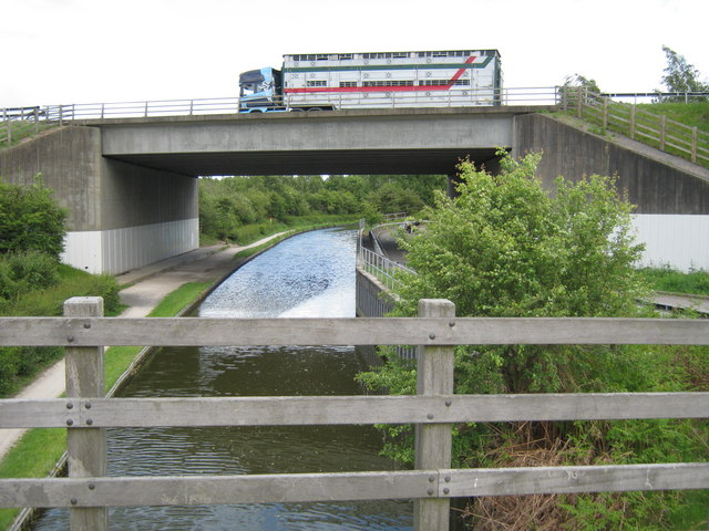
Alvecote is a small village located in the county of Warwickshire, England. It lies approximately 4 miles northeast of the town of Tamworth and is situated within the North Warwickshire district. The village is bordered by the Coventry Canal to the west and the River Anker to the east.

Alvecote is known for its rich history, dating back to Roman times. The remains of a Roman fort, Mancetter, can be found within close proximity to the village. The area also played a significant role during the Industrial Revolution, with several coal mines operating in the vicinity.

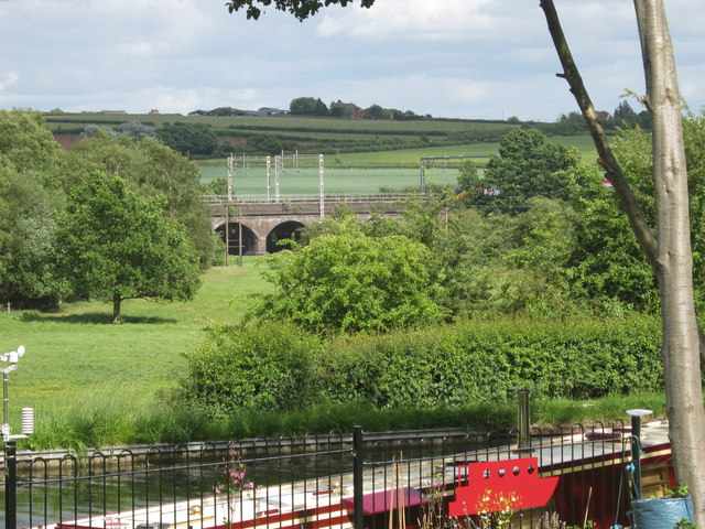
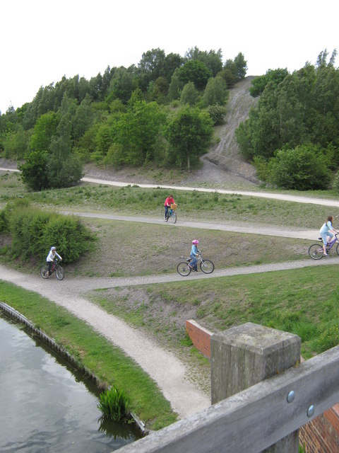
Today, Alvecote is a peaceful and picturesque village, offering a tranquil escape from the nearby urban areas. It is characterized by its charming cottages, many of which date back to the 18th and 19th centuries. The village is surrounded by beautiful countryside, with ample opportunities for outdoor activities such as walking, cycling, and fishing.

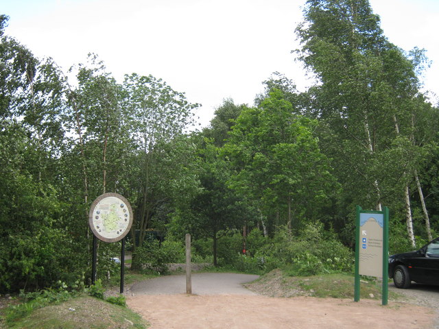
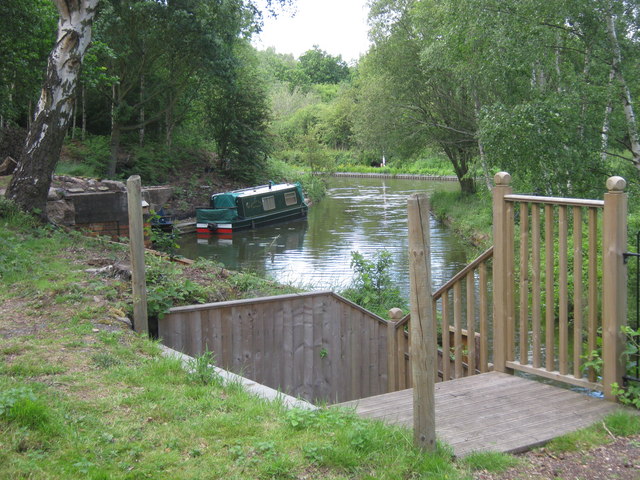
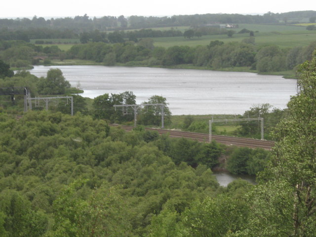
One of the notable landmarks in Alvecote is the Alvecote Pools Nature Reserve, a protected area that provides a habitat for a variety of wildlife and a peaceful environment for visitors. The reserve features several pools and wetlands, attracting numerous bird species throughout the year.

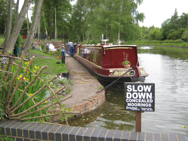
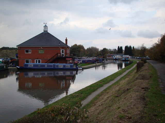
Alvecote is also home to Alvecote Marina, a popular destination for boating enthusiasts. The marina offers moorings, boat rentals, and a range of facilities for both residents and visitors.

Overall, Alvecote is a charming village with a rich history, beautiful scenery, and a welcoming community, making it an attractive place to live or visit in Warwickshire.

If you have any feedback on the listing, please let us know in the comments section below.
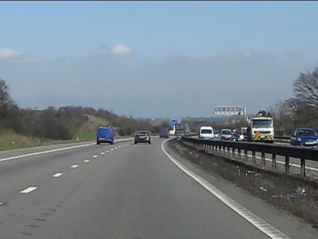
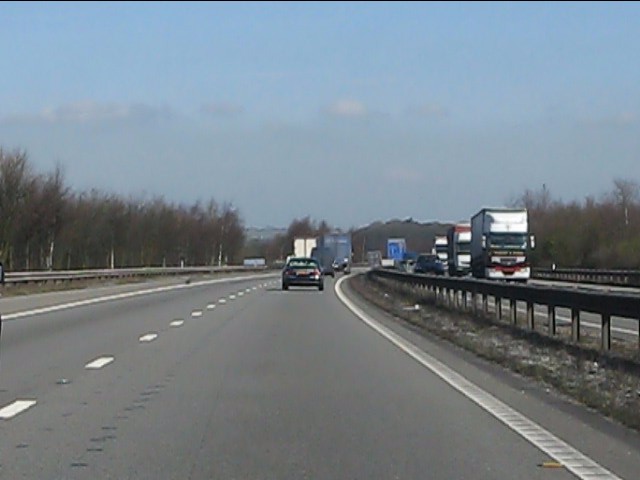
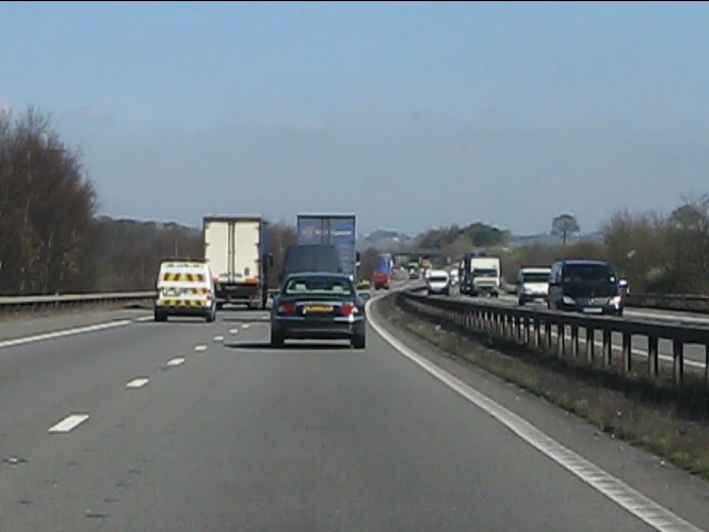
Alvecote Images

Images are sourced within 2km of 52.638878/-1.634012 or Grid Reference SK2404. Thanks to Geograph Open Source API. All images are credited.

M42 Motorway curving around Polesworth
M42 Motorway near Pooley Hall
M42 Motorway near Polesworth
Alvecote Priory Peaceful site, alongside Coventry Canal (no longer having car-park due to vandalism)

<span class="nowrap"><a title="http://www.northwarks.gov.uk/info/200332/places_to_visit/85/picnic_areas_in_north_warwickshire/2" rel="nofollow ugc noopener" href="http://www.northwarks.gov.uk/info/200332/places_to_visit/85/picnic_areas_in_north_warwickshire/2">Link</a><img style="margin-left:2px;" alt="External link" title="External link - shift click to open in new window" src="https://s1.geograph.org.uk/img/external.png" width="10" height="10"/></span>
Alvecote Priory
Peaceful site, alongside Coventry Canal (no longer having car-park due to vandalism) LinkExternal link
Ruins of Alvecote Priory Delightful quiet spot, alongside Coventry Canal

<span class="nowrap"><a title="http://www.northwarks.gov.uk/info/200332/places_to_visit/85/picnic_areas_in_north_warwickshire/2" rel="nofollow ugc noopener" href="http://www.northwarks.gov.uk/info/200332/places_to_visit/85/picnic_areas_in_north_warwickshire/2">Link</a><img style="margin-left:2px;" alt="External link" title="External link - shift click to open in new window" src="https://s1.geograph.org.uk/img/external.png" width="10" height="10"/></span>
Ruins of Alvecote Priory
Delightful quiet spot, alongside Coventry Canal LinkExternal link
Path to Pooley Heritage Centre Pathway down from car park at Pooley Heritage site

<span class="nowrap"><a title="http://www.warwickshire.gov.uk/web/corporate/pages.nsf/Links/55940A8538A8910180256CD00057A182" rel="nofollow ugc noopener" href="http://www.warwickshire.gov.uk/web/corporate/pages.nsf/Links/55940A8538A8910180256CD00057A182">Link</a><img style="margin-left:2px;" alt="External link" title="External link - shift click to open in new window" src="https://s1.geograph.org.uk/img/external.png" width="10" height="10"/></span>
Path to Pooley Heritage Centre
Pathway down from car park at Pooley Heritage site LinkExternal link
North Warwickshire Heritage Information board at pathway to Heritage Centre next to Pooley Country Park's car park

<span class="nowrap"><a title="http://www.warwickshire.gov.uk/web/corporate/pages.nsf/Links/55940A8538A8910180256CD00057A182" rel="nofollow ugc noopener" href="http://www.warwickshire.gov.uk/web/corporate/pages.nsf/Links/55940A8538A8910180256CD00057A182">Link</a><img style="margin-left:2px;" alt="External link" title="External link - shift click to open in new window" src="https://s1.geograph.org.uk/img/external.png" width="10" height="10"/></span>
North Warwickshire Heritage
Information board at pathway to Heritage Centre next to Pooley Country Park's car park LinkExternal link
Pooley Heritage Centre Situated on site of former colliery, alongside Coventry canal; cafe, historic and nature facts

<span class="nowrap"><a title="http://www.warwickshire.gov.uk/web/corporate/pages.nsf/Links/55940A8538A8910180256CD00057A182" rel="nofollow ugc noopener" href="http://www.warwickshire.gov.uk/web/corporate/pages.nsf/Links/55940A8538A8910180256CD00057A182">Link</a><img style="margin-left:2px;" alt="External link" title="External link - shift click to open in new window" src="https://s1.geograph.org.uk/img/external.png" width="10" height="10"/></span>
Pooley Heritage Centre
Situated on site of former colliery, alongside Coventry canal; cafe, historic and nature facts LinkExternal link
Pooley Heritage Centre Visitor centre and cafe alongside Coventry Canal, near M42 and north-west of Polesworth

<span class="nowrap"><a title="http://www.warwickshire.gov.uk/web/corporate/pages.nsf/Links/55940A8538A8910180256CD00057A182" rel="nofollow ugc noopener" href="http://www.warwickshire.gov.uk/web/corporate/pages.nsf/Links/55940A8538A8910180256CD00057A182">Link</a><img style="margin-left:2px;" alt="External link" title="External link - shift click to open in new window" src="https://s1.geograph.org.uk/img/external.png" width="10" height="10"/></span>
Pooley Heritage Centre
Visitor centre and cafe alongside Coventry Canal, near M42 and north-west of Polesworth LinkExternal link
Private Moorings Along Coventry Canal, at location of Pooley Heritage Centre, moorings with pleasant gardens in a small 'cutting', possibly dating back to days of coal-mining in the area

<span class="nowrap"><a title="http://www.warwickshire.gov.uk/web/corporate/pages.nsf/Links/55940A8538A8910180256CD00057A182" rel="nofollow ugc noopener" href="http://www.warwickshire.gov.uk/web/corporate/pages.nsf/Links/55940A8538A8910180256CD00057A182">Link</a><img style="margin-left:2px;" alt="External link" title="External link - shift click to open in new window" src="https://s1.geograph.org.uk/img/external.png" width="10" height="10"/></span>
Private Moorings
Along Coventry Canal, at location of Pooley Heritage Centre, moorings with pleasant gardens in a small 'cutting', possibly dating back to days of coal-mining in the area LinkExternal link
Picnic benches and trail Pooley Heritage centre and country park on a sunny weekend
Picnic benches and trail
Pooley Heritage centre and country park on a sunny weekend
Two forms of transport View from Pooley country park, and canal boat moorings of Coventry canal, looking across to railway viaduct crossing River Anker, north of Polesworth
Two forms of transport
View from Pooley country park, and canal boat moorings of Coventry canal, looking across to railway viaduct crossing River Anker, north of Polesworth
Moorings, Pooley Country Park Moorings alongside Coventry Canal near Polesworth
Moorings, Pooley Country Park
Moorings alongside Coventry Canal near Polesworth
M42 crosses Coventry Canal Motorway crossing canal just north of Pooley (Fields) Country park and heritage centre. Road is private accessing former colliery site beyond.  The woods beyond are at the foot of former colliery spoil heap (now a hill to climb up)
M42 crosses Coventry Canal
Motorway crossing canal just north of Pooley (Fields) Country park and heritage centre. Road is private accessing former colliery site beyond. The woods beyond are at the foot of former colliery spoil heap (now a hill to climb up)
Cycle and footpath trails, Pooley View from footbridge crossing Coventry canal in country park at Pooley (Fields), towards hillock (former colliery spoil)
Cycle and footpath trails, Pooley
View from footbridge crossing Coventry canal in country park at Pooley (Fields), towards hillock (former colliery spoil)
Coventry Canal and M42 View of canal and M42 crossing above, near Pooley Heritage centre and country park. Trail on left of canal is part of the country park, whilst road under motorway on right of canal is private, and used for pedestrians.
Coventry Canal and M42
View of canal and M42 crossing above, near Pooley Heritage centre and country park. Trail on left of canal is part of the country park, whilst road under motorway on right of canal is private, and used for pedestrians.
Alvecote Pools View from atop the former spoil heap in Pooley Country Park, looking north beyond the West Coast mainline, to Alvecote Pools.

On the left, north end of main lake, is Shuttington Bridge
Alvecote Pools
View from atop the former spoil heap in Pooley Country Park, looking north beyond the West Coast mainline, to Alvecote Pools. On the left, north end of main lake, is Shuttington Bridge
M42 north and surrounding countryside View from atop Pooley Country Park former spoil heap (colliery) looking north-east towards M42 as it crosses River Anker
M42 north and surrounding countryside
View from atop Pooley Country Park former spoil heap (colliery) looking north-east towards M42 as it crosses River Anker
Show me another place!

Alvecote is located at Grid Ref: SK2404 (Lat: 52.638878, Lng: -1.634012)

Administrative County: Warwickshire

District: North Warwickshire

Police Authority: Warwickshire

What 3 Words

///poster.bath.mixed. Near Polesworth, Warwickshire

Nearby Locations

Alvecote

Related Wikis

Alvecote Pools

Alvecote Pools is a Site of Special Scientific Interest (SSSI) and nature reserve situated alongside the River Anker, adjacent to the hamlet of Alvecote...
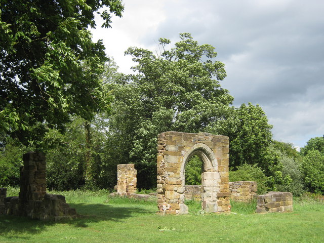
Alvecote Priory

Alvecote Priory is a ruined Benedictine Priory in Alvecote, Warwickshire, England. The site has been scheduled as an ancient monument. Now very little...

Shuttington

Shuttington is a village and civil parish in North Warwickshire, England, situated north-east of Tamworth, Staffordshire. In the 2001 census, the parish...

Alvecote

Alvecote is a hamlet in the North Warwickshire district of Warwickshire, England, situated on the county border with Staffordshire. Other settlements nearby...

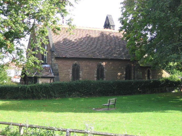
St Editha's Church, Amington

Amington Parish Church (dedicated to St Editha) is a Grade II listed parish church in the Church of England in Amington. == History == The church was built...

Statfold Barn Railway

The Statfold Barn Railway is a narrow gauge railway based near Tamworth, Staffordshire and partially in Warwickshire, England. Founded by engineering entrepreneur...

Landau Forte Academy Amington

Landau Forte Academy Amington (previously Landau Forte Academy Tamworth), is a high school situated in Amington, a suburb of Tamworth, Staffordshire. The...

Amington

Amington is a suburban village, parish and ward, in Staffordshire, England. Formerly a distinct village, it is now part of the Tamworth borough, with no...

Nearby Amenities

Located within 500m of 52.638878,-1.634012
Traffic Signals
Lat/Long: 52.6429995/-1.6342547
Traffic Signals
Lat/Long: 52.6431051/-1.6338437
Bus Stop
Caravan Park
Bus: yes
Naptan AtcoCode: 4200F087100
Naptan Bearing: NW
Naptan CommonName: Caravan Park
Naptan Indicator: Adj
Naptan Landmark: Caravan Park
Naptan NaptanCode: warapjpw
Naptan Street: Robeys Lane
Naptan Verified: no
Public Transport: platform
Source: naptan_import
Lat/Long: 52.6387992/-1.6359932
Bus Stop
Shuttington Road
Bus: yes
Naptan AtcoCode: 4200F125450
Naptan Bearing: SW
Naptan CommonName: Shuttington Road
Naptan Indicator: Adj
Naptan Landmark: Alvecote Lane
Naptan NaptanCode: wardgtwp
Naptan Street: Shuttington Road
Naptan Verified: no
Public Transport: platform
Source: naptan_import
Lat/Long: 52.6416089/-1.6391875
Bus Stop
Shuttington Road
Bus: yes
Naptan AtcoCode: 4200F125451
Naptan Bearing: NE
Naptan CommonName: Shuttington Road
Naptan Indicator: Opp
Naptan Landmark: Alvecote Lane
Naptan NaptanCode: wardgtwt
Naptan Street: Shuttington Road
Naptan Verified: no
Public Transport: platform
Source: naptan_import
Lat/Long: 52.6416948/-1.6391909
Alvecote
Place: hamlet
Lat/Long: 52.637981/-1.6332104
Power: tower
Source: Bing
Lat/Long: 52.6390677/-1.6395617
Power: tower
Source: Bing
Lat/Long: 52.6367554/-1.6396029
Traffic Signals
Traffic Signals Direction: forward
Lat/Long: 52.6367308/-1.6312996
Traffic Signals
Traffic Signals Direction: backward
Lat/Long: 52.6372566/-1.6317968
Traffic Signals
Traffic Signals Direction: forward
Lat/Long: 52.6370455/-1.6309654
Post Box
Ref: B79 93
Lat/Long: 52.6386059/-1.6357612
Barrier: stile
Foot: yes
Motor Vehicle: no
Lat/Long: 52.6403984/-1.6377331
Waste Basket
Lat/Long: 52.6397593/-1.6370215
Waste Basket
Lat/Long: 52.6396088/-1.6366744
Bench
Lat/Long: 52.6395722/-1.6365966
Bench
Lat/Long: 52.6394573/-1.6364153
Bench
Lat/Long: 52.6381934/-1.6353251
Waste Basket
Lat/Long: 52.6386369/-1.6357905
Waste Basket
Lat/Long: 52.6420349/-1.6300858
Access: no
Barrier: kissing_gate
Foot: yes
Lat/Long: 52.6423725/-1.6314431
Access: no
Barrier: kissing_gate
Foot: yes
Lat/Long: 52.6432046/-1.6329927
Generator Method: photovoltaic
Generator Output Electricity: yes
Generator Source: solar
Generator Type: solar_photovoltaic_panel
Location: roof
Power: generator
Lat/Long: 52.6379967/-1.6346294
Generator Method: photovoltaic
Generator Output Electricity: yes
Generator Source: solar
Generator Type: solar_photovoltaic_panel
Location: roof
Power: generator
Lat/Long: 52.6389229/-1.6363192
Generator Method: photovoltaic
Generator Output Electricity: yes
Generator Source: solar
Generator Type: solar_photovoltaic_panel
Location: roof
Power: generator
Lat/Long: 52.6388692/-1.6357559
Generator Method: photovoltaic
Generator Output Electricity: yes
Generator Source: solar
Generator Type: solar_photovoltaic_panel
Location: roof
Power: generator
Lat/Long: 52.6387113/-1.6355869
Parking
Capacity: 3
Parking: street_side
Source: bing
Lat/Long: 52.6356096/-1.6315945
Generator Method: photovoltaic
Generator Output Electricity: yes
Generator Source: solar
Generator Type: solar_photovoltaic_panel
Location: roof
Power: generator
Lat/Long: 52.6388253/-1.6352823
Generator Method: photovoltaic
Generator Output Electricity: yes
Generator Source: solar
Generator Type: solar_photovoltaic_panel
Location: roof
Power: generator
Lat/Long: 52.6379102/-1.6342889
Information: route_marker
Operator: Warwickshire County Council
Tourism: information
Lat/Long: 52.6428043/-1.6347662
Information: route_marker
Operator: Warwickshire County Council
Tourism: information
Lat/Long: 52.6374262/-1.6321537
Information: route_marker
Operator: Warwickshire County Council
Tourism: information
Lat/Long: 52.6389603/-1.6302882
Information: route_marker
Operator: Warwickshire County Council
Tourism: information
Lat/Long: 52.641477/-1.6332789
Information: route_marker
Operator: Warwickshire County Council
Tourism: information
Lat/Long: 52.6406547/-1.6329651
Power: pole
Lat/Long: 52.6378319/-1.6332668
Power: portal
Transformer: distribution
Transition: yes
Lat/Long: 52.6379104/-1.6332205
The data included in this document is from www.openstreetmap.org. The data is made available under ODbL.

Have you been to Alvecote?

Leave your review of Alvecote below (or comments, questions and feedback).