Rivox Moor

Wood, Forest in Dumfriesshire

Scotland

Rivox Moor

Middle Gill Cluster of houses by the B7076 just north of Coatsgate. The M74, the river (Evan Water), the B7076  and the railway all run parallel at this point and quite close together.
Middle Gill Credit: Roger May

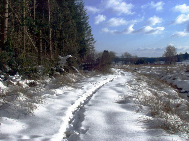
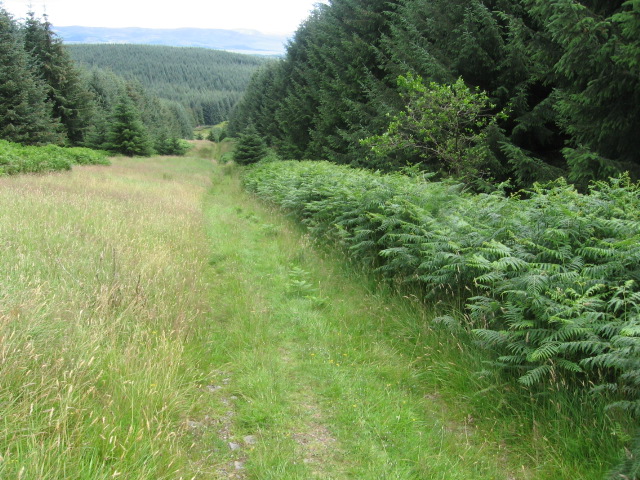
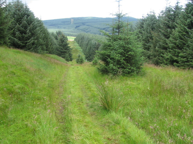
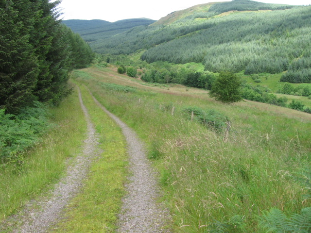
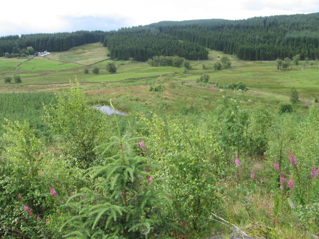
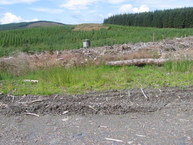
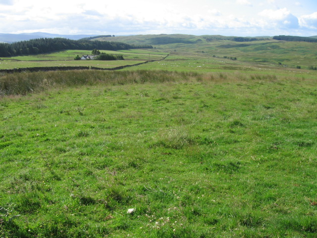
Rivox Moor, located in Dumfriesshire, Scotland, is a sprawling wood and forest area that covers a significant portion of the region. This natural landscape is renowned for its scenic beauty and diverse flora and fauna. Spanning approximately 200 hectares, Rivox Moor offers a tranquil retreat for nature enthusiasts and adventurers alike.

The woodlands of Rivox Moor are predominantly composed of native species such as oak, birch, and pine trees. These trees create a dense canopy, providing shade and shelter to a wide array of wildlife that thrives within the forest. Visitors can expect to spot various species of birds, including woodpeckers and owls, as well as small mammals like squirrels and rabbits.

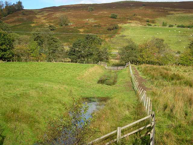
The moorland within the forest is characterized by its open, heather-covered terrain, interspersed with patches of marshes and ponds. This diverse habitat supports a range of plant species, such as heather, cotton grass, and bog myrtle. During the summer months, the moorland comes alive with vibrant colors, as wildflowers bloom in abundance.

Rivox Moor offers numerous walking trails and paths, allowing visitors to explore the woodlands and immerse themselves in its natural beauty. The peaceful atmosphere and stunning vistas make it an ideal location for hiking, birdwatching, and photography. Additionally, the forest is home to several picnic areas, where visitors can enjoy a leisurely lunch surrounded by the sights and sounds of nature.

Overall, Rivox Moor in Dumfriesshire is a captivating wood and forest landscape that showcases the beauty of Scotland's natural heritage. With its diverse ecosystems and stunning vistas, it provides a memorable experience for anyone seeking solace in the great outdoors.

If you have any feedback on the listing, please let us know in the comments section below.
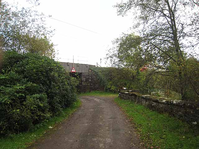
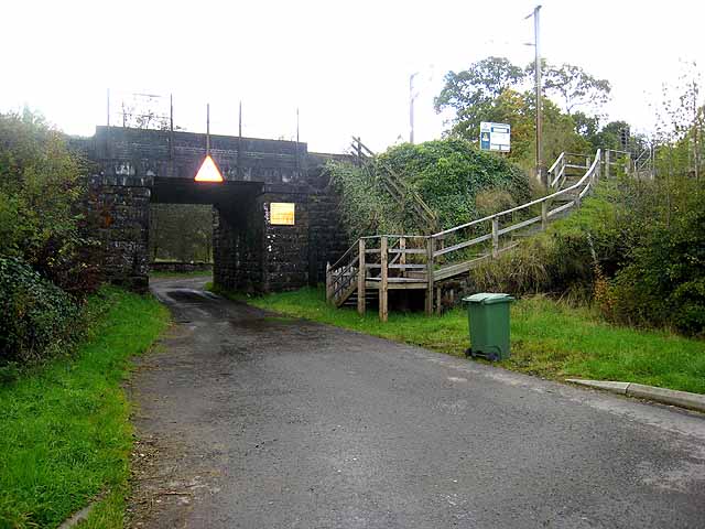
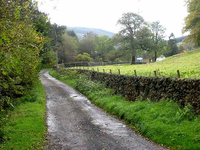
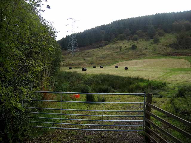
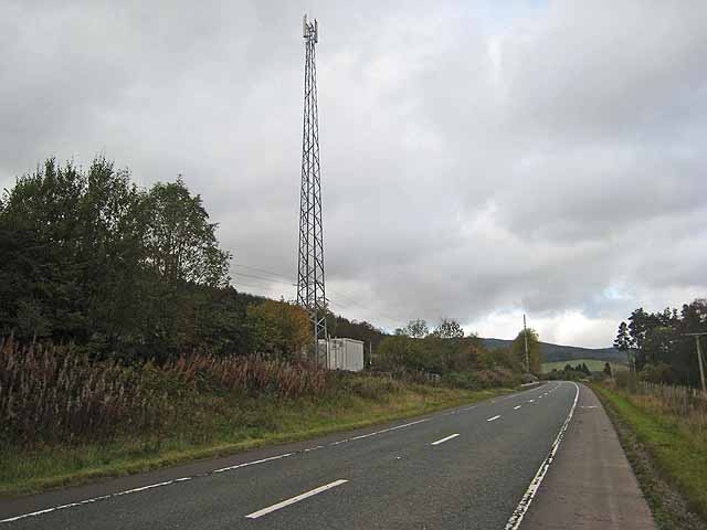
Rivox Moor Images

Images are sourced within 2km of 55.334635/-3.5156968 or Grid Reference NT0305. Thanks to Geograph Open Source API. All images are credited.

Middle Gill Cluster of houses by the B7076 just north of Coatsgate. The M74, the river (Evan Water), the B7076  and the railway all run parallel at this point and quite close together.
Middle Gill
Cluster of houses by the B7076 just north of Coatsgate. The M74, the river (Evan Water), the B7076 and the railway all run parallel at this point and quite close together.
Another view along the Southern Upland Way
Wet Delivery Sainsbury's articulated lorry on the A74(M) on a very wet day. The spray from lorries was reaching me on a forest track.
Wet Delivery
Sainsbury's articulated lorry on the A74(M) on a very wet day. The spray from lorries was reaching me on a forest track.
Southern Upland Way at Craig Hill
Southern Upland Way at bridge over Garpol Water
Southern Upland Way near Rivox
Track to Mosshope
Track to Mosshope
Towards Holmshaw
Towards Holmshaw
Longbedholm Plantation
Towards Rosetta
Towards Rosetta
Longbedholm Hill
Longbedholm Hill
The road from Middlegill A little side road off the B7076. The bridge carries the West Coast Main Line railway.
The road from Middlegill
A little side road off the B7076. The bridge carries the West Coast Main Line railway.
Bridge over the road to Middlegill Middlegill is a hamlet which lies just off the B7076. The bridge carries the West Coast Main Line railway and the steps are for access by maintenance staff.
Bridge over the road to Middlegill
Middlegill is a hamlet which lies just off the B7076. The bridge carries the West Coast Main Line railway and the steps are for access by maintenance staff.
The lane to Middlegill Lane off the B7076 leading to the hamlet of Middlegill.
The lane to Middlegill
Lane off the B7076 leading to the hamlet of Middlegill.
Field and forest at Middlegill
Railway telecom mast by the B7076 The West Coast Main Line railway lies immediately to the left, but out of sight, of the road.

In recent years the A74 has been replaced by the M74. Between Hartshope <a href="https://www.geograph.org.uk/gridref/NT0312">NT0312</a> and Coatsgate <a href="https://www.geograph.org.uk/gridref/NT0605">NT0605</a>, the motorway follows the alignment of the old road. A new road (part of the B7076) has been constructed along the west side of the river for local access and to serve frontage owners. Cycle lanes have been established on both sides of this road and the whole length of the B7076 has been designated as National Cycle Network 
<span class="nowrap"><a title="http://www.sustrans.org.uk/default.asp?sID=1089735289781" rel="nofollow ugc noopener" href="http://www.sustrans.org.uk/default.asp?sID=1089735289781">Link</a><img style="margin-left:2px;" alt="External link" title="External link - shift click to open in new window" src="https://s1.geograph.org.uk/img/external.png" width="10" height="10"/></span> route 74. Although a bit monotonous, this is the one part of the National Cycle Network which provides a continuous length for high-speed cycling from Gretna on the Scottish Border up to north of Abington.
Railway telecom mast by the B7076
The West Coast Main Line railway lies immediately to the left, but out of sight, of the road. In recent years the A74 has been replaced by the M74. Between Hartshope NT0312 and Coatsgate NT0605, the motorway follows the alignment of the old road. A new road (part of the B7076) has been constructed along the west side of the river for local access and to serve frontage owners. Cycle lanes have been established on both sides of this road and the whole length of the B7076 has been designated as National Cycle Network LinkExternal link route 74. Although a bit monotonous, this is the one part of the National Cycle Network which provides a continuous length for high-speed cycling from Gretna on the Scottish Border up to north of Abington.
Ditch in valley of Evan Water A ditch draining the narrow stretch of flat land in the floor of the valley of the Evan Water. The line of trees marks the river itself, whilst beyond, it is just possible to make out the line of the M74.
Ditch in valley of Evan Water
A ditch draining the narrow stretch of flat land in the floor of the valley of the Evan Water. The line of trees marks the river itself, whilst beyond, it is just possible to make out the line of the M74.
Show me another place!

Rivox Moor is located at Grid Ref: NT0305 (Lat: 55.334635, Lng: -3.5156968)

Unitary Authority: Dumfries and Galloway

Police Authority: Dumfries and Galloway

What 3 Words

///fatigued.longer.collapsed. Near Moffat, Dumfries & Galloway

Nearby Locations

Rivox Moor Rivox Moor

Related Wikis

Auchencastle railway station

Auchencastle railway station was a private station which served Auchencastle, near Beattock, in the Scottish county of Dumfries and Galloway. It was used...

Greenhillstairs

Greenhillstairs is the steep B719 road north of Moffat in Dumfries and Galloway, Scotland. The road, about 3 miles long, leaves the A701 Moffat to Edinburgh...
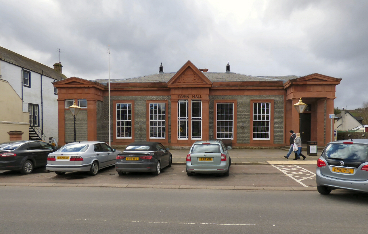
Moffat Town Hall

Moffat Town Hall is a municipal building in the High Street in Moffat, Dumfries and Galloway, Scotland. The structure, which is used as community events...

Moffat Museum

Moffat Museum is a community museum in Moffat, Scotland. It was established in the Old Moffat Bakehouse in 1984. The museum expanded into a neighbouring...

Nearby Amenities

Located within 500m of 55.334635,-3.5156968
Rivox Moor
Ele: 315
Natural: peak
Lat/Long: 55.3343411/-3.5141204
The data included in this document is from www.openstreetmap.org. The data is made available under ODbL.

Have you been to Rivox Moor?

Leave your review of Rivox Moor below (or comments, questions and feedback).