Castle

Settlement in Somerset Somerset West and Taunton

England

Castle

Direction Sign – Signpost on the B3227 in Wiveliscombe Located on the southeast side of the junction of the B3227 New Road and Challick Lane in Wiveliscombe parish. 1 arm and pyramid finial. The arm is missing on Google Earth in 2009 and the pillar itself is hidden by the hedgerow in 2018. 

Milestone Society National ID: SO_ST0727
Direction Sign – Signpost on the B3227 in Wiveliscombe Credit: John V Nicholls

Castle, Somerset is a small village located in the county of Somerset, England. Situated in the picturesque region of South West England, the village is surrounded by stunning natural landscapes and is known for its rich history and charming character.

The village gets its name from the historic Castle Cary Castle, which was built in the 12th century and played a significant role in the region's medieval past. The castle, although now in ruins, still stands as a prominent landmark in the area and attracts history enthusiasts and visitors from all around.

Castle, Somerset is a quintessential English village, with its narrow streets lined with traditional stone cottages and quaint buildings. The village center is home to a few local shops, a pub, and a village hall which serves as a community hub for various events and gatherings.

Surrounded by rolling hills and beautiful countryside, Castle, Somerset offers ample opportunities for outdoor activities such as hiking, cycling, and horseback riding. The village is also located near the Mendip Hills, an Area of Outstanding Natural Beauty, which offers stunning views and a range of recreational activities.

With its close-knit community and friendly atmosphere, Castle, Somerset provides a peaceful and idyllic setting for residents and visitors alike. The village's rich history, natural beauty, and warm hospitality make it a charming destination for those seeking a taste of authentic English countryside living.

If you have any feedback on the listing, please let us know in the comments section below.

Castle Images

Images are sourced within 2km of 51.04412/-3.2994504 or Grid Reference ST0928. Thanks to Geograph Open Source API. All images are credited.

Direction Sign – Signpost on the B3227 in Wiveliscombe Located on the southeast side of the junction of the B3227 New Road and Challick Lane in Wiveliscombe parish. 1 arm and pyramid finial. The arm is missing on Google Earth in 2009 and the pillar itself is hidden by the hedgerow in 2018. 

Milestone Society National ID: SO_ST0727
Direction Sign – Signpost on the B3227 in Wiveliscombe
Located on the southeast side of the junction of the B3227 New Road and Challick Lane in Wiveliscombe parish. 1 arm and pyramid finial. The arm is missing on Google Earth in 2009 and the pillar itself is hidden by the hedgerow in 2018. Milestone Society National ID: SO_ST0727
Wiveliscombe : West Road B3227 West Road with the rugby club in view.
Wiveliscombe : West Road B3227
West Road with the rugby club in view.
Wiveliscombe : Recreation Ground A recreation ground and rugby club.
Wiveliscombe : Recreation Ground
A recreation ground and rugby club.
Wiveliscombe : Croft Way B3227 Looking along Croft Way.
Wiveliscombe : Croft Way B3227
Looking along Croft Way.
Wiveliscombe : Croft Way Car Park A car park off the B3227.
Wiveliscombe : Croft Way Car Park
A car park off the B3227.
Wiveliscombe : Lister House Surgery A medical centre off Croft Way.
Wiveliscombe : Lister House Surgery
A medical centre off Croft Way.
Wiveliscombe : Lister House Surgery A medical centre off Croft Way.
Wiveliscombe : Lister House Surgery
A medical centre off Croft Way.
Wiveliscombe : High Street High Street off Croft Way.
Wiveliscombe : High Street
High Street off Croft Way.
Wiveliscombe : St Andrew's Church The church was built by Richard Carver between 1827 and 1829, on the site of an earlier medieval church. It originally had a gallery but this is now the organ loft. The Rose window was added in 1915. The parish is part of the Wiveliscombe and the Hills benefice, within the Diocese of Bath and Wells.
Wiveliscombe : St Andrew's Church
The church was built by Richard Carver between 1827 and 1829, on the site of an earlier medieval church. It originally had a gallery but this is now the organ loft. The Rose window was added in 1915. The parish is part of the Wiveliscombe and the Hills benefice, within the Diocese of Bath and Wells.
Wiveliscombe : St Andrew's Church Grounds In the grounds of St Andrew's Church.
Wiveliscombe : St Andrew's Church Grounds
In the grounds of St Andrew's Church.
Wiveliscombe : St Andrew's Church A footpath heads around the church.
Wiveliscombe : St Andrew's Church
A footpath heads around the church.
Wiveliscombe : Masonic Hall Masonic Hall. Early C19. Stucco with hipped Welsh slate roof, deep eaves and soffit board, brick stacks to right. 2-storeys, 4-bays with central porch and single storey, single bay projection with moulded cornice in front of right-hand bay. All windows sashes with glaring bars. Tuscan porch with eight panel door and wreath knocker.
Wiveliscombe : Masonic Hall
Masonic Hall. Early C19. Stucco with hipped Welsh slate roof, deep eaves and soffit board, brick stacks to right. 2-storeys, 4-bays with central porch and single storey, single bay projection with moulded cornice in front of right-hand bay. All windows sashes with glaring bars. Tuscan porch with eight panel door and wreath knocker.
Wiveliscombe : Bishops Green Bishops Green off Station Road.
Wiveliscombe : Bishops Green
Bishops Green off Station Road.
Wiveliscombe : Palace Garden Looking along Palace Garden.
Wiveliscombe : Palace Garden
Looking along Palace Garden.
Wiveliscombe : Houses Houses off Mill Lane.
Wiveliscombe : Houses
Houses off Mill Lane.
Wiveliscombe : Grassy Field A right of way heads through the field.
Wiveliscombe : Grassy Field
A right of way heads through the field.
Wiveliscombe : Grassy Field A field with a right of way through it.
Wiveliscombe : Grassy Field
A field with a right of way through it.
Show me another place!

Castle is located at Grid Ref: ST0928 (Lat: 51.04412, Lng: -3.2994504)

Administrative County: Somerset

District: Somerset West and Taunton

Police Authority: Avon and Somerset

What 3 Words

///multiple.modem.measures. Near Wiveliscombe, Somerset

Nearby Locations

Castle Ford Castle Hill

Related Wikis

King's Castle, Wiveliscombe

King's Castle is an Iron Age Hillfort 1 kilometre (0.62 mi) east of Wiveliscombe in Somerset, England. It is surrounded by two banks with a ditch between...

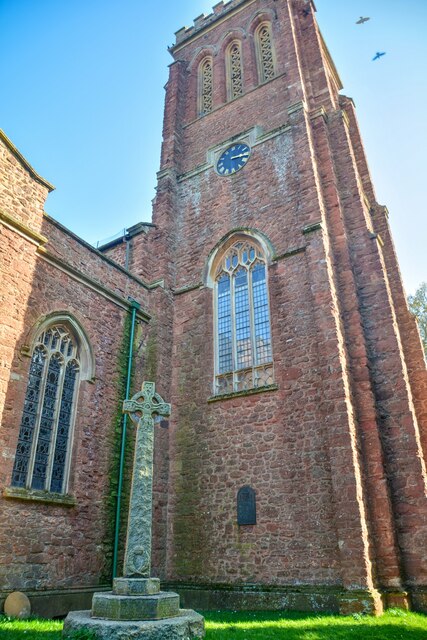
Church of St Andrew, Wiveliscombe

The Church Of St Andrew in Wiveliscombe, Somerset, England was built in 1829. It is a Grade II* listed building. == History == The church was built by...

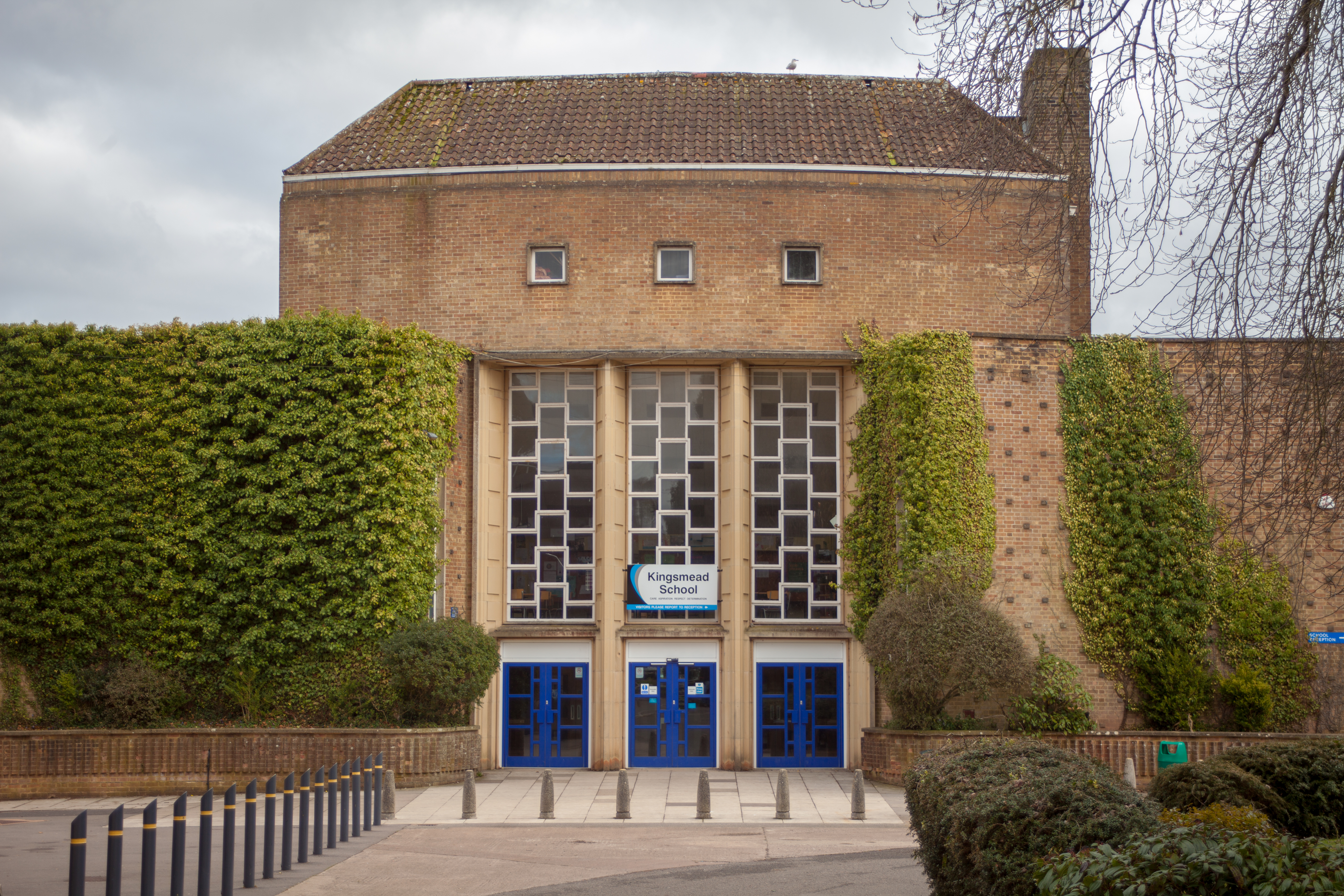
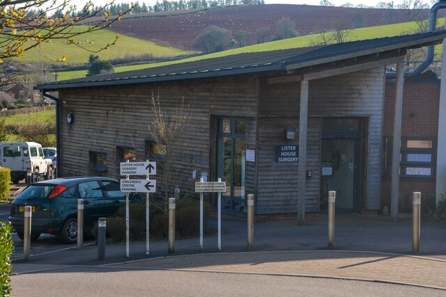
Kingsmead School, Wiveliscombe

Kingsmead School (KS) is a coeducational state school in Wiveliscombe, Somerset, England, serving the north-west of Taunton Deane district. It had 804...
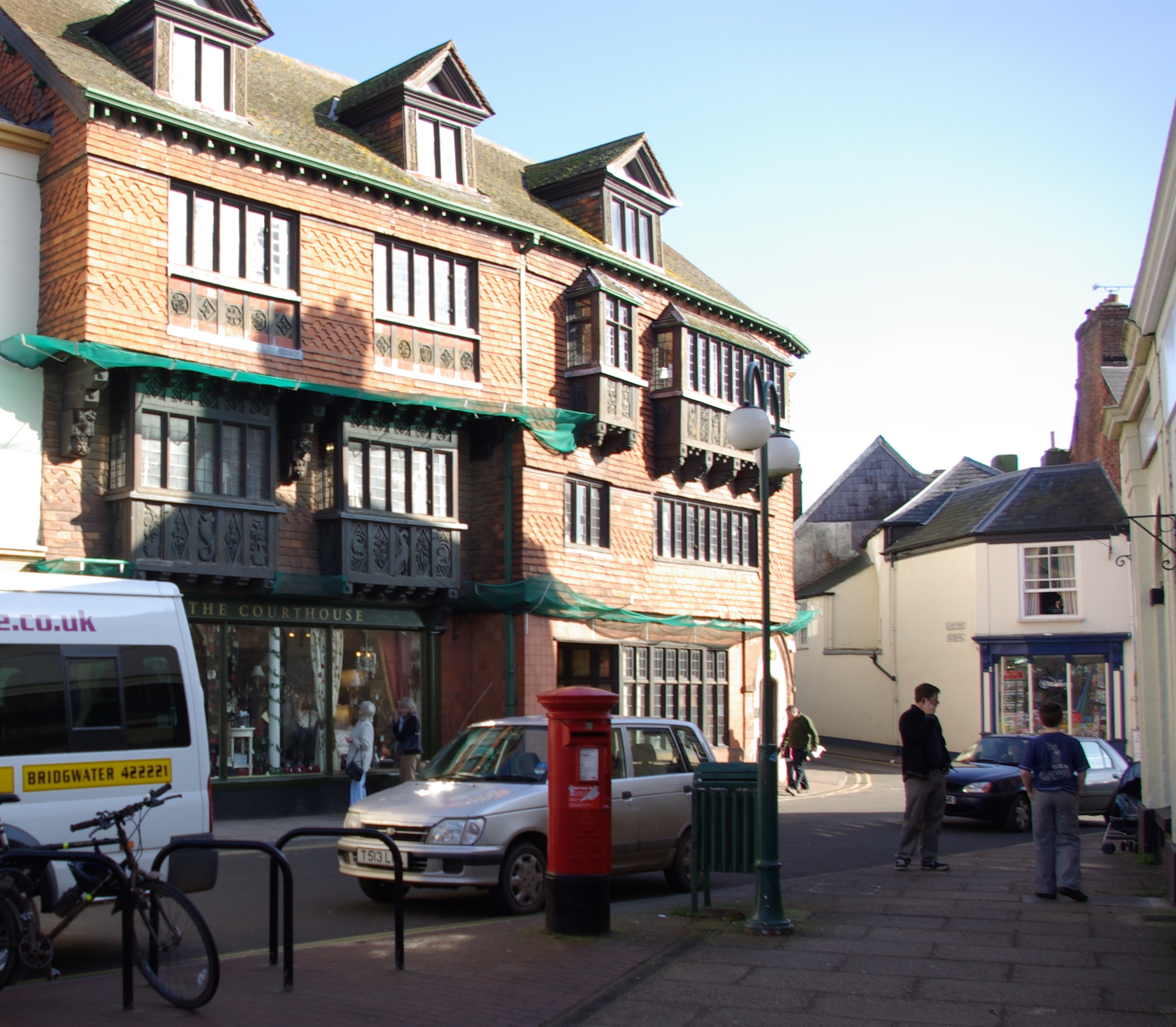
Wiveliscombe

Wiveliscombe (, locally ) is a town and civil parish in Somerset, England, situated 9 miles (14 km) west of Taunton. The town has a population of 2,893...

Abbotsfield, Wiveliscombe

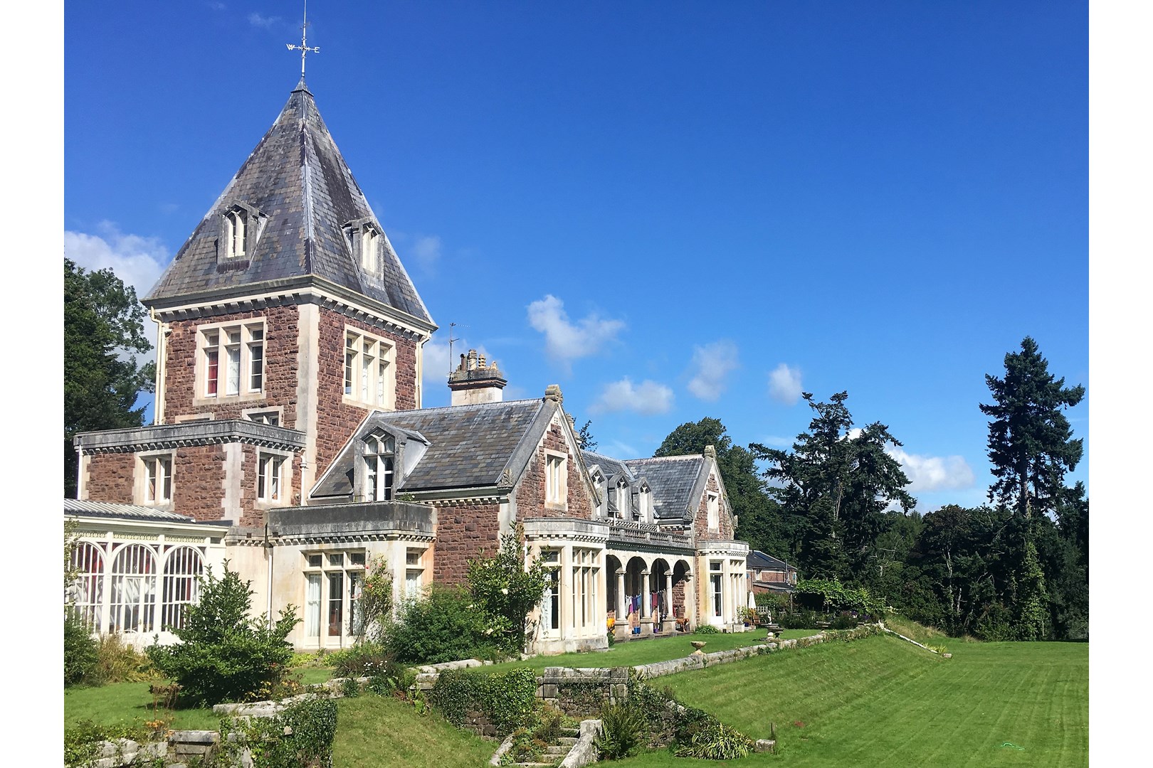
Abbotsfield is a country house and farm, to the west of the town of Wiveliscombe, Somerset, England. Built in 1872, it became a Grade II listed building...

Holme Moor & Clean Moor

Holme Moor & Clean Moor (grid reference ST095260) is a 10.8 hectare (26.7 acre) biological Site of Special Scientific Interest south of Wiveliscombe in...

Fitzhead

Fitzhead is a village and civil parish in Somerset, England, situated approximately 6 miles (9.7 km) north west of Taunton. The village has an estimated...

Church of St James the Great, Fitzhead

The Anglican Church of St James the Great in Fitzhead, Somerset, England was built in the 15th century. It is a Grade II* listed building. == History... ==

Nearby Amenities

Located within 500m of 51.04412,-3.2994504
Wiveliscombe
Direction: backward
Source City Limit: sign
Traffic Sign: city_limit
Lat/Long: 51.0416201/-3.303901
Direction: backward
Maxspeed: 30 mph
Source Maxspeed: sign
Traffic Sign: maxspeed
Lat/Long: 51.0415572/-3.3032593
Power: pole
Lat/Long: 51.0412658/-3.3003614
Power: pole
Lat/Long: 51.0443284/-3.2999054
Power: pole
Lat/Long: 51.0424497/-3.3002166
Power: pole
Lat/Long: 51.0466892/-3.2994924
Post Box
Operator: Royal Mail
Operator Wikidata: Q638098
Post Box Type: wall
Ref: TA4 464D
Royal Cypher: VR
Royal Cypher Wikidata: Q33102356
Lat/Long: 51.0445085/-3.3060165
Give Way
Direction: forward
Lat/Long: 51.0424682/-3.3054015
Brand: National Grid
Brand Wikidata: Q1465461
Material: wood
Operator: National Grid Electricity Distribution Plc
Operator Old: Western Power Distribution
Operator Wikidata: Q7988183
Owner: National Grid Electricity Distribution (South West) Plc
Owner Wikidata: Q114397866
Power: pole
Lat/Long: 51.0460432/-3.2931358
Brand: National Grid
Brand Wikidata: Q1465461
Material: wood
Operator: National Grid Electricity Distribution Plc
Operator Old: Western Power Distribution
Operator Wikidata: Q7988183
Owner: National Grid Electricity Distribution (South West) Plc
Owner Wikidata: Q114397866
Power: pole
Lat/Long: 51.0482801/-3.2990071
Brand: National Grid
Brand Wikidata: Q1465461
Material: wood
Operator: National Grid Electricity Distribution Plc
Operator Old: Western Power Distribution
Operator Wikidata: Q7988183
Owner: National Grid Electricity Distribution (South West) Plc
Owner Wikidata: Q114397866
Power: pole
Lat/Long: 51.0478644/-3.2992753
Brand: National Grid
Brand Wikidata: Q1465461
Material: wood
Operator: National Grid Electricity Distribution Plc
Operator Old: Western Power Distribution
Operator Wikidata: Q7988183
Owner: National Grid Electricity Distribution (South West) Plc
Owner Wikidata: Q114397866
Power: pole
Lat/Long: 51.0475339/-3.2973951
Brand: National Grid
Brand Wikidata: Q1465461
Material: wood
Operator: National Grid Electricity Distribution Plc
Operator Old: Western Power Distribution
Operator Wikidata: Q7988183
Owner: National Grid Electricity Distribution (South West) Plc
Owner Wikidata: Q114397866
Power: pole
Lat/Long: 51.0468982/-3.2960299
Brand: National Grid
Brand Wikidata: Q1465461
Cables: 3
Material: wood
Operator: National Grid Electricity Distribution Plc
Operator Old: Western Power Distribution
Operator Wikidata: Q7988183
Owner: National Grid Electricity Distribution (South West) Plc
Owner Wikidata: Q114397866
Power: pole
Switch: mechanical
Lat/Long: 51.0481055/-3.298633
Power: pole
Lat/Long: 51.0420617/-3.2945842
Power: pole
Lat/Long: 51.0413703/-3.2943857
Power: pole
Lat/Long: 51.040522/-3.3013782
Noexit: yes
Lat/Long: 51.040313/-3.3026172
The data included in this document is from www.openstreetmap.org. The data is made available under ODbL.

Have you been to Castle?

Leave your review of Castle below (or comments, questions and feedback).