Easterton Clump

Wood, Forest in Lanarkshire

Scotland

Easterton Clump

Farm buildings, Chesterhall Park Farm
Farm buildings, Chesterhall Park Farm Credit: JThomas

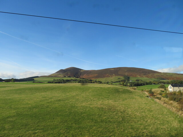
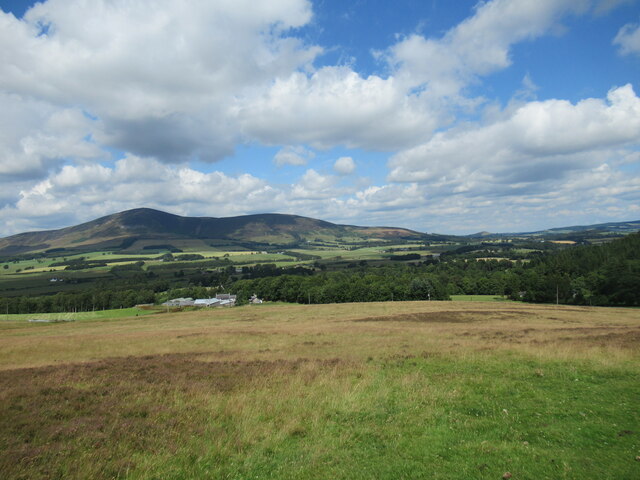
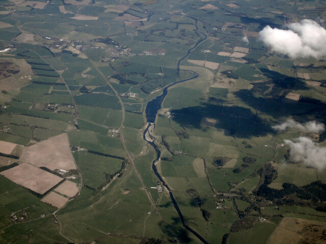
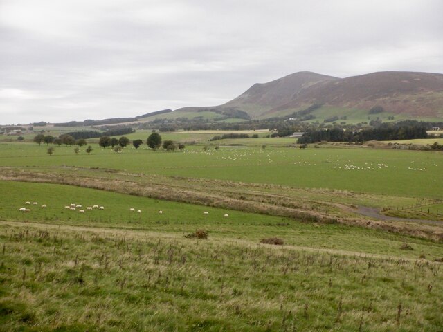
Easterton Clump is a picturesque woodland located in Lanarkshire, Scotland. Covering an area of approximately 50 acres, it is a well-known destination for nature lovers, hikers, and birdwatchers. The clump is situated just outside the village of Easterton, offering a tranquil and peaceful retreat from the hustle and bustle of everyday life.

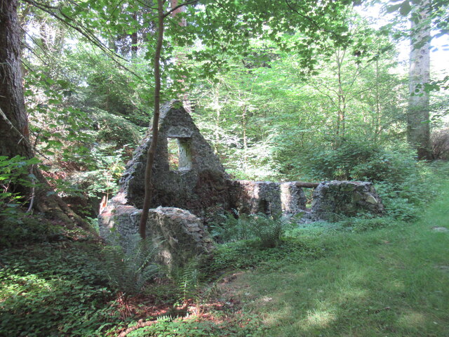
The woodland is primarily composed of native trees such as oak, birch, and beech, creating a diverse and lush habitat for a variety of flora and fauna. The forest floor is carpeted with bluebells and wildflowers during the spring, adding to the natural beauty of the area. Several walking trails wind their way through the clump, providing visitors with opportunities to explore and immerse themselves in the natural surroundings.

Bird enthusiasts will be delighted to find a wide range of avian species in Easterton Clump. From woodpeckers and thrushes to owls and finches, the woodland serves as an important habitat and breeding ground for numerous birds. Binoculars and a keen eye are essential for spotting these feathered creatures as they flit among the branches.

In addition to its natural allure, Easterton Clump also holds historical significance. It is believed that the clump has been in existence for hundreds of years, with records dating back to the 17th century. The woodland has witnessed numerous changes over time, serving as a witness to the ever-evolving landscape of Lanarkshire.

Overall, Easterton Clump is a captivating woodland that offers a serene escape into nature. With its scenic beauty, diverse wildlife, and historical significance, it is a must-visit destination for anyone seeking to connect with the natural world.

If you have any feedback on the listing, please let us know in the comments section below.

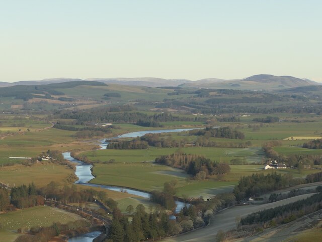
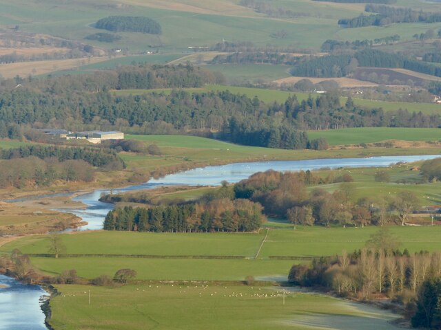
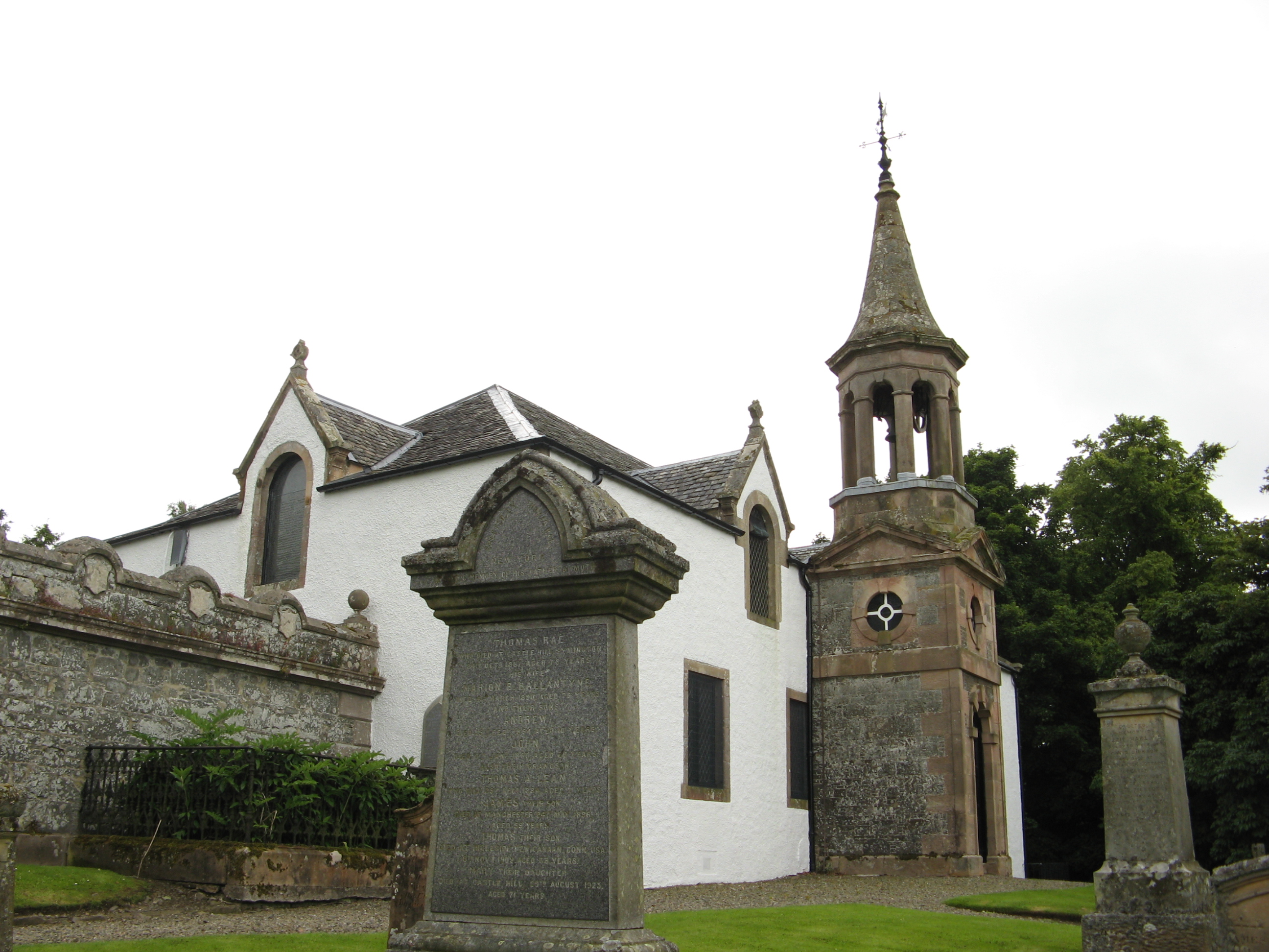
Easterton Clump Images

Images are sourced within 2km of 55.568869/-3.6041158 or Grid Reference NS9831. Thanks to Geograph Open Source API. All images are credited.

Farm buildings, Chesterhall Park Farm
Grazing near Chesterhall Park Farm Off the A73.
Grazing near Chesterhall Park Farm
Off the A73.
A73 towards Lanark
A73 towards Lanark
Tinto, from near Wyndales Farm Looking northwest from the West Coast Mainline.
Tinto, from near Wyndales Farm
Looking northwest from the West Coast Mainline.
Ruined building on the Lamington Burn This might be a ruined corn mill, although old Ordnance Survey maps also show a bathing house in the vicinity (these grounds are part of the estate of Lamington House, demolished in the 1950s).
Ruined building on the Lamington Burn
This might be a ruined corn mill, although old Ordnance Survey maps also show a bathing house in the vicinity (these grounds are part of the estate of Lamington House, demolished in the 1950s).
Rough grazing at Hillhouse, Lamington Looking towards the farm buildings at Hillhouse, with Tinto rising in the background, and the tiny steep hill of Quothquan Law also visible in the distance.
Rough grazing at Hillhouse, Lamington
Looking towards the farm buildings at Hillhouse, with Tinto rising in the background, and the tiny steep hill of Quothquan Law also visible in the distance.
Clydesdale from the air Looking downstream from Lamington.
Clydesdale from the air
Looking downstream from Lamington.
Track by Cowgill Loch The Key Cleuch pass with an artificial loch in a meltwater channel. The hillside on the left (Broad Hill) has been planted with trees.
Track by Cowgill Loch
The Key Cleuch pass with an artificial loch in a meltwater channel. The hillside on the left (Broad Hill) has been planted with trees.
Pass at the head of Key Cleuch West of Cowgill Loch, the hillside on the right has been planted with trees.
Pass at the head of Key Cleuch
West of Cowgill Loch, the hillside on the right has been planted with trees.
Lamington to Cowgill track An old road through Key Cleuch and a very fine through route with a spectacular meltwater channel. This is the western side.
Lamington to Cowgill track
An old road through Key Cleuch and a very fine through route with a spectacular meltwater channel. This is the western side.
Pines, head of Key Cleuch Scots pines at the top of the pass between Lamington and Cowgill.
Pines, head of Key Cleuch
Scots pines at the top of the pass between Lamington and Cowgill.
Woodland near Cowgill Loch Mature trees including a very large sycamore at the head of the pass between Cowgill and Lamington.
Woodland near Cowgill Loch
Mature trees including a very large sycamore at the head of the pass between Cowgill and Lamington.
Clyde Valley near Langholm Clyde flood plain under Tinto
Clyde Valley near Langholm
Clyde flood plain under Tinto
River Clyde, Lamington The wide section is due to gravel extraction.
River Clyde, Lamington
The wide section is due to gravel extraction.
River Clyde, Lamington The wide section is due to gravel extraction.
River Clyde, Lamington
The wide section is due to gravel extraction.
Noticeboard, Lamington Some well produced pleas to the motorised litter chuckers from the responsible citizens of Lamington Primary School.   The other notice refers to a long standing campaign against gravel extraction from the River Clyde and its flood plain.
Noticeboard, Lamington
Some well produced pleas to the motorised litter chuckers from the responsible citizens of Lamington Primary School. The other notice refers to a long standing campaign against gravel extraction from the River Clyde and its flood plain.
Lamington Church
Lamington Church
Grassland, Lamington Grass growth is just starting again at the end of Winter. Warm sunshine has stripped the fresh snow off the southern slopes of Tinto.
Grassland, Lamington
Grass growth is just starting again at the end of Winter. Warm sunshine has stripped the fresh snow off the southern slopes of Tinto.
Show me another place!

Easterton Clump is located at Grid Ref: NS9831 (Lat: 55.568869, Lng: -3.6041158)

Unitary Authority: South Lanarkshire

Police Authority: Lanarkshire

What 3 Words

///assures.perky.framework. Near Biggar, South Lanarkshire

Related Wikis

Lamington, South Lanarkshire

Lamington is a conservation village in South Lanarkshire in Scotland, roughly between Biggar and Lanark and sits astride the A702 trunk road. It is reputed...

Lamington railway station

Lamington railway station served the village of Lamington, South Lanarkshire, Scotland from 1848 to 1965 on the Caledonian main line. == History == The...

Unthank, South Lanarkshire

Unthank is a small village in South Lanarkshire, Scotland. == Note == The geographic coordinates are from the Ordnance Survey. == References ==

Symington, South Lanarkshire

Symington is a small village in South Lanarkshire, Scotland, 3 miles (5 km) southwest of Biggar, 10 miles (16 km) east of Douglas and 13 miles (21 km)...

Wiston, South Lanarkshire

Wiston is a small village in South Lanarkshire, Scotland. It is located 13 miles (21 km) south east of Lanark and 8 miles (13 km) south west of Biggar...

Roberton, South Lanarkshire

Roberton is a village in South Lanarkshire, Scotland. == Origins == The origins of the town of Roberton are intertwined with those of the Robertons of...

A72 road

The A72 road is a major route in Scotland connecting Hamilton in South Lanarkshire, with Galashiels in the Scottish Borders. It travels for over 97 kilometres...

Coulter, South Lanarkshire

Coulter or Culter (both spellings in use, pronounced "Cooter" with no "l") is a small village and civil parish in South Lanarkshire, Scotland. It lies...

Related Videos

Ayr & District Rambling Club, Lamington to Whitelaw, Lamington, Sept 5th 2020

We head towards Biggar where we stop at Lamington to walk the route to Whitelaw and back. 11 miles and approx 2500 feet of ...

Kilmarnock Ramblers, Lamington to Whitelaw, Nr Biggar, July 10th 2022

A beautiful Summers day and we travel down To Lamington not far from Abington Services for our walk from Lamington to ...

Lamington Hill winter hike over fog inversion

A winter hike up Lamington Hill from Cowgill, Coulter. The entire valley shrouded in freezing fog below.

Nearby Amenities

Located within 500m of 55.568869,-3.6041158
Power: pole
Lat/Long: 55.5662695/-3.6102925
Power: pole
Lat/Long: 55.5660279/-3.6092686
Power: pole
Lat/Long: 55.5657384/-3.6079529
Power: pole
Lat/Long: 55.5654896/-3.6068889
Power: pole
Lat/Long: 55.5658293/-3.6060132
Power: pole
Lat/Long: 55.5661583/-3.6051607
Power: pole
Lat/Long: 55.5665446/-3.6041665
Power: pole
Lat/Long: 55.5669333/-3.6031744
Power: pole
Lat/Long: 55.5673268/-3.6021696
Power: pole
Lat/Long: 55.5677048/-3.6012219
Power: pole
Lat/Long: 55.5680313/-3.6003695
Power: pole
Lat/Long: 55.5684165/-3.5994049
Power: pole
Lat/Long: 55.5688004/-3.598417
Power: pole
Lat/Long: 55.5691951/-3.5973996
Power: pole
Lat/Long: 55.5695969/-3.5964032
Power: pole
Lat/Long: 55.5650662/-3.607185
Power: pole
Lat/Long: 55.5651356/-3.6064722
Power: pole
Lat/Long: 55.5676007/-3.6005747
Power: pole
Lat/Long: 55.5675194/-3.6000183
Material: wood
Power: pole
Lat/Long: 55.5674787/-3.5997137
The data included in this document is from www.openstreetmap.org. The data is made available under ODbL.

Have you been to Easterton Clump?

Leave your review of Easterton Clump below (or comments, questions and feedback).