Altrincham

Settlement in Cheshire

England

Altrincham

The Stonemasons Arms SJ7889 forms part of the residential area of Timperley.  The housing in this area grew following WWI around the village centre, at the very heart, the local pub.
The Stonemasons Arms Credit: Ian Rutson

Altrincham is a town located in Cheshire, a county in northwest England. Situated approximately 8 miles southwest of Manchester city center, Altrincham is part of the Greater Manchester Urban Area. It covers an area of about 9 square miles and has a population of around 52,000 residents.

The town has a rich history dating back to the medieval period when it was a market town known for its agricultural activities. Today, Altrincham is a vibrant and thriving town with a diverse economy. It has a bustling town center with a wide range of shops, restaurants, and cafes, making it a popular destination for both residents and visitors.

Altrincham is well-connected by transportation links, with its own train station providing easy access to Manchester and other nearby towns. Additionally, several major roads, including the A56 and M56 motorway, pass through the town, facilitating commuting and travel.

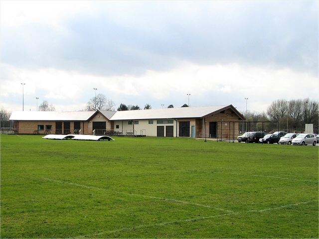
The town is known for its excellent schools, both primary and secondary, making it an attractive location for families. There are also several parks and green spaces, such as Altrincham Golf Course and John Leigh Park, providing recreational opportunities for residents.

Altrincham is famous for its market, which dates back to the 13th century. The market offers a wide range of goods, including fresh produce, clothing, crafts, and antiques, attracting shoppers from the local area and beyond.

Overall, Altrincham is a vibrant town with a rich history, excellent amenities, and a thriving community, making it a desirable place to live and visit in Cheshire.

If you have any feedback on the listing, please let us know in the comments section below.
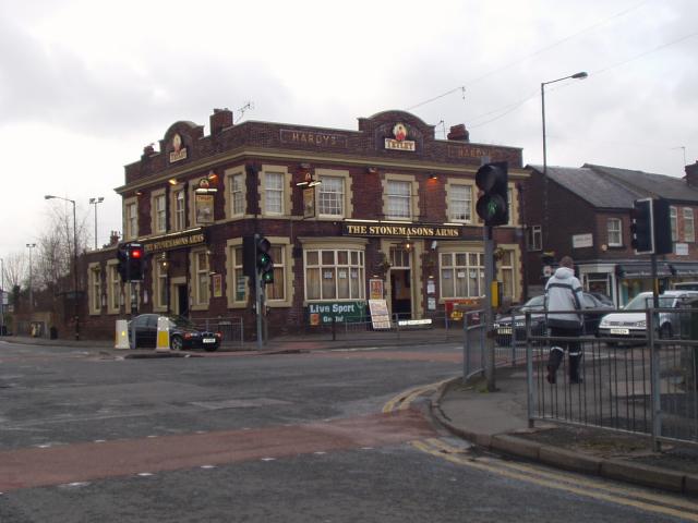
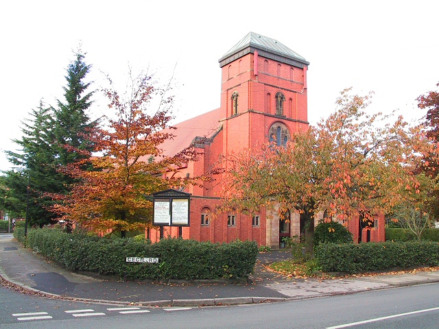
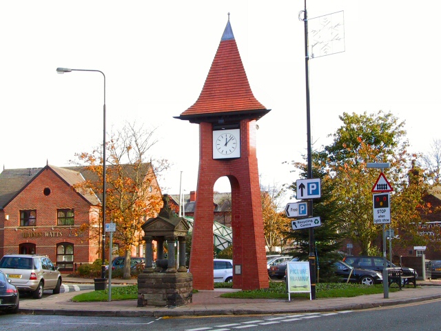
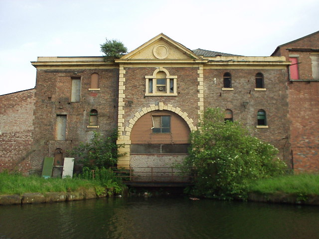
Altrincham Images

Images are sourced within 2km of 53.38881/-2.334521 or Grid Reference SJ7788. Thanks to Geograph Open Source API. All images are credited.

The Stonemasons Arms SJ7889 forms part of the residential area of Timperley.  The housing in this area grew following WWI around the village centre, at the very heart, the local pub.
The Stonemasons Arms
SJ7889 forms part of the residential area of Timperley. The housing in this area grew following WWI around the village centre, at the very heart, the local pub.
Retail Park This picture taken at SJ766892 looking west at the retail park.
Retail Park
This picture taken at SJ766892 looking west at the retail park.
St Georges Church This image was taken from SJ767882 looking WSW towards St Georges Church, Altrincham.
St Georges Church
This image was taken from SJ767882 looking WSW towards St Georges Church, Altrincham.
Green Lane at Baguley Pedestrian way and bridle path leading over the railway bridge at Brooks Drive. From the roundabout at the top of Brooklands Road.
Green Lane at Baguley
Pedestrian way and bridle path leading over the railway bridge at Brooks Drive. From the roundabout at the top of Brooklands Road.
Hale United Reformed Church On the corner of Cecil Road, Hale, this church is circa 1904.
Hale United Reformed Church
On the corner of Cecil Road, Hale, this church is circa 1904.
Old and New The fountain is of 1908 vintage, the clock quite a bit more recent. They stand in the square near Hale station and level crossing.
Old and New
The fountain is of 1908 vintage, the clock quite a bit more recent. They stand in the square near Hale station and level crossing.
Altrincham. An L.R.V.set, based in Manchester, at a Station shared with B.R. I would suspect that the L.R.V's. run on ex-B.R. right-of-way??
Altrincham.
An L.R.V.set, based in Manchester, at a Station shared with B.R. I would suspect that the L.R.V's. run on ex-B.R. right-of-way??
Altrincham. Another variety of B.R. self-propelled stock.
Altrincham.
Another variety of B.R. self-propelled stock.
Altrincham. A set of L.R.V.'s setting off back to Manchester. The B.R. tracks are on the right-hand side of the Platform on which I was standing.
Altrincham.
A set of L.R.V.'s setting off back to Manchester. The B.R. tracks are on the right-hand side of the Platform on which I was standing.
Altrincham. A general view of the Station with the B.R. section to the right.
Altrincham.
A general view of the Station with the B.R. section to the right.
Sheep in Sylvan Grove This house was built by the Countess of the Dunham Estate for her Estate Manager in 1900. Typical Victorian neo-Tudor
Sheep in Sylvan Grove
This house was built by the Countess of the Dunham Estate for her Estate Manager in 1900. Typical Victorian neo-Tudor
Canal Warehouse, Broadheath, Altrincham Built in 1833 by the Bridgewater Canal Company, this warehouse is located on the south bank of the canal.
Canal Warehouse, Broadheath, Altrincham
Built in 1833 by the Bridgewater Canal Company, this warehouse is located on the south bank of the canal.
Timperley Bridge Road bridge over the canal which forms part of the Cheshire Ring. View looking roughly northeast, in the direction of Manchester city centre. The lift down to the platform of Timperley Metro station descends from the turret behind the lamp-post to the right of centre shot.
Timperley Bridge
Road bridge over the canal which forms part of the Cheshire Ring. View looking roughly northeast, in the direction of Manchester city centre. The lift down to the platform of Timperley Metro station descends from the turret behind the lamp-post to the right of centre shot.
Trams at Navigation Road station, near Altrincham, Cheshire Car no 1020 of Manchester Metrolink heads a two-car formation on a down service from Manchester to Altrincham.  The method of working this station is very unusual: the left-hand track is used by trams in both directions, while the right-hand track, which is not electrified, is used for 'heavy rail' services, usually Manchester-Stockport-Altrincham-Chester
Trams at Navigation Road station, near Altrincham, Cheshire
Car no 1020 of Manchester Metrolink heads a two-car formation on a down service from Manchester to Altrincham. The method of working this station is very unusual: the left-hand track is used by trams in both directions, while the right-hand track, which is not electrified, is used for 'heavy rail' services, usually Manchester-Stockport-Altrincham-Chester
Christ Church, Timperley A view of the church across the graveyard. The church stands on the corner of Ridgeway Road.
Christ Church, Timperley
A view of the church across the graveyard. The church stands on the corner of Ridgeway Road.
Timperley Brook Looking north up Wellfield Lane at the point where Timperley Brook passes beneath it.The new stone retaining walls, road surface and kerbstones lead one to the conclusion that a new culvert has recently been constructed here.
Timperley Brook
Looking north up Wellfield Lane at the point where Timperley Brook passes beneath it.The new stone retaining walls, road surface and kerbstones lead one to the conclusion that a new culvert has recently been constructed here.
Timperley Brook Looking eastward at Timperley Brook from the roadway above the culvert at Wellfield Lane.
Timperley Brook
Looking eastward at Timperley Brook from the roadway above the culvert at Wellfield Lane.
Ash Lane Bus Shelter Viewed from the end of Woburn Drive, and looking down Ash Lane in the direction of Shay Lane. The bus "shelter" offers little protection from the elements during inclement weather. The houses bordering this curving lane look out across open farmland, towards Davenport Green.
Ash Lane Bus Shelter
Viewed from the end of Woburn Drive, and looking down Ash Lane in the direction of Shay Lane. The bus "shelter" offers little protection from the elements during inclement weather. The houses bordering this curving lane look out across open farmland, towards Davenport Green.
Show me another place!

Altrincham is located at Grid Ref: SJ7788 (Lat: 53.38881, Lng: -2.334521)

Unitary Authority: Trafford

Police Authority: Greater Manchester

What 3 Words

///lend.hunt.nature. Near Altrincham, Manchester

Nearby Locations

Altrincham

Related Wikis

Blessed Thomas Holford Catholic College

Blessed Thomas Holford Catholic College is a secondary school based in Altrincham, Greater Manchester. The school specialises in maths and computing, and...

Timperley

Timperley is a suburban area in the borough of Trafford, Greater Manchester, England. Within the boundaries of the historic county of Cheshire, it is approximately...

Wellington School, Timperley

Wellington School is a mixed secondary school and sixth form with academy status. It is located in Timperley in the English county of Greater Manchester...
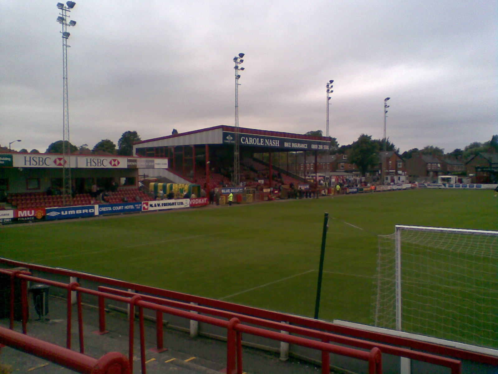
Moss Lane

Moss Lane (currently known as the J. Davidson Stadium for sponsorship purposes) is a multi-purpose stadium in Altrincham, Greater Manchester, England....

Nearby Amenities

Located within 500m of 53.38881,-2.334521
Crossing
Crossing: traffic_signals
Crossing Island: no
Crossing Ref: puffin
Kerb: lowered
Tactile Paving: yes
Lat/Long: 53.3917235/-2.3315953
Traffic Calming: cushion
Lat/Long: 53.3897174/-2.3281473
Pub
Hare and Hounds
Lat/Long: 53.3913222/-2.3290658
Bus Stop
Timperley, Stockport Road / near Hare and Hounds
Bus: yes
Naptan AtcoCode: 1800SJ40751
Naptan Bearing: W
Naptan CommonName: Stockport Road/Hare and Hounds
Naptan Indicator: Op Shell Garage
Naptan Landmark: Sports Club
Naptan NaptanCode: manjtgwj
Naptan PlusbusZoneRef: MNCRPIC
Naptan ShortCommonName: Hare and Hounds
Naptan Street: STOCKPORT ROAD
Naptan Verified: no
Network: TfGM
Operator: TfGM
Public Transport: platform
Source: naptan_import
Lat/Long: 53.3915552/-2.330849
Bus Stop
Timperley, Stockport Road / outside The Old Hall
Bus: yes
Naptan AtcoCode: 1800SJ40761
Naptan Bearing: W
Naptan CommonName: Stockport Road/The Old Hall
Naptan Indicator: Golf Club
Naptan Landmark: GOLF CLUB
Naptan NaptanCode: manjtgwm
Naptan PlusbusZoneRef: MNCRPIC
Naptan ShortCommonName: The Old Hall
Naptan Street: STOCKPORT ROAD
Naptan Verified: no
Network: TfGM
Operator: TfGM
Public Transport: platform
Source: naptan_import
Lat/Long: 53.3916665/-2.3360377
Bus Stop
Timperley, Stockport Road / opposite The Old Hall
Bus: yes
Naptan AtcoCode: 1800SJ41021
Naptan Bearing: E
Naptan CommonName: Stockport Road/The Old Hall
Naptan Indicator: Opp Golf Club
Naptan Landmark: OPP GOLF CLUB
Naptan NaptanCode: manjtjdg
Naptan PlusbusZoneRef: MNCRPIC
Naptan ShortCommonName: The Old Hall
Naptan Street: STOCKPORT ROAD
Naptan Verified: no
Network: TfGM
Operator: TfGM
Public Transport: platform
Source: naptan_import
Lat/Long: 53.3917556/-2.3363091
Traffic Calming: cushion
Lat/Long: 53.3894322/-2.3271791
Traffic Calming: cushion
Lat/Long: 53.3899721/-2.3287704
Traffic Calming: cushion
Lat/Long: 53.3905206/-2.329393
Traffic Signals
Traffic Signals: signal
Traffic Signals Direction: backward
Lat/Long: 53.3913747/-2.3295808
Traffic Signals
Traffic Signals: signal
Traffic Signals Direction: forward
Lat/Long: 53.3917462/-2.3299403
Cycleway: asl
Direction: forward
Lat/Long: 53.3915588/-2.3300099
Turning Circle
Lat/Long: 53.3925082/-2.3317514
Cycleway: asl
Direction: forward
Lat/Long: 53.3911859/-2.3407187
Defibrillator
Emergency: defibrillator
Lat/Long: 53.3906049/-2.3367555
Entrance: yes
Lat/Long: 53.3857243/-2.3388879
Post Box
Lat/Long: 53.3857752/-2.3394607
Traffic Signals
Traffic Signals: signal
Traffic Signals Direction: forward
Lat/Long: 53.3916468/-2.3287641
Give Way
Direction: forward
Lat/Long: 53.391489/-2.3286127
Traffic Signals
Traffic Signals: signal
Traffic Signals Direction: forward
Lat/Long: 53.3915284/-2.3285902
Cycleway: asl
Direction: backward
Lat/Long: 53.3915901/-2.3295208
Traffic Signals
Traffic Signals: signal
Traffic Signals Direction: backward
Lat/Long: 53.3915947/-2.3294612
Cycleway: asl
Direction: forward
Lat/Long: 53.3916616/-2.3300346
Traffic Signals
Traffic Signals: signal
Traffic Signals Direction: forward
Lat/Long: 53.3916257/-2.3300832
Traffic Signals
Traffic Signals: signal
Traffic Signals Direction: forward
Lat/Long: 53.3915601/-2.3300684
Cycleway: asl
Direction: backward
Lat/Long: 53.3914172/-2.3296196
Give Way
Direction: forward
Lat/Long: 53.3914054/-2.3295172
Traffic Signals
Traffic Signals: signal
Traffic Signals Direction: forward
Lat/Long: 53.3914806/-2.3294542
Crossing
Crossing: traffic_signals
Crossing Island: yes
Crossing Ref: puffin
Tactile Paving: yes
Lat/Long: 53.3914609/-2.329473
Cycleway: asl
Direction: forward
Lat/Long: 53.3917162/-2.3299095
Crossing
Crossing: traffic_signals
Crossing Island: yes
Crossing Ref: puffin
Tactile Paving: yes
Lat/Long: 53.3916957/-2.3300015
Crossing
Crossing: traffic_signals
Crossing Island: yes
Crossing Ref: puffin
Tactile Paving: yes
Lat/Long: 53.3916902/-2.3298828
Crossing
Crossing: traffic_signals
Crossing Island: yes
Crossing Ref: puffin
Tactile Paving: yes
Lat/Long: 53.3915876/-2.3295552
Crossing
Crossing: traffic_signals
Crossing Island: yes
Crossing Ref: puffin
Tactile Paving: yes
Lat/Long: 53.3914434/-2.3296435
Traffic Signals
Traffic Signals: signal
Traffic Signals Direction: forward
Lat/Long: 53.3911901/-2.340661
Bus Stop
TImperley, Wood Drive / by Stanley Drive
Bus: yes
Naptan AtcoCode: 1800SJ00231
Naptan NaptanCode: MANWAJAJ
Network: TfGM
Operator: TfGM
Public Transport: platform
Lat/Long: 53.3896686/-2.3278387
Golf: clubhouse
Lat/Long: 53.3899067/-2.3373782
Pub
Old Hall
Addr City: Altrincham
Addr Housename: Old Hall
Addr Postcode: WA15 7LP
Addr Street: Stockport Road
Opening Hours: Mo-Su 11:00-23:00
Phone: +44 161 929 6332
Website: https://www.oldhallaltrincham.co.uk/
Lat/Long: 53.3903906/-2.3367266
Give Way
Direction: forward
Lat/Long: 53.391736/-2.3292101
Access: customers
Leisure: pitch
Sport: cricket
Surface: grass
Lat/Long: 53.3912329/-2.3322935
Wildlife at King George V Pool
Tourism: information
Lat/Long: 53.3875267/-2.3389605
Bench
Lat/Long: 53.3876461/-2.336878
Bench
Lat/Long: 53.3874379/-2.3384437
Waste Basket
Lat/Long: 53.3879513/-2.3404763
Bench
Lat/Long: 53.3875027/-2.3389382
Life Ring
Emergency: life_ring
Lat/Long: 53.3877497/-2.3368501
Waste Basket
Lat/Long: 53.3877052/-2.3368565
The data included in this document is from www.openstreetmap.org. The data is made available under ODbL.

Have you been to Altrincham?

Leave your review of Altrincham below (or comments, questions and feedback).