Earlseat Wood

Wood, Forest in Nairnshire

Scotland

Earlseat Wood

Pasture and woodland near Wester Milton Looking south-eastward.
Pasture and woodland near Wester Milton Credit: Peter Wood

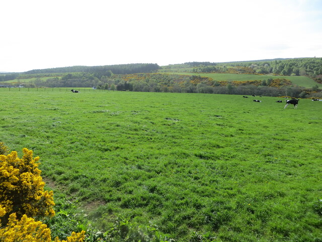
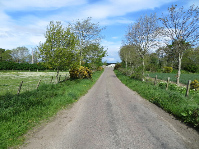
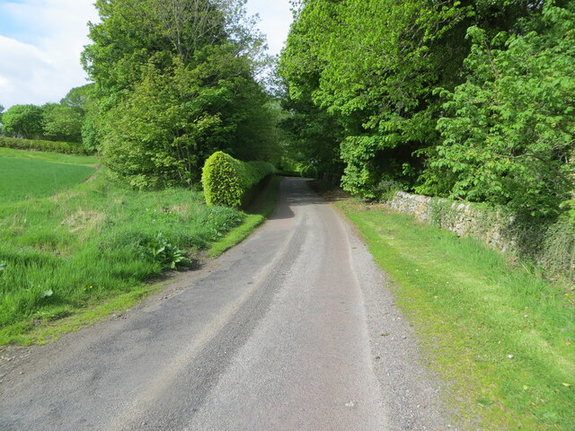
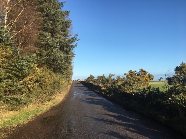
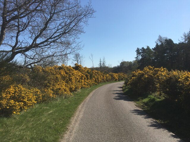
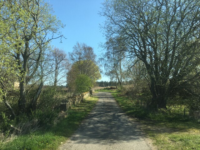
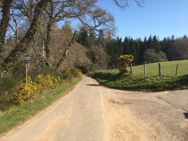
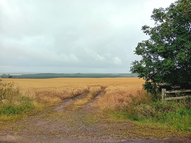
Earlseat Wood, located in Nairnshire, is a picturesque forest that covers an area of approximately 100 acres. Situated in the northeast of Scotland, this woodland is renowned for its natural beauty and is a popular destination for nature enthusiasts and hikers alike.

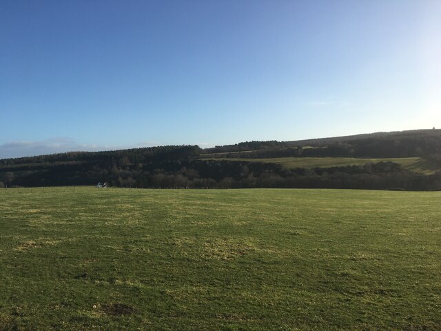
The wood features a diverse range of tree species, including Scots pine, birch, and oak, creating a vibrant and lush environment. The dense canopy provides a habitat for various fauna, such as red squirrels, roe deer, and a variety of bird species, making it an ideal spot for wildlife observation.

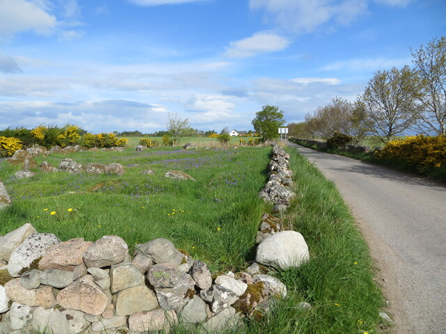
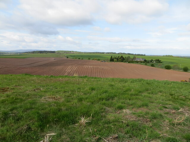
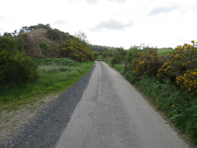
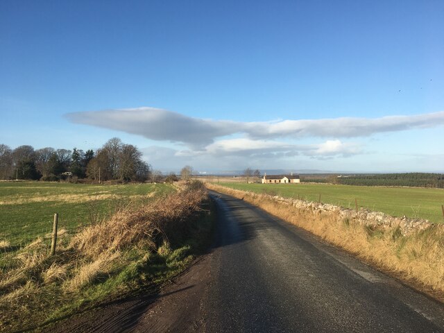
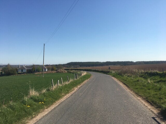
Traversing through Earlseat Wood is made easy by a network of well-maintained trails, allowing visitors to explore the area at their own pace. The paths wind through the forest, offering stunning views of the surrounding landscape, including rolling hills and open meadows. Along the way, there are designated picnic areas and benches, providing opportunities for visitors to relax and enjoy the peaceful ambiance.

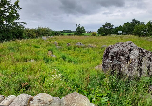
In addition to its natural beauty, Earlseat Wood holds historical significance. The area is known to have been inhabited since ancient times, with archaeological evidence suggesting human presence dating back thousands of years. This adds an extra layer of intrigue to the woodland, making it an exciting destination for history enthusiasts as well.

Overall, Earlseat Wood in Nairnshire is a haven for nature lovers, offering a tranquil escape from the hustle and bustle of everyday life. Its combination of breathtaking scenery, diverse wildlife, and rich history make it an enchanting place to visit and explore.

If you have any feedback on the listing, please let us know in the comments section below.

Earlseat Wood Images

Images are sourced within 2km of 57.567486/-3.7368677 or Grid Reference NH9654. Thanks to Geograph Open Source API. All images are credited.

Pasture and woodland near Wester Milton Looking south-eastward.
Pasture and woodland near Wester Milton
Looking south-eastward.
Minor road at Moyness Stone Circle Looking north-westward.
For information of the Stone Circle see : <a title="https://www.geograph.org.uk/photo/272629" href="https://www.geograph.org.uk/photo/272629">Link</a>
Minor road at Moyness Stone Circle
Looking north-westward. For information of the Stone Circle see : Link
Land under cultivation at Earlseat Looking south-westward from the Triangulation Pillar.
Land under cultivation at Earlseat
Looking south-westward from the Triangulation Pillar.
Track giving access to Boghole Farm Looking south-eastward.
Track giving access to Boghole Farm
Looking south-eastward.
Minor road and Earlsmill Bridge crossing Muckle Burn Looking north-westward.
Minor road and Earlsmill Bridge crossing Muckle Burn
Looking north-westward.
Minor road approaching Earlsmill House Looking south-westward.
Minor road approaching Earlsmill House
Looking south-westward.
Ordnance Survey Cut Mark This mark can be found on Earlsmill Bridge parapet. There was once a rivet associated with the mark but this is no longer present.
The recorded details give a height of 35.9441 metres above sea level.
For more detail see : <span class="nowrap"><a title="https://www.bench-marks.org.uk/bm171252" rel="nofollow ugc noopener" href="https://www.bench-marks.org.uk/bm171252">Link</a><img style="margin-left:2px;" alt="External link" title="External link - shift click to open in new window" src="https://s1.geograph.org.uk/img/external.png" width="10" height="10"/></span>
Ordnance Survey Cut Mark
This mark can be found on Earlsmill Bridge parapet. There was once a rivet associated with the mark but this is no longer present. The recorded details give a height of 35.9441 metres above sea level. For more detail see : LinkExternal link
Mains of Moyness Stone Circle Stone Circle in Highland. A partly destroyed Clava Ringcairn with an 18.2m diameter external kerb of contiguous stones. The north-eastern portion of the site was removed in the early part of the 19th century when a road was built. The internal setting, of which there is now no trace, had a 7.3m diameter kerb with a paved interior. The outer stone circle is ruined with only 1 upright surviving 5.5m from the outer kerb.
Mains of Moyness Stone Circle
Stone Circle in Highland. A partly destroyed Clava Ringcairn with an 18.2m diameter external kerb of contiguous stones. The north-eastern portion of the site was removed in the early part of the 19th century when a road was built. The internal setting, of which there is now no trace, had a 7.3m diameter kerb with a paved interior. The outer stone circle is ruined with only 1 upright surviving 5.5m from the outer kerb.
Farmland near Milton
Road towards Moyness
Minor road towards Auldearn
Minor road near Earlsmill
Minor road near Earlseat Wood
Oilseed crop near Earlseat
Minor road near Easter Milton
Minor road past Glenshiel Farm
Minor road near Whitemire
Arable Field At Moyness.
Arable Field
At Moyness.
Show me another place!

Earlseat Wood is located at Grid Ref: NH9654 (Lat: 57.567486, Lng: -3.7368677)

Unitary Authority: Highland

Police Authority: Highlands and Islands

What 3 Words

///gurgled.bottom.infringe. Near Forres, Moray

Nearby Locations

Earlseat Wood

Related Wikis

Brodie railway station

Brodie railway station served the area of Brodie, Moray, Scotland from 1857 to 1965 on the Inverness and Aberdeen Junction Railway. == History == The station...

Brightmony House

Brightmony House is an 18th-century manor house located south of Auldearn, Highland in Scotland. It is a Category A listed building == History == The property...

Darnaway Castle

Darnaway Castle, also known as Tarnaway Castle, is located in Darnaway Forest, 3 miles (4.8 km) southwest of Forres in Moray, Scotland. This was Comyn...

Kinsteary House

Kinsteary House is a manor house and site of a possible castle located south of Auldearn, Highland in Scotland. == History == The property passed by marriage...

Rodney's Stone

Rodney's Stone is a two-metre high Pictish cross slab now located close on the approach way to Brodie Castle, near Forres, Moray, Scotland. It was originally...

Battle of Auldearn

The Battle of Auldearn was an engagement of the Wars of the Three Kingdoms. It took place on 9 May 1645, in and around the village of Auldearn in Nairnshire...

Littlemill

Littlemill is a village located close to Nairn in Nairnshire, Scottish Highlands and is in the Scottish council area of Highland. == References ==

Auldearn

Auldearn (Scottish Gaelic: Allt Ăˆireann) is a village situated east of the River Nairn, just outside Nairn in the Highland council area of Scotland. It...

Nearby Amenities

Located within 500m of 57.567486,-3.7368677
Power: pole
Lat/Long: 57.5686156/-3.7445241
Power: pole
Lat/Long: 57.5690156/-3.7433254
Power: pole
Lat/Long: 57.5693513/-3.7423106
Power: pole
Lat/Long: 57.5696927/-3.741301
Power: pole
Lat/Long: 57.5700541/-3.7402222
Power: pole
Lat/Long: 57.5704141/-3.7391727
Power: pole
Lat/Long: 57.5707384/-3.7381818
Power: pole
Lat/Long: 57.5710941/-3.7371483
Power: pole
Lat/Long: 57.5714226/-3.736184
Power: pole
Lat/Long: 57.5717583/-3.7351718
The data included in this document is from www.openstreetmap.org. The data is made available under ODbL.

Have you been to Earlseat Wood?

Leave your review of Earlseat Wood below (or comments, questions and feedback).