Birse Brae

Wood, Forest in Dumfriesshire

Scotland

Birse Brae

Wardlaw Trig Point The trig point on Wardlaw.
Wardlaw Trig Point Credit: Rab McMurdo

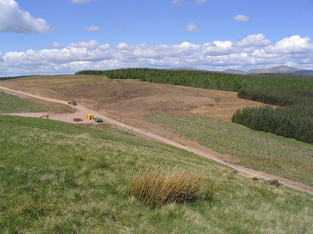
Birse Brae is a picturesque woodland located in Dumfriesshire, Scotland. Spanning over a vast area, it is renowned for its natural beauty and diverse ecosystem. The forest is situated on a gently sloping hillside, providing visitors with stunning panoramic views of the surrounding countryside.

The woodland is predominantly composed of native tree species such as oak, birch, and beech, creating a rich tapestry of colors throughout the seasons. The dense canopy of the trees provides a peaceful and serene atmosphere, making it a popular destination for nature enthusiasts and hikers seeking tranquility.

Birse Brae is not only visually appealing but also hosts a wide range of wildlife. Birdwatchers can spot a variety of species, including woodpeckers, owls, and various songbirds. The forest is also home to mammals such as deer, foxes, and squirrels, adding to the biodiversity of the area.

Trails and paths meander through the woodland, allowing visitors to explore the area at their own pace. These paths are well-maintained and offer different levels of difficulty, catering to both casual walkers and experienced hikers. The forest also features picnic areas and benches, providing opportunities for visitors to relax and enjoy the natural surroundings.

Birse Brae is a true gem of Dumfriesshire, offering a tranquil escape from the hustle and bustle of everyday life. Its natural beauty, diverse flora and fauna, and well-maintained trails make it a must-visit destination for nature lovers and outdoor enthusiasts alike.

If you have any feedback on the listing, please let us know in the comments section below.
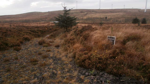
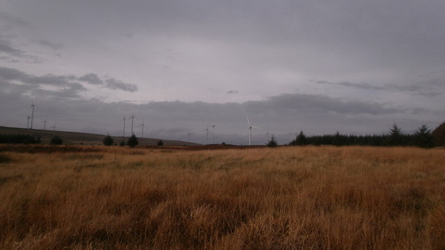
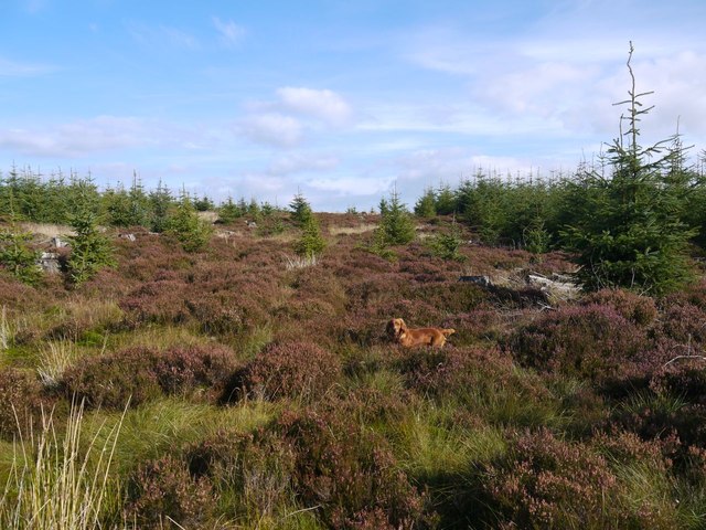
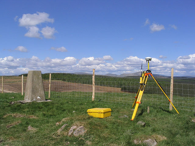
Birse Brae Images

Images are sourced within 2km of 55.19253/-3.6497172 or Grid Reference NX9589. Thanks to Geograph Open Source API. All images are credited.

Wardlaw Trig Point The trig point on Wardlaw.
Wardlaw Trig Point
The trig point on Wardlaw.
No 2 turbine, Dalswinton windfarm This view takes in turbines 2,3 & 4 on Fern Hill
No 2 turbine, Dalswinton windfarm
This view takes in turbines 2,3 & 4 on Fern Hill
Pennyland Loch Looking from the track SW towards Pennyland Loch
Pennyland Loch
Looking from the track SW towards Pennyland Loch
Ride on Glenmaid Moor This is within the Forestry Commission Ae Forest District plantation on Glenmaid Moor
Ride on Glenmaid Moor
This is within the Forestry Commission Ae Forest District plantation on Glenmaid Moor
Pennyland Moor Looking NW on Pennyland Moor. Dalswinton windfarm in the background.
Pennyland Moor
Looking NW on Pennyland Moor. Dalswinton windfarm in the background.
Dalswinton Wind Farm One of the turbines at Dalswinton Wind Farm with Queensberry in the distance.
Dalswinton Wind Farm
One of the turbines at Dalswinton Wind Farm with Queensberry in the distance.
Auchencairn Height summit cairn Summit Cairn. The nearby "Royach Cairn" exists only as a dip in the ground.
Auchencairn Height summit cairn
Summit Cairn. The nearby "Royach Cairn" exists only as a dip in the ground.
Mid Cairn
Mid Cairn
Deil's Dike
Deil's Dike
The trig point on Wardlaw At 280m with a flush bracket number S7755. The surveying equipment is in connection with nearby construction work for Dalswinton windfarm.
The trig point on Wardlaw
At 280m with a flush bracket number S7755. The surveying equipment is in connection with nearby construction work for Dalswinton windfarm.
Wardlaw Construction works for Dalswinton windfarm viewed from Wardlaw. I had intended cycling on to Pennyland Farm but there was just too much heavy plant operations and traffic so I turned back at this point.
Wardlaw
Construction works for Dalswinton windfarm viewed from Wardlaw. I had intended cycling on to Pennyland Farm but there was just too much heavy plant operations and traffic so I turned back at this point.
Dalswinton Wind Farm Two of the 15 wind turbines at the Dalswinton wind farm, 80m high to hub height, 121m to blade tip. Photograph taken during the open day organised by the operators Airtricity.
Dalswinton Wind Farm
Two of the 15 wind turbines at the Dalswinton wind farm, 80m high to hub height, 121m to blade tip. Photograph taken during the open day organised by the operators Airtricity.
Pennyland trig OS name for the pillar. Dalswinton windfarm and its control building behind.
Pennyland trig
OS name for the pillar. Dalswinton windfarm and its control building behind.
Fern Hill Looking across Pennyland Burn to the Dalswinton wind farm
Fern Hill
Looking across Pennyland Burn to the Dalswinton wind farm
Dalswinton Windfarm on Pennyland Moor: aerial 2016
Dalswinton wind farm from the air The 15 turbine wind farm on Fern Hill has an installed capacity of 30MW and has been generating since June 2008 <span class="nowrap"><a title="https://www.infinis.com/our-business/onshore-wind/our-operations/dalswinton/" rel="nofollow ugc noopener" href="https://www.infinis.com/our-business/onshore-wind/our-operations/dalswinton/">Link</a><img style="margin-left:2px;" alt="External link" title="External link - shift click to open in new window" src="https://s1.geograph.org.uk/img/external.png" width="10" height="10"/></span> .
Dalswinton wind farm from the air
The 15 turbine wind farm on Fern Hill has an installed capacity of 30MW and has been generating since June 2008 LinkExternal link .
Gowkstane Burn, Forest of Ae
Show me another place!

Birse Brae is located at Grid Ref: NX9589 (Lat: 55.19253, Lng: -3.6497172)

Unitary Authority: Dumfries and Galloway

Police Authority: Dumfries and Galloway

What 3 Words

///fittingly.supplied.spoil. Near Thornhill, Dumfries & Galloway

Nearby Locations

Birse Brae Peat Moss

Related Wikis

Ae, Dumfries and Galloway

Ae (pronounced ) is a village in Dumfries and Galloway, south west Scotland. The village is located on the edge of a 15,000-acre (61 km2) human-made conifer...

Loch Ettrick

Loch Ettrick is a body of water near Thornhill and Ae, Dumfries and Galloway, in the Southern Uplands of Scotland.

Auldgirth railway station

Auldgirth railway station was a station which served Auldgirth, in the Scottish county of Dumfries and Galloway. It was served by trains on what is now...

Closeburn Castle

Closeburn Castle is a privately owned tower house, probably of the 14th century, but possibly older, and is one of the oldest continually inhabited houses...

Nearby Amenities

Located within 500m of 55.19253,-3.6497172
Auchengeith
Ele: 299.9
Natural: peak
Note: OS7: 984 feet
Lat/Long: 55.1957818/-3.6465774
Generator Method: wind_turbine
Generator Source: wind
Generator Type: horizontal_axis
Power: generator
Lat/Long: 55.1909353/-3.6564724
Auchengeith Moor
Place: locality
Lat/Long: 55.1951243/-3.643794
The data included in this document is from www.openstreetmap.org. The data is made available under ODbL.

Have you been to Birse Brae?

Leave your review of Birse Brae below (or comments, questions and feedback).