Mabie Forest
Wood, Forest in Kirkcudbrightshire
Scotland
Mabie Forest

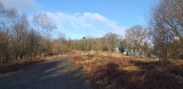
Mabie Forest is a picturesque woodland located in the historical county of Kirkcudbrightshire, Scotland. Covering an area of approximately 1,300 hectares, this expansive forest is a haven for nature enthusiasts and outdoor adventurers alike.
The forest is predominantly made up of coniferous trees, with Sitka spruce being the most common species found here. However, pockets of ancient broadleaf woodland can also be found, adding to the diversity of the landscape. The forest is managed by Forestry and Land Scotland, ensuring the preservation of its natural beauty and the sustainability of its resources.
Mabie Forest offers a range of outdoor activities for visitors to enjoy. There are numerous walking and cycling trails that weave through the forest, catering to all levels of ability. The trails are well-marked and maintained, providing a safe and enjoyable experience for hikers and bikers. For those seeking a more adrenaline-fueled adventure, there is a mountain bike trail center within the forest, known for its challenging routes and thrilling descents.
The forest is also home to an abundance of wildlife, including red squirrels, roe deer, and a variety of bird species. Birdwatchers can spot buzzards, woodpeckers, and even ospreys in the right season. The tranquil surroundings of Mabie Forest make it an ideal spot for nature lovers to relax and observe the local flora and fauna.
Overall, Mabie Forest in Kirkcudbrightshire is a captivating destination for those seeking to immerse themselves in the natural beauty of Scotland. With its diverse woodland, recreational activities, and abundant wildlife, it offers an unforgettable experience for visitors of all ages.
If you have any feedback on the listing, please let us know in the comments section below.
Mabie Forest Images
Images are sourced within 2km of 55.022752/-3.6667944 or Grid Reference NX9371. Thanks to Geograph Open Source API. All images are credited.


Mabie Forest is located at Grid Ref: NX9371 (Lat: 55.022752, Lng: -3.6667944)
Unitary Authority: Dumfries and Galloway
Police Authority: Dumfries and Galloway
What 3 Words
///verve.proved.triangles. Near Dumfries, Dumfries & Galloway
Nearby Locations
Related Wikis

Mabie, Dumfries and Galloway
Mabie is a collection of mountain biking routes located in Dumfries and Galloway, southwest Scotland. The mountain bike routes are part of the 7Stanes...

Lochaber Loch
Lochaber Loch is a small, lowland freshwater loch that lies among steep-sided hills, approximately 4.5 mi (7.2 km) to the west of Dumfries, Scotland. The...

Lochanhead railway station
Lochanhead railway station served the settlement of Lochanhead, Dumfries and Galloway, Scotland from 1859 to 1965 on the Castle Douglas and Dumfries Railway...
Pict's Knowe
Pict's Knowe (grid reference NX 9538 7213) is a henge monument in the parish of Troqueer, Dumfries and Galloway. It is one of a small group of henge monuments...
Nearby Amenities
Located within 500m of 55.022752,-3.6667944Have you been to Mabie Forest?
Leave your review of Mabie Forest below (or comments, questions and feedback).