Carrow Hill

Settlement in Monmouthshire

Wales

Carrow Hill

Stone building in a corner of the churchyard, Llanvaches In the NW corner of St Dubritius churchyard in the Church in Wales Diocese of Monmouth.
Stone building in a corner of the churchyard, Llanvaches Credit: Jaggery

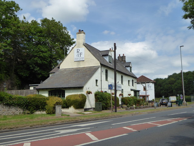
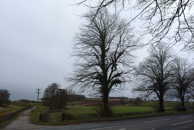
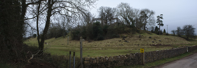
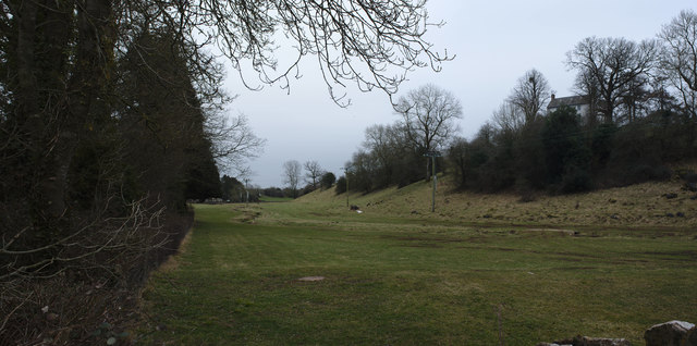
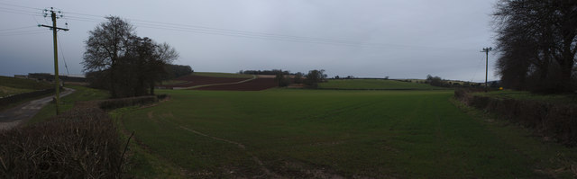
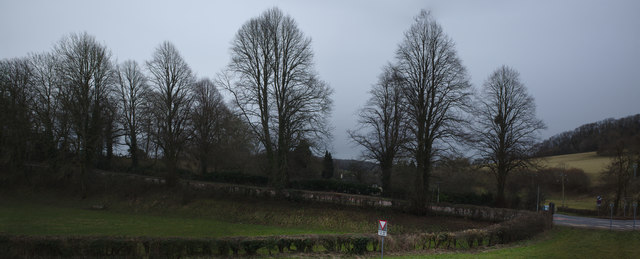
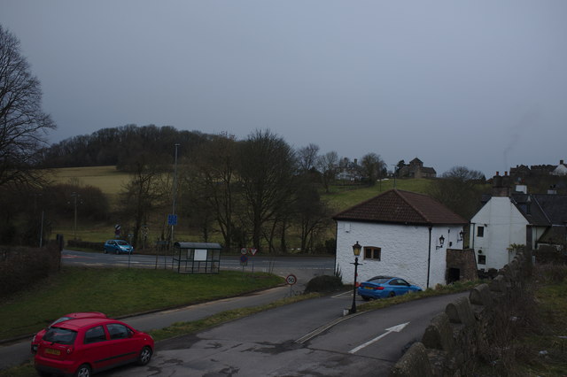
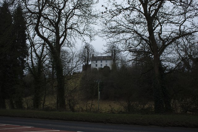
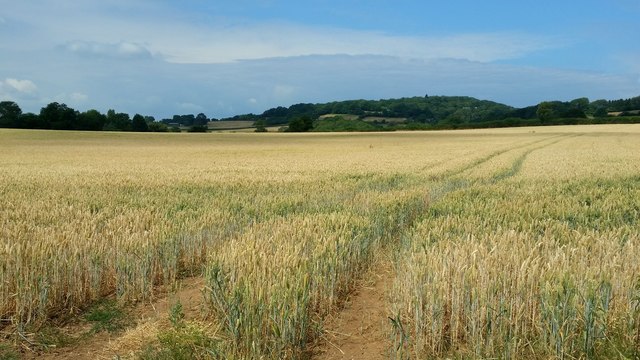
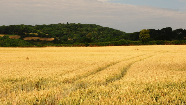
Carrow Hill is a small village located in Monmouthshire, Wales. Situated on the banks of the River Wye, it is surrounded by picturesque countryside and offers stunning views of the nearby hills and valleys. The village is known for its tranquility and natural beauty, making it a popular destination for those seeking a peaceful retreat.

The history of Carrow Hill dates back to medieval times, and remnants of this rich past can still be seen in the village. The quaint architecture of the houses and buildings adds to the charm of the area, with many of them displaying traditional Welsh features. The village also has a small but welcoming community, ensuring a warm and friendly atmosphere for residents and visitors alike.

Nature enthusiasts will find plenty to explore in Carrow Hill. The surrounding countryside offers ample opportunities for hiking, cycling, and wildlife spotting. The nearby River Wye is a popular spot for fishing, kayaking, and canoeing, attracting outdoor enthusiasts from far and wide.

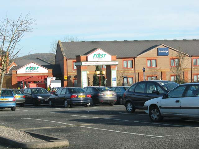
Despite its small size, Carrow Hill is well-connected to the rest of Monmouthshire and beyond. The village benefits from good transport links, with regular bus services to nearby towns and cities. The bustling market town of Monmouth is just a short drive away, offering a range of amenities including shops, restaurants, and schools.

In conclusion, Carrow Hill is a charming and peaceful village in Monmouthshire, Wales. With its stunning natural surroundings and friendly community, it is an ideal place for those seeking a tranquil lifestyle in a beautiful setting.

If you have any feedback on the listing, please let us know in the comments section below.
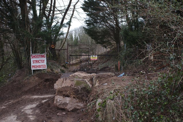
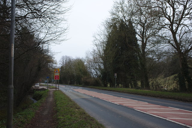
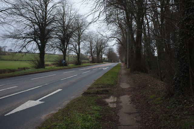
Carrow Hill Images

Images are sourced within 2km of 51.610531/-2.816781 or Grid Reference ST4390. Thanks to Geograph Open Source API. All images are credited.

Stone building in a corner of the churchyard, Llanvaches In the NW corner of St Dubritius churchyard in the Church in Wales Diocese of Monmouth.
Stone building in a corner of the churchyard, Llanvaches
In the NW corner of St Dubritius churchyard in the Church in Wales Diocese of Monmouth.
Evergreen tree in winter, Llanvaches In St Dubritius churchyard viewed in December 2021.
Evergreen tree in winter, Llanvaches
In St Dubritius churchyard viewed in December 2021.
Welcome to St Dubritius Church Llanvaches The Welcome board is above the perimeter wall on the north side
of the village churchyard in the Church in Wales Diocese of Monmouth.
Welcome to St Dubritius Church Llanvaches
The Welcome board is above the perimeter wall on the north side of the village churchyard in the Church in Wales Diocese of Monmouth.
The Rock and Fountain Inn, Penhow Beside the A48.
The Rock and Fountain Inn, Penhow
Beside the A48.
The track to Castle Farm
The house on the hill A 17th century house on the site of Penhow Castle
<span class="nowrap"><a title="http://map.coflein.gov.uk/index.php?action=do_details&numlink=221292" rel="nofollow ugc noopener" href="http://map.coflein.gov.uk/index.php?action=do_details&numlink=221292">Link</a><img style="margin-left:2px;" alt="External link" title="External link - shift click to open in new window" src="https://s1.geograph.org.uk/img/external.png" width="10" height="10"/></span>
The house on the hill
A 17th century house on the site of Penhow Castle LinkExternal link
A natural moat l land below Penhow Castle the natural plain and its little stream forms a natural barrier
A natural moat
l land below Penhow Castle the natural plain and its little stream forms a natural barrier
Field at Penhow
Field at Penhow
Row of trees
Row of trees
Quarry wall A curious ring wall left around a quarry, and then breached.
Quarry wall
A curious ring wall left around a quarry, and then breached.
Disused Quarry Another view of <a href="https://www.geograph.org.uk/photo/5703090">ST4291 : Quarry wall</a>
Disused Quarry
Another view of ST4291 : Quarry wall
Quarry entrance a series of stern warnings
Quarry entrance
a series of stern warnings
The A48 The A48 runs 119 miles from Gloucester to Carmarthen across South Wales. <span class="nowrap"><a title="http://www.sabre-roads.org.uk/wiki/index.php?title=A48" rel="nofollow ugc noopener" href="http://www.sabre-roads.org.uk/wiki/index.php?title=A48">Link</a><img style="margin-left:2px;" alt="External link" title="External link - shift click to open in new window" src="https://s1.geograph.org.uk/img/external.png" width="10" height="10"/></span>
The A48
The A48 runs 119 miles from Gloucester to Carmarthen across South Wales. LinkExternal link
A48 The A48 runs 119 miles from Gloucester to Carmarthen across South Wales. <span class="nowrap"><a title="http://www.sabre-roads.org.uk/wiki/index.php?title=A48" rel="nofollow ugc noopener" href="http://www.sabre-roads.org.uk/wiki/index.php?title=A48">Link</a><img style="margin-left:2px;" alt="External link" title="External link - shift click to open in new window" src="https://s1.geograph.org.uk/img/external.png" width="10" height="10"/></span>
A48
The A48 runs 119 miles from Gloucester to Carmarthen across South Wales. LinkExternal link
Barn at the Rock and Fountain Inn This is an ancient monument, a 17th century barn and stable
<span class="nowrap"><a title="http://map.coflein.gov.uk/index.php?action=do_details&numlink=43361" rel="nofollow ugc noopener" href="http://map.coflein.gov.uk/index.php?action=do_details&numlink=43361">Link</a><img style="margin-left:2px;" alt="External link" title="External link - shift click to open in new window" src="https://s1.geograph.org.uk/img/external.png" width="10" height="10"/></span>
Barn at the Rock and Fountain Inn
This is an ancient monument, a 17th century barn and stable LinkExternal link
Penhow Castle Grade II* Listed Penhow was developed from a heavily-built keep and was the first castle with a stone keep to be built in Britain by the conquering Normans in 1070 and has claims to be the oldest inhabited castle in Wales. Less than a century after the keep tower was built the larger area of the inner bailey was enclosed within a thick stone curtain wall. By the 14th century Penhow was quite a stronghold. The drawbridge was operated by counterweights of stone rediscovered in 1979. Above the lower hall, the Great Hall achieved its present shape in the late 1480s. The Lewis family converted Penhow from an old-fashioned castle to a modern house shortly after 1674. Thomas Lewis' son Thomas was High Sheriff of the county. Stephen Weeks bought the Norman stronghold in 1973 and rebuilt the ruins into an award-winning attraction that opened to the public in 1978. Penhow Castle was sold to a London businessman and closed to the public on 29th December 2002. The important thing about the house is that it was home to the famous Seymour family which eventually produced a King and Queen of England in Jane Seymour and Edward VI.
Penhow Castle
Grade II* Listed Penhow was developed from a heavily-built keep and was the first castle with a stone keep to be built in Britain by the conquering Normans in 1070 and has claims to be the oldest inhabited castle in Wales. Less than a century after the keep tower was built the larger area of the inner bailey was enclosed within a thick stone curtain wall. By the 14th century Penhow was quite a stronghold. The drawbridge was operated by counterweights of stone rediscovered in 1979. Above the lower hall, the Great Hall achieved its present shape in the late 1480s. The Lewis family converted Penhow from an old-fashioned castle to a modern house shortly after 1674. Thomas Lewis' son Thomas was High Sheriff of the county. Stephen Weeks bought the Norman stronghold in 1973 and rebuilt the ruins into an award-winning attraction that opened to the public in 1978. Penhow Castle was sold to a London businessman and closed to the public on 29th December 2002. The important thing about the house is that it was home to the famous Seymour family which eventually produced a King and Queen of England in Jane Seymour and Edward VI.
Ripening wheat An arable field to the west of Llanfair-Discoed and east of Llanvaches.
Ripening wheat
An arable field to the west of Llanfair-Discoed and east of Llanvaches.
Ripening wheat, 2 Telephoto shot from the same spot as <a href="https://www.geograph.org.uk/photo/5849974">ST4392 : Ripening wheat</a>.
The wooded hill in the distance is at Castell-prin Wood.
Ripening wheat, 2
Telephoto shot from the same spot as ST4392 : Ripening wheat. The wooded hill in the distance is at Castell-prin Wood.
Show me another place!

Carrow Hill is located at Grid Ref: ST4390 (Lat: 51.610531, Lng: -2.816781)

Unitary Authority: Monmouthshire

Police Authority: Gwent

What 3 Words

///assorted.fells.ordeals. Near Llanvaches, Newport

Related Wikis

St. Brides Netherwent

St. Brides Netherwent (Welsh: Sant-y-brid) is a parish and largely deserted village in Monmouthshire, south-east Wales. It is centred 2 miles north of...

Penhow Castle

Penhow Castle, Penhow, Newport dates from the early 12th century. Extended and reconstructed in almost every century since, it has been claimed to be the...

Llanvaches

Llanvaches or Llanfaches is a village and community parish within the boundaries of the city of Newport, Wales. It lies to the east of the urban area...

Penhow Woodlands National Nature Reserve

Penhow Woodlands National Nature Reserve is a national nature reserve and Site of Special Scientific Interest located in south east Wales near the village...

Penhow

Penhow (Welsh: Pen-hŵ) is a small village and community (parish) just inside the eastern edge of the boundary of the city of Newport, South Wales, within...

Llanvair Discoed

Llanvair Discoed (Welsh: Llanfair Is Coed) is a small village in Monmouthshire, south-east Wales, 6 miles west of Chepstow and 10 miles east of Newport...

Wentwood

Wentwood (Welsh: Coed Gwent), in Monmouthshire, South Wales, is a forested area of hills, rising to 1,014 feet (309 m) above sea level. It is located to...

Magor services

Magor services (in Welsh: Gwasanaethau Magwyr) is a motorway service station on the M4, located just off junction 23A, at Magor near Newport, in Monmouthshire...

Nearby Amenities

Located within 500m of 51.610531,-2.816781
Summit Energies Ltd
Office: company
Lat/Long: 51.6097474/-2.8137453
Direction: 195
Generator Method: photovoltaic
Generator Output Electricity: yes
Generator Solar Modules: 14
Generator Source: solar
Generator Type: solar_photovoltaic_panel
Location: roof
Power: generator
Lat/Long: 51.6107538/-2.8145215
The data included in this document is from www.openstreetmap.org. The data is made available under ODbL.

Have you been to Carrow Hill?

Leave your review of Carrow Hill below (or comments, questions and feedback).