Ach-mhairc-mhòir Wood

Wood, Forest in Perthshire

Scotland

Ach-mhairc-mhòir Wood

Ruins at Ach Mhairc Mhoir The remains of a depopulated township in Glen Tilt. In total it comprises twenty-seven buildings, four corn-drying kilns and several enclosures within an area of lazy-bed cultivation and clearance heaps. The remains vary from grass covered footings 0.5m high to drystone walls 1.5m high suggesting two phases of depopulation, the first beginning about 1850. See <span class="nowrap"><a title="https://canmore.org.uk/site/25886/ach-mhaire-mhoir" rel="nofollow ugc noopener" href="https://canmore.org.uk/site/25886/ach-mhaire-mhoir">Link</a><img style="margin-left:2px;" alt="External link" title="External link - shift click to open in new window" src="https://s1.geograph.org.uk/img/external.png" width="10" height="10"/></span>

The name means 'big field/meadow of the horse', I think, although I may be corrected by a proper Gaelic scholar.
Ruins at Ach Mhairc Mhoir Credit: Alan O'Dowd

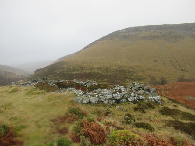
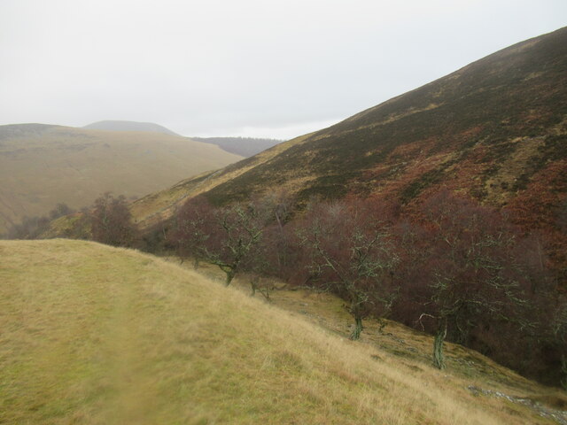
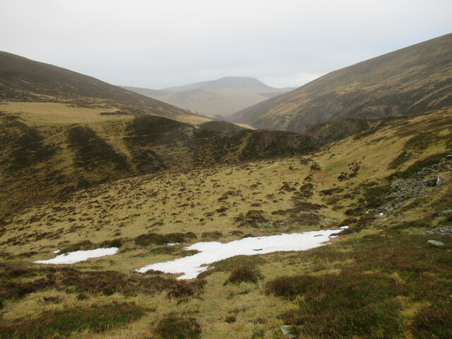
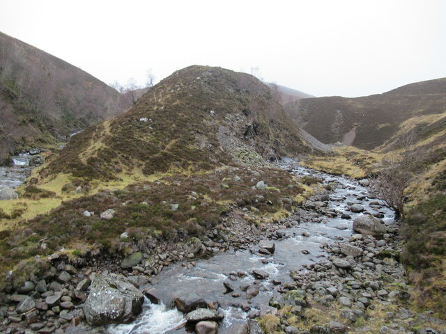
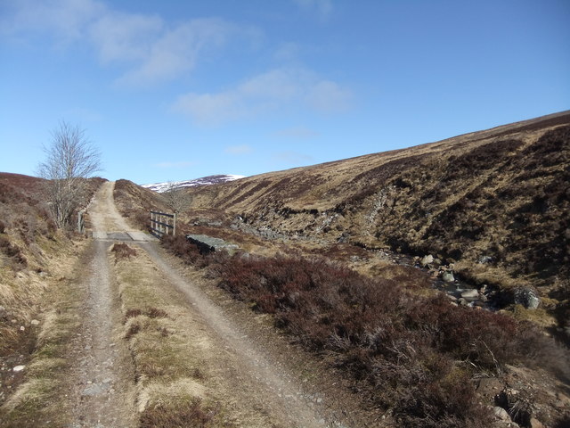
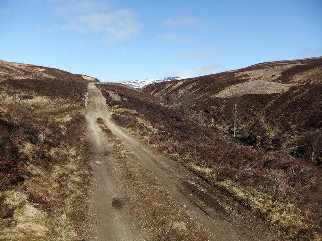
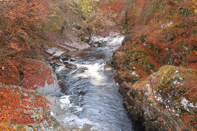
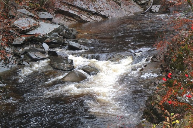
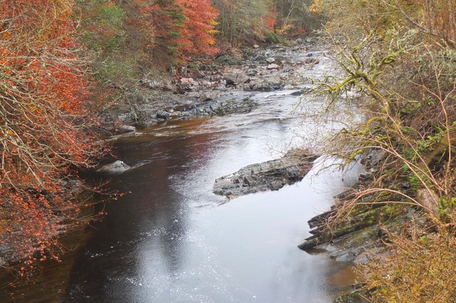
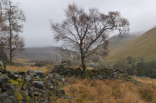
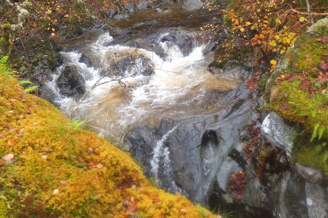
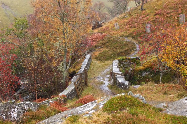
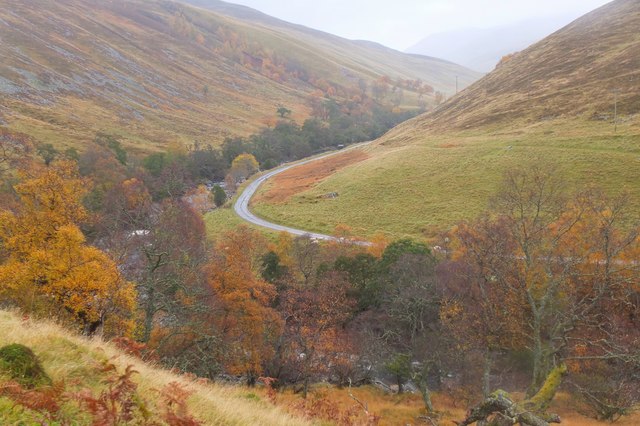
Ach-mhairc-mhòir Wood, located in Perthshire, Scotland, is a picturesque forest renowned for its natural beauty and rich biodiversity. Spanning over a vast area, the wood is characterized by its dense canopy of native trees, including oak, birch, and Scots pine.

The forest is home to an array of wildlife, making it a haven for nature enthusiasts and photographers. Red deer, roe deer, and various bird species such as woodpeckers and jays can often be spotted within the wood. The tranquil atmosphere and lush vegetation also attract a diverse range of insects, including butterflies and dragonflies.

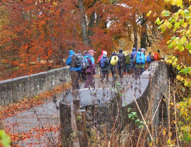
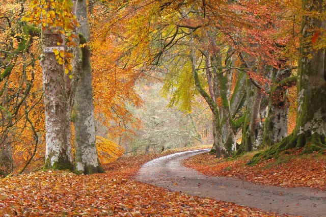
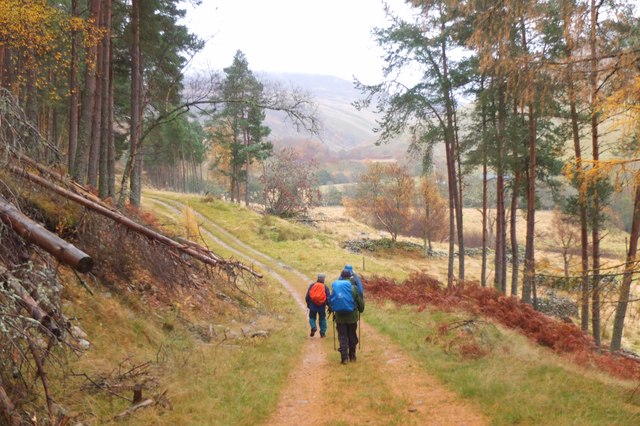
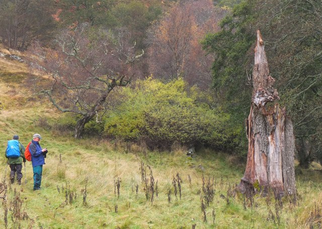
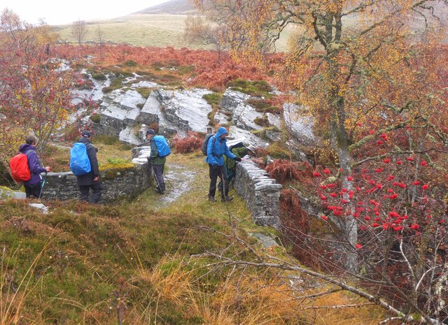
Visitors to Ach-mhairc-mhòir Wood can explore a network of well-maintained trails, offering stunning views of the surrounding countryside. These trails cater to different levels of difficulty, ensuring that both casual walkers and avid hikers can enjoy the wood. The forest also provides opportunities for recreational activities such as picnicking, camping, and wildlife observation.

The management of Ach-mhairc-mhòir Wood is focused on conservation and sustainable forestry practices. Efforts are made to preserve the natural habitat and protect the diverse ecosystem within the wood. Local forestry experts work diligently to maintain a healthy balance between human activities and the preservation of the forest's unique ecosystem.

Ach-mhairc-mhòir Wood is a hidden gem in Perthshire, offering visitors an escape into nature and a chance to immerse themselves in the serenity of the Scottish countryside. With its breathtaking scenery and abundant wildlife, it is a must-visit destination for those seeking a peaceful retreat or an adventure in the great outdoors.

If you have any feedback on the listing, please let us know in the comments section below.

Ach-mhairc-mhòir Wood Images

Images are sourced within 2km of 56.819951/-3.8209257 or Grid Reference NN8871. Thanks to Geograph Open Source API. All images are credited.

Ruins at Ach Mhairc Mhoir The remains of a depopulated township in Glen Tilt. In total it comprises twenty-seven buildings, four corn-drying kilns and several enclosures within an area of lazy-bed cultivation and clearance heaps. The remains vary from grass covered footings 0.5m high to drystone walls 1.5m high suggesting two phases of depopulation, the first beginning about 1850. See <span class="nowrap"><a title="https://canmore.org.uk/site/25886/ach-mhaire-mhoir" rel="nofollow ugc noopener" href="https://canmore.org.uk/site/25886/ach-mhaire-mhoir">Link</a><img style="margin-left:2px;" alt="External link" title="External link - shift click to open in new window" src="https://s1.geograph.org.uk/img/external.png" width="10" height="10"/></span>

The name means 'big field/meadow of the horse', I think, although I may be corrected by a proper Gaelic scholar.
Ruins at Ach Mhairc Mhoir
The remains of a depopulated township in Glen Tilt. In total it comprises twenty-seven buildings, four corn-drying kilns and several enclosures within an area of lazy-bed cultivation and clearance heaps. The remains vary from grass covered footings 0.5m high to drystone walls 1.5m high suggesting two phases of depopulation, the first beginning about 1850. See LinkExternal link The name means 'big field/meadow of the horse', I think, although I may be corrected by a proper Gaelic scholar.
Path on the east bank of the Allt Diridh ('the straight/perpendicular burn') Close to the ruined township of Ach Mhairc Mhoir.
Path on the east bank of the Allt Diridh ('the straight/perpendicular burn')
Close to the ruined township of Ach Mhairc Mhoir.
Hillside above the confluence of the Allt Diridh and Allt Mhairc Very snowless conditions for January, with this probably being the lowest remnant of any snow on this hill.

Allt Diridh translates from Gaelic as 'straight or perpendicular burn/stream' and Allt Mhairc means 'burn/stream of the horse'.
Hillside above the confluence of the Allt Diridh and Allt Mhairc
Very snowless conditions for January, with this probably being the lowest remnant of any snow on this hill. Allt Diridh translates from Gaelic as 'straight or perpendicular burn/stream' and Allt Mhairc means 'burn/stream of the horse'.
At the confluence of Allt Diridh and Allt Mhairc Allt Diridh ('straight or perpendicular burn') and Allt Mhairc ('burn of the horse') meet here, at the foot of Beinn Mheadhonach ('middle hill'), which may well have got its name from its position between the two burns.
At the confluence of Allt Diridh and Allt Mhairc
Allt Diridh ('straight or perpendicular burn') and Allt Mhairc ('burn of the horse') meet here, at the foot of Beinn Mheadhonach ('middle hill'), which may well have got its name from its position between the two burns.
Bridge on the track by Allt Slanaidh
Track by the Allt Slanaidh
Gilbert's Bridge, Glen Tilt A substantial bridge over the River Tilt, and a link between the tracks on the west bank and the right of way up the glen from Fenderbridge on the east side.
Gilbert's Bridge, Glen Tilt
A substantial bridge over the River Tilt, and a link between the tracks on the west bank and the right of way up the glen from Fenderbridge on the east side.
Upstream from Gilbert's Bridge, Glen Tilt The River Tilt drains a large catchment area of the Forest of Atholl hills and much of it flows through rocky gorges such as this.
Upstream from Gilbert's Bridge, Glen Tilt
The River Tilt drains a large catchment area of the Forest of Atholl hills and much of it flows through rocky gorges such as this.
The River Tilt above Gilbert's Bridge A closer view of some rapids upstream.
The River Tilt above Gilbert's Bridge
A closer view of some rapids upstream.
Downstream from Gilbert's Bridge The River Tilt in autumn.
Downstream from Gilbert's Bridge
The River Tilt in autumn.
Autumn woods in Glen Tilt A fine display of autumn colours by the river near Gilbert's Bridge.
Autumn woods in Glen Tilt
A fine display of autumn colours by the river near Gilbert's Bridge.
Track in Glen Tilt Walkers on the west bank of the river north of Gilbert's Bridge.
Track in Glen Tilt
Walkers on the west bank of the river north of Gilbert's Bridge.
Old enclosures in Glen Tilt Old drystone enclosures on the west bank of the Tilt.
Old enclosures in Glen Tilt
Old drystone enclosures on the west bank of the Tilt.
Tree stump near the River Tilt The remains of a substantial tree in an area of rough grazing by the river.
Tree stump near the River Tilt
The remains of a substantial tree in an area of rough grazing by the river.
Ach-mhairc Bridge, Glen Tilt A stone bridge over the Allt Mhairc which originates at Loch Mhairc, not far from the headwaters of the Tarf Water.
Ach-mhairc Bridge, Glen Tilt
A stone bridge over the Allt Mhairc which originates at Loch Mhairc, not far from the headwaters of the Tarf Water.
Waterworn rock, Allt Mhairc In the rocky bed of the burn by the bridge; note the smoothed-out hole R of centre.
Waterworn rock, Allt Mhairc
In the rocky bed of the burn by the bridge; note the smoothed-out hole R of centre.
Ach-mhairc Bridge, Glen Tilt A stone bridge, very much in keeping with the surrounding rocky scenery.
Ach-mhairc Bridge, Glen Tilt
A stone bridge, very much in keeping with the surrounding rocky scenery.
Glen Tilt view A bend in the line of the glen seen from the path to Gaw's Bridge.
Glen Tilt view
A bend in the line of the glen seen from the path to Gaw's Bridge.
Show me another place!

Ach-mhairc-mhòir Wood is located at Grid Ref: NN8871 (Lat: 56.819951, Lng: -3.8209257)

Unitary Authority: Perth and Kinross

Police Authority: Tayside

What 3 Words

///copes.cork.respected. Near Blair Atholl, Perth & Kinross

Related Wikis

Glen Tilt

Glen Tilt (Scottish Gaelic: Gleann Teilt) is a glen in the extreme north of Perthshire, Scotland. Beginning at the confines of Aberdeenshire, it follows...

Càrn Liath (Munro)

Carn Liath (976 m) is a mountain in the Grampian Mountains of Scotland. It lies east of Blair Atholl in Perthshire, Scotland. Although belonging to the...

Lude House

Lude House (also known as House of Lude or Lude Estate) is a Category B listed country house and estate in Blair Atholl, Perth and Kinross, Scotland. It...

Loch Moraig

Loch Moraig is a freshwater loch, located 2 miles northeast of Blair Atholl. Loch Moraig was an artificial loch, originally a Snipe marsh, that was dammed...

Carn a' Chlamain

Càrn a' Chlamain (Gaelic: Càrn a' Chlamhain) is a Scottish mountain situated roughly 12 kilometres north of Blair Atholl in the Forest of Atholl. It is...

Bridge of Tilt

Bridge of Tilt (Scottish Gaelic: Drochaid Theilt) is a village in Perthshire, Scotland, built around the River Tilt (Scottish Gaelic: Abhainn Teilt), near...

Blair Castle

Blair Castle (in Scottish Gaelic: Caisteil Bhlàir) stands in its grounds near the village of Blair Atholl in Perthshire in Scotland. It is the ancestral...

Beinn a' Ghlò

Beinn a’ Ghlò is a Scottish mountain situated roughly 10 km (6 mi) north east of Blair Atholl in the Forest of Atholl in between Glen Tilt and Glen Loch...

Nearby Amenities

Located within 500m of 56.819951,-3.8209257
Waterway: waterfall
Lat/Long: 56.8194979/-3.8234997
Power: pole
Lat/Long: 56.8156738/-3.8226597
Power: pole
Lat/Long: 56.8161701/-3.8218545
Power: pole
Lat/Long: 56.8166244/-3.8211124
Power: pole
Lat/Long: 56.8170688/-3.8203725
Power: pole
Lat/Long: 56.817417/-3.8197996
Power: pole
Lat/Long: 56.8177774/-3.8192041
Power: pole
Lat/Long: 56.8185675/-3.8191613
Power: pole
Lat/Long: 56.8190601/-3.819141
Power: pole
Lat/Long: 56.8195835/-3.8191116
Power: pole
Lat/Long: 56.8200081/-3.8190913
Power: pole
Lat/Long: 56.8206167/-3.8190575
Power: pole
Lat/Long: 56.8210253/-3.8179996
Power: pole
Lat/Long: 56.8214116/-3.8170094
Power: pole
Lat/Long: 56.8218609/-3.8158478
Power: pole
Lat/Long: 56.8221485/-3.8150583
The data included in this document is from www.openstreetmap.org. The data is made available under ODbL.

Have you been to Ach-mhairc-mhòir Wood?

Leave your review of Ach-mhairc-mhòir Wood below (or comments, questions and feedback).