Island Wood

Wood, Forest in Dunbartonshire

Scotland

Island Wood

Forth and Clyde Canal
Forth and Clyde Canal Credit: Euan Nelson

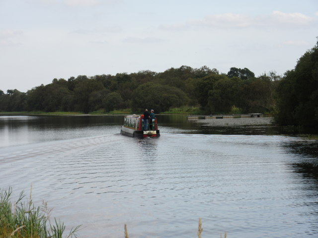
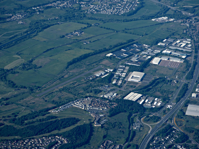
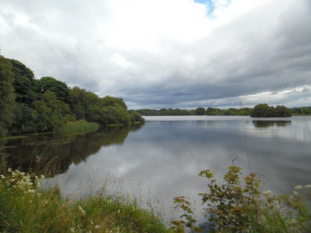
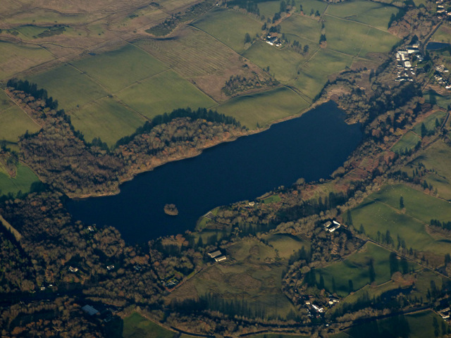
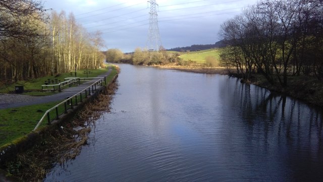
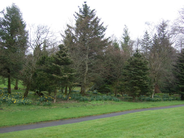
Island Wood is a picturesque forest located in Dunbartonshire, Scotland. Spread over an area of approximately 100 acres, it is a popular destination for nature enthusiasts, hikers, and families seeking a tranquil retreat. The wood is situated on a small island, surrounded by the tranquil waters of Loch Lomond.

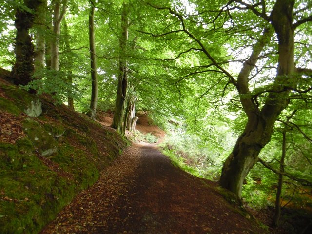
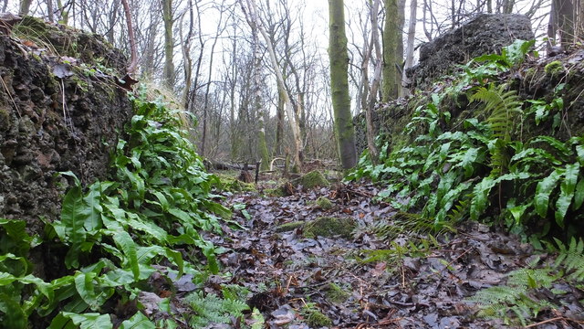
The woodland is characterized by a diverse range of flora and fauna, making it a haven for wildlife. Ancient oak trees dominate the landscape, their branches stretching towards the sky and creating a natural canopy that filters the sunlight. The forest floor is carpeted with ferns, wildflowers, and moss, adding to the enchanting atmosphere.

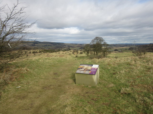
A network of well-maintained trails winds through the wood, allowing visitors to explore its beauty at their own pace. Whether strolling leisurely or embarking on a more challenging hike, there is a path suitable for every level of fitness. Along the way, visitors may encounter various species of birds, such as woodpeckers and owls, as well as elusive mammals like red squirrels and deer.

Island Wood offers more than just natural beauty. It also provides educational opportunities for visitors of all ages. The wood has an informative visitor center that showcases the history and ecology of the area through interactive exhibits and displays. Additionally, guided tours and workshops are regularly organized to promote environmental awareness and understanding.

In summary, Island Wood in Dunbartonshire is a captivating forest retreat, offering a peaceful escape from the hustle and bustle of everyday life. With its stunning scenery, diverse wildlife, and educational facilities, it is a must-visit destination for nature lovers and those seeking a deeper connection with the natural world.

If you have any feedback on the listing, please let us know in the comments section below.

Island Wood Images

Images are sourced within 2km of 55.975367/-4.0112873 or Grid Reference NS7477. Thanks to Geograph Open Source API. All images are credited.

Forth and Clyde Canal
The Antonine Wall, Croy Hill Construction of the Antonine Wall began sometime after 140AD, running from Old Kilpatrick in the west to Bridgeness in the east.  The section of the wall that once stood here was built by the Sixth Legion, and excavations have revealed that a fortlet once occupied the area in the picture.
The Antonine Wall, Croy Hill
Construction of the Antonine Wall began sometime after 140AD, running from Old Kilpatrick in the west to Bridgeness in the east. The section of the wall that once stood here was built by the Sixth Legion, and excavations have revealed that a fortlet once occupied the area in the picture.
The Antonine Wall, Croy Hill On this section of the Antonine Wall was sited a fort which housed a Roman garrison of approximately 200 men.
The Antonine Wall, Croy Hill
On this section of the Antonine Wall was sited a fort which housed a Roman garrison of approximately 200 men.
East side of Croy Hill The line of the Antonine Wall runs left to right across the bottom of this picture and a small Roman fort lay to the right. The paths in the centre of the picture give access to or from the Forth and Clyde Canal.
East side of Croy Hill
The line of the Antonine Wall runs left to right across the bottom of this picture and a small Roman fort lay to the right. The paths in the centre of the picture give access to or from the Forth and Clyde Canal.
Cumbernauld Airport from the air The airport is at Wardaprk in the north part of the town. The 820m asphalt runway can be clearly seen in this photo which was taken from a Prague bound flight from Glasgow.

Cumbernauld Airport web site <span class="nowrap"><a title="http://www.cumbernauldairport.org/" rel="nofollow ugc noopener" href="http://www.cumbernauldairport.org/">Link</a><img style="margin-left:2px;" alt="External link" title="External link - shift click to open in new window" src="https://s1.geograph.org.uk/img/external.png" width="10" height="10"/></span> .
Cumbernauld Airport from the air
The airport is at Wardaprk in the north part of the town. The 820m asphalt runway can be clearly seen in this photo which was taken from a Prague bound flight from Glasgow. Cumbernauld Airport web site LinkExternal link .
Kelvinhead, North Lanarkshire Public car park in the hamlet near Banton.
Kelvinhead, North Lanarkshire
Public car park in the hamlet near Banton.
Banton, North Lanarkshire A few houses in the village just north of the crossroads.
Banton, North Lanarkshire
A few houses in the village just north of the crossroads.
Banton-Kilsyth path passes through woods Near to Banton Loch.
Banton-Kilsyth path passes through woods
Near to Banton Loch.
Banton Loch from the west
Banton Loch from the air Formerly known as Townhead reservoir. Built in 1772 to provide water to the nearby Forth & Clyde Canal . Speirs Island can be seen within the loch.

On the site of the Battle of Kilsyth (1645).
Banton Loch from the air
Formerly known as Townhead reservoir. Built in 1772 to provide water to the nearby Forth & Clyde Canal . Speirs Island can be seen within the loch. On the site of the Battle of Kilsyth (1645).
The Forth & Clyde Canal from the air Banton and Banton Loch can be seen beyond the canal.
The Forth & Clyde Canal from the air
Banton and Banton Loch can be seen beyond the canal.
Natural fernery Ferns adorning some old buildings
Natural fernery
Ferns adorning some old buildings
Forth and Clyde Canal, Wester Dullatur
Former colliery building, Dullatur The colliery at Dullatur was operated by the Cadzow Coal Company, with production ceasing in 1964.
Former colliery building, Dullatur
The colliery at Dullatur was operated by the Cadzow Coal Company, with production ceasing in 1964.
Roman soldier, Dullatur Two temporary Roman camps once occupied the site of the modern village of Dullatur.
Roman soldier, Dullatur
Two temporary Roman camps once occupied the site of the modern village of Dullatur.
Ruined building, Arniebog There was once a farm at Arniebog, and this ruined edifice possibly form part of that.  Arniebog sat on the line of the Antonine Wall, and Roman sculpture was found near here in the nineteenth century.
Ruined building, Arniebog
There was once a farm at Arniebog, and this ruined edifice possibly form part of that. Arniebog sat on the line of the Antonine Wall, and Roman sculpture was found near here in the nineteenth century.
Woodland beside Stirling Road (A803), Kilsyth
Lodge off Stirling Road (A803), Kilsyth
Show me another place!

Island Wood is located at Grid Ref: NS7477 (Lat: 55.975367, Lng: -4.0112873)

Unitary Authority: North Lanarkshire

Police Authority: Lanarkshire

What 3 Words

///heightens.mixer.scaffold. Near Croy, North Lanarkshire

Nearby Locations

Dullatur Island Wood

Related Wikis

Dullatur railway station

Dullatur railway station served the village of Dullatur, North Lanarkshire, Scotland from 1876 to 1967 on the Edinburgh and Glasgow Railway. == History... ==
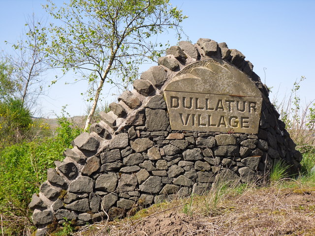
Dullatur

Dullatur is a village (population 720 (est. 2012)) near Cumbernauld, Scotland. Like Condorrat, Castlecary and Luggiebank, it predates the new town of Cumbernauld...

Battle of Kilsyth

The Battle of Kilsyth, fought on 15 August 1645 near Kilsyth, was an engagement of the Wars of the Three Kingdoms. The largest battle of the conflict in...

Banton Loch

Banton Loch, also known as Kilsyth Loch, Townhead Reservoir and once nicknamed Bakers' Loch, is an artificial freshwater lake located to the east of Kilsyth...

Nearby Amenities

Located within 500m of 55.975367,-4.0112873
Design: barrel
Power: tower
Lat/Long: 55.9766123/-4.0148388
Design: barrel
Power: tower
Lat/Long: 55.9779953/-4.0089764
Power: pole
Lat/Long: 55.9765347/-4.0182658
Power: pole
Lat/Long: 55.9769823/-4.0169117
Power: pole
Lat/Long: 55.9776374/-4.0160055
Material: wood
Power: pole
Lat/Long: 55.9783087/-4.0150619
Material: wood
Power: pole
Lat/Long: 55.9788752/-4.014239
Power: pole
Lat/Long: 55.9794463/-4.013439
Power: pole
Lat/Long: 55.974468/-4.0191282
Power: pole
Lat/Long: 55.9747746/-4.0182283
Power: pole
Lat/Long: 55.9750649/-4.01717
Power: pole
Lat/Long: 55.9753551/-4.0160889
Power: pole
Lat/Long: 55.975643/-4.0150098
Power: pole
Lat/Long: 55.9759321/-4.0139515
Power: pole
Lat/Long: 55.976227/-4.012887
Power: pole
Lat/Long: 55.9765149/-4.0118079
Power: pole
Lat/Long: 55.9767865/-4.0106767
Power: pole
Lat/Long: 55.9770697/-4.0094851
Power: pole
Lat/Long: 55.9773192/-4.0084331
Power: pole
Lat/Long: 55.9775919/-4.007302
Power: pole
Lat/Long: 55.9778787/-4.0061166
Power: pole
Lat/Long: 55.9766245/-4.0165888
Power: pole
Lat/Long: 55.9757747/-4.0158597
Power: pole
Lat/Long: 55.9761874/-4.0143577
Power: pole
Lat/Long: 55.9753982/-4.0134765
Power: pole
Lat/Long: 55.9745356/-4.0131807
Power: pole
Lat/Long: 55.9738339/-4.0127995
Power: pole
Lat/Long: 55.9732919/-4.0125745
Power: pole
Lat/Long: 55.9725959/-4.0122183
Power: pole
Lat/Long: 55.97183/-4.0118496
Power: pole
Lat/Long: 55.9709883/-4.0114392
Power: pole
Lat/Long: 55.9717857/-4.012112
Power: pole
Lat/Long: 55.9716074/-4.0130932
Power: pole
Lat/Long: 55.971387/-4.0143577
The data included in this document is from www.openstreetmap.org. The data is made available under ODbL.

Have you been to Island Wood?

Leave your review of Island Wood below (or comments, questions and feedback).