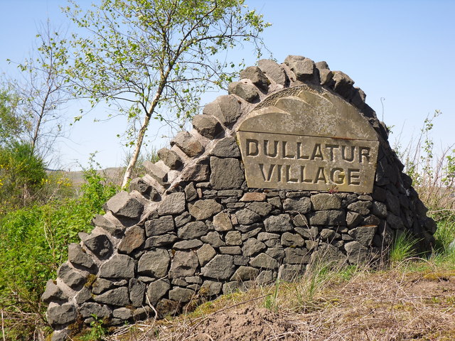
Dullatur

Settlement in Dunbartonshire

Scotland

Dullatur

Forth and Clyde Canal
Forth and Clyde Canal Credit: Euan Nelson

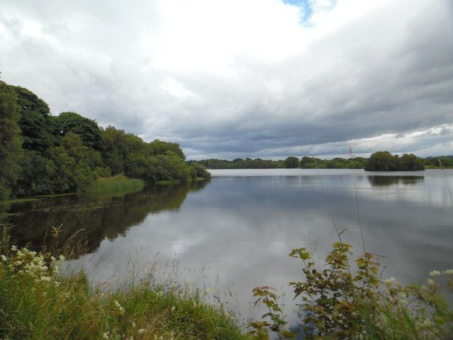
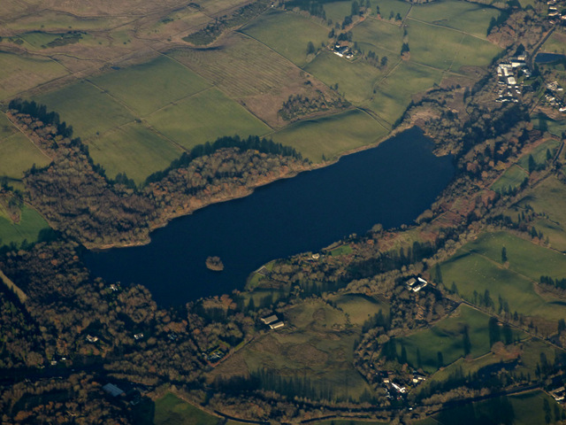
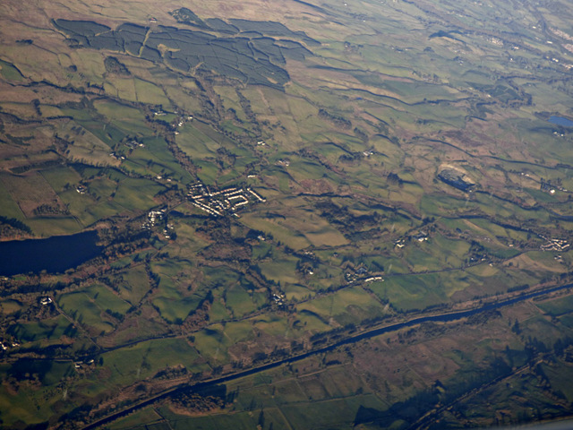
Dullatur is a small village located in the region of Dunbartonshire, Scotland. Situated approximately 10 miles northeast of Glasgow, Dullatur is nestled between the towns of Cumbernauld and Kirkintilloch. The village is set in a picturesque countryside setting, surrounded by rolling hills and farmland.

Dullatur is known for its tranquil atmosphere and close-knit community. The village features a mix of residential properties, ranging from traditional stone cottages to modern houses. The area is popular with families and individuals looking for a peaceful and scenic place to live, away from the hustle and bustle of city life.

Despite its rural setting, Dullatur offers convenient access to nearby amenities and transportation links. The village is served by regular bus services, connecting residents to neighboring towns and cities. Additionally, the M80 motorway is easily accessible, providing a direct route to Glasgow and other major cities in central Scotland.

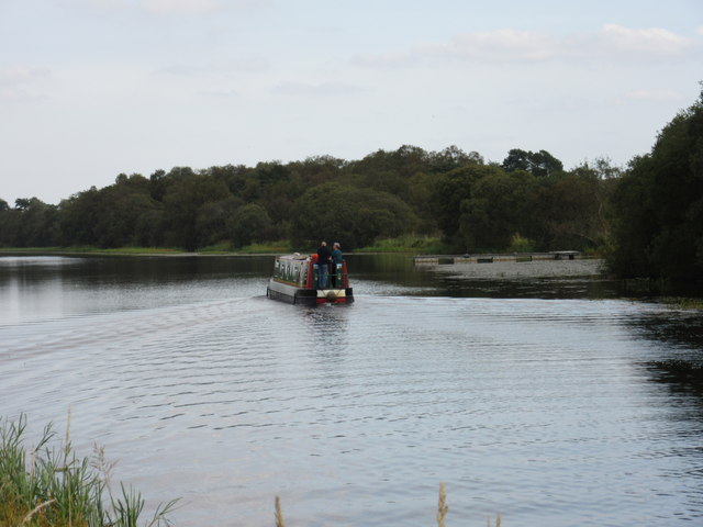
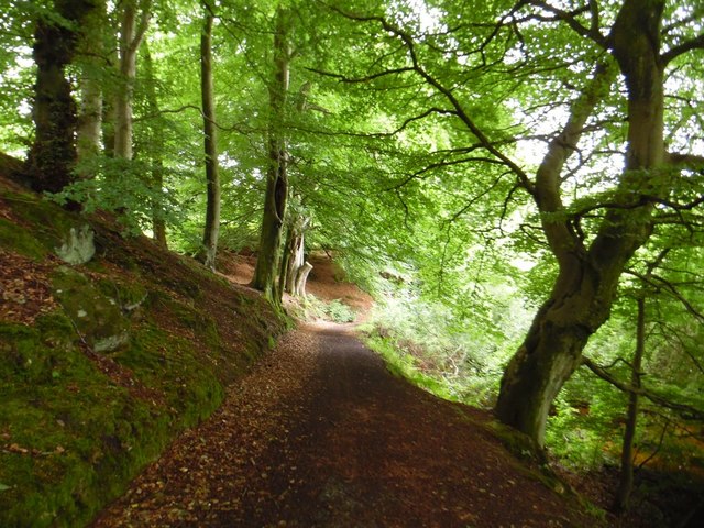
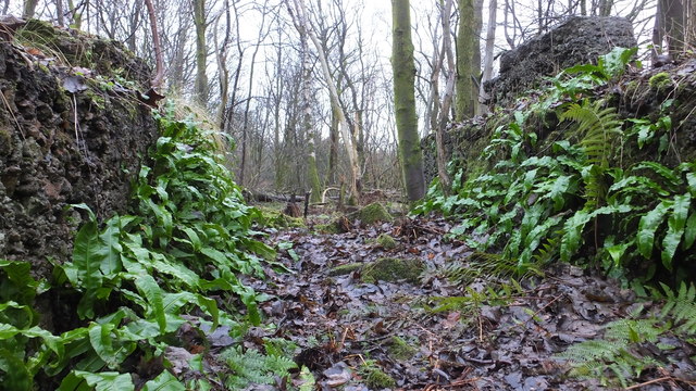
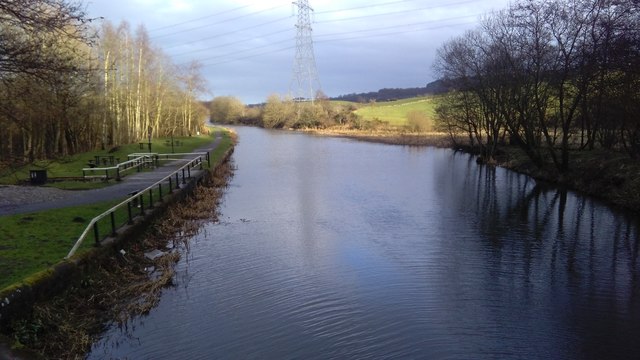
Nature enthusiasts and outdoor lovers will find plenty to explore in the surrounding area. Dullatur is close to the Antonine Wall, a UNESCO World Heritage Site, which offers scenic walking and cycling routes. Nearby, the Dullatur Golf Club provides a picturesque setting for golf enthusiasts.

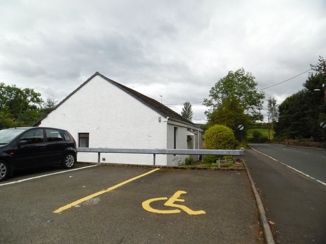
In terms of amenities, Dullatur has a local community center, which serves as a hub for various social activities and events. The village also has a primary school, providing education for the younger residents.

Overall, Dullatur offers a peaceful and scenic village lifestyle while providing easy access to nearby towns and cities, making it an attractive place to live for those seeking a balance between rural and urban living.

If you have any feedback on the listing, please let us know in the comments section below.
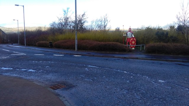
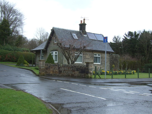
Dullatur Images

Images are sourced within 2km of 55.969882/-4.011627 or Grid Reference NS7477. Thanks to Geograph Open Source API. All images are credited.

Forth and Clyde Canal
The Antonine Wall, Croy Hill Construction of the Antonine Wall began sometime after 140AD, running from Old Kilpatrick in the west to Bridgeness in the east.  The section of the wall that once stood here was built by the Sixth Legion, and excavations have revealed that a fortlet once occupied the area in the picture.
The Antonine Wall, Croy Hill
Construction of the Antonine Wall began sometime after 140AD, running from Old Kilpatrick in the west to Bridgeness in the east. The section of the wall that once stood here was built by the Sixth Legion, and excavations have revealed that a fortlet once occupied the area in the picture.
The Antonine Wall, Croy Hill On this section of the Antonine Wall was sited a fort which housed a Roman garrison of approximately 200 men.
The Antonine Wall, Croy Hill
On this section of the Antonine Wall was sited a fort which housed a Roman garrison of approximately 200 men.
East side of Croy Hill The line of the Antonine Wall runs left to right across the bottom of this picture and a small Roman fort lay to the right. The paths in the centre of the picture give access to or from the Forth and Clyde Canal.
East side of Croy Hill
The line of the Antonine Wall runs left to right across the bottom of this picture and a small Roman fort lay to the right. The paths in the centre of the picture give access to or from the Forth and Clyde Canal.
Cumbernauld from the air Looking north over Balloch along the line of the M80 motorway.
Cumbernauld from the air
Looking north over Balloch along the line of the M80 motorway.
Kelvinhead, North Lanarkshire Public car park in the hamlet near Banton.
Kelvinhead, North Lanarkshire
Public car park in the hamlet near Banton.
Banton-Kilsyth path passes through woods Near to Banton Loch.
Banton-Kilsyth path passes through woods
Near to Banton Loch.
Banton Loch from the west
Banton Loch from the air Formerly known as Townhead reservoir. Built in 1772 to provide water to the nearby Forth & Clyde Canal . Speirs Island can be seen within the loch.

On the site of the Battle of Kilsyth (1645).
Banton Loch from the air
Formerly known as Townhead reservoir. Built in 1772 to provide water to the nearby Forth & Clyde Canal . Speirs Island can be seen within the loch. On the site of the Battle of Kilsyth (1645).
The Forth & Clyde Canal from the air Banton and Banton Loch can be seen beyond the canal.
The Forth & Clyde Canal from the air
Banton and Banton Loch can be seen beyond the canal.
Natural fernery Ferns adorning some old buildings
Natural fernery
Ferns adorning some old buildings
Forth and Clyde Canal, Wester Dullatur
Former colliery building, Dullatur The colliery at Dullatur was operated by the Cadzow Coal Company, with production ceasing in 1964.
Former colliery building, Dullatur
The colliery at Dullatur was operated by the Cadzow Coal Company, with production ceasing in 1964.
Roman soldier, Dullatur Two temporary Roman camps once occupied the site of the modern village of Dullatur.
Roman soldier, Dullatur
Two temporary Roman camps once occupied the site of the modern village of Dullatur.
Woodland beside Stirling Road (A803), Kilsyth
Lodge off Stirling Road (A803), Kilsyth
Stirling Road (A803), Kilsyth Heading south east.
Stirling Road (A803), Kilsyth
Heading south east.
Grazing, Shawend Looking south from Stirling Road (A803).
Grazing, Shawend
Looking south from Stirling Road (A803).
Show me another place!

Dullatur is located at Grid Ref: NS7477 (Lat: 55.969882, Lng: -4.011627)

Unitary Authority: North Lanarkshire

Police Authority: Lanarkshire

What 3 Words

///otter.lemons.gone. Near Croy, North Lanarkshire

Nearby Locations

Island Wood Dullatur

Related Wikis

Dullatur railway station

Dullatur railway station served the village of Dullatur, North Lanarkshire, Scotland from 1876 to 1967 on the Edinburgh and Glasgow Railway. == History... ==

Dullatur

Dullatur is a village (population 720 (est. 2012)) near Cumbernauld, Scotland. Like Condorrat, Castlecary and Luggiebank, it predates the new town of Cumbernauld...

Cumbernauld and Kilsyth (district)

Cumbernauld and Kilsyth was one of nineteen local government districts in the Strathclyde region of Scotland between 1975 and 1996. == History == The district...
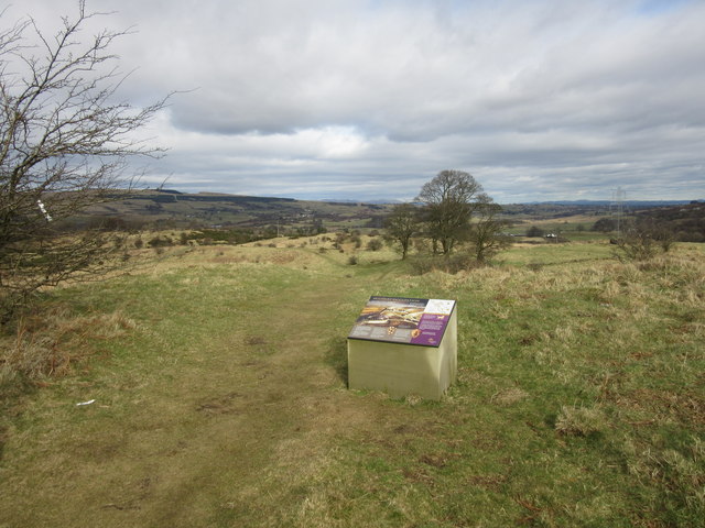
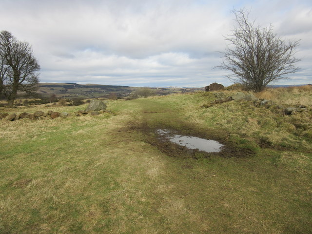
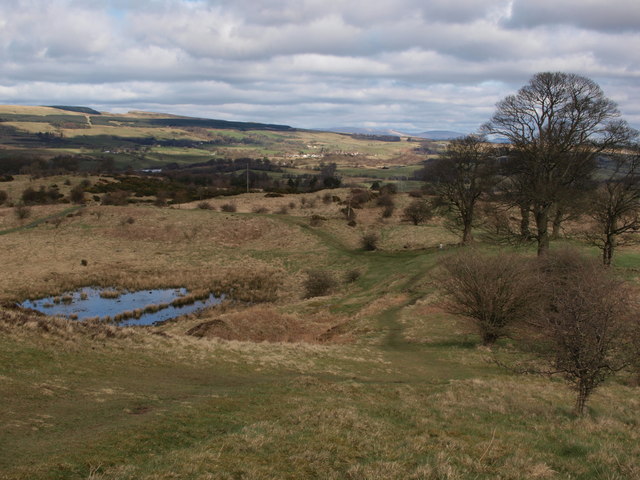
Croy Hill

Croy Hill was a Roman fort, fortlet, and probable temporary camp on the Antonine Wall, near Croy, to the north east of the village in Scotland. Two communication...

Nearby Amenities

Located within 500m of 55.969882,-4.011627
Dullatur
Is In: North Lanarkshire, Scotland, UK
Name En: Dullatur
Name Gd: Duibhleitir
Place: village
Wikidata: Q5313445
Wikipedia: en:Dullatur
Lat/Long: 55.9677115/-4.0072739
Post Box
Lat/Long: 55.9697249/-4.0123075
Barrier: bollard
Source: survey
Lat/Long: 55.9674132/-4.0062007
Barrier: block
Lat/Long: 55.9684578/-4.0162787
Barrier: bollard
Lat/Long: 55.9677559/-4.0163407
Man Made: mast
Lat/Long: 55.9684264/-4.0165706
Addr Housenumber: 11
Addr Street: Victoria Terrace
Wikidata: Q17826036
Lat/Long: 55.9695632/-4.0112288
Addr Housenumber: 10
Addr Street: Victoria Terrace
Wikidata: Q17826142
Lat/Long: 55.9695242/-4.0113442
Addr Housenumber: 9
Addr Street: Victoria Terrace
Wikidata: Q17826104
Lat/Long: 55.9694874/-4.0114622
Addr Housenumber: 8
Addr Street: Victoria Terrace
Wikidata: Q17826056
Lat/Long: 55.9694454/-4.0115735
Addr Housenumber: 7
Addr Street: Victoria Terrace
Wikidata: Q17826041
Lat/Long: 55.9694101/-4.0116821
Addr Housenumber: 6
Addr Street: Victoria Terrace
Wikidata: Q17826128
Lat/Long: 55.9693726/-4.0117934
Addr Housenumber: 5
Addr Street: Victoria Terrace
Wikidata: Q17826116
Lat/Long: 55.9693313/-4.0119021
Addr Housenumber: 4
Addr Street: Victoria Terrace
Wikidata: Q17826081
Lat/Long: 55.969293/-4.0120161
Addr Housenumber: 3
Addr Street: Victoria Terrace
Wikidata: Q17826046
Lat/Long: 55.969257/-4.0121301
Addr Housenumber: 2
Addr Street: Victoria Terrace
Wikidata: Q17826069
Lat/Long: 55.9692187/-4.0122414
Addr Housenumber: 1
Addr Street: Victoria Terrace
Wikidata: Q17826092
Lat/Long: 55.9691812/-4.0123661
Power: pole
Lat/Long: 55.9738339/-4.0127995
Power: pole
Lat/Long: 55.9732919/-4.0125745
Power: pole
Lat/Long: 55.9725959/-4.0122183
Power: pole
Lat/Long: 55.97183/-4.0118496
Power: pole
Lat/Long: 55.9709883/-4.0114392
Power: pole
Lat/Long: 55.9717857/-4.012112
Power: pole
Lat/Long: 55.9716074/-4.0130932
Power: pole
Lat/Long: 55.971387/-4.0143577
Power: pole
Lat/Long: 55.9711655/-4.015516
Power: pole
Lat/Long: 55.9708764/-4.0165826
Power: pole
Lat/Long: 55.9706095/-4.01757
Power: pole
Lat/Long: 55.970585/-4.0165597
Power: pole
Lat/Long: 55.9698389/-4.016418
Material: wood
Power: pole
Lat/Long: 55.9690041/-4.0162847
Material: wood
Power: pole
Lat/Long: 55.9685891/-4.0175346
Material: wood
Power: pole
Lat/Long: 55.9682778/-4.0184679
Dullatur
Historic Railway: station
Railway: site
Wikidata: Q97327980
Wikipedia: en:Dullatur railway station
Lat/Long: 55.9698429/-4.0124896
Waste Basket
Lat/Long: 55.9668415/-4.0074063
Bench
Backrest: yes
Material: metal
Lat/Long: 55.9667848/-4.0073531
Bench
Backrest: yes
Material: metal
Lat/Long: 55.9667702/-4.007338
Waste Basket
Lat/Long: 55.9667493/-4.0072785
Post Box
Lat/Long: 55.9684735/-4.0093951
Railway: signal
Railway Signal Direction: forward
Railway Signal Main: GB-NR:main
Railway Signal Main Form: light
Ref: CG13
Lat/Long: 55.9683256/-4.0175703
Railway: signal
Railway Signal Direction: forward
Railway Signal Main: GB-NR:main
Railway Signal Main Form: light
Ref: CG12
Lat/Long: 55.9715921/-4.004312
The data included in this document is from www.openstreetmap.org. The data is made available under ODbL.

Have you been to Dullatur?

Leave your review of Dullatur below (or comments, questions and feedback).