Dullingham

Settlement in Cambridgeshire East Cambridgeshire

England

Dullingham

"the kings head", Dullingham Someone tell them about capital letters please! Still, it's a service in TL65 and there aren't many.
"the kings head", Dullingham Credit: Hugh Venables

Dullingham is a small village located in the county of Cambridgeshire, England. Situated approximately 12 miles east of Cambridge, it is part of the East Cambridgeshire district. With a population of around 1,000 residents, Dullingham is a close-knit community that offers a peaceful and picturesque setting.

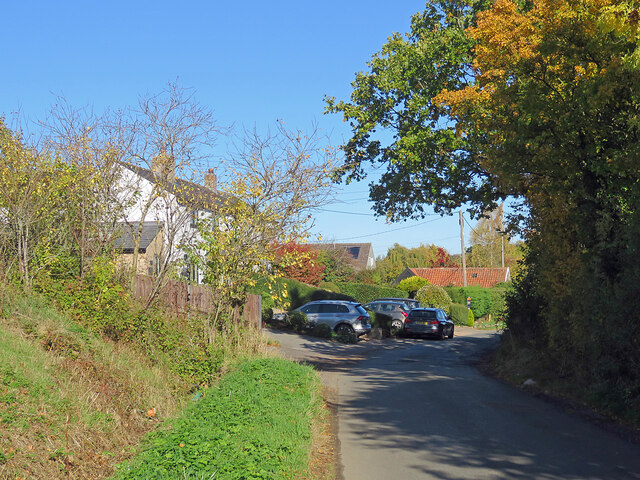
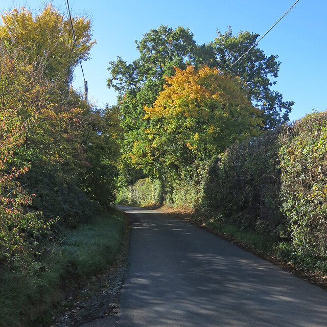
The village is characterized by its charming rural landscape, featuring rolling hills, meadows, and fields. It is surrounded by the beautiful countryside that is typical of the Cambridgeshire region. Dullingham is located in close proximity to the River Cam, which further adds to the natural beauty of the area.

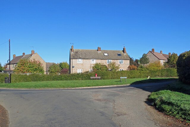
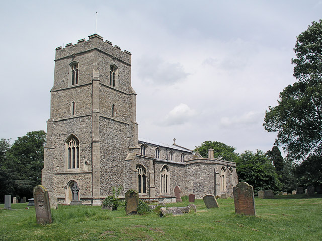
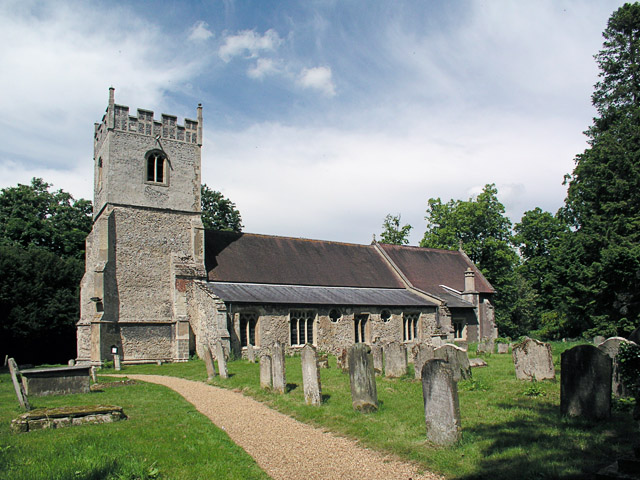
Historically, Dullingham has strong ties to agriculture, with farming being a significant part of the local economy. The village is known for its traditional thatched-roof cottages and historic buildings, such as the Grade II listed St. Mary's Church, which dates back to the 12th century. These architectural features give the village a timeless and picturesque atmosphere.

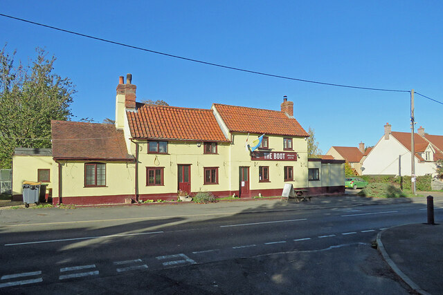
Despite its small size, Dullingham offers a range of amenities to its residents. These include a village hall, a primary school, a pub, and a post office. The village is well-connected to nearby towns and cities, with regular bus services and a train station providing easy access to Cambridge and London.

Dullingham is a peaceful and idyllic village that appeals to those seeking a quiet and rural lifestyle. With its natural beauty, historic charm, and community spirit, it provides a unique and welcoming environment for its residents.

If you have any feedback on the listing, please let us know in the comments section below.

Dullingham Images

Images are sourced within 2km of 52.195019/0.382693 or Grid Reference TL6257. Thanks to Geograph Open Source API. All images are credited.

"the kings head", Dullingham Someone tell them about capital letters please! Still, it's a service in TL65 and there aren't many.
"the kings head", Dullingham
Someone tell them about capital letters please! Still, it's a service in TL65 and there aren't many.
North-west from Westley Waterless Straight on for Westley Bottom.
North-west from Westley Waterless
Straight on for Westley Bottom.
Westley Waterless: water shortage After the drought summer of 2022 the water level looks low in the pond on Church Lane.

For comparison: <a href="https://www.geograph.org.uk/photo/3276200">TL6156 : Westley Waterless: Church Lane and pond</a> (2012).
Westley Waterless: water shortage
After the drought summer of 2022 the water level looks low in the pond on Church Lane. For comparison: TL6156 : Westley Waterless: Church Lane and pond (2012).
Westley Waterless: building work A new house on Main Road
Westley Waterless: building work
A new house on Main Road
Converted water tower near Burrough Green A house on the B1061 between Dullingham and Brinkley.
Converted water tower near Burrough Green
A house on the B1061 between Dullingham and Brinkley.
Houses at Cross Green A straggle of houses on the road from Dullingham Ley to Dullingham.
Houses at Cross Green
A straggle of houses on the road from Dullingham Ley to Dullingham.
Between Dullingham Ley and Dullingham A cloudless October morning.
Between Dullingham Ley and Dullingham
A cloudless October morning.
Light, shade and changing colours A cloudless October morning in the horse-racing country south of Newmarket. This is the single-track dead-end lane to Dullingham Ley and Widgham Green, serving a scattering of houses and a number of stud farms.
Light, shade and changing colours
A cloudless October morning in the horse-racing country south of Newmarket. This is the single-track dead-end lane to Dullingham Ley and Widgham Green, serving a scattering of houses and a number of stud farms.
A fine autumn morning in East Cambridgeshire The road from Woodditton to Stetchworth.
A fine autumn morning in East Cambridgeshire
The road from Woodditton to Stetchworth.
Signpost near Lower Ley Farm This is where the lane to Stetchworth Ley and Stetchworth Park Farm (no through road) leaves the road from Stetchworth to Woodditton.
Signpost near Lower Ley Farm
This is where the lane to Stetchworth Ley and Stetchworth Park Farm (no through road) leaves the road from Stetchworth to Woodditton.
Stetchworth: flint and pantiles A row of cottages whose Gothick ground-floor window and door reveals suggest they might have been built early in the 19th century.
Stetchworth: flint and pantiles
A row of cottages whose Gothick ground-floor window and door reveals suggest they might have been built early in the 19th century.
Stetchworth: The Marquis of Granby A 19th-century brick pub at the corner of High Street (ahead) and Tea Kettle Lane the road to Dullingham.
Stetchworth: The Marquis of Granby
A 19th-century brick pub at the corner of High Street (ahead) and Tea Kettle Lane the road to Dullingham.
Entering Stetchworth Bright sunlight and deep shadows on a fine October morning. This is where the road from Dullingham meets Mill Lane (left) and Tea Kettle Lane (ahead).
Entering Stetchworth
Bright sunlight and deep shadows on a fine October morning. This is where the road from Dullingham meets Mill Lane (left) and Tea Kettle Lane (ahead).
Down Stetchworth Road Council-built houses between Stetchworth and Dullingham (ahead).
Down Stetchworth Road
Council-built houses between Stetchworth and Dullingham (ahead).
Dullingham: houses on the corner Council-built houses on the sharp corner where the dead-end lane from Dullingham Ley meets Stetchworth Road on the edge of Dullingham.
Dullingham: houses on the corner
Council-built houses on the sharp corner where the dead-end lane from Dullingham Ley meets Stetchworth Road on the edge of Dullingham.
Dullingham: St Mary All things bright and beautiful on a lovely October morning. St Mary's is Grade I listed - see <span class="nowrap"><a title="http://www.britishlistedbuildings.co.uk/en-49159-parish-church-of-st-mary-dullingham-cambr" rel="nofollow ugc noopener" href="http://www.britishlistedbuildings.co.uk/en-49159-parish-church-of-st-mary-dullingham-cambr">Link</a><img style="margin-left:2px;" alt="External link" title="External link - shift click to open in new window" src="https://s1.geograph.org.uk/img/external.png" width="10" height="10"/></span> .
Dullingham: St Mary
All things bright and beautiful on a lovely October morning. St Mary's is Grade I listed - see LinkExternal link .
Dullingham: The Boot Photographed from the shadows of Church Close on a bright October morning. The pub was flying a Ukrainian flag during the eighth month of the Russian invasion of Ukraine.
Dullingham: The Boot
Photographed from the shadows of Church Close on a bright October morning. The pub was flying a Ukrainian flag during the eighth month of the Russian invasion of Ukraine.
Dullingham: a house with a history The Grade II listing for the house on the left begins "Originally the workhouse, now dwellings. Late C17 or early C18. Local red brick; red pantile roof. Two symmetrical stacks and rear stack. Two storeys and attic with outshut. Central facade gable with round window."
Dullingham: a house with a history
The Grade II listing for the house on the left begins "Originally the workhouse, now dwellings. Late C17 or early C18. Local red brick; red pantile roof. Two symmetrical stacks and rear stack. Two storeys and attic with outshut. Central facade gable with round window."
Show me another place!

Dullingham is located at Grid Ref: TL6257 (Lat: 52.195019, Lng: 0.382693)

Administrative County: Cambridgeshire

District: East Cambridgeshire

Police Authority: Cambridgeshire

What 3 Words

///pumpkin.bloomers.running. Near Newmarket, Suffolk

Related Wikis

Dullingham

Dullingham is a small village and civil parish in East Cambridgeshire, England. It is situated 4 miles (6 km) south of Newmarket and 14 miles (23 km) east...

Stetchworth

Stetchworth is a small village and civil parish in East Cambridgeshire, England, 3 miles (5 km) to the south of the horse-racing centre of Newmarket and...

Dullingham railway station

Dullingham is a railway station that serves the village of Dullingham in Cambridgeshire, England. It is about 1 mile (1.6 km) north-west of the centre...

Westley Waterless

Westley Waterless is a small village and civil parish in East Cambridgeshire, England, 5 miles south west of Newmarket. == History == The parish of Westley...

Nearby Amenities

Located within 500m of 52.195019,0.382693
Dullingham
Is In: Cambridgeshire, England, UK
Place: village
Wikidata: Q2144078
Lat/Long: 52.1954061/0.3847907
Post Box
CB8 9UP – Cross Roads | Dullingham
Collection Times: Mo-Fr 17:00; Sa 09:30
Operator: Royal Mail
Post Box Type: wall
Ref: CB8 117
Royal Cypher: EIIR
Royal Cypher Wikidata: Q33102113
Source: survey
Lat/Long: 52.1951094/0.38111
Bus Stop
Recreation Ground
Naptan AtcoCode: 0500EDULL002
Naptan Bearing: E
Naptan CommonName: Recreation Ground
Naptan Indicator: opp
Naptan Landmark: Stetchworth Road
Naptan NaptanCode: cmbdgmwa
Naptan ShortCommonName: Recreation Ground
Naptan Street: Stetchworth Road
Naptan Verified: no
Source: naptan_import
Lat/Long: 52.1950976/0.3840034
Bus Stop
Recreation Ground
Naptan AtcoCode: 0500EDULL003
Naptan Bearing: W
Naptan BusStopType: CUS
Naptan CommonName: Recreation Ground
Naptan Indicator: near
Naptan Landmark: Stetchworth Road
Naptan NaptanCode: cmbdgmwd
Naptan ShortCommonName: Recreation Ground
Naptan Street: Stetchworth Road
Naptan Verified: no
Source: naptan_import
Lat/Long: 52.1950581/0.3839946
Bus Stop
Church Close
Naptan AtcoCode: 0500EDULL013
Naptan Bearing: N
Naptan BusStopType: CUS
Naptan CommonName: Church Close
Naptan Indicator: opp
Naptan Landmark: Church Close
Naptan NaptanCode: cmbdgpaj
Naptan ShortCommonName: Church Close
Naptan Street: Brinkley Road
Naptan Verified: no
Source: naptan_import
Lat/Long: 52.1935798/0.3837266
Bus Stop
Church Close
Naptan AtcoCode: 0500EDULL014
Naptan Bearing: S
Naptan BusStopType: CUS
Naptan CommonName: Church Close
Naptan Indicator: near
Naptan Landmark: Church Close
Naptan NaptanCode: cmbgdtdj
Naptan ShortCommonName: Church Close
Naptan Street: Brinkley Road
Naptan Verified: no
Source: naptan_import
Lat/Long: 52.1936951/0.3837994
Power: pole
Lat/Long: 52.1929551/0.3778032
Power: pole
Lat/Long: 52.1922667/0.3785885
Power: pole
Lat/Long: 52.1949093/0.3755443
Power: pole
Lat/Long: 52.1936038/0.3770462
Power: pole
Lat/Long: 52.1941842/0.3763838
Power: transformer
Lat/Long: 52.1948238/0.3820378
Power: transformer
Lat/Long: 52.1922802/0.3836122
Power: pole
Lat/Long: 52.1922859/0.3824334
Power: pole
Lat/Long: 52.193723/0.3814906
Power: pole
Lat/Long: 52.1922826/0.3811218
Power: pole
Lat/Long: 52.1928388/0.3812668
Power: pole
Lat/Long: 52.1946421/0.3817132
Power: pole
Lat/Long: 52.1922867/0.379835
Leisure: picnic_table
Lat/Long: 52.1949644/0.3842405
Waste Basket
Lat/Long: 52.1950004/0.3842798
Bench
Lat/Long: 52.1936303/0.3851309
Dullingham
Man Made: village_sign
Source: survey
Tourism: artwork
Lat/Long: 52.1945919/0.3838415
The data included in this document is from www.openstreetmap.org. The data is made available under ODbL.

Have you been to Dullingham?

Leave your review of Dullingham below (or comments, questions and feedback).