Cluan Wood

Wood, Forest in Perthshire

Scotland

Cluan Wood

Disused Railway finding new life as a Recreational Trail near Dalchonzie Looking westward.
Disused Railway finding new life as a Recreational Trail near Dalchonzie Credit: Peter Wood

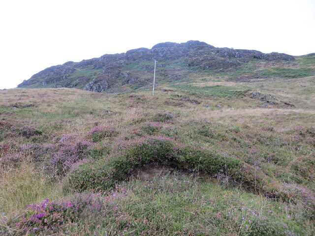
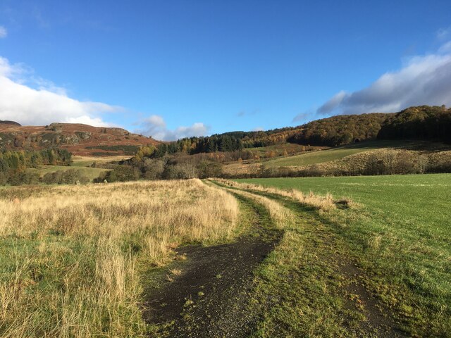
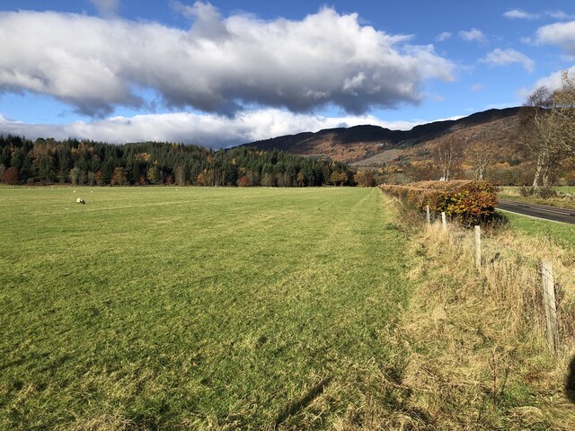
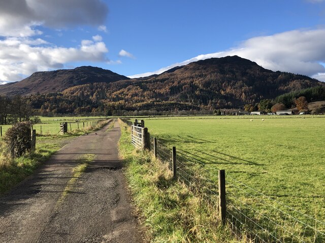
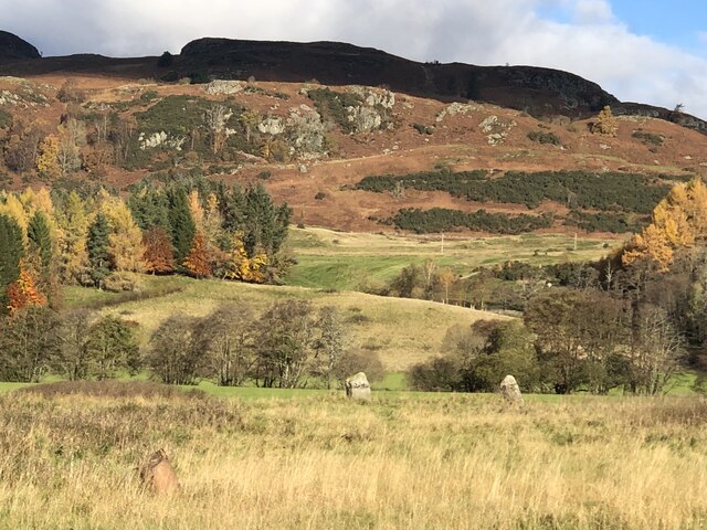
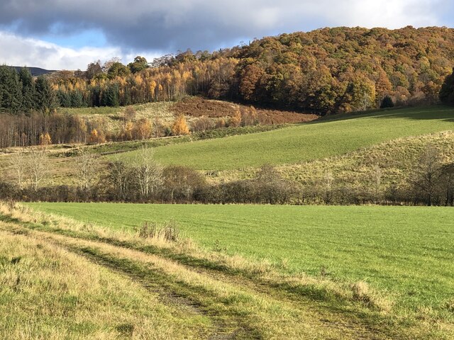
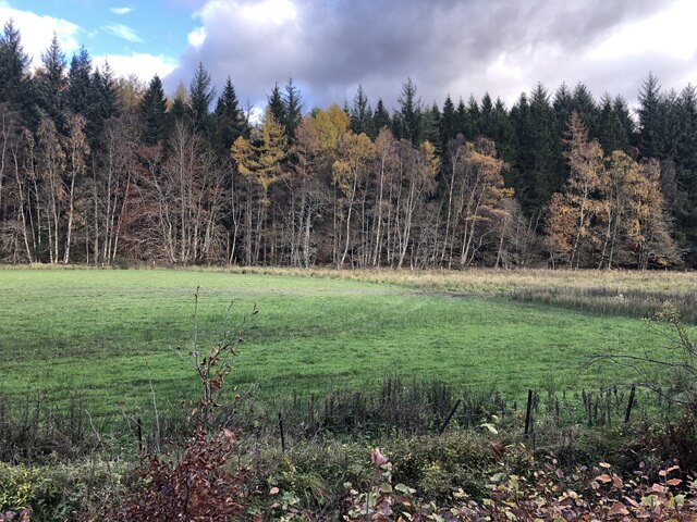
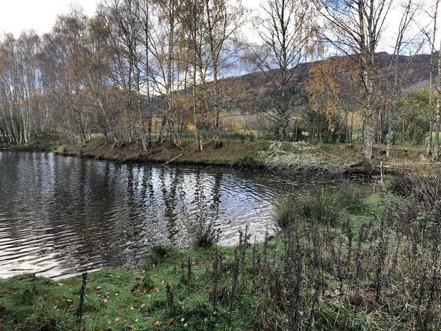
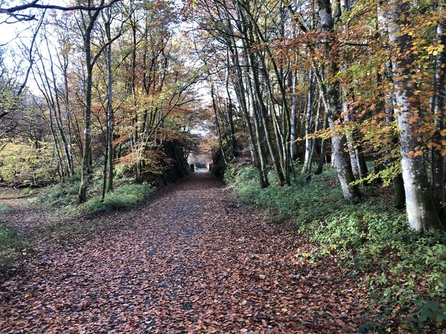
Cluan Wood is a picturesque forest located in the county of Perthshire, Scotland. Covering an area of approximately 500 acres, it is renowned for its natural beauty and rich biodiversity. The wood is situated near the village of Cluanie, nestled within the stunning Scottish Highlands.

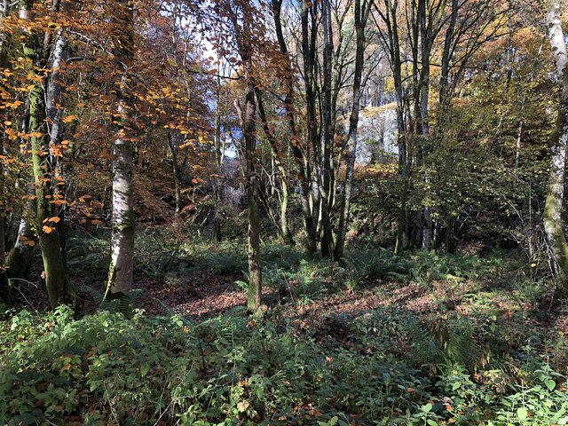
The forest is predominantly composed of native tree species, including Scots pine, birch, and oak. These towering trees create a dense canopy, providing shade and shelter for a diverse array of wildlife. Visitors can expect to encounter a plethora of bird species, such as red kites, buzzards, and woodpeckers. Additionally, the wood is home to mammals including red deer, foxes, and badgers.

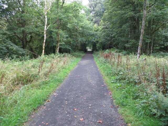
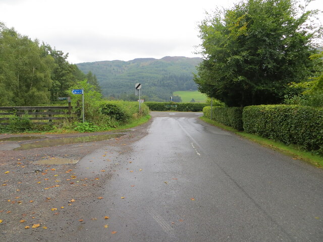
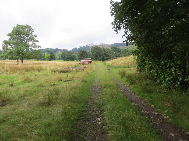
Cluan Wood offers numerous walking trails that wind through its enchanting landscape. These paths cater to all abilities, from leisurely strolls to more challenging hikes. As visitors explore the wood, they will come across babbling streams and serene ponds, adding to the tranquility of the area.

The wood is a popular destination for nature enthusiasts and photographers, as it presents countless opportunities for capturing stunning images of the surrounding scenery. Its beauty is further enhanced during the autumn months when the trees transform into a vibrant tapestry of reds, oranges, and golds.

Overall, Cluan Wood is a captivating forest that invites visitors to immerse themselves in its natural wonders. Whether one is seeking a peaceful retreat, a chance to observe wildlife, or simply a scenic walk, this forest in Perthshire offers a truly enchanting experience.

If you have any feedback on the listing, please let us know in the comments section below.

Cluan Wood Images

Images are sourced within 2km of 56.388049/-4.0347613 or Grid Reference NN7423. Thanks to Geograph Open Source API. All images are credited.

Disused Railway finding new life as a Recreational Trail near Dalchonzie Looking westward.
Disused Railway finding new life as a Recreational Trail near Dalchonzie
Looking westward.
River Earn near Dalchonzie Looking eastward from the road bridge.
River Earn near Dalchonzie
Looking eastward from the road bridge.
Minor road from Dalchonzie joining the A85 Looking northward.
Minor road from Dalchonzie joining the A85
Looking northward.
Field track passing stored lumber near Aberuchill Castle Looking southward.
Field track passing stored lumber near Aberuchill Castle
Looking southward.
The crags of Sgorr Racaineach Looking southward from the minor road.
The crags of Sgorr Racaineach
Looking southward from the minor road.
Farm track near Tullybannocher
East Lodge, Dunira Situated beside the A85, this is one of the former lodge houses to the Dunira Estate. A drive leads up to the site of the main house (which burnt down in 1948), but is now overgrown in places.
East Lodge, Dunira
Situated beside the A85, this is one of the former lodge houses to the Dunira Estate. A drive leads up to the site of the main house (which burnt down in 1948), but is now overgrown in places.
East Lodge, Dunira One of the former lodge houses to the Dunira Estate. The solar panels on the roof provided hot water, but did not produce electricity.
East Lodge, Dunira
One of the former lodge houses to the Dunira Estate. The solar panels on the roof provided hot water, but did not produce electricity.
Ordnance Survey Cut Mark This mark can be found on Dalchonzie Bridge,
The recorded details give a height of 73.116 metres above sea level.
For more detail see : <span class="nowrap"><a title="https://www.bench-marks.org.uk/bm150465" rel="nofollow ugc noopener" href="https://www.bench-marks.org.uk/bm150465">Link</a><img style="margin-left:2px;" alt="External link" title="External link - shift click to open in new window" src="https://s1.geograph.org.uk/img/external.png" width="10" height="10"/></span>
Ordnance Survey Cut Mark
This mark can be found on Dalchonzie Bridge, The recorded details give a height of 73.116 metres above sea level. For more detail see : LinkExternal link
A85 towards Comrie
A85 towards Comrie
Field, Tullybannocher The very flat floor of Strath Earn with woodland on Drumlochlan Hill in the background.
Field, Tullybannocher
The very flat floor of Strath Earn with woodland on Drumlochlan Hill in the background.
Road to Wester Tullybannocher
Standing stones, Tullybannocher Remains of a stone circle in Strath Earn.
Standing stones, Tullybannocher
Remains of a stone circle in Strath Earn.
Twenty Shilling Wood The western end of the oak wood above Comrie.
Twenty Shilling Wood
The western end of the oak wood above Comrie.
Crappich Wood
Crappich Wood
Flight pool, Dunira Inhabited by a large number of mallard.
Flight pool, Dunira
Inhabited by a large number of mallard.
Lochearnhead, St Fillans and Comrie Railway Closed in 1951 the trackbed is mostly available as a path from here to Lochearmhead. Begrudgingly here given the passive aggressive signage at parking area.

The railway ran to Balquhidder from the main line at Gleneagles via Crieff. Before the tracks were lifted, it was used to build some of the hydroelectric infrastructure.
Lochearnhead, St Fillans and Comrie Railway
Closed in 1951 the trackbed is mostly available as a path from here to Lochearmhead. Begrudgingly here given the passive aggressive signage at parking area. The railway ran to Balquhidder from the main line at Gleneagles via Crieff. Before the tracks were lifted, it was used to build some of the hydroelectric infrastructure.
Woodland, Strath Earn Between the A85 and the Balquidder to Gleneagles railway trackbed.
Woodland, Strath Earn
Between the A85 and the Balquidder to Gleneagles railway trackbed.
Show me another place!

Cluan Wood is located at Grid Ref: NN7423 (Lat: 56.388049, Lng: -4.0347613)

Unitary Authority: Perth and Kinross

Police Authority: Tayside

What 3 Words

///snow.escorting.elects. Near Comrie, Perth & Kinross

Nearby Locations

Cluan Wood

Related Wikis

Dunira, Perthshire

Dunira (Scottish Gaelic: Dùn Iar) is an estate of about 350 hectares (860 acres) in Perthshire, Scotland, 3 miles (5 kilometres) northwest of Comrie and...

Dalchonzie Halt railway station

Dalchonzie Halt railway station, Dalchonzie Platform railway station or Dalchonzie Siding in the Parish of Comrie, Perth and Kinross, Scotland was an intermediate...

Dalchonzie

Dalchonzie is a place by the river Earn in Perthshire. Buildings there include a country house, a hydro-electric power station and farms. From 1903 to...

Central Lowlands

The Central Lowlands, sometimes called the Midland Valley or Central Valley, is a geologically defined area of relatively low-lying land in southern Scotland...

Nearby Amenities

Located within 500m of 56.388049,-4.0347613
Power: pole
Lat/Long: 56.3900168/-4.041456
Power: pole
Lat/Long: 56.3906925/-4.0411262
Power: pole
Lat/Long: 56.3916515/-4.0395307
Power: pole
Lat/Long: 56.3915175/-4.0384513
Power: pole
Lat/Long: 56.3910374/-4.0372927
Power: pole
Lat/Long: 56.3906024/-4.0362112
Power: pole
Lat/Long: 56.3901496/-4.0350826
Power: pole
Lat/Long: 56.3893346/-4.0330652
Power: pole
Lat/Long: 56.3889208/-4.0320244
Power: pole
Lat/Long: 56.3885794/-4.0312053
Power: pole
Lat/Long: 56.3881188/-4.0301313
Power: pole
Lat/Long: 56.3873038/-4.0290787
Power: pole
Lat/Long: 56.389727/-4.0340366
The data included in this document is from www.openstreetmap.org. The data is made available under ODbL.

Have you been to Cluan Wood?

Leave your review of Cluan Wood below (or comments, questions and feedback).