Dalwhat Wood
Wood, Forest in Dumfriesshire
Scotland
Dalwhat Wood

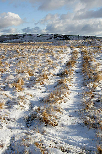
Dalwhat Wood is a picturesque forest located in Dumfriesshire, Southwest Scotland. Covering an area of approximately 300 hectares, the wood is part of the larger Galloway Forest Park, known for its outstanding natural beauty and diverse wildlife.
Characterized by its dense and ancient woodland, Dalwhat Wood boasts a rich variety of tree species, including oak, birch, beech, and Scots pine. This diverse ecosystem provides a haven for a wide range of flora and fauna, making it a popular destination for nature enthusiasts and birdwatchers.
The wood is crisscrossed by several well-maintained footpaths and trails, offering visitors the opportunity to explore its tranquil surroundings. The paths wind through the forest, providing stunning views of the surrounding hills and valleys. Along the way, one can encounter various wildlife species, including red squirrels, roe deer, and a plethora of bird species, such as woodpeckers and owls.
Dalwhat Wood also offers a range of recreational activities, including hiking, cycling, and nature photography. Several picnic areas are scattered throughout the wood, providing the perfect spot for a leisurely lunch or a peaceful moment of relaxation amidst nature.
Visitors to Dalwhat Wood can also learn about its rich history through the interpretation boards placed at strategic points. These boards provide information about the wood's past use as a source of timber and its importance in the local economy.
Overall, Dalwhat Wood is a captivating natural haven, offering visitors a chance to immerse themselves in the beauty of Dumfriesshire's ancient woodland and experience the tranquility of nature.
If you have any feedback on the listing, please let us know in the comments section below.
Dalwhat Wood Images
Images are sourced within 2km of 55.219995/-3.9844556 or Grid Reference NX7393. Thanks to Geograph Open Source API. All images are credited.


Dalwhat Wood is located at Grid Ref: NX7393 (Lat: 55.219995, Lng: -3.9844556)
Unitary Authority: Dumfries and Galloway
Police Authority: Dumfries and Galloway
What 3 Words
///appraised.bikes.reflected. Near Thornhill, Dumfries & Galloway
Nearby Locations
Related Wikis

Carsphairn and Scaur Hills
The Carsphairn and Scaur Hills are the western and eastern hills respectively of a hill range in the Southern Uplands of Scotland. Ordnance Survey maps...

Craigdarroch
"Craigdarroch, An Accessory to Murder" is an expansion set for the board game Kill Doctor Lucky Craigdarroch is a house near Moniaive, Dumfries and Galloway...

Moniaive
Moniaive ( 'monny-IVE'; Scottish Gaelic: Am Moine Naomh, "The Holy Moor") is a village in the Parish of Glencairn, in Dumfries and Galloway, southwest...

Moniaive railway station
Moniaive railway station is the closed station terminus of the Cairn Valley Light Railway (CVR) branch, from Dumfries. It served the rural area of Moniaive...

Crawfordton House
Crawfordton House is a category B listed 19th-century country house, situated close to Moniaive in Dumfriesshire, Scotland. It was operated as Crawfordton...

Cademuir International School
Cademuir International School was a specialist school at Moniaive in Dumfries and Galloway, Scotland. The school, founded by Robert Mulvey in 1990, was...

Tynron
Tynron is a village and civil parish in Dumfries and Galloway, south-west Scotland, lying in a hollow of the Shinnel Water, 2 miles (3.2 km) from Moniaive...

Glencairn, Dumfries and Galloway
Glencairn is an ecclesiastical and civil parish in Dumfries and Galloway, Scotland. == Location == According to John Bartholomew's 1887 Gazetteer of the...
Nearby Amenities
Located within 500m of 55.219995,-3.9844556Have you been to Dalwhat Wood?
Leave your review of Dalwhat Wood below (or comments, questions and feedback).