Colziumbea Plantation

Wood, Forest in Stirlingshire

Scotland

Colziumbea Plantation

Rowancraig Spring Made into a shrine. With the offering of an empty can of coke.
Rowancraig Spring Credit: Mick Garratt

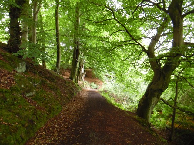
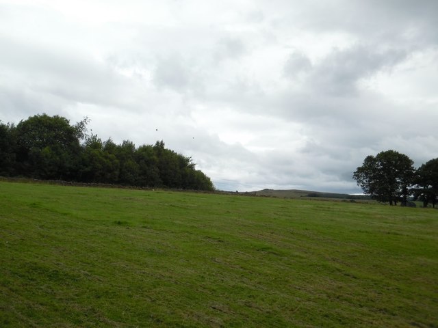
Colziumbea Plantation is a charming woodland area located in Stirlingshire, Scotland. Spread across a sprawling expanse, this plantation is a haven for nature enthusiasts and those seeking tranquility amidst the beauty of the outdoors.

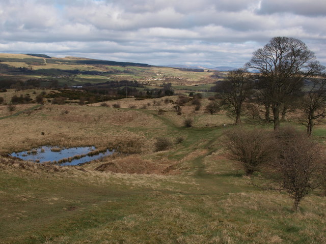
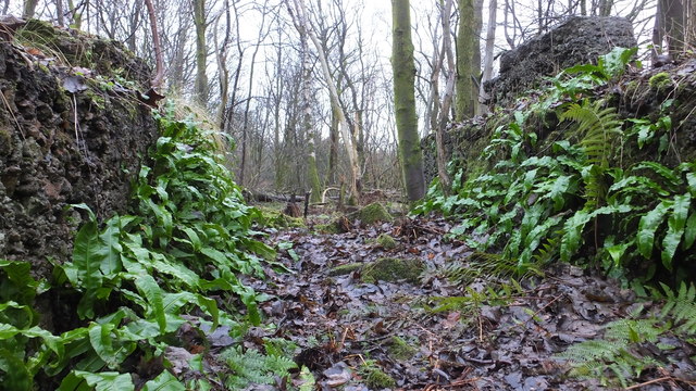
The plantation boasts a diverse range of trees and flora, including a mix of coniferous and deciduous species. Tall, majestic pine trees stand alongside vibrant oak and beech trees, creating a picturesque setting that changes with the seasons. The forest floor is adorned with a carpet of ferns, wildflowers, and moss, adding to its ethereal charm.

The plantation is home to a variety of wildlife, making it a perfect spot for birdwatching and wildlife spotting. Visitors may have the chance to catch a glimpse of red squirrels, roe deer, and even elusive pine martens. The melodious songs of songbirds echo through the trees, creating a harmonious symphony that enchants all who visit.

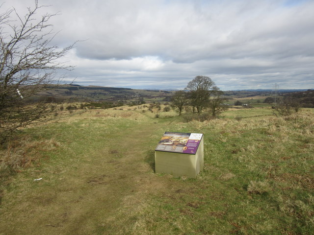
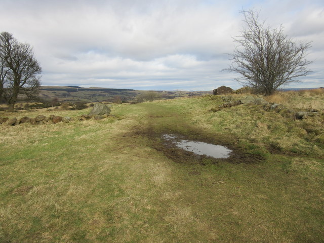
There are several well-maintained walking trails that wind their way through the plantation, allowing visitors to explore its natural wonders at their own pace. These paths take visitors through ancient woodlands, past babbling brooks, and offer breathtaking views of the surrounding countryside.

Colziumbea Plantation is not only a place of natural beauty but also of historical significance. The ruins of Colzium House, a 17th-century mansion, can be found within the plantation's grounds. These ruins add a touch of intrigue and provide visitors with a glimpse into the area's rich past.

In conclusion, Colziumbea Plantation in Stirlingshire is a stunning woodland area that offers a peaceful retreat for nature lovers. With its diverse range of trees, abundant wildlife, and well-maintained trails, it provides an opportunity to immerse oneself in the beauty of nature and experience the tranquility of the Scottish countryside.

If you have any feedback on the listing, please let us know in the comments section below.

Colziumbea Plantation Images

Images are sourced within 2km of 55.97577/-4.0229118 or Grid Reference NS7377. Thanks to Geograph Open Source API. All images are credited.

Rowancraig Spring Made into a shrine. With the offering of an empty can of coke.
Rowancraig Spring
Made into a shrine. With the offering of an empty can of coke.
The Antonine Wall, Croy Hill Construction of the Antonine Wall began sometime after 140AD, running from Old Kilpatrick in the west to Bridgeness in the east.  The section of the wall that once stood here was built by the Sixth Legion, and excavations have revealed that a fortlet once occupied the area in the picture.
The Antonine Wall, Croy Hill
Construction of the Antonine Wall began sometime after 140AD, running from Old Kilpatrick in the west to Bridgeness in the east. The section of the wall that once stood here was built by the Sixth Legion, and excavations have revealed that a fortlet once occupied the area in the picture.
The Antonine Wall, Croy Hill On this section of the Antonine Wall was sited a fort which housed a Roman garrison of approximately 200 men.
The Antonine Wall, Croy Hill
On this section of the Antonine Wall was sited a fort which housed a Roman garrison of approximately 200 men.
Auchinstarry Marina, Kilsyth
East side of Croy Hill The line of the Antonine Wall runs left to right across the bottom of this picture and a small Roman fort lay to the right. The paths in the centre of the picture give access to or from the Forth and Clyde Canal.
East side of Croy Hill
The line of the Antonine Wall runs left to right across the bottom of this picture and a small Roman fort lay to the right. The paths in the centre of the picture give access to or from the Forth and Clyde Canal.
Kelvinhead, North Lanarkshire Public car park in the hamlet near Banton.
Kelvinhead, North Lanarkshire
Public car park in the hamlet near Banton.
Banton, North Lanarkshire A few houses in the village just north of the crossroads.
Banton, North Lanarkshire
A few houses in the village just north of the crossroads.
Banton-Kilsyth path passes through woods Near to Banton Loch.
Banton-Kilsyth path passes through woods
Near to Banton Loch.
Banton Loch from the west
Fields east of Riskend Quarry
Banton Loch from the air Formerly known as Townhead reservoir. Built in 1772 to provide water to the nearby Forth & Clyde Canal . Speirs Island can be seen within the loch.

On the site of the Battle of Kilsyth (1645).
Banton Loch from the air
Formerly known as Townhead reservoir. Built in 1772 to provide water to the nearby Forth & Clyde Canal . Speirs Island can be seen within the loch. On the site of the Battle of Kilsyth (1645).
Kilsyth from the air Looking over new houses at Cavalry Park Road towards Colzium House.
Kilsyth from the air
Looking over new houses at Cavalry Park Road towards Colzium House.
The Forth & Clyde Canal from the air Banton and Banton Loch can be seen beyond the canal.
The Forth & Clyde Canal from the air
Banton and Banton Loch can be seen beyond the canal.
Natural fernery Ferns adorning some old buildings
Natural fernery
Ferns adorning some old buildings
Forth and Clyde Canal, Wester Dullatur
Former colliery building, Dullatur The colliery at Dullatur was operated by the Cadzow Coal Company, with production ceasing in 1964.
Former colliery building, Dullatur
The colliery at Dullatur was operated by the Cadzow Coal Company, with production ceasing in 1964.
Roman soldier, Dullatur Two temporary Roman camps once occupied the site of the modern village of Dullatur.
Roman soldier, Dullatur
Two temporary Roman camps once occupied the site of the modern village of Dullatur.
Burngreen, Kilsyth Looking east.
Burngreen, Kilsyth
Looking east.
Show me another place!

Colziumbea Plantation is located at Grid Ref: NS7377 (Lat: 55.97577, Lng: -4.0229118)

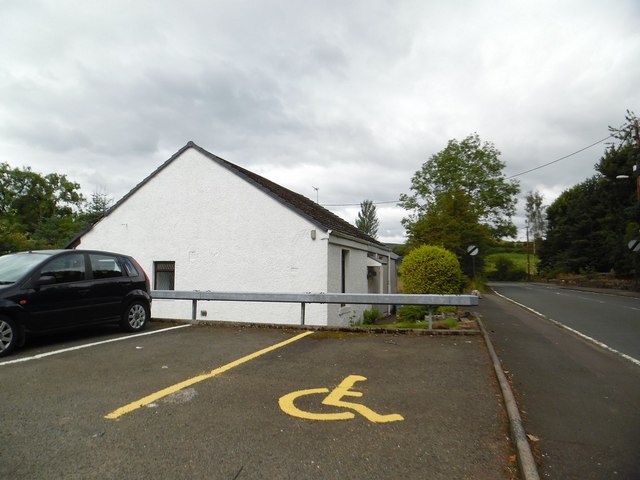
Unitary Authority: North Lanarkshire

Police Authority: Lanarkshire

What 3 Words

///civil.stubble.household. Near Croy, North Lanarkshire

Related Wikis

Colzium railway station

Colzium railway station served the area of Colzium, North Lanarkshire, Scotland from 1888 to 1917 on the Kilsyth and Bonnybridge Railway. == History... ==
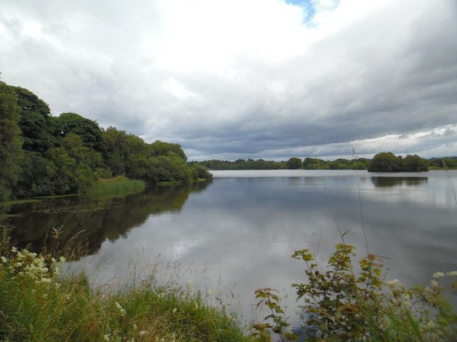
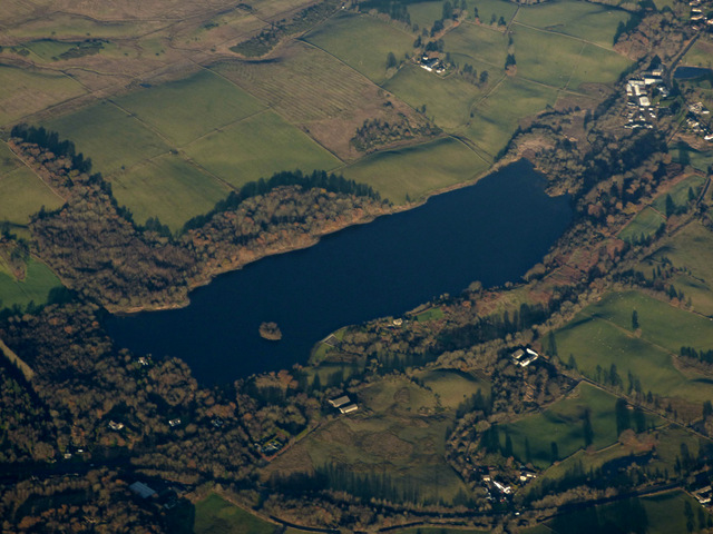
Banton Loch

Banton Loch, also known as Kilsyth Loch, Townhead Reservoir and once nicknamed Bakers' Loch, is an artificial freshwater lake located to the east of Kilsyth...

Dullatur railway station

Dullatur railway station served the village of Dullatur, North Lanarkshire, Scotland from 1876 to 1967 on the Edinburgh and Glasgow Railway. == History... ==

Battle of Kilsyth

The Battle of Kilsyth, fought on 15 August 1645 near Kilsyth, was an engagement of the Wars of the Three Kingdoms. The largest battle of the conflict in...

Dullatur

Dullatur is a village (population 720 (est. 2012)) near Cumbernauld, Scotland. Like Condorrat, Castlecary and Luggiebank, it predates the new town of Cumbernauld...

Croy Hill

Croy Hill was a Roman fort, fortlet, and probable temporary camp on the Antonine Wall, near Croy, to the north east of the village in Scotland. Two communication...

Colzium

Colzium House and Estate (pronounced Coal-Zee-Um) is about 500 metres to the north-east of Kilsyth, North Lanarkshire, Scotland. The present house dates...

Cumbernauld and Kilsyth (district)

Cumbernauld and Kilsyth was one of nineteen local government districts in the Strathclyde region of Scotland between 1975 and 1996. == History == The district...

Nearby Amenities

Located within 500m of 55.97577,-4.0229118
Note: Name changes at town boundary
Lat/Long: 55.9773497/-4.0198169
Barrier: cycle_barrier
Bicycle: yes
Foot: yes
Horse: yes
Motor Vehicle: no
Source: survey
Lat/Long: 55.972779/-4.0242105
Parking
Capacity: 6
Fee: no
Parking: surface
Lat/Long: 55.97855/-4.0172872
Design: barrel
Power: tower
Lat/Long: 55.9754836/-4.0196232
Design: barrel
Power: tower
Lat/Long: 55.9729715/-4.0210523
Old Coal Pit
Historic: mine
Lat/Long: 55.9769905/-4.0276162
Old Coal Pit
Historic: mine
Lat/Long: 55.9793436/-4.0251164
Old Coal Pit
Historic: mine
Lat/Long: 55.9783292/-4.0192263
Bench: yes
Leisure: picnic_table
Material: metal
Survey Date: 2020-10-10
Lat/Long: 55.9728222/-4.0241336
Bench: no
Leisure: picnic_table
Material: metal
Survey Date: 2020-10-10
Lat/Long: 55.9728579/-4.0238768
Bench: yes
Leisure: picnic_table
Material: metal
Survey Date: 2020-10-10
Lat/Long: 55.9728459/-4.0237957
Turning Circle
Lat/Long: 55.9778468/-4.0227164
Barrier: bollard
Bicycle: yes
Colour: grey
Foot: yes
Material: stone
Lat/Long: 55.9758923/-4.0294055
Barrier: bollard
Bicycle: yes
Colour: grey
Foot: yes
Material: stone
Lat/Long: 55.9759144/-4.0293721
Information: board
Survey Date: 2020-10-10
Tourism: information
Lat/Long: 55.9727972/-4.0241567
Power: pole
Lat/Long: 55.9743095/-4.0304171
Power: pole
Lat/Long: 55.975812/-4.0295234
Power: pole
Lat/Long: 55.975826/-4.0281964
Power: pole
Lat/Long: 55.9758458/-4.0265277
Power: pole
Lat/Long: 55.9758575/-4.0253153
Power: pole
Lat/Long: 55.9758773/-4.0241904
Power: pole
Lat/Long: 55.9756558/-4.0235259
Power: pole
Lat/Long: 55.9753691/-4.022703
Power: pole
Lat/Long: 55.9753808/-4.0218135
Power: pole
Lat/Long: 55.9757468/-4.0207427
Power: pole
Lat/Long: 55.9760603/-4.0197303
Power: pole
Lat/Long: 55.9765347/-4.0182658
Power: pole
Lat/Long: 55.9769823/-4.0169117
Power: pole
Lat/Long: 55.9776374/-4.0160055
Power: pole
Lat/Long: 55.9742431/-4.0289088
Power: pole
Lat/Long: 55.9741859/-4.0273006
Power: pole
Lat/Long: 55.9741929/-4.0261174
Power: pole
Lat/Long: 55.9742407/-4.0249612
Power: pole
Lat/Long: 55.9742804/-4.0240717
Power: pole
Lat/Long: 55.9743037/-4.0228134
Power: pole
Lat/Long: 55.9743177/-4.0217822
Power: pole
Lat/Long: 55.9743421/-4.0208885
Power: pole
Lat/Long: 55.974468/-4.0191282
Power: pole
Lat/Long: 55.9747746/-4.0182283
Power: pole
Lat/Long: 55.9750649/-4.01717
Power: pole
Lat/Long: 55.9753551/-4.0160889
Power: pole
Lat/Long: 55.975643/-4.0150098
Power: pole
Lat/Long: 55.9766245/-4.0165888
Power: pole
Lat/Long: 55.9757747/-4.0158597
The data included in this document is from www.openstreetmap.org. The data is made available under ODbL.

Have you been to Colziumbea Plantation?

Leave your review of Colziumbea Plantation below (or comments, questions and feedback).