Wellbog Plantation

Wood, Forest in Lanarkshire

Scotland

Wellbog Plantation

Bridge over burn near Crookedstone The burn doesn't appear to have a name, although it could perhaps be considered a branch of the Darngaber Burn. It empties into the Powforth Burn, which flows for a short distance to the Avon Water.
Bridge over burn near Crookedstone Credit: Alan O'Dowd

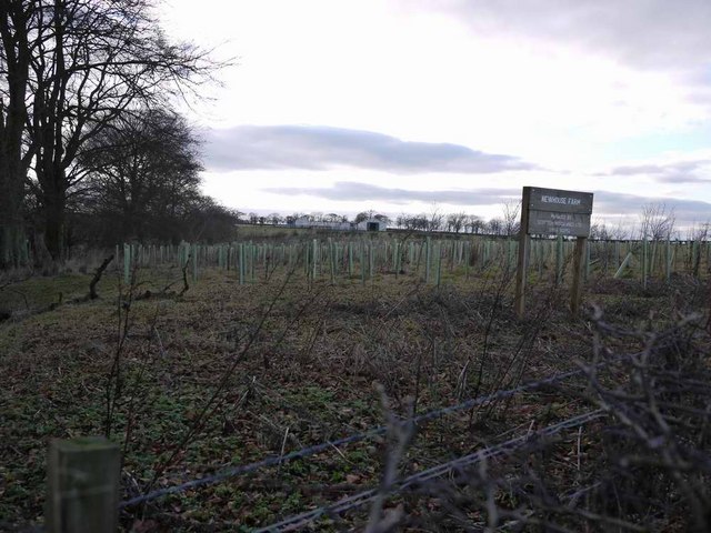
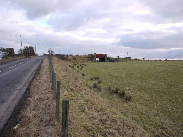
Wellbog Plantation is a sprawling woodland located in Lanarkshire, Scotland. Spanning over a vast area, it is a significant natural resource and an important part of the region's ecosystem. The plantation primarily consists of densely packed trees, creating a lush and vibrant forest environment.

The woodland is home to a diverse range of species, both flora and fauna. The tree species found in Wellbog Plantation include oak, birch, beech, and pine, among others. These trees provide habitat and food for numerous animals, including birds, insects, and mammals.

Wellbog Plantation is a popular destination for nature enthusiasts and outdoor enthusiasts alike. Its extensive network of walking trails offers visitors the opportunity to explore the woodland and appreciate its beauty at their own pace. The trails wind through the forest, providing picturesque views of the trees, shrubs, and wildflowers that adorn the landscape.

The plantation also serves as a vital carbon sink, absorbing and storing large amounts of carbon dioxide from the atmosphere, thus playing a crucial role in combating climate change. Additionally, it contributes to the preservation of biodiversity by providing a sanctuary for various species.

Wellbog Plantation is actively managed by forestry professionals who ensure its health and sustainability. They undertake regular maintenance activities, such as tree planting, thinning, and harvesting, to maintain a balanced ecosystem and ensure the continued growth and development of the woodland.

Overall, Wellbog Plantation is a treasured natural asset in Lanarkshire, offering a wealth of ecological, recreational, and environmental benefits to the local community and beyond.

If you have any feedback on the listing, please let us know in the comments section below.

Wellbog Plantation Images

Images are sourced within 2km of 55.727727/-4.0257959 or Grid Reference NS7250. Thanks to Geograph Open Source API. All images are credited.

Bridge over burn near Crookedstone The burn doesn't appear to have a name, although it could perhaps be considered a branch of the Darngaber Burn. It empties into the Powforth Burn, which flows for a short distance to the Avon Water.
Bridge over burn near Crookedstone
The burn doesn't appear to have a name, although it could perhaps be considered a branch of the Darngaber Burn. It empties into the Powforth Burn, which flows for a short distance to the Avon Water.
Un-named burn near Crookedstone The burn doesn't appear to have a name, although it could perhaps be considered a branch of the Darngaber Burn. It empties into the Powforth Burn, which flows for a short distance to the Avon Water.
Un-named burn near Crookedstone
The burn doesn't appear to have a name, although it could perhaps be considered a branch of the Darngaber Burn. It empties into the Powforth Burn, which flows for a short distance to the Avon Water.
Track to East Crookedstone After Crookedstone, the tarmac road gives way to an unsurfaced track.
Track to East Crookedstone
After Crookedstone, the tarmac road gives way to an unsurfaced track.
Track near East Crookedstone The small belt of trees on the left shelters the farm buildings.
Track near East Crookedstone
The small belt of trees on the left shelters the farm buildings.
Craigthorn  Farm Near Glassford
Craigthorn Farm Near Glassford
Cows on Thinacre Muir
Newhouse Farm
Newhouse Farm
Country Houses Houses on the road from Quarter to Stonehouse
Country Houses
Houses on the road from Quarter to Stonehouse
Crookedstone farm
Crookedstone farm
Burn near Crookedstone
Crookedstonemuir Farm Located in the rural section of Lanarkshire, about 5 miles south of Hamilton
Crookedstonemuir Farm
Located in the rural section of Lanarkshire, about 5 miles south of Hamilton
The fields beside Highlawside Farm This is typical of the farming land around Glassford (which is about half a mile to the south of here).
The fields beside Highlawside Farm
This is typical of the farming land around Glassford (which is about half a mile to the south of here).
Fields at Crookedstonemuir The hill on the far horizon is Tinto
Fields at Crookedstonemuir
The hill on the far horizon is Tinto
Plotcock Road houses
New tree planting at Newhouse farm
Old railway bridge Strangely, shown on the 50,000 OS mapping, but not on the 25,000.
Old railway bridge
Strangely, shown on the 50,000 OS mapping, but not on the 25,000.
Minor Road Junction near Larkhall The road to the right leads to Larkhall via Millheugh while the road straight on leads to Quarter and then to Hamilton.
Minor Road Junction near Larkhall
The road to the right leads to Larkhall via Millheugh while the road straight on leads to Quarter and then to Hamilton.
Road from Plotcock to Larkhall
Show me another place!

Wellbog Plantation is located at Grid Ref: NS7250 (Lat: 55.727727, Lng: -4.0257959)

Unitary Authority: South Lanarkshire

Police Authority: Lanarkshire

What 3 Words

///puncture.proof.assures. Near Larkhall, South Lanarkshire

Related Wikis

Quarter, South Lanarkshire

Quarter is a village in South Lanarkshire, Scotland, on the hill above the Clyde Valley. == History == Francis Groome described the village in 1884-4 thus...

Quarter railway station

Quarter railway station served the village of Quarter, South Lanarkshire, Scotland, from 1863 to 1945 on the Hamilton and Strathaven Railway. == History... ==

Earnock

Earnock was an ancient estate in an area south of Hamilton in Lanarkshire, Scotland. It extended from the western side of Strathaven Road to the western...

Hamilton (district)

Hamilton (Scottish Gaelic: Hamaltan) was a local government district in the Strathclyde region of Scotland from 1975 to 1996, lying to the south-east of...

Nearby Amenities

Located within 500m of 55.727727,-4.0257959
Power: pole
Lat/Long: 55.723773/-4.0220575
Power: pole
Lat/Long: 55.7237625/-4.0234182
Power: pole
Lat/Long: 55.7237437/-4.02426
Power: pole
Lat/Long: 55.7237284/-4.0255039
Power: pole
Lat/Long: 55.7239221/-4.0262353
Power: pole
Lat/Long: 55.72426/-4.0275418
Power: pole
Lat/Long: 55.7245745/-4.0287607
Power: pole
Lat/Long: 55.724882/-4.0299859
Power: pole
Lat/Long: 55.7252375/-4.0313549
Power: pole
Lat/Long: 55.725586/-4.0327093
Power: pole
Lat/Long: 55.726337/-4.0332094
Power: pole
Lat/Long: 55.7244161/-4.0306652
The data included in this document is from www.openstreetmap.org. The data is made available under ODbL.

Have you been to Wellbog Plantation?

Leave your review of Wellbog Plantation below (or comments, questions and feedback).