Carlton

Settlement in Bedfordshire

England

Carlton

Carlton and Harrold from the air Carlton is the village to the left of centre, Harold is at the top, between the lakes.
Carlton and Harrold from the air Credit: Thomas Nugent

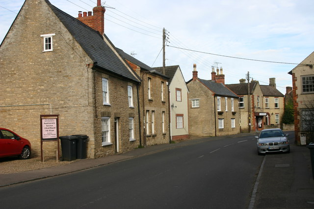
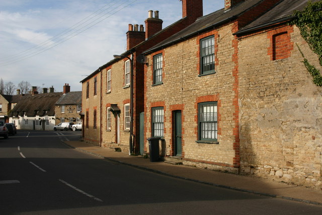
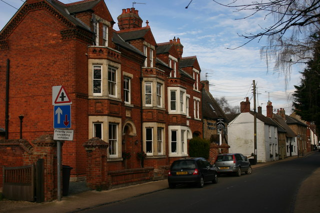
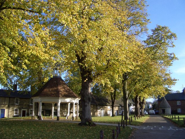
Carlton is a small village located in the county of Bedfordshire, England. Situated approximately 2 miles northwest of the town of Bedford, Carlton is a rural community with a population of around 600 residents. The village is nestled amidst picturesque countryside, offering a tranquil and peaceful environment.

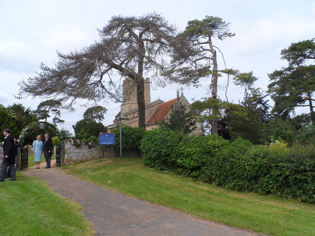
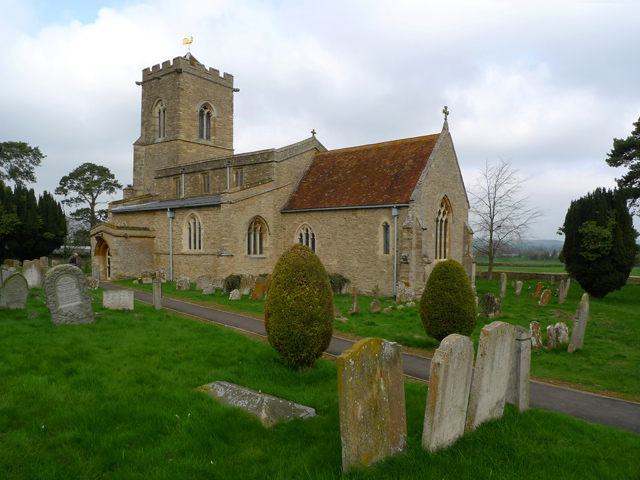
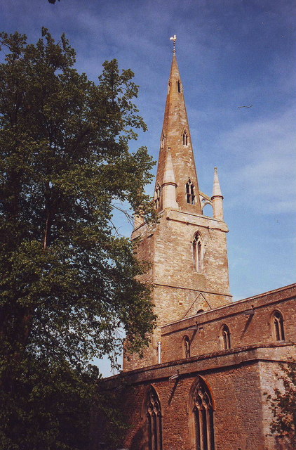
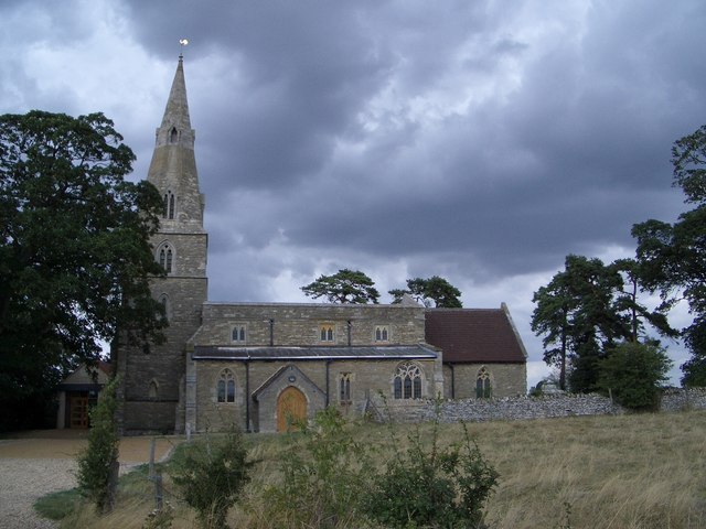
The history of Carlton dates back to medieval times, and evidence of its past can still be seen in the form of historic buildings and landmarks. The centerpiece of the village is the 13th-century St. Mary's Church, a Grade I listed building that showcases stunning architectural features and serves as a reminder of the village's rich heritage.

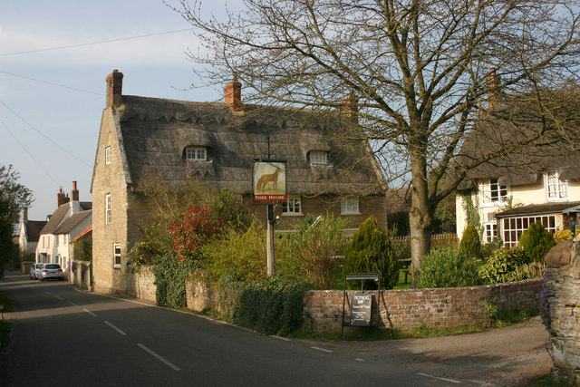
Despite its small size, Carlton boasts a close-knit community that takes pride in its village spirit. The village has a primary school, providing education for local children, and a community hall that serves as a hub for various social events and activities. Additionally, there is a village pub that offers a warm and friendly atmosphere for both residents and visitors.

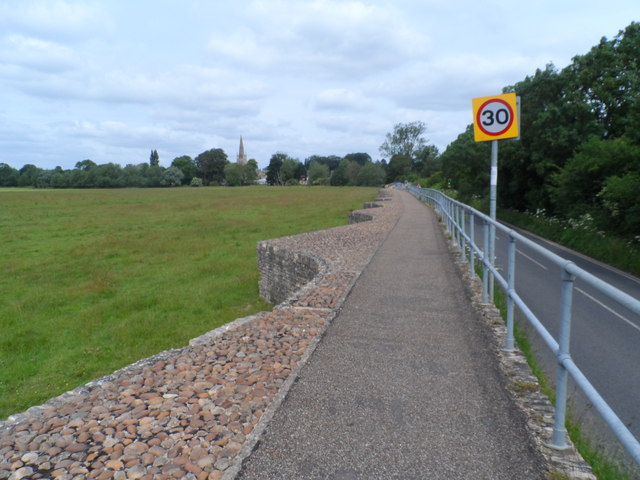
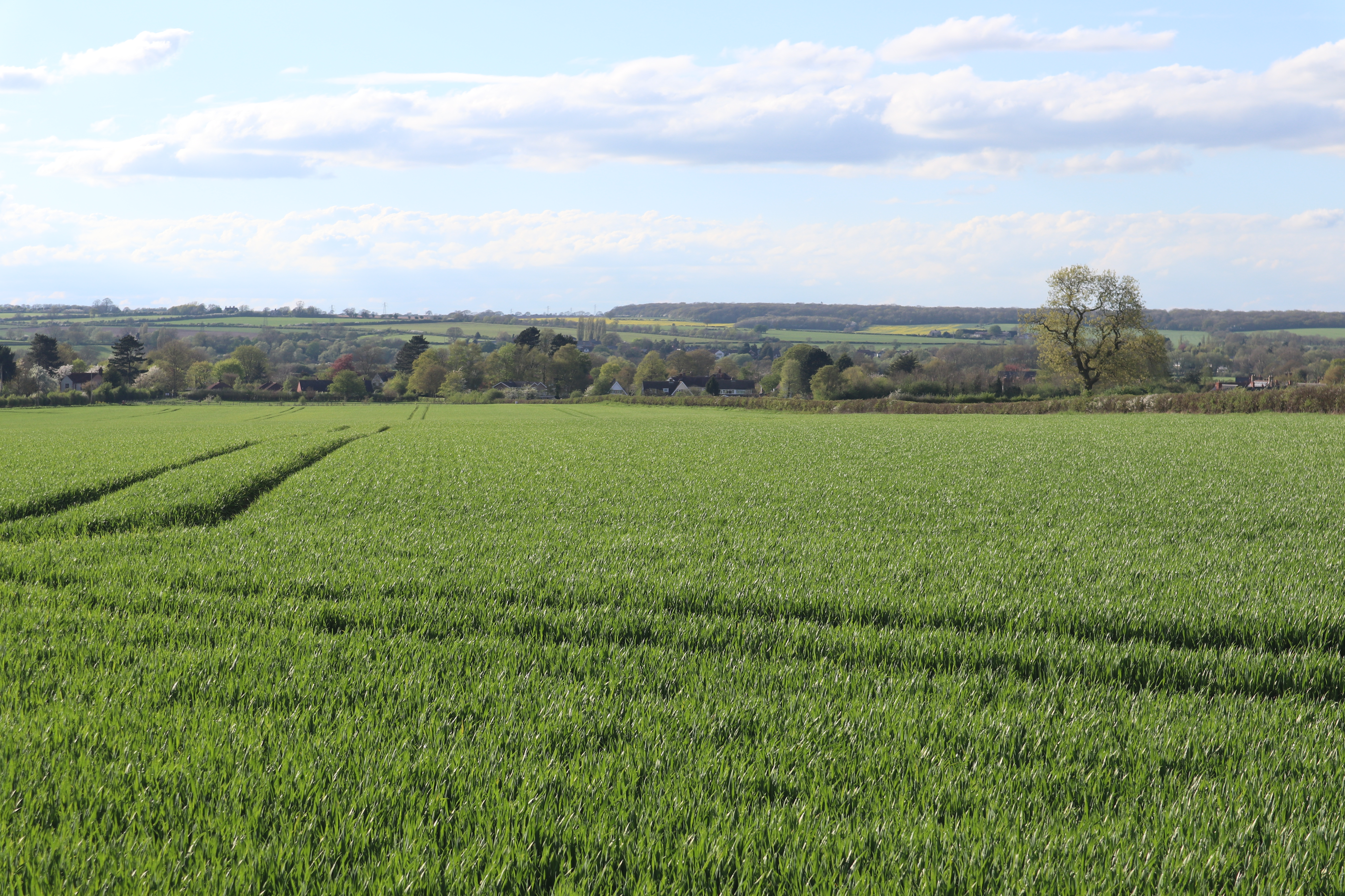
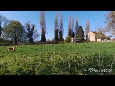
Surrounded by beautiful countryside, Carlton provides ample opportunities for outdoor activities and exploration. The village is located near the River Great Ouse, offering scenic riverside walks and the chance to observe local wildlife. The nearby Bedford Park provides additional recreational facilities, including sports fields and playgrounds.

Overall, Carlton, Bedfordshire, is a charming village that offers a peaceful and idyllic lifestyle. With its rich history, tight-knit community, and stunning surroundings, it is a place that attracts those seeking a tranquil escape from the hustle and bustle of city life.

If you have any feedback on the listing, please let us know in the comments section below.

Carlton Images

Images are sourced within 2km of 52.189319/-0.60800448 or Grid Reference SP9555. Thanks to Geograph Open Source API. All images are credited.

Carlton and Harrold from the air Carlton is the village to the left of centre, Harold is at the top, between the lakes.
Carlton and Harrold from the air
Carlton is the village to the left of centre, Harold is at the top, between the lakes.
St Peter & All Saints church, Harrold
Spring Close Farm
Spring Close Farm
Looking across the flood plain of the Great Ouse towards St Peter's Church, Harrold
Wedding party at St Mary the Virgin, Carlton
Causeway leading to Harrold Bridge The causeway is about 6 feet above the level of the fields below
Causeway leading to Harrold Bridge
The causeway is about 6 feet above the level of the fields below
Harrold Bridge See <span class="nowrap"><a title="http://www.transportheritage.com/find-heritage-locations.html?sobi2Task=sobi2Details&sobi2Id=765" rel="nofollow ugc noopener" href="http://www.transportheritage.com/find-heritage-locations.html?sobi2Task=sobi2Details&sobi2Id=765">Link</a><img style="margin-left:2px;" alt="External link" title="External link - shift click to open in new window" src="https://s1.geograph.org.uk/img/external.png" width="10" height="10"/></span> This bridege was originally constructed in the 14th century but has undergone almost continuous repair and reconstruction since.
Harrold Bridge
See LinkExternal link This bridege was originally constructed in the 14th century but has undergone almost continuous repair and reconstruction since.
Road into Carlton According to <span class="nowrap"><a title="http://www.carltonwithchellington.co.uk/village_history.htm" rel="nofollow ugc noopener" href="http://www.carltonwithchellington.co.uk/village_history.htm">Link</a><img style="margin-left:2px;" alt="External link" title="External link - shift click to open in new window" src="https://s1.geograph.org.uk/img/external.png" width="10" height="10"/></span> this is the most southerly example of the use of the viking-derived name Carleton (meaning free man). It indicates that this was as far south as the Vikings got. The River Ouse formed a boundary to the Viking influence.
Road into Carlton
According to LinkExternal link this is the most southerly example of the use of the viking-derived name Carleton (meaning free man). It indicates that this was as far south as the Vikings got. The River Ouse formed a boundary to the Viking influence.
St Nicholas' Church, Chellington C12 church now used as a retreat centre. See <span class="nowrap"><a title="http://www.carltonwithchellington.co.uk/village_history.htm" rel="nofollow ugc noopener" href="http://www.carltonwithchellington.co.uk/village_history.htm">Link</a><img style="margin-left:2px;" alt="External link" title="External link - shift click to open in new window" src="https://s1.geograph.org.uk/img/external.png" width="10" height="10"/></span> for further information.
St Nicholas' Church, Chellington
C12 church now used as a retreat centre. See LinkExternal link for further information.
High Street, Harrold As seen from opposite the United Reformed chapel looking east.
High Street, Harrold
As seen from opposite the United Reformed chapel looking east.
High Street, Harrold Looking west towards Brook Lane.
High Street, Harrold
Looking west towards Brook Lane.
Harrold House, High Street, Harrold "A tall, symmetrical Victorian-Jacobean villa" as Pevsner puts it.
Harrold House, High Street, Harrold
"A tall, symmetrical Victorian-Jacobean villa" as Pevsner puts it.
High Street, Harrold This terrace of quite large Victorian houses represents yet another architectural style to be found in High Street. The picture was taken looking east towards Church Walk.
High Street, Harrold
This terrace of quite large Victorian houses represents yet another architectural style to be found in High Street. The picture was taken looking east towards Church Walk.
St Peter, Harrold The tower dates from around 1290-1350 but the spire dates from any time thereafter to around 1530.
St Peter, Harrold
The tower dates from around 1290-1350 but the spire dates from any time thereafter to around 1530.
St Peter, Harrold The main part of the church dates from different times in the C13. According to Pevsner the positioning of a lancet window at the far end of the chancel suggests that the latter was once longer than it is today.
St Peter, Harrold
The main part of the church dates from different times in the C13. According to Pevsner the positioning of a lancet window at the far end of the chancel suggests that the latter was once longer than it is today.
Grebe Lake, Harrold-Odell Country Park This is the largest of the three lakes in the Country Park. They were created with the flooding of the sand and gravel workings that ceased operation in the 1980s.
Grebe Lake, Harrold-Odell Country Park
This is the largest of the three lakes in the Country Park. They were created with the flooding of the sand and gravel workings that ceased operation in the 1980s.
Kingfisher Water, Harrold-Odell Country Park The Country Park opened in 1986 and features flooded sand and gravel workings such as this. The church on the hill is the now decommissioned St Nicholas, Chellington.
Kingfisher Water, Harrold-Odell Country Park
The Country Park opened in 1986 and features flooded sand and gravel workings such as this. The church on the hill is the now decommissioned St Nicholas, Chellington.
'The Fox', Carlton (Beds) Taken looking north up High Street (sometimes referred to as Bedford Road).
'The Fox', Carlton (Beds)
Taken looking north up High Street (sometimes referred to as Bedford Road).
Show me another place!

Carlton is located at Grid Ref: SP9555 (Lat: 52.189319, Lng: -0.60800448)

Unitary Authority: Bedford

Police Authority: Bedfordshire

What 3 Words

///drawn.brew.stumpy. Near Harrold, Bedfordshire

Nearby Locations

Chellington Carlton

Related Wikis

Carlton with Chellington

Carlton with Chellington is a civil parish in the historical Hundred of Willey in Bedfordshire, England, and is within the Borough of Bedford. The parish...

Church of St Mary, Carlton, Bedfordshire

Church of St Mary is a Grade I listed church in Carlton, Bedfordshire, England. == See also == Grade I listed buildings in Bedfordshire == References ==

Carlton, Bedfordshire

Carlton is a village and former civil parish, now in the parish of Carlton and Chellington, in the Bedford district, in the ceremonial county of Bedfordshire...

Harrold Priory

Harrold Priory was a priory in Harrold, Bedfordshire, England. It was established in 1138 and disestablished in 1536. == History == The priory of Harrold...

Harrold Hall

Harrold Hall was a country house in Harrold, Bedfordshire, England. Dated to 1210, the house was demolished in 1961. == References ==

Harrold, Bedfordshire

Harrold is a village, civil parish and electoral ward in the Borough of Bedford within Bedfordshire, England, around nine miles north-west of Bedford....

Church of St Peter, Harrold, Bedfordshire

Church of St Peter is a Grade I listed church in Harrold, Bedfordshire, England. == See also == Grade I listed buildings in Bedfordshire == References ==

Chellington

Chellington is a village and former civil parish, now in the parish of Carlton and Chellington, in the Bedford district, in the ceremonial county of Bedfordshire...

Related Videos

Walking the dog

Bebop in Harrold.

Harrold Village, Bedfordshire

Harrold Village from the sky.

Park up in our NV200

One night stay at Harold Odell Park.

Pipers Campsite Carlton Beds

I went to a lovely campsite in Carlton Beds which was had stables in Betty. I met a couple of women and spent the evening with ...

Nearby Amenities

Located within 500m of 52.189319,-0.60800448
Parking
Note: Pub car par for The Fox
Source: GPS waypoint
Lat/Long: 52.1874911/-0.605334
Note: and a little park
Source: GPS waypoint
Lat/Long: 52.1865006/-0.6057269
Turning Circle
Lat/Long: 52.1867164/-0.6065554
Pub
The Fox
Addr City: Carlton
Addr Country: GB
Addr Housenumber: 35
Addr Postcode: MK43 7LA
Addr Street: High Street
Fhrs Authority: Bedford
Fhrs Id: 103117
Fhrs Local Authority Id: 34522
Outdoor Seating: yes
Smoking: isolated
Source: GPS waypoint
Lat/Long: 52.1872032/-0.6060269
Turning Circle
Lat/Long: 52.1888783/-0.6058203
Leisure: garden
Lat/Long: 52.1863933/-0.6053561
Turning Circle
Lat/Long: 52.1904542/-0.6060358
Carlton
Is In: Bedfordshire
Place: village
Wikidata: Q1519434
Lat/Long: 52.1903678/-0.6049492
Turning Circle
Lat/Long: 52.1881153/-0.6057849
Turning Circle
Lat/Long: 52.1898313/-0.6064576
Power: tower
Lat/Long: 52.1872007/-0.6144349
Post Box
Operator: Royal Mail
Ref: MK43 59
Lat/Long: 52.1864274/-0.6057899
Post Box
Operator: Royal Mail
Ref: MK43 357
Lat/Long: 52.1901733/-0.6072649
Barrier: kissing_gate
Lat/Long: 52.1869044/-0.6095159
Barrier: kissing_gate
Lat/Long: 52.1864933/-0.6093228
Turning Circle
Lat/Long: 52.1890653/-0.6091883
Noexit: yes
Lat/Long: 52.188865/-0.6026025
Turning Circle
Lat/Long: 52.1897163/-0.6049843
The data included in this document is from www.openstreetmap.org. The data is made available under ODbL.

Have you been to Carlton?

Leave your review of Carlton below (or comments, questions and feedback).