Carlton

Settlement in Nottinghamshire Gedling

England

Carlton

On the first day of Christmas . . . . . . the birds couldn't get their numbers right - neither six geese a-laying nor seven swans a-swimming.
On the first day of Christmas . . . Credit: Alan Murray-Rust

Carlton is a suburban village located in the county of Nottinghamshire in England. Situated approximately four miles northeast of Nottingham city center, it lies within the borough of Gedling. With a population of around 10,000 residents, Carlton is a bustling residential area with a rich history.

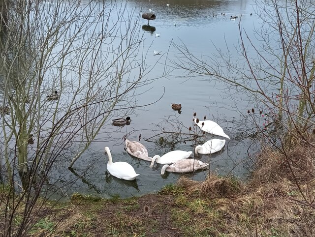
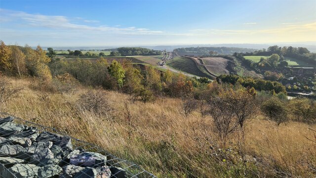
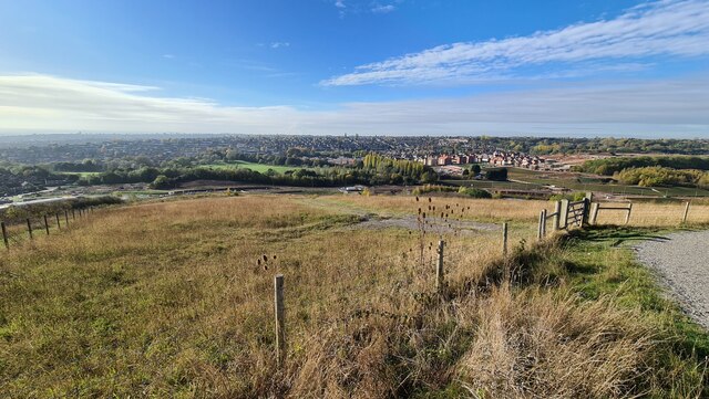
The village is known for its close proximity to the River Trent, which runs along its western boundary. This picturesque setting provides residents with access to beautiful riverside walks and recreational activities. Additionally, Carlton boasts several green spaces, including Colwick Country Park and Gedling Country Park, offering ample opportunities for outdoor enthusiasts to enjoy nature.

The village has a well-developed infrastructure, with a range of amenities and services. It is home to a variety of shops, including supermarkets, convenience stores, and local businesses, catering to the needs of its residents. Carlton also has a number of schools, making it an attractive location for families.

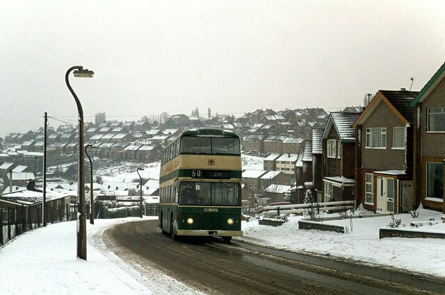
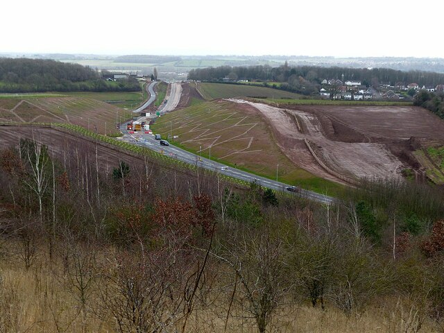
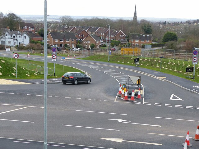
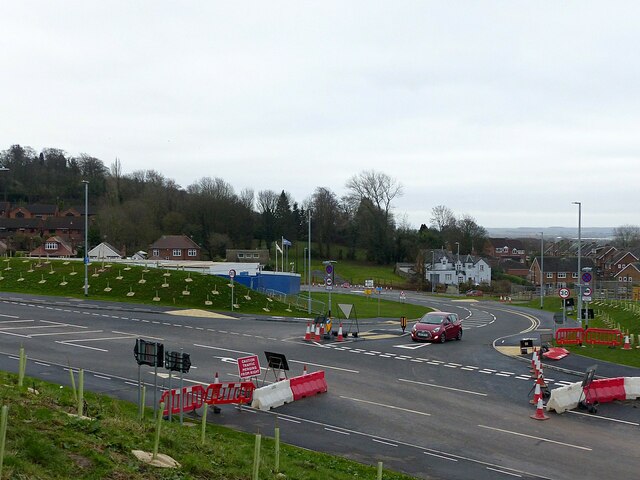
Transportation links in Carlton are excellent, with frequent bus services connecting the village to Nottingham city center and surrounding areas. Carlton also benefits from its close proximity to major road networks, such as the A52 and the A612, providing easy access to nearby towns and cities.

Overall, Carlton is a thriving village that offers a balance between urban convenience and natural beauty. With its rich history, range of amenities, and excellent transport links, it is a popular place to live for both families and professionals.

If you have any feedback on the listing, please let us know in the comments section below.
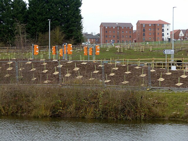
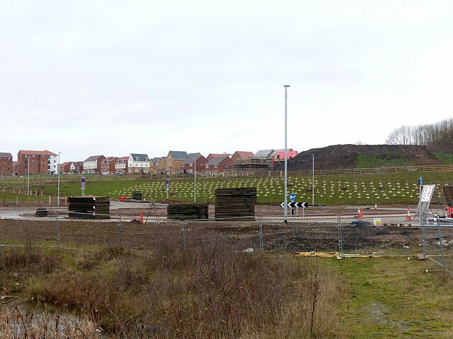
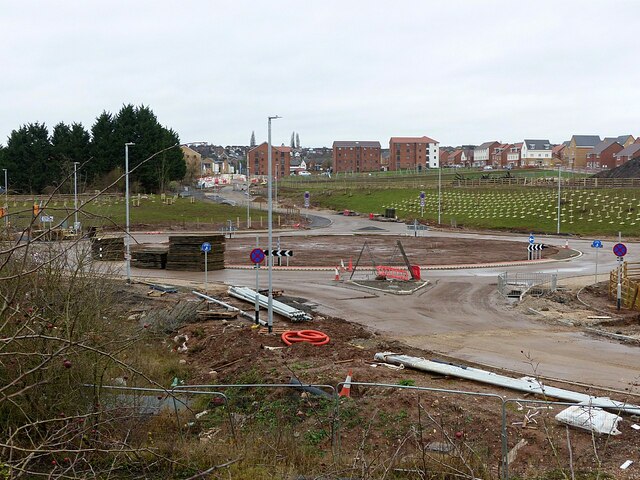
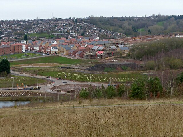
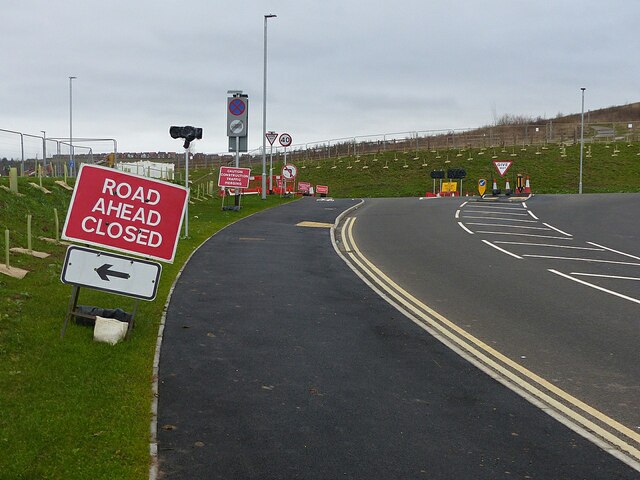
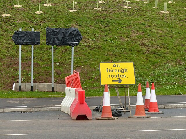
Carlton Images

Images are sourced within 2km of 52.970951/-1.090135 or Grid Reference SK6141. Thanks to Geograph Open Source API. All images are credited.

On the first day of Christmas . . . . . . the birds couldn't get their numbers right - neither six geese a-laying nor seven swans a-swimming.
On the first day of Christmas . . .
. . . the birds couldn't get their numbers right - neither six geese a-laying nor seven swans a-swimming.
Climbing through the snow – 1978 Snowfall in the hillier parts of the Nottingham conurbation generally results in some bus services being suspended until some clearance has taken place. Shelford Road, with a gradient of around 1 in 10 is one of these; here sufficient salt has got onto the carriageway to allow service to resume.

The bus is a Daimler Fleetline with bodywork by Northern Counties to Nottingham City Transport's own design, new in 1976.

This is one of a series of views featuring buses in the 60s, 70s, and 80s. <a title="https://www.geograph.org.uk/search.php?i=137652761" href="https://www.geograph.org.uk/search.php?i=137652761">Link</a>
Climbing through the snow – 1978
Snowfall in the hillier parts of the Nottingham conurbation generally results in some bus services being suspended until some clearance has taken place. Shelford Road, with a gradient of around 1 in 10 is one of these; here sufficient salt has got onto the carriageway to allow service to resume. The bus is a Daimler Fleetline with bodywork by Northern Counties to Nottingham City Transport's own design, new in 1976. This is one of a series of views featuring buses in the 60s, 70s, and 80s. Link
The South Viewing Platform in Gedling Country Park Providing extensive views to the south and west over Nottingham and the Trent Valley.
The South Viewing Platform in Gedling Country Park
Providing extensive views to the south and west over Nottingham and the Trent Valley.
Exposition Board in Gedling Country Park Giving details of the solar power installation and the extraction of methane gas from the abandioned mine workings.
Exposition Board in Gedling Country Park
Giving details of the solar power installation and the extraction of methane gas from the abandioned mine workings.
Gedling Access Road construction
Gedling Access Road and new housing
Christmas Day holiday No work taking place on the Gedling Access Road.
Christmas Day holiday
No work taking place on the Gedling Access Road.
Gedling Access Road construction – 251221 – 1 Moving towards completion, with opening due in the New Year.
Gedling Access Road construction – 251221 – 1
Moving towards completion, with opening due in the New Year.
Gedling Access Road construction – 251221 – 2 Direction signs and traffic lights in place and newly planted trees, adjacent to the Waldrom Road roundabout.
Gedling Access Road construction – 251221 – 2
Direction signs and traffic lights in place and newly planted trees, adjacent to the Waldrom Road roundabout.
Gedling Access Road construction – 251221 – 3 The roundabout at Chase Farm (Waldrom Road) is complete. In the background the development of housing continues.
Gedling Access Road construction – 251221 – 3
The roundabout at Chase Farm (Waldrom Road) is complete. In the background the development of housing continues.
Gedling Access Road construction – 251221 – 4 The roundabout at Waldrom Road looking towards the Chase Farm development. The road in the foreground will give access to a small business/industrial development on the site of the former Gedling Colliery.
Gedling Access Road construction – 251221 – 4
The roundabout at Waldrom Road looking towards the Chase Farm development. The road in the foreground will give access to a small business/industrial development on the site of the former Gedling Colliery.
Gedling Country Park at Christmas 2021 – 6 View towards the Chase Farm housing development with the roundabout at the connection to the Gedling Access Road.
Gedling Country Park at Christmas 2021 – 6
View towards the Chase Farm housing development with the roundabout at the connection to the Gedling Access Road.
Gedling Access Road construction – 251221 – 7 The section between the two links with Lambley Lane is now open to traffic. The road at various stages of construction from the same viewpoint can be seen here <a title="https://www.geograph.org.uk/search.php?i=149328936&page=1&displayclass=slide" href="https://www.geograph.org.uk/search.php?i=149328936&page=1&displayclass=slide">Link</a>
Gedling Access Road construction – 251221 – 7
The section between the two links with Lambley Lane is now open to traffic. The road at various stages of construction from the same viewpoint can be seen here Link
Gedling Access Road construction – 251221 – 8 The lower link to Lambley Lane. There are two separate T-junctions, around 200 metres apart, rather than a crossroads on the old alignment of Lambley Lane.
Gedling Access Road construction – 251221 – 8
The lower link to Lambley Lane. There are two separate T-junctions, around 200 metres apart, rather than a crossroads on the old alignment of Lambley Lane.
Gedling Access Road construction – 251221 – 9 The lower link to Lambley Lane. There are two separate T-junctions, around 200 metres apart, rather than a crossroads on the old alignment of Lambley Lane <a title="https://www.geograph.org.uk/photo/7054782" href="https://www.geograph.org.uk/photo/7054782">Link</a> .
Gedling Access Road construction – 251221 – 9
The lower link to Lambley Lane. There are two separate T-junctions, around 200 metres apart, rather than a crossroads on the old alignment of Lambley Lane Link .
Gedling Access Road construction – 251221 – 10 Lambley Lane at the lower junction, now a cul-de-sac serving a small number of houses.
Gedling Access Road construction – 251221 – 10
Lambley Lane at the lower junction, now a cul-de-sac serving a small number of houses.
Gedling Access Road construction – 251221 – 11 The lower link to Lambley Lane, now open to traffic. The sign ought to read 'Not yet open' rather than 'Closed'.
Gedling Access Road construction – 251221 – 11
The lower link to Lambley Lane, now open to traffic. The sign ought to read 'Not yet open' rather than 'Closed'.
Gedling Access Road construction – 251221 – 12 Bagged road signs at the lower link with Lambley Lane, waiting for opening in the New Year.
Gedling Access Road construction – 251221 – 12
Bagged road signs at the lower link with Lambley Lane, waiting for opening in the New Year.
Show me another place!

Carlton is located at Grid Ref: SK6141 (Lat: 52.970951, Lng: -1.090135)

Administrative County: Nottinghamshire

District: Gedling

Police Authority: Nottinghamshire

What 3 Words

///plays.remove.ridge. Near Burton Joyce, Nottinghamshire

Nearby Locations

Carlton

Related Wikis

Carlton, Nottinghamshire

Carlton is a town in the Borough of Gedling, Nottinghamshire, England. It is to the east of Nottingham. The population at the 2011 Census was 6,881. It...

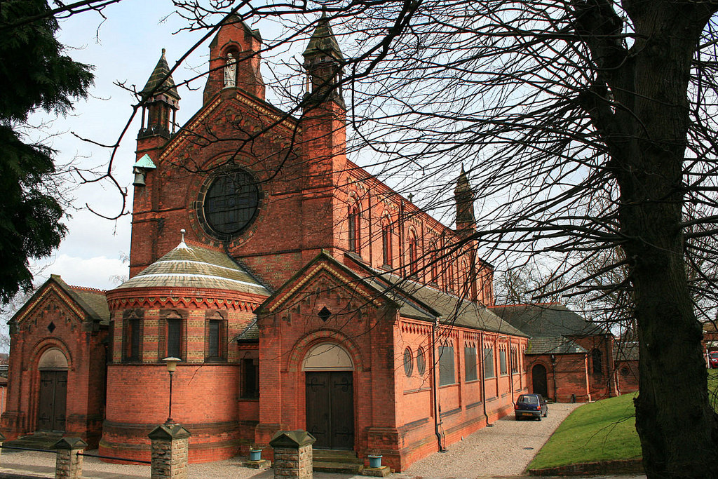
St Paul's Church, Carlton-in-the-Willows

St. Paul's Church, Carlton-in-the-Willows is a parish church in the Church of England in Carlton, Nottinghamshire. It is a Grade II listed building....

Gedling

Gedling is a village and former civil parish which gives its name to the larger Borough of Gedling in Nottinghamshire, England. It lies 4 miles (6.4 km...

The Carlton Academy

The Carlton Academy is a secondary school in Nottinghamshire, previously known as The Wheldon School and Sports Academy. The school is sponsored by the...

Mary Hardstaff Homes

The Mary Hardstaff Homes, are 10 almshouses on Arnold Lane in Gedling, Nottingham. These were built as Almshouses in 1936 for the widows and orphans of...

Carlton railway station

Carlton railway station serves the suburb of Carlton, Nottinghamshire, England. The station is 3 miles (5 km) east of Nottingham on the Nottingham to Lincoln...

Borough of Gedling

Gedling is a local government district with borough status in Nottinghamshire, England. The council is based in Arnold. The borough also includes Carlton...

Sherwood Academy

Sherwood Academy (formerly Sherwood E-ACT Academy, The Gedling School and Gedling Secondary Modern) was a secondary school with academy status located...

Nearby Amenities

Located within 500m of 52.970951,-1.090135
Traffic Signals
Lat/Long: 52.9669133/-1.0878583
Turning Circle
Lat/Long: 52.9715103/-1.0840164
Image: https://www.mapillary.com/map/im/S_hzS9ULQVzmL0e8xx96Sg
Lat/Long: 52.9710518/-1.0869324
Bus Stop
Bakewell Avenue
Bench: no
Bin: no
Bus: yes
Lit: no
Local Ref: GE0190
Naptan AtcoCode: 3300GE0190
Naptan Bearing: NW
Naptan CommonName: Bakewell Avenue
Naptan Crossing: Bakewell Avenue
Naptan Indicator: adj
Naptan NaptanCode: ntsawpwt
Naptan Notes: (This stop renumbered from 3300GE16)
Naptan PlusbusZoneRef: NTNG
Naptan Street: Westdale Lane East
Naptan Verified: yes
Public Transport: platform
Shelter: no
Source: naptan_import;GPS
Tactile Paving: no
Lat/Long: 52.9750243/-1.090373
Bus Stop
Ramsdale Road
Bench: no
Bin: no
Bus: yes
Lit: yes
Local Ref: GE0191
Naptan AtcoCode: 3300GE0191
Naptan Bearing: NW
Naptan CommonName: Ramsdale Road
Naptan Crossing: Ramsdale Road
Naptan Indicator: adj
Naptan Landmark: Westdale Tavern
Naptan NaptanCode: ntsawtad
Naptan Notes: (This stop renumbered from 3300GE15)
Naptan PlusbusZoneRef: NTNG
Naptan Street: Westdale Lane East
Naptan Verified: yes
Public Transport: platform
Shelter: no
Source: naptan_import
Tactile Paving: no
Lat/Long: 52.973908/-1.0878245
Bus Stop
Carlton Square
Bus: yes
Naptan AtcoCode: 3300GE0051
Naptan Bearing: NE
Naptan CommonName: Carlton Square
Naptan Crossing: Carlton Square
Naptan Indicator: NE-bound
Naptan NaptanCode: ntsatpda
Naptan Notes: (This stop renumbered from 3300CA21)
Naptan PlusbusZoneRef: NTNG
Naptan Street: Burton Road
Naptan Verified: yes
Public Transport: platform
Shelter: yes
Source: naptan_import
Lat/Long: 52.9673472/-1.0868861
Mini Roundabout
Direction: clockwise
Lat/Long: 52.9680314/-1.0897763
Entrance: main
Lat/Long: 52.9675995/-1.0891824
Bus Stop
Ramsdale Road
Bench: yes
Bin: yes
Bus: yes
Lit: yes
Naptan AtcoCode: 3300GE0192
Naptan Bearing: SE
Naptan CommonName: Ramsdale Road
Naptan Crossing: Ramsdale Road
Naptan Indicator: opp
Naptan Landmark: Westdale Tavern
Naptan NaptanCode: ntsawtag
Naptan Notes: (This stop renumbered from 3300GE09)
Naptan PlusbusZoneRef: NTNG
Naptan Street: Westdale Lane East
Naptan Verified: yes
Public Transport: platform
Shelter: yes
Source: naptan_import
Tactile Paving: no
Lat/Long: 52.9737954/-1.0872119
Post Box
Collection Times: Mo-Fr 16:45; Sa 11:30
Image: https://www.mapillary.com/map/im/JSRiHGss5CN4F-1LLe38Pw
Phone: +44 345 774 0740
Post Box Type: pillar
Ref: NG4 453
Royal Cypher: GR
Royal Cypher Wikidata: Q33102273
Website: https://www.royalmail.com/
Lat/Long: 52.9741782/-1.088648
Entrance: main
Lat/Long: 52.9729293/-1.0852654
Bus Stop
Carlton Square
Bus: yes
Naptan AtcoCode: 3300GE0042
Naptan Bearing: SW
Naptan CommonName: Carlton Square
Naptan Crossing: Carlton Square
Naptan Indicator: SW-bound
Naptan NaptanCode: ntsatmwp
Naptan Notes: (This stop renumbered to 3300CA01)
Naptan PlusbusZoneRef: NTNG
Naptan Street: Burton Road
Naptan Verified: yes
Public Transport: platform
Shelter: yes
Source: naptan_import
Lat/Long: 52.9671676/-1.0869048
Bus Stop
Belper Avenue
Bus: yes
Naptan AtcoCode: 3300GE0043
Naptan Bearing: NW
Naptan CommonName: Belper Avenue
Naptan Crossing: Belper Avenue
Naptan Indicator: opp
Naptan NaptanCode: ntsatmwt
Naptan Notes: (This stop renumbered from 3300CA26)
Naptan PlusbusZoneRef: NTNG
Naptan Street: Cavendish Road
Naptan Verified: no
Public Transport: platform
Source: naptan_import
Lat/Long: 52.9720993/-1.0970166
Bus Stop
Belper Avenue
Bus: yes
Naptan AtcoCode: 3300GE0044
Naptan Bearing: SE
Naptan CommonName: Belper Avenue
Naptan Crossing: Belper Avenue
Naptan Indicator: adj
Naptan NaptanCode: ntsatpad
Naptan Notes: (This stop renumbered from 3300CA34)
Naptan PlusbusZoneRef: NTNG
Naptan Street: Cavendish Road
Naptan Verified: no
Public Transport: platform
Source: naptan_import
Lat/Long: 52.9717892/-1.0964274
Bus Stop
Rushcliffe Avenue
Bus: yes
Naptan AtcoCode: 3300GE0045
Naptan Bearing: SE
Naptan CommonName: Rushcliffe Avenue
Naptan Crossing: Rushcliffe Avenue
Naptan Indicator: opp
Naptan NaptanCode: ntsatpag
Naptan Notes: (This stop renumbered from 3300CA35)
Naptan PlusbusZoneRef: NTNG
Naptan Street: Cavendish Road
Naptan Verified: no
Public Transport: platform
Source: naptan_import
Lat/Long: 52.9700886/-1.0938718
Bus Stop
Rushcliffe Avenue
Bus: yes
Naptan AtcoCode: 3300GE0046
Naptan Bearing: NW
Naptan CommonName: Rushcliffe Avenue
Naptan Crossing: Rushcliffe Avenue
Naptan Indicator: adj
Naptan NaptanCode: ntsatpaj
Naptan Notes: (This stop renumbered from 3300CA25)
Naptan PlusbusZoneRef: NTNG
Naptan Street: Cavendish Road
Naptan Verified: no
Public Transport: platform
Shelter: no
Source: naptan_import
Lat/Long: 52.9700628/-1.0940213
Bus Stop
Cemetery
Bus: yes
Naptan AtcoCode: 3300GE0047
Naptan Bearing: NW
Naptan CommonName: Cemetery
Naptan Crossing: Worth Street
Naptan Indicator: opp
Naptan Landmark: Cemetery
Naptan NaptanCode: ntsatpam
Naptan Notes: (This stop renumbered from 3300CA24)
Naptan PlusbusZoneRef: NTNG
Naptan Street: Cavendish Road
Naptan Verified: no
Public Transport: platform
Source: naptan_import
Lat/Long: 52.9689506/-1.0920045
Bus Stop
Cemetery
Bus: yes
Naptan AtcoCode: 3300GE0048
Naptan Bearing: SE
Naptan CommonName: Cemetery
Naptan Crossing: Worth Street
Naptan Indicator: adj
Naptan Landmark: Cemetery
Naptan NaptanCode: ntsatpap
Naptan Notes: (This stop renumbered from 3300CA36)
Naptan PlusbusZoneRef: NTNG
Naptan Street: Cavendish Road
Naptan Verified: no
Public Transport: platform
Source: naptan_import
Lat/Long: 52.9688109/-1.0913671
Bus Stop
Carlton Square
Bus: yes
Local Ref: GE0049
Naptan AtcoCode: 3300GE0049
Naptan Bearing: NW
Naptan CommonName: Carlton Square
Naptan Crossing: Carlton Square
Naptan Indicator: NW-bound
Naptan Landmark: Police Station
Naptan NaptanCode: ntsatpat
Naptan Notes: (This stop renumbered from 3300CA23)
Naptan PlusbusZoneRef: NTNG
Naptan Street: Cavendish Road
Naptan Verified: yes
Public Transport: platform
Shelter: yes
Source: naptan_import
Lat/Long: 52.967779/-1.0892595
Bus Stop
Carlton Square
Bus: yes
Local Ref: GE0060
Naptan AtcoCode: 3300GE0060
Naptan Bearing: SE
Naptan CommonName: Carlton Square
Naptan Crossing: Carlton Square
Naptan Indicator: SE-bound
Naptan Landmark: Police Station
Naptan NaptanCode: ntsawdam
Naptan Notes: (This stop renumbered from 3300CA37)
Naptan PlusbusZoneRef: NTNG
Naptan Street: Cavendish Road
Naptan Verified: yes
Public Transport: platform
Shelter: yes
Source: naptan_import
Lat/Long: 52.9672948/-1.0882571
Bus Stop
Cromwell Street
Bus: yes
Naptan AtcoCode: 3300GE0115
Naptan Bearing: SE
Naptan CommonName: Cromwell Street
Naptan Crossing: Cromwell Street
Naptan Indicator: opp
Naptan NaptanCode: ntsapwdm
Naptan Notes: (This stop renumbered from 3300CA85)
Naptan PlusbusZoneRef: NTNG
Naptan Street: Foxhill Road East
Naptan Verified: no
Public Transport: platform
Source: naptan_import
Lat/Long: 52.9676311/-1.0922555
Bus Stop
Cromwell Street
Bus: yes
Naptan AtcoCode: 3300GE0116
Naptan Bearing: NW
Naptan CommonName: Cromwell Street
Naptan Crossing: Cromwell Street
Naptan Indicator: adj
Naptan NaptanCode: ntsawmwa
Naptan Notes: (This stop renumbered from 3300CA80)
Naptan PlusbusZoneRef: NTNG
Naptan Street: Foxhill Road East
Naptan Verified: no
Public Transport: platform
Source: naptan_import
Lat/Long: 52.9676158/-1.0926132
Bus Stop
Bell Street
Bus: yes
Naptan AtcoCode: 3300GE0117
Naptan Bearing: NW
Naptan CommonName: Bell Street
Naptan Crossing: Bell Street
Naptan Indicator: adj
Naptan NaptanCode: ntsawmwd
Naptan Notes: (This stop renumbered from 3300CA81)
Naptan PlusbusZoneRef: NTNG
Naptan Street: Foxhill Road East
Naptan Verified: no
Public Transport: platform
Source: naptan_import
Lat/Long: 52.9686701/-1.0964775
Bus Stop
Victoria Street
Bench: yes
Bus: yes
Naptan AtcoCode: 3300GE0193
Naptan Bearing: NW
Naptan CommonName: Victoria Street
Naptan Crossing: Victoria Street
Naptan Indicator: opp
Naptan NaptanCode: ntsawtaj
Naptan Notes: (This stop renumbered from 3300GE14)
Naptan PlusbusZoneRef: NTNG
Naptan Street: Westdale Lane East
Naptan Verified: yes
Public Transport: platform
Shelter: yes
Source: naptan_import
Lat/Long: 52.9724192/-1.0836073
Bus Stop
Bakewell Avenue
Bench: yes
Bin: no
Bus: yes
Lit: no
Naptan AtcoCode: 3300GE0212
Naptan Bearing: SE
Naptan CommonName: Bakewell Avenue
Naptan Crossing: Bakewell Avenue
Naptan Indicator: opp
Naptan NaptanCode: ntsatmtg
Naptan Notes: (This stop renumbered from 3300GE08)
Naptan PlusbusZoneRef: NTNG
Naptan Street: Westdale Lane East
Naptan Verified: yes
Public Transport: platform
Shelter: yes
Source: naptan_import
Tactile Paving: no
Lat/Long: 52.9752322/-1.0905325
Bus Stop
Barons Close
Bench: no
Bin: no
Bus: yes
Lit: no
Naptan AtcoCode: 3300GE0548
Naptan Bearing: NE
Naptan CommonName: Barons Close
Naptan Crossing: Barons Close
Naptan Indicator: opp
Naptan Landmark: Westdale Tavern
Naptan NaptanCode: ntsapdtj
Naptan Notes: (This stop renumbered from 3300GE85)
Naptan PlusbusZoneRef: NTNG
Naptan Street: Adbolton Avenue
Naptan Verified: no
Public Transport: platform
Shelter: no
Source: naptan_import
Tactile Paving: no
Lat/Long: 52.9741852/-1.0876355
Image: https://www.mapillary.com/map/im/zcweNh-X1RMsQCr3W1JDwA
Lat/Long: 52.9706065/-1.0839535
Turning Circle
Lat/Long: 52.9744006/-1.0932411
Turning Circle
Lat/Long: 52.9740251/-1.0935791
Turning Circle
Lat/Long: 52.9693385/-1.0864094
Turning Circle
Source: Bing
Lat/Long: 52.9691455/-1.0848499
Turning Circle
Lat/Long: 52.970023/-1.0830901
Turning Circle
Lat/Long: 52.9689052/-1.086296
Turning Circle
Lat/Long: 52.9728799/-1.0967225
Image: https://www.mapillary.com/map/im/aQ9FpCZkNUypKPCQhHhB7g
Lat/Long: 52.9710235/-1.0837831
Turning Circle
Lat/Long: 52.9704393/-1.0846588
Crossing
Crossing: uncontrolled
Crossing Ref: zebra
Lat/Long: 52.9669028/-1.0892494
Parking Entrance
Lat/Long: 52.9666858/-1.0889646
Crossing
Crossing: uncontrolled
Crossing Ref: zebra
Lat/Long: 52.9668452/-1.0902774
Crossing
Crossing: uncontrolled
Crossing Ref: zebra
Lat/Long: 52.9668482/-1.0900686
Barrier: bollard
Lat/Long: 52.9665235/-1.0898474
Crossing
Crossing: traffic_signals
Source: survey
Lat/Long: 52.9668363/-1.0880658
Crossing
Crossing: traffic_signals
Source: survey
Lat/Long: 52.9670204/-1.0875878
Crossing
Crossing: traffic_signals
Source: survey
Lat/Long: 52.9667825/-1.0876599
Crossing
Button Operated: yes
Crossing: traffic_signals
Source: survey
Lat/Long: 52.9670162/-1.088009
Crossing
Crossing: uncontrolled
Crossing Ref: zebra
Lat/Long: 52.9675098/-1.0919171
Barrier: cycle_barrier
Bicycle: no
Foot: yes
Image: https://www.mapillary.com/map/im/nARkZ8lPEMqqf_PAM9fC0g
Lat/Long: 52.9683888/-1.0843094
Turning Circle
Source: Bing
Lat/Long: 52.9684798/-1.0843001
Post Box
Collection Times: Mo-Fr 09:00; Sa 07:00
Image: https://www.mapillary.com/map/im/qOmcdLT006Cb1X_Uhllgqg
Phone: +44 345 774 0740
Post Box Type: lamp
Ref: NG4 451D
Royal Cypher: EIIR
Royal Cypher Wikidata: Q33102113
Source: survey
Website: https://www.royalmail.com/
Lat/Long: 52.9675648/-1.0916431
Crossing
Crossing: uncontrolled
Crossing Ref: zebra
Description: This is a school crossing
Image: https://www.mapillary.com/map/im/AOXd4qnVUniqbY3YXgEDsg
Source: survey
Lat/Long: 52.9684674/-1.0955639
Atm
Capacity: 2
Operator: Tesco
Source: survey
Wheelchair: yes
Lat/Long: 52.9667458/-1.0904768
Entrance: main
Lat/Long: 52.9668563/-1.0903777
Post Box
Collection Times: Mo-Fr 17:15; Sa 10:00
Indoor: yes
Phone: +44 345 774 0740
Post Box Type: indoor_pillar
Ref: NG4 496
Royal Cypher: EIIR
Royal Cypher Wikidata: Q33102113
Source: survey
Website: https://www.royalmail.com/
Wheelchair: yes
Lat/Long: 52.9669328/-1.0904185
Crossing
Crossing: uncontrolled
Lat/Long: 52.9670907/-1.0903542
Note: Enquiry Office window
Lat/Long: 52.9723671/-1.0837949
Addr City: Nottingham
Addr Housenumber: 41a
Addr Postcode: NG4 3JN
Addr Street: Westdale Lane East
Entrance: yes
Level: 1
Ref: 41a
Lat/Long: 52.9728417/-1.0852907
Addr City: Nottingham
Addr Housenumber: 43a
Addr Postcode: NG4 3JN
Addr Street: Westdale Lane East
Entrance: yes
Level: 1
Ref: 43a
Lat/Long: 52.9728653/-1.0853557
Addr City: Nottingham
Addr Housenumber: 45a
Addr Postcode: NG4 3JN
Addr Street: Westdale Lane East
Entrance: yes
Level: 1
Ref: 45a
Lat/Long: 52.9728782/-1.0853915
Addr City: Nottingham
Addr Housenumber: 47a
Addr Postcode: NG4 3JN
Addr Street: Westdale Lane East
Entrance: yes
Level: 1
Ref: 47a
Lat/Long: 52.9729027/-1.085456
Entrance: main
Lat/Long: 52.9729111/-1.0852148
Crossing
Crossing: uncontrolled
Crossing Island: no
Crossing Ref: zebra
Source: survey
Tactile Paving: yes
Lat/Long: 52.9729232/-1.084976
Entrance: main
Lat/Long: 52.9729622/-1.0853572
Hinge: horizontal
Image: https://www.mapillary.com/map/im/_TFOCCUAcztu87AwMUgz_Q
Man Made: street_cabinet
Operator: Virgin Media
Operator Previous: Diamond Cable
Operator Wikidata: Q1199764
Ref Virgin Tel: 0870 888 3116
Utility: telecom
Lat/Long: 52.9674957/-1.0914035
Hinge: horizontal
Image: https://www.mapillary.com/map/im/_TFOCCUAcztu87AwMUgz_Q
Man Made: street_cabinet
Operator: Virgin Media
Operator Previous: Diamond Cable
Operator Wikidata: Q1199764
Ref Virgin Tel: 0870 888 3116
Utility: telecom
Lat/Long: 52.9675508/-1.0918083
Hinge: horizontal
Image: https://www.mapillary.com/map/im/Aw2Gk3l2-LRC7GfrQyyR7A
Man Made: street_cabinet
Operator: Virgin Media
Operator Previous: Diamond Cable
Operator Wikidata: Q1199764
Ref Virgin Tel: 0870 888 3116
Utility: telecom
Lat/Long: 52.9676936/-1.0924108
Hinge: horizontal
Image: https://www.mapillary.com/map/im/-YGzDG0HVzNkgHEZK-WJGg
Man Made: street_cabinet
Operator: Virgin Media
Operator Previous: Diamond Cable
Operator Wikidata: Q1199764
Ref Virgin Tel: 0870 888 3116
Utility: telecom
Lat/Long: 52.9679808/-1.0900304
Bench
Backrest: yes
Colour: brown
Material: wood
Seats: 3
Lat/Long: 52.9683254/-1.0946386
Bench
Backrest: yes
Colour: brown
Material: wood
Seats: 3
Lat/Long: 52.9688149/-1.096361
Bench
Backrest: yes
Colour: brown
Material: wood
Seats: 3
Lat/Long: 52.9688782/-1.0965665
Bench
Backrest: yes
Colour: brown
Image: https://www.mapillary.com/map/im/tX3S4SeLbkBVew8Qs-zAlw
Material: wood
Seats: 4
Lat/Long: 52.967046/-1.0909877
Grit Bin
Email: waste@gedling.gov.uk
Image: https://www.mapillary.com/map/im/cpbXFp803Yzb8Gd9015ixw
Phone: +44 115 901 3621
Website: http://www.gedling.gov.uk/wasterecyclingenvironment/winteradverseweather/roadgrittinggrittingbins/
Lat/Long: 52.9674986/-1.0923219
Addr City: Nottingham
Addr Flats: 1-6
Addr Housename: The Windings
Addr Postcode: NG4 1EF
Addr Street: Chesterfield Street
Entrance: yes
Image: https://www.mapillary.com/map/im/A_1IhudY38HC6gpa9_sLDA
Ref: 1-6
Lat/Long: 52.9673267/-1.0943046
Give Way
Direction: backward
Image: https://www.mapillary.com/map/im/UZVV6JtYc6CDKBYBqMtT1A
Lat/Long: 52.9678324/-1.0933755
Give Way
Image: https://www.mapillary.com/map/im/qG7fwE-mT19koEGQ3jPJWQ
Lat/Long: 52.9675151/-1.0922027
Carlton
Place: town
Wikidata: Q2736123
Wikipedia: en:Carlton, Nottinghamshire
Lat/Long: 52.9669396/-1.087857
Grit Bin
Email: waste@gedling.gov.uk
Image: https://www.mapillary.com/map/im/XaoIo1qZqVJBoNZgAEslEA
Phone: +44 115 901 3621
Website: http://www.gedling.gov.uk/wasterecyclingenvironment/winteradverseweather/roadgrittinggrittingbins/
Lat/Long: 52.9676604/-1.0891854
Give Way
Direction: forward
Image: http://mapillary.com/map/im/LSTqxwp4otAUke6KgHnusA
Lat/Long: 52.9679293/-1.0933464
Hinge: horizontal
Image: http://mapillary.com/map/im/thVTsN5Hf5hb28ud4lssKg
Man Made: street_cabinet
Operator: Virgin Media
Operator Previous: Diamond Cable
Operator Wikidata: Q1199764
Ref Virgin Tel: 0870 888 3116
Utility: telecom
Lat/Long: 52.9690334/-1.0923316
Image: http://mapillary.com/map/im/ZEjAQhm2D8bGspFdVFe73A
Traffic Calming: cushion
Lat/Long: 52.9690608/-1.092189
Image: http://mapillary.com/map/im/ZEjAQhm2D8bGspFdVFe73A
Traffic Calming: cushion
Lat/Long: 52.9695054/-1.0930869
Image: http://mapillary.com/map/im/ZEjAQhm2D8bGspFdVFe73A
Traffic Calming: cushion
Lat/Long: 52.970187/-1.0941242
Hinge: horizontal
Image: http://mapillary.com/map/im/mtk6fHBNFEe-lAgd6qfMZg
Man Made: street_cabinet
Operator: Virgin Media
Operator Previous: Diamond Cable
Operator Wikidata: Q1199764
Ref: CCC00262
Ref Virgin Tel: 0870 888 3116
Utility: telecom
Lat/Long: 52.9704333/-1.0946449
Image: http://mapillary.com/map/im/iWgo-YrZPNfmJ8Y98dMT3w
Traffic Calming: cushion
Lat/Long: 52.9708493/-1.0951481
Image: http://mapillary.com/map/im/n7oGR2tEEgqqwvE_7JaKIQ
Traffic Calming: cushion
Lat/Long: 52.9714101/-1.0960473
Image: https://www.mapillary.com/map/im/zbCXAebnPYo98rXEM69wZg
Traffic Calming: cushion
Lat/Long: 52.9721763/-1.0970029
Hinge: horizontal
Image: http://mapillary.com/map/im/hLBFVzGemfwJeoI_psbjrQ
Man Made: street_cabinet
Operator: Virgin Media
Operator Previous: Diamond Cable
Operator Wikidata: Q1199764
Ref Virgin Tel: 0870 888 3116
Utility: telecom
Lat/Long: 52.9739562/-1.095696
Hinge: horizontal
Image: https://www.mapillary.com/map/im/bQKmyTOVd3VnT6X_AOfpXw
Man Made: street_cabinet
Operator: Virgin Media
Operator Previous: Diamond Cable
Operator Wikidata: Q1199764
Ref Virgin Tel: 0870 888 3116
Utility: telecom
Lat/Long: 52.9745224/-1.0941884
Grit Bin
Email: waste@gedling.gov.uk
Image: https://www.mapillary.com/map/im/orFpWTnWzb6GOB80Vzzi4w
Note: 2015-10-01: tel 0300 500 80 80 for refills
Phone: +44 115 901 3621
Website: http://www.gedling.gov.uk/wasterecyclingenvironment/winteradverseweather/roadgrittinggrittingbins/
Lat/Long: 52.974566/-1.094124
Stop
Image: https://www.mapillary.com/map/im/g-vCQFc7fvez8MDwtWKejQ
Note: Emergency vehicles only
Lat/Long: 52.9745471/-1.0940709
Image: https://www.mapillary.com/map/im/f8iNNNokK7h5uw-iPlx_fg
Traffic Calming: cushion
Lat/Long: 52.9745613/-1.0940576
Hinge: horizontal
Image: https://www.mapillary.com/map/im/Dn7JuRQP57nPdsXFb7vTAg
Man Made: street_cabinet
Operator: Virgin Media
Operator Previous: Diamond Cable
Operator Wikidata: Q1199764
Ref: 087
Ref Virgin Tel: 0870 888 3116
Utility: telecom
Lat/Long: 52.9721362/-1.0961679
Grit Bin
Email: waste@gedling.gov.uk
Image: https://www.mapillary.com/map/im/xjtXbShXp1V4n14AQygnPw
Note: 2015-10-01: tel 0300 500 80 80 for refills
Phone: +44 115 901 3621
Website: http://www.gedling.gov.uk/wasterecyclingenvironment/winteradverseweather/roadgrittinggrittingbins/
Lat/Long: 52.9746616/-1.0938142
Grit Bin
Email: waste@gedling.gov.uk
Image: https://www.mapillary.com/map/im/0VDsRX0wD5I7F4u-BU3hwA
Note: 2015-10-01: tel 0300 500 80 80 for refills
Phone: +44 115 901 3621
Website: http://www.gedling.gov.uk/wasterecyclingenvironment/winteradverseweather/roadgrittinggrittingbins/
Lat/Long: 52.97539/-1.0910609
Turning Circle
Lat/Long: 52.9737321/-1.0939443
Hinge: horizontal
Image: https://www.mapillary.com/map/im/TTKYnCnOSdsqzGj89zvYuw
Man Made: street_cabinet
Operator: Virgin Media
Operator Previous: Diamond Cable
Operator Wikidata: Q1199764
Ref: 264
Ref Virgin Tel: 0870 888 3116
Utility: telecom
Lat/Long: 52.9715782/-1.0953927
Turning Circle
Lat/Long: 52.9733024/-1.0942098
Hinge: horizontal
Image: https://www.mapillary.com/map/im/L_pFLi0ntdaSHC_UhP_wtw
Man Made: street_cabinet
Operator: Virgin Media
Operator Previous: Diamond Cable
Operator Wikidata: Q1199764
Ref Virgin Tel: 0870 888 3116
Utility: telecom
Lat/Long: 52.9722598/-1.0929458
Grit Bin
Email: waste@gedling.gov.uk
Image: https://www.mapillary.com/map/im/Wes8BRaBcq7MBTBm0KOabQ
Note: 2015-10-01: tel 0300 500 80 80 for refills
Phone: +44 115 901 3621
Website: http://www.gedling.gov.uk/wasterecyclingenvironment/winteradverseweather/roadgrittinggrittingbins/
Lat/Long: 52.9728066/-1.093784
Hinge: horizontal
Image: https://www.mapillary.com/map/im/kSYMnAx0PPUI_MAY1yV3sw
Man Made: street_cabinet
Operator: Virgin Media
Operator Previous: Diamond Cable
Operator Wikidata: Q1199764
Ref Virgin Tel: 0870 888 3116
Utility: telecom
Lat/Long: 52.9736133/-1.0924536
Hinge: horizontal
Image: https://www.mapillary.com/map/im/fMNd8-LgPwNG4PcPjxQT0Q
Man Made: street_cabinet
Operator: Virgin Media
Operator Previous: Diamond Cable
Operator Wikidata: Q1199764
Ref: B#3 151
Ref Virgin Tel: 0870 888 3116
Utility: telecom
Lat/Long: 52.9708279/-1.0949493
Hinge: horizontal
Image: https://www.mapillary.com/map/im/56eac1N1VK-Qi0c_ZiwasA
Man Made: street_cabinet
Operator: Openreach
Operator Wikidata: Q7096543
Utility: telecom
Lat/Long: 52.9713052/-1.0957137
Hinge: horizontal
Image: https://www.mapillary.com/map/im/56eac1N1VK-Qi0c_ZiwasA
Man Made: street_cabinet
Operator: BT plc
Ref: 30
Street Cabinet: telephone
Lat/Long: 52.9713125/-1.0957298
Hinge: horizontal
Image: https://www.mapillary.com/map/im/gFrQuh14VGDm3nvOpGeuzg
Man Made: street_cabinet
Operator: Virgin Media
Operator Previous: Diamond Cable
Operator Wikidata: Q1199764
Ref: B#2 151
Ref Virgin Tel: 0870 888 3116
Utility: telecom
Lat/Long: 52.9718092/-1.0964299
Barrier: kissing_gate
Bicycle: no
Foot: yes
Image: https://www.mapillary.com/map/im/16cj728byG05CxXOoakHOw
Note: The moving part of this kissing gate is actually fixed (see image); essentially, it stops bicycles getting through
Lat/Long: 52.9702215/-1.0930335
Image: https://www.mapillary.com/map/im/0owuGU_EwkfUJId1yqmlRw
Lat/Long: 52.9721029/-1.0895942
Barrier: cycle_barrier
Bicycle: no
Foot: yes
Image: https://www.mapillary.com/map/im/aB1SlNYdCCDT0parDw6hcQ
Lat/Long: 52.9721087/-1.090344
Barrier: cycle_barrier
Bicycle: no
Foot: yes
Image: https://www.mapillary.com/map/im/uRvLb4_rB-oFFGJyRE4KTQ
Lat/Long: 52.9721212/-1.0896285
Waste Basket
Image: https://www.mapillary.com/map/im/TldAOnrZgwzY5zw1MpPZpQ
Waste: dog_excrement
Lat/Long: 52.9720627/-1.0904681
Waste Basket
Image: https://www.mapillary.com/map/im/FpNtUZIek3ZTpRn4AwO0fA
Waste: dog_excrement
Lat/Long: 52.9724584/-1.0909723
Grit Bin
Email: waste@gedling.gov.uk
Image: https://www.mapillary.com/map/im/KhStiIpHwltJLca1KlGFPA
Note: 2015-10-01: tel 0300 500 80 80 for refills (although this one is likely to be a private bin)
Phone: +44 115 901 3621
Website: http://www.gedling.gov.uk/wasterecyclingenvironment/winteradverseweather/roadgrittinggrittingbins/
Lat/Long: 52.9724968/-1.0907772
Hinge: horizontal
Image: https://www.mapillary.com/map/im/XhvJTHd68yqUVldeZGZ4rQ
Man Made: street_cabinet
Operator: Openreach
Operator Wikidata: Q7096543
Utility: telecom
Lat/Long: 52.9741197/-1.0885181
Hinge: horizontal
Image: https://www.mapillary.com/map/im/kVWSlQ_eC3jYj3ABQkJ-0Q
Man Made: street_cabinet
Operator: BT plc
Ref: 27
Street Cabinet: telephone
Lat/Long: 52.9741366/-1.0885034
Grit Bin
Email: waste@gedling.gov.uk
Image: https://www.mapillary.com/map/im/nJMtnSAB1nDWSn9bUgiOKw
Note: 2015-10-01: tel 0300 500 80 80 for refills
Phone: +44 115 901 3621
Website: http://www.gedling.gov.uk/wasterecyclingenvironment/winteradverseweather/roadgrittinggrittingbins/
Lat/Long: 52.9738233/-1.0914337
Grit Bin
Email: waste@gedling.gov.uk
Image: https://www.mapillary.com/map/im/GyyZYCc8V3s0MDT-V47OtQ
Note: 2015-10-01: tel 0300 500 80 80 for refills (although this one is likely to be a private bin)
Phone: +44 115 901 3621
Website: http://www.gedling.gov.uk/wasterecyclingenvironment/winteradverseweather/roadgrittinggrittingbins/
Lat/Long: 52.9739996/-1.0921332
Image: https://www.mapillary.com/map/im/zBzd0K6jHZP_wtXRQPA_PA
Traffic Calming: choker
Lat/Long: 52.9741019/-1.0882186
Grit Bin
Email: waste@gedling.gov.uk
Image: https://www.mapillary.com/map/im/en3hsDiuQOz1pYv54Au-4A
Note: 2015-10-01: tel 0300 500 80 80 for refills (although this one is likely to be a private bin)
Phone: +44 115 901 3621
Website: http://www.gedling.gov.uk/wasterecyclingenvironment/winteradverseweather/roadgrittinggrittingbins/
Lat/Long: 52.9720783/-1.0896911
Hinge: horizontal
Image: https://www.mapillary.com/map/im/-PMkvmkjIGGr9_Qy-sdDAA
Man Made: street_cabinet
Operator: Virgin Media
Operator Previous: Diamond Cable
Operator Wikidata: Q1199764
Ref Virgin Tel: 0870 888 3116
Utility: telecom
Lat/Long: 52.9715493/-1.0889682
Hinge: horizontal
Image: https://www.mapillary.com/map/im/HBZw9mvZHumMAe0Je6waJA
Man Made: street_cabinet
Operator: Virgin Media
Operator Previous: Diamond Cable
Operator Wikidata: Q1199764
Ref: 531
Ref Virgin Tel: 0870 888 3116
Utility: telecom
Lat/Long: 52.971857/-1.0877411
Turning Circle
Lat/Long: 52.9720347/-1.0866508
Grit Bin
Email: waste@gedling.gov.uk
Image: https://www.mapillary.com/map/im/Ypq098Z0rxRjllhw8eP6Pg
Note: 2015-10-01: tel 0300 500 80 80 for refills (although this one is likely to be a private bin)
Phone: +44 115 901 3621
Website: http://www.gedling.gov.uk/wasterecyclingenvironment/winteradverseweather/roadgrittinggrittingbins/
Lat/Long: 52.9728001/-1.0905258
Hinge: horizontal
Image: https://www.mapillary.com/map/im/Dv-Bbn7U6lA-seN1vh9jAw
Man Made: street_cabinet
Operator: Virgin Media
Operator Previous: Diamond Cable
Operator Wikidata: Q1199764
Ref Virgin Tel: 0870 888 3116
Utility: telecom
Lat/Long: 52.9735124/-1.0895415
Grit Bin
Email: waste@gedling.gov.uk
Image: https://www.mapillary.com/map/im/DjZLz-c0ojaoHNgNjTGx0A
Note: 2015-10-01: tel 0300 500 80 80 for refills (although this one is likely to be a private bin)
Phone: +44 115 901 3621
Website: http://www.gedling.gov.uk/wasterecyclingenvironment/winteradverseweather/roadgrittinggrittingbins/
Lat/Long: 52.9708608/-1.0859711
Grit Bin
Email: waste@gedling.gov.uk
Image: https://www.mapillary.com/map/im/F9yQNXdiBHt44P0hO1pzrg
Note: 2015-10-01: tel 0300 500 80 80 for refills (although this one is likely to be a private bin)
Phone: +44 115 901 3621
Website: http://www.gedling.gov.uk/wasterecyclingenvironment/winteradverseweather/roadgrittinggrittingbins/
Lat/Long: 52.971641/-1.0839541
Hinge: horizontal
Image: https://www.mapillary.com/map/im/09xsjiDs0IWmrVvQrIsReA
Man Made: street_cabinet
Operator: Virgin Media
Operator Previous: Diamond Cable
Operator Wikidata: Q1199764
Ref: 772
Ref Virgin Tel: 0870 888 3116
Utility: telecom
Lat/Long: 52.9722737/-1.0830462
Turning Circle
Lat/Long: 52.9710664/-1.083954
Hinge: horizontal
Image: https://www.mapillary.com/map/im/FulimM-pcNCZcTurmXNZEw
Man Made: street_cabinet
Operator: Virgin Media
Operator Previous: Diamond Cable
Operator Wikidata: Q1199764
Ref: 771
Ref Virgin Tel: 0870 888 3116
Utility: telecom
Lat/Long: 52.9704001/-1.0830179
Image: https://www.mapillary.com/map/im/UbTyhkV9mRol985pfW-65A
Lat/Long: 52.9700528/-1.086946
Turning Circle
Lat/Long: 52.9704889/-1.0860596
Image: https://www.mapillary.com/map/im/1_-wtd2CyDSDl3M48fXsHQ
Lat/Long: 52.9706214/-1.0870788
Hinge: horizontal
Image: https://www.mapillary.com/map/im/waA78AkAp9XcdPbPM3Gdbg
Man Made: street_cabinet
Operator: Virgin Media
Operator Previous: Diamond Cable
Ref Virgin Tel: 0870 888 3116
Street Cabinet: cable_tv
Lat/Long: 52.9697804/-1.0848141
Hinge: horizontal
Image: https://www.mapillary.com/map/im/-6xaUyX1Pq-2ea_72a_ZAA
Man Made: street_cabinet
Operator: Virgin Media
Operator Previous: Diamond Cable
Operator Wikidata: Q1199764
Ref: B#2 147
Ref Virgin Tel: 0870 888 3116
Utility: telecom
Lat/Long: 52.9699266/-1.0863912
Grit Bin
Email: waste@gedling.gov.uk
Image: https://www.mapillary.com/map/im/tiGmESN5DiD68WMmviZzCw
Note: 2015-10-01: tel 0300 500 80 80 for refills (although this one is likely to be a private bin)
Phone: +44 115 901 3621
Website: http://www.gedling.gov.uk/wasterecyclingenvironment/winteradverseweather/roadgrittinggrittingbins/
Lat/Long: 52.9702706/-1.0876841
Hinge: horizontal
Image: https://www.mapillary.com/map/im/1E1q_SWwaJYPt5NqsXasWQ
Man Made: street_cabinet
Operator: Virgin Media
Operator Previous: Diamond Cable
Operator Wikidata: Q1199764
Ref Virgin Tel: 0870 888 3116
Utility: telecom
Lat/Long: 52.9709523/-1.0871248
Hinge: horizontal
Image: https://www.mapillary.com/map/im/YhSvxBBwtYKeJgckoxFdSQ
Man Made: street_cabinet
Operator: Virgin Media
Operator Previous: Diamond Cable
Operator Wikidata: Q1199764
Ref: 770
Ref Virgin Tel: 0870 888 3116
Utility: telecom
Lat/Long: 52.9692877/-1.0832839
Barrier: cycle_barrier
Bicycle: no
Foot: yes
Image: https://www.mapillary.com/map/im/GzZLYXuuSastKkidg8n7RA
Lat/Long: 52.9680895/-1.0843936
Hinge: horizontal
Image: https://www.mapillary.com/map/im/V5ZYcT4d3a9zKziSMNO2rg
Man Made: street_cabinet
Operator: Virgin Media
Operator Previous: Diamond Cable
Operator Wikidata: Q1199764
Ref: 768
Ref Virgin Tel: 0870 888 3116
Utility: telecom
Lat/Long: 52.9681541/-1.0858306
Hinge: horizontal
Image: https://www.mapillary.com/map/im/yjShnHJy6IsR-aEFoComBg
Man Made: street_cabinet
Operator: Virgin Media
Operator Previous: Diamond Cable
Operator Wikidata: Q1199764
Ref Virgin Tel: 0870 888 3116
Utility: telecom
Lat/Long: 52.9684021/-1.0866514
Hinge: horizontal
Image: https://www.mapillary.com/map/im/eCrOlZCkDF3yAorP6c_q5g
Man Made: street_cabinet
Operator: Virgin Media
Operator Previous: Diamond Cable
Operator Wikidata: Q1199764
Ref Virgin Tel: 0870 888 3116
Utility: telecom
Lat/Long: 52.9691573/-1.0864408
Hinge: horizontal
Image: https://www.mapillary.com/map/im/FlwIUWX0RedAfDQZDtkhYw
Man Made: street_cabinet
Operator: Virgin Media
Operator Previous: Diamond Cable
Operator Wikidata: Q1199764
Ref Virgin Tel: 0870 888 3116
Utility: telecom
Lat/Long: 52.9691694/-1.0874761
Hinge: horizontal
Image: https://www.mapillary.com/map/im/dfOr1ies29umWs1gqIF4uA
Man Made: street_cabinet
Operator: Virgin Media
Operator Previous: Diamond Cable
Operator Wikidata: Q1199764
Ref Virgin Tel: 0870 888 3116
Utility: telecom
Lat/Long: 52.9676372/-1.0885128
Bench
Backrest: yes
Image: https://www.mapillary.com/map/im/tS0tTkBPNwwnIdN9HUNDzg
Material: wood
Lat/Long: 52.9670952/-1.0878369
Hinge: horizontal
Image: https://www.mapillary.com/map/im/_U_xLz8S9aUQHIqNStyppg
Man Made: street_cabinet
Operator: Virgin Media
Operator Previous: Diamond Cable
Operator Wikidata: Q1199764
Ref Virgin Tel: 0870 888 3116
Utility: telecom
Lat/Long: 52.9675459/-1.0883599
Fire Hydrant
Emergency: fire_hydrant
Fire Hydrant Diameter: 180
Fire Hydrant Position: lane
Fire Hydrant Type: pillar
Image: https://www.mapillary.com/map/im/V-B1WVUI-XNhVx2VxEgA9A
Operator: STW
Lat/Long: 52.9748594/-1.089866
Fire Hydrant
Emergency: fire_hydrant
Fire Hydrant Diameter: 180
Fire Hydrant Position: sidewalk
Fire Hydrant Type: pillar
Image: https://www.mapillary.com/map/im/s_2YqRWs-dx1vX1lLeqivw
Operator: NCWW
Ref: 12
Lat/Long: 52.974945/-1.0900095
Hinge: horizontal
Image: https://www.mapillary.com/map/im/aoza2XOLKAKAqNAc8wcjeg
Man Made: street_cabinet
Operator: Virgin Media
Operator Previous: Diamond Cable
Operator Wikidata: Q1199764
Ref Virgin Tel: 0870 888 3116
Utility: telecom
Lat/Long: 52.9751324/-1.0903354
Hinge: horizontal
Image: https://www.mapillary.com/map/im/kuJI59cYx6RSdDjs3amVAA
Man Made: street_cabinet
Operator: Virgin Media
Operator Previous: Diamond Cable
Operator Wikidata: Q1199764
Ref Virgin Tel: 0870 888 3116
Utility: telecom
Lat/Long: 52.9734958/-1.0863761
Image: https://www.mapillary.com/map/im/nS4XxfSRl9MhXogb_1P0CQ
Operator: STW
Pipeline: valve
Substance: sewage
Lat/Long: 52.9729644/-1.0847439
Image: https://www.mapillary.com/map/im/YgE8skZrOONnFmZdT8uk3Q
Operator: STW
Pipeline: valve
Substance: sewage
Lat/Long: 52.9733965/-1.0861011
Give Way
Lat/Long: 52.9753691/-1.0909761
Give Way
Lat/Long: 52.9747271/-1.0898925
Give Way
Lat/Long: 52.9748046/-1.0898261
Fire Hydrant
Emergency: fire_hydrant
Fire Hydrant Type: pillar
Note: This is in the centre of the pavement (sidewalk) but otherwise unmarked.
Operator: STW
Lat/Long: 52.9748284/-1.0897269
Give Way
Lat/Long: 52.9743725/-1.088841
Image: https://www.mapillary.com/map/im/q2Lfwly2LjxoV_muEeDPrA
Operator: STW
Pipeline: valve
Substance: sewage
Lat/Long: 52.9744161/-1.0888785
Hinge: horizontal
Image: https://www.mapillary.com/map/im/02cP49snNuwqK-HSU1woTw
Man Made: street_cabinet
Operator: Virgin Media
Operator Previous: Diamond Cable
Operator Wikidata: Q1199764
Ref: 267
Ref Virgin Tel: 0870 888 3116
Utility: telecom
Lat/Long: 52.9741949/-1.0876192
Hinge: horizontal
Image: https://www.mapillary.com/map/im/SbFd6YQr298W6h56D3wVDA
Man Made: street_cabinet
Operator: Virgin Media
Operator Previous: Diamond Cable
Operator Wikidata: Q1199764
Ref: 0042
Ref Virgin Tel: 0870 888 3116
Utility: telecom
Lat/Long: 52.9740737/-1.0877453
Image: https://www.mapillary.com/map/im/8GgWlPok9blXGuK6leMrgQ
Operator: STW
Pipeline: valve
Substance: sewage
Lat/Long: 52.97406/-1.0877533
Give Way
Lat/Long: 52.9739704/-1.0877547
Give Way
Lat/Long: 52.9741674/-1.0885446
Fire Hydrant
Emergency: fire_hydrant
Fire Hydrant Type: pillar
Image: https://www.mapillary.com/map/im/V-B1WVUI-XNhVx2VxEgA9A
Operator: NCWW
Lat/Long: 52.9743712/-1.0871917
Give Way
Lat/Long: 52.9729205/-1.0848476
Give Way
Lat/Long: 52.9737814/-1.0843929
Give Way
Lat/Long: 52.9737395/-1.0873827
Give Way
Lat/Long: 52.9733381/-1.0862803
Operator: STW
Pipeline: valve
Substance: sewage
Lat/Long: 52.9725885/-1.0837184
Give Way
Lat/Long: 52.9725247/-1.0836768
Give Way
Lat/Long: 52.9729204/-1.0850957
Give Way
Lat/Long: 52.9723325/-1.0832074
Give Way
Lat/Long: 52.9726208/-1.0842857
Give Way
Lat/Long: 52.968799/-1.0964897
Give Way
Direction: backward
Lat/Long: 52.9679623/-1.0898674
Give Way
Direction: forward
Lat/Long: 52.9680834/-1.0898405
Give Way
Direction: forward
Lat/Long: 52.9680027/-1.0896742
Give Way
Direction: forward
Lat/Long: 52.9675439/-1.0886912
Elevator
Lat/Long: 52.9670675/-1.0888679
Generator Method: photovoltaic
Generator Output Electricity: yes
Generator Source: solar
Generator Type: solar_photovoltaic_panel
Location: roof
Power: generator
Lat/Long: 52.9748928/-1.0933941
Generator Method: photovoltaic
Generator Output Electricity: yes
Generator Source: solar
Generator Type: solar_photovoltaic_panel
Location: roof
Power: generator
Lat/Long: 52.973539/-1.0933389
Generator Method: photovoltaic
Generator Output Electricity: yes
Generator Source: solar
Generator Type: solar_photovoltaic_panel
Location: roof
Power: generator
Lat/Long: 52.9742182/-1.0940803
Generator Method: photovoltaic
Generator Output Electricity: yes
Generator Source: solar
Generator Type: solar_photovoltaic_panel
Location: roof
Power: generator
Lat/Long: 52.9741436/-1.0941564
Check Date: 25/07/2023
Man Made: manhole
Manhole: sewer
Operator: Severn Trent
Source: survey
Start Date: 26/07/2023
Lat/Long: 52.9742117/-1.0885238
Give Way
Direction: forward
Lat/Long: 52.9683222/-1.0947932
The data included in this document is from www.openstreetmap.org. The data is made available under ODbL.

Have you been to Carlton?

Leave your review of Carlton below (or comments, questions and feedback).