Cailhead Plantation

Wood, Forest in Dunbartonshire

Scotland

Cailhead Plantation

Wetland pasture Flat and damp low lying ground along the River Kelvin.
Wetland pasture Credit: Richard Webb

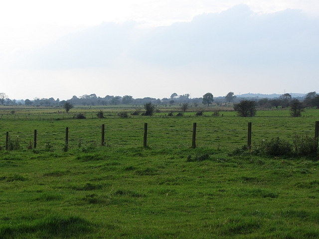
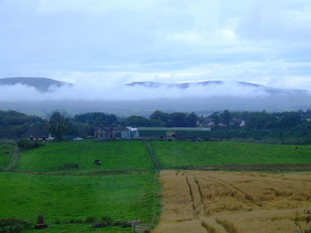
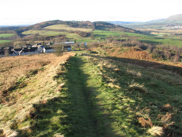
Cailhead Plantation is a picturesque woodland located in Dunbartonshire, Scotland. Situated on the eastern slope of the Kilpatrick Hills, this forested area covers a vast expanse of approximately 300 hectares. It is managed by Forestry and Land Scotland and is well-known for its diverse range of flora and fauna.

The woodland consists primarily of native species such as Scots pine, birch, and oak trees, creating a stunning and vibrant landscape throughout the year. The plantation is particularly renowned for its dense pine forest, which provides a habitat for various bird species including crossbills and wood warblers. Visitors can enjoy the melodious songs of these birds as they explore the area.

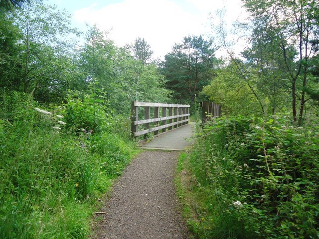
Cailhead Plantation offers numerous walking trails, providing visitors with the opportunity to immerse themselves in the natural beauty of the forest. These trails wind through the woodland, offering stunning views of the surrounding countryside. Along the way, one may encounter various wildlife species such as red squirrels, roe deer, and even the occasional glimpse of a badger or fox.

The forest is also a popular spot for outdoor recreational activities. It offers opportunities for mountain biking, horseback riding, and orienteering, attracting both locals and tourists seeking an adrenaline rush amidst the breathtaking scenery.

Overall, Cailhead Plantation is a captivating destination for nature enthusiasts and outdoor enthusiasts alike. With its stunning woodland, diverse wildlife, and recreational opportunities, it offers a memorable experience for all who visit.

If you have any feedback on the listing, please let us know in the comments section below.

Cailhead Plantation Images

Images are sourced within 2km of 55.955163/-4.0592882 or Grid Reference NS7175. Thanks to Geograph Open Source API. All images are credited.

Wetland pasture Flat and damp low lying ground along the River Kelvin.
Wetland pasture
Flat and damp low lying ground along the River Kelvin.
Twechar Bridge over the Forth and Clyde Canal Quoting from the guide to the Millennium Link "Here, a single-leaf bascule bridge has been refurbished and was recommissioned in January 2001. The work involved replacing the mechanical and electrical operating equipment, replacing the bridge structure and reinstating the control system. The control building has been rebuilt and the area around the bridge site landscaped."
Twechar Bridge over the Forth and Clyde Canal
Quoting from the guide to the Millennium Link "Here, a single-leaf bascule bridge has been refurbished and was recommissioned in January 2001. The work involved replacing the mechanical and electrical operating equipment, replacing the bridge structure and reinstating the control system. The control building has been rebuilt and the area around the bridge site landscaped."
Entrance to Heritage Path The small rectangular sign reads;
"Heritage Path
River Kelvin Walkway
The walkway follows an old mineral
railway which formed part of an extensive
system of lines that connected the
Twechar pits, Dumbreck pit, Kilsyth,
Auchinstarry quarry and several gravel pits.
Small railway engines called pugs hauled
trains of tubs containing coal, ironstone,
mine waste, quarry stone, coke and gravel.
Built in stages from the 1860's it was used
until the 1960's."
Entrance to Heritage Path
The small rectangular sign reads; "Heritage Path River Kelvin Walkway The walkway follows an old mineral railway which formed part of an extensive system of lines that connected the Twechar pits, Dumbreck pit, Kilsyth, Auchinstarry quarry and several gravel pits. Small railway engines called pugs hauled trains of tubs containing coal, ironstone, mine waste, quarry stone, coke and gravel. Built in stages from the 1860's it was used until the 1960's."
Auchinstarry Totem Pole
Broadwood Loch nature reserve Wooden bridge over drainage channel.
Broadwood Loch nature reserve
Wooden bridge over drainage channel.
Drum Mains, empty plot What looks like a natural meadow is actually a massive landscaped area of heathland awaiting a factory to be built on it. It has waited a while.
Drum Mains, empty plot
What looks like a natural meadow is actually a massive landscaped area of heathland awaiting a factory to be built on it. It has waited a while.
Drum Mains, empty plot [2] Another flattened empty space awaiting a building.
Drum Mains, empty plot [2]
Another flattened empty space awaiting a building.
Drum Mains, road to nowhere Made up road infra structure in part of this commercial/industrial estate that is so far unused.
Drum Mains, road to nowhere
Made up road infra structure in part of this commercial/industrial estate that is so far unused.
Drum Mains, radar tower base New installation. We know it's a radar tower because a notice posted by North Lanarkshire Council Planning Dept. on a nearby lamp standard tells us so.
Drum Mains, radar tower base
New installation. We know it's a radar tower because a notice posted by North Lanarkshire Council Planning Dept. on a nearby lamp standard tells us so.
West Board Farm The mist is above the River Kelvin, with the Kilsyth Hills in the distance. Viewed from an Edinburgh bound train, just west of Croy station.
West Board Farm
The mist is above the River Kelvin, with the Kilsyth Hills in the distance. Viewed from an Edinburgh bound train, just west of Croy station.
Croy railway station, looking South-West View from platform 1 at Croy railway station, looking roughly South-West towards Glasgow Queen Street.

Unusually for a station near Glasgow, platform 2 is for Glasgow-bound trains rather than platform 1.  This may have something to do with the station also serving Edinburgh, with Eastbound services leaving from platform 1.  Bishopbriggs and Lenzie stations, both on the same line, are the same in terms of platform numbering.
Croy railway station, looking South-West
View from platform 1 at Croy railway station, looking roughly South-West towards Glasgow Queen Street. Unusually for a station near Glasgow, platform 2 is for Glasgow-bound trains rather than platform 1. This may have something to do with the station also serving Edinburgh, with Eastbound services leaving from platform 1. Bishopbriggs and Lenzie stations, both on the same line, are the same in terms of platform numbering.
A landfill site Now full and overgrown, this was the entrance to a landfill site.
A landfill site
Now full and overgrown, this was the entrance to a landfill site.
Hope Park landfill site An inspection hatch and seepage of iron rich water at a closed landfill site.
Hope Park landfill site
An inspection hatch and seepage of iron rich water at a closed landfill site.
Broadwood Stadium The 8,029-capacity home of Clyde FC.
Broadwood Stadium
The 8,029-capacity home of Clyde FC.
Drumgrew Plantation On a hillside by the B8048.
Drumgrew Plantation
On a hillside by the B8048.
Mollins Road Winding road northwest of Cumbernauld, between Twechar and the industrial parks.
Mollins Road
Winding road northwest of Cumbernauld, between Twechar and the industrial parks.
Edge of woodland at Mollins Road
Show me another place!

Cailhead Plantation is located at Grid Ref: NS7175 (Lat: 55.955163, Lng: -4.0592882)

Unitary Authority: East Dunbartonshire

Police Authority: Greater Glasgow

What 3 Words

///clan.curls.corkscrew. Near Croy, North Lanarkshire

Related Wikis

Auchinstarry

Auchinstarry is a village in North Lanarkshire, Scotland, UK, near to Kilsyth. It is the site of a Roman fort. Auchinstarry Basin is on the Forth and Clyde...

Bar Hill Fort

Bar Hill Fort was a Roman fort on the Antonine Wall in Scotland. It was built around the year 142 A.D.. Older maps and documents sometimes spell the name...

Croy, North Lanarkshire

Croy is a village in North Lanarkshire, Scotland. A former mining community, Croy is situated south of Kilsyth and north of Cumbernauld, some 13 miles...

Cumbernauld, Kilsyth and Kirkintilloch East (UK Parliament constituency)

Cumbernauld, Kilsyth and Kirkintilloch East is a constituency of the House of Commons of the Parliament of the United Kingdom. It was created for the 2005...

Nearby Amenities

Located within 500m of 55.955163,-4.0592882
Gartshore Pits Nos5&6
Historic: mine
Lat/Long: 55.9539863/-4.061428
Power: pole
Lat/Long: 55.9519091/-4.0630294
Power: pole
Lat/Long: 55.9521692/-4.061492
Power: pole
Lat/Long: 55.9524095/-4.059938
Power: pole
Lat/Long: 55.9523628/-4.0588068
Power: pole
Lat/Long: 55.9519744/-4.0575986
Power: pole
Lat/Long: 55.9516362/-4.0564986
Material: wood
Power: pole
Lat/Long: 55.9513224/-4.0555112
Power: pole
Lat/Long: 55.951705/-4.0584318
Power: pole
Lat/Long: 55.9511475/-4.0580985
Power: pole
Lat/Long: 55.9517727/-4.0645293
Power: pole
Lat/Long: 55.9521494/-4.0630649
Power: pole
Lat/Long: 55.9525576/-4.0615545
Power: pole
Lat/Long: 55.952939/-4.0600671
Power: pole
Lat/Long: 55.9532912/-4.0587297
Power: pole
Lat/Long: 55.9536423/-4.0573569
Power: pole
Lat/Long: 55.9540785/-4.0557133
Power: pole
Lat/Long: 55.9543922/-4.0545446
Power: pole
Lat/Long: 55.9547234/-4.0532739
Material: wood
Power: pole
Lat/Long: 55.9513271/-4.0554091
The data included in this document is from www.openstreetmap.org. The data is made available under ODbL.

Have you been to Cailhead Plantation?

Leave your review of Cailhead Plantation below (or comments, questions and feedback).