Barhill Wood

Wood, Forest in Dunbartonshire

Scotland

Barhill Wood

House on the B8048 At the bottom of Easterton Farm Road.
House on the B8048 Credit: Stephen Sweeney

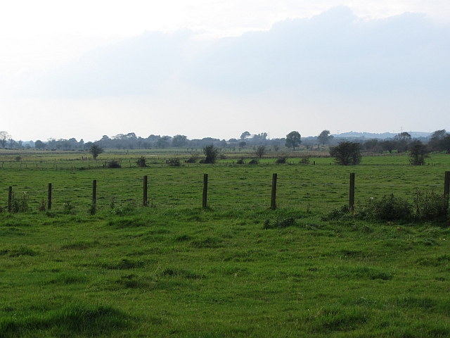
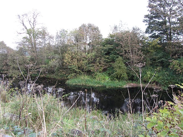
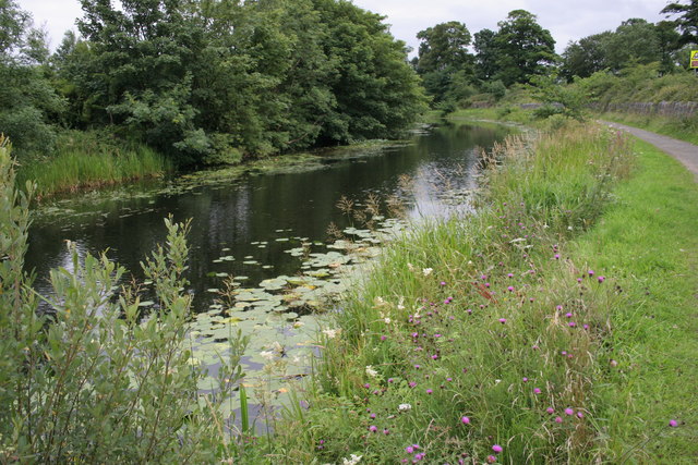
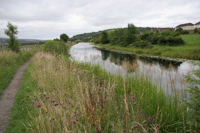
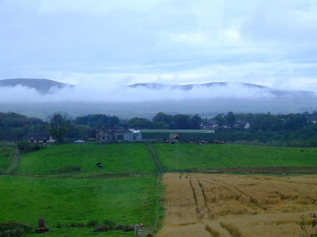
Barhill Wood, located in Dunbartonshire, Scotland, is a captivating forest that spans over a vast area. The wood is nestled in a picturesque landscape, boasting breathtaking views of rolling hills and serene meadows. With its tranquil atmosphere and rich biodiversity, Barhill Wood is a haven for nature enthusiasts and hikers alike.

The wood is primarily composed of native broadleaf trees, including oak, birch, and ash, which create a lush and verdant canopy overhead. These trees provide a habitat for numerous species of birds, such as the robin, chaffinch, and blackbird, making it a popular spot for birdwatchers throughout the year.

The forest floor is carpeted with a vibrant array of wildflowers and ferns, adding a splash of color to the surroundings. It is not uncommon to spot woodland creatures like red squirrels, badgers, and deer, as they roam freely within the wood.

Barhill Wood features several well-marked trails, allowing visitors to explore its beauty at their own pace. These paths wind through the forest, leading to hidden clearings and viewpoints, where one can marvel at the stunning panoramas of the surrounding countryside.

In addition to its natural beauty, Barhill Wood also offers educational opportunities. Local conservation organizations occasionally arrange guided walks and nature workshops, providing visitors with insights into the forest's ecological importance and the various species that call it home.

Overall, Barhill Wood is a captivating destination that offers a tranquil escape into nature. Whether you are looking for a peaceful stroll, a birdwatching adventure, or a chance to immerse yourself in the wonders of the natural world, this forest is sure to leave a lasting impression.

If you have any feedback on the listing, please let us know in the comments section below.
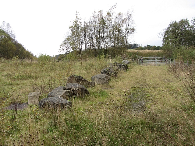
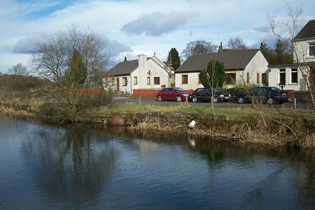
Barhill Wood Images

Images are sourced within 2km of 55.956611/-4.0656287 or Grid Reference NS7175. Thanks to Geograph Open Source API. All images are credited.

House on the B8048 At the bottom of Easterton Farm Road.
House on the B8048
At the bottom of Easterton Farm Road.
Wetland pasture Flat and damp low lying ground along the River Kelvin.
Wetland pasture
Flat and damp low lying ground along the River Kelvin.
Twechar Bridge over the Forth and Clyde Canal Quoting from the guide to the Millennium Link "Here, a single-leaf bascule bridge has been refurbished and was recommissioned in January 2001. The work involved replacing the mechanical and electrical operating equipment, replacing the bridge structure and reinstating the control system. The control building has been rebuilt and the area around the bridge site landscaped."
Twechar Bridge over the Forth and Clyde Canal
Quoting from the guide to the Millennium Link "Here, a single-leaf bascule bridge has been refurbished and was recommissioned in January 2001. The work involved replacing the mechanical and electrical operating equipment, replacing the bridge structure and reinstating the control system. The control building has been rebuilt and the area around the bridge site landscaped."
Forth and Clyde Canal, Towpath and Road (B8023) Approaching Twechar.
Forth and Clyde Canal, Towpath and Road (B8023)
Approaching Twechar.
Wester Gartshore East Lodge On the B8048 east of Kirkintilloch.
Wester Gartshore East Lodge
On the B8048 east of Kirkintilloch.
Entrance to Heritage Path The small rectangular sign reads;
"Heritage Path
River Kelvin Walkway
The walkway follows an old mineral
railway which formed part of an extensive
system of lines that connected the
Twechar pits, Dumbreck pit, Kilsyth,
Auchinstarry quarry and several gravel pits.
Small railway engines called pugs hauled
trains of tubs containing coal, ironstone,
mine waste, quarry stone, coke and gravel.
Built in stages from the 1860's it was used
until the 1960's."
Entrance to Heritage Path
The small rectangular sign reads; "Heritage Path River Kelvin Walkway The walkway follows an old mineral railway which formed part of an extensive system of lines that connected the Twechar pits, Dumbreck pit, Kilsyth, Auchinstarry quarry and several gravel pits. Small railway engines called pugs hauled trains of tubs containing coal, ironstone, mine waste, quarry stone, coke and gravel. Built in stages from the 1860's it was used until the 1960's."
Forth and Clyde Canal
Forth and Clyde Canal Water lilies and the bank-side vegetation make this part of the canal, near Twechar, very attractive at this time of year (August).
Forth and Clyde Canal
Water lilies and the bank-side vegetation make this part of the canal, near Twechar, very attractive at this time of year (August).
Forth and Clyde Canal Looking towards Twechar.
Forth and Clyde Canal
Looking towards Twechar.
Auchinstarry Totem Pole
Drum Mains, empty plot [2] Another flattened empty space awaiting a building.
Drum Mains, empty plot [2]
Another flattened empty space awaiting a building.
Drum Mains, road to nowhere Made up road infra structure in part of this commercial/industrial estate that is so far unused.
Drum Mains, road to nowhere
Made up road infra structure in part of this commercial/industrial estate that is so far unused.
Drum Mains, radar tower base New installation. We know it's a radar tower because a notice posted by North Lanarkshire Council Planning Dept. on a nearby lamp standard tells us so.
Drum Mains, radar tower base
New installation. We know it's a radar tower because a notice posted by North Lanarkshire Council Planning Dept. on a nearby lamp standard tells us so.
West Board Farm The mist is above the River Kelvin, with the Kilsyth Hills in the distance. Viewed from an Edinburgh bound train, just west of Croy station.
West Board Farm
The mist is above the River Kelvin, with the Kilsyth Hills in the distance. Viewed from an Edinburgh bound train, just west of Croy station.
Croy railway station, looking South-West View from platform 1 at Croy railway station, looking roughly South-West towards Glasgow Queen Street.

Unusually for a station near Glasgow, platform 2 is for Glasgow-bound trains rather than platform 1.  This may have something to do with the station also serving Edinburgh, with Eastbound services leaving from platform 1.  Bishopbriggs and Lenzie stations, both on the same line, are the same in terms of platform numbering.
Croy railway station, looking South-West
View from platform 1 at Croy railway station, looking roughly South-West towards Glasgow Queen Street. Unusually for a station near Glasgow, platform 2 is for Glasgow-bound trains rather than platform 1. This may have something to do with the station also serving Edinburgh, with Eastbound services leaving from platform 1. Bishopbriggs and Lenzie stations, both on the same line, are the same in terms of platform numbering.
A landfill site Now full and overgrown, this was the entrance to a landfill site.
A landfill site
Now full and overgrown, this was the entrance to a landfill site.
Hope Park landfill site An inspection hatch and seepage of iron rich water at a closed landfill site.
Hope Park landfill site
An inspection hatch and seepage of iron rich water at a closed landfill site.
Drumgrew Plantation On a hillside by the B8048.
Drumgrew Plantation
On a hillside by the B8048.
Show me another place!

Barhill Wood is located at Grid Ref: NS7175 (Lat: 55.956611, Lng: -4.0656287)

Unitary Authority: East Dunbartonshire

Police Authority: Greater Glasgow

What 3 Words

///vegans.sleepless.greed. Near Twechar, East Dunbartonshire

Related Wikis

Bar Hill Fort

Bar Hill Fort was a Roman fort on the Antonine Wall in Scotland. It was built around the year 142 A.D.. Older maps and documents sometimes spell the name...

Auchinstarry

Auchinstarry is a village in North Lanarkshire, Scotland, UK, near to Kilsyth. It is the site of a Roman fort. Auchinstarry Basin is on the Forth and Clyde...

Antonine Wall

The Antonine Wall, known to the Romans as Vallum Antonini, was a turf fortification on stone foundations, built by the Romans across what is now the Central...

Twechar

Twechar is a small former mining village historically in Dunbartonshire and administered by the council area of East Dunbartonshire, Scotland close to...

Nearby Amenities

Located within 500m of 55.956611,-4.0656287
Castle Hill
Corbett: no
Donald: no
Ele: 170
Graham: no
Munro: no
Natural: peak
Note: height confirmed by gps and alti meter
Lat/Long: 55.9605671/-4.0694475
Bar Hill
Ele: 161
Natural: peak
Note: height confirmed by gps
Wikidata: Q24656404
Lat/Long: 55.9590747/-4.0719686
Old Ironstone Mine
Historic: mine
Lat/Long: 55.9601483/-4.0633111
Old Ironstone Mine
Historic: mine
Lat/Long: 55.9606767/-4.0647702
Old Ironstone Mine
Historic: mine
Lat/Long: 55.960905/-4.0667443
Old Ironstone Mine
Historic: mine
Lat/Long: 55.9596798/-4.0645127
Gartshore Pits Nos5&6
Historic: mine
Lat/Long: 55.9539863/-4.061428
The data included in this document is from www.openstreetmap.org. The data is made available under ODbL.

Have you been to Barhill Wood?

Leave your review of Barhill Wood below (or comments, questions and feedback).