Mullach Charlabhaigh

Settlement in Ross-shire

Scotland

Mullach Charlabhaigh
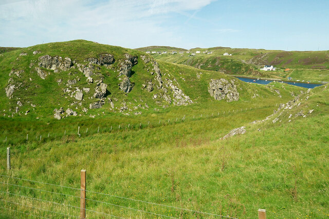
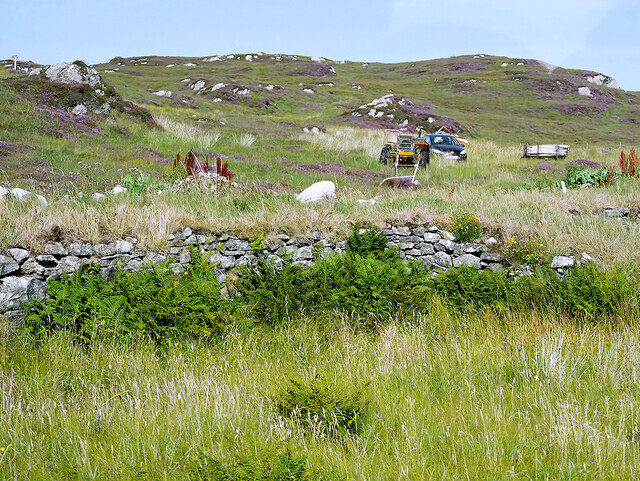
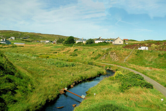
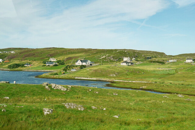
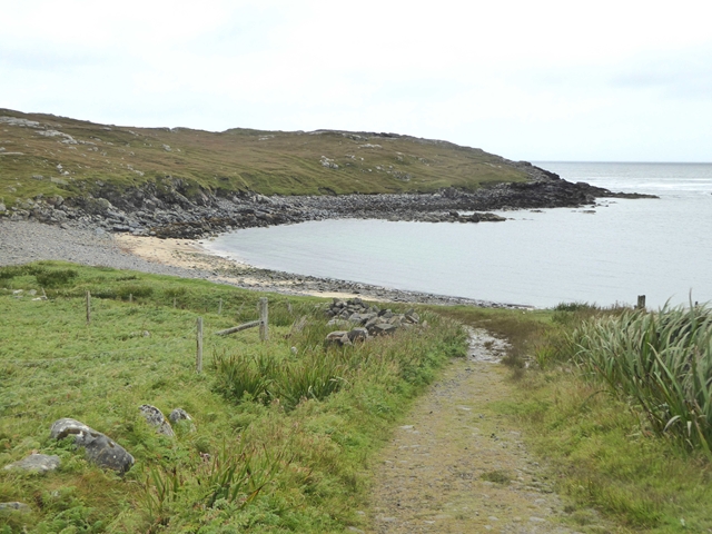
View towards Loch Chàrlabhaigh
View towards Loch Chàrlabhaigh Credit: David Dixon

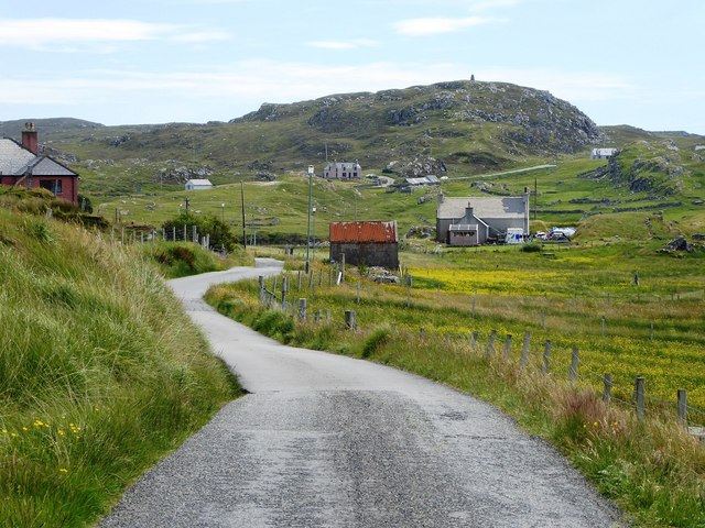
Mullach Charlabhaigh is a small village located in Ross-shire, Scotland. It is situated near the coast, offering stunning views of the surrounding landscape and the nearby sea. The village is known for its picturesque setting, with rolling hills and lush greenery that provide a peaceful and idyllic atmosphere.

Mullach Charlabhaigh is home to a tight-knit community of residents who take pride in their village and its rich history. The village has a few local amenities, including a small grocery store, a pub, and a post office, making it a convenient place to live for its residents.

The village is surrounded by beautiful countryside, making it a popular destination for outdoor enthusiasts. There are numerous walking and hiking trails in the area, as well as opportunities for fishing and birdwatching.

Overall, Mullach Charlabhaigh is a charming and tranquil village that offers a peaceful retreat from the hustle and bustle of city life. Its stunning natural surroundings and welcoming community make it a wonderful place to visit or call home.

If you have any feedback on the listing, please let us know in the comments section below.

Mullach Charlabhaigh Images

Images are sourced within 2km of 58.286101/-6.7791773 or Grid Reference NB2043. Thanks to Geograph Open Source API. All images are credited.

View towards Loch Chàrlabhaigh
Doune Carloway
Doune Carloway
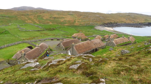
Blackhouse Village at Garenin
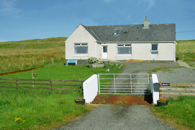
Bungalow, Upper Carloway
Abhainn Chàrlabhaigh
Carloway, Isle of Lewis
Byre, Carloway
Byre, Carloway
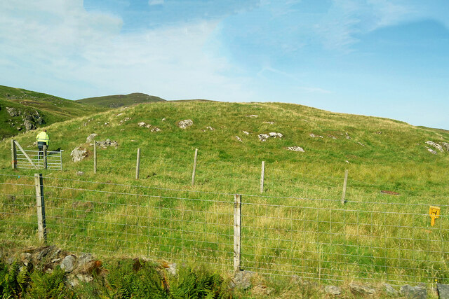
Hill near Carloway
Hill near Carloway
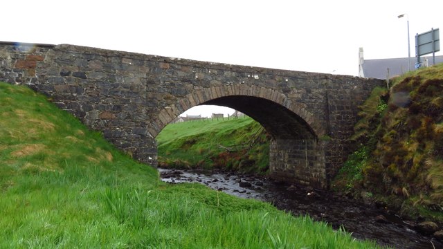
Bridge carrying A858 over Abhainn Charlabhaigh, Carloway
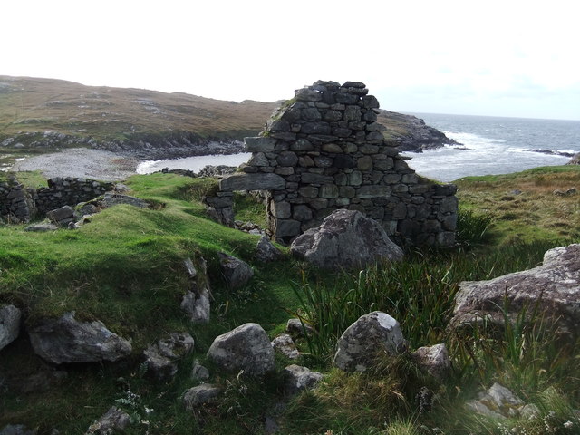
Ruin by Loch Garenin
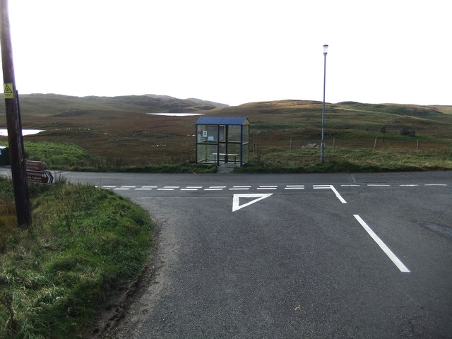
Bus shelter near the Tweed Mill
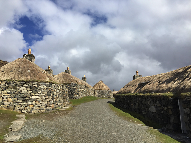
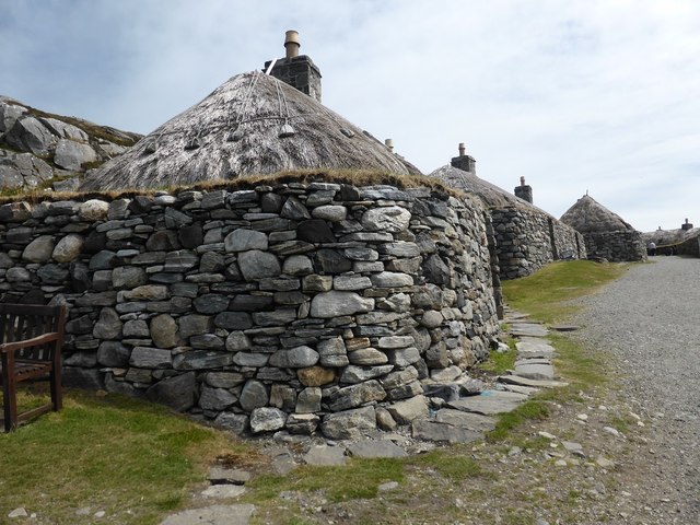
Na Gearrannan The main road through the restored part of the old village of blackhouses. People lived in some of these houses up until 1974.
Na Gearrannan
The main road through the restored part of the old village of blackhouses. People lived in some of these houses up until 1974.
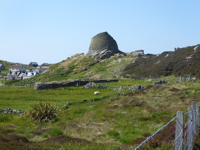
Carloway Broch, from the access path
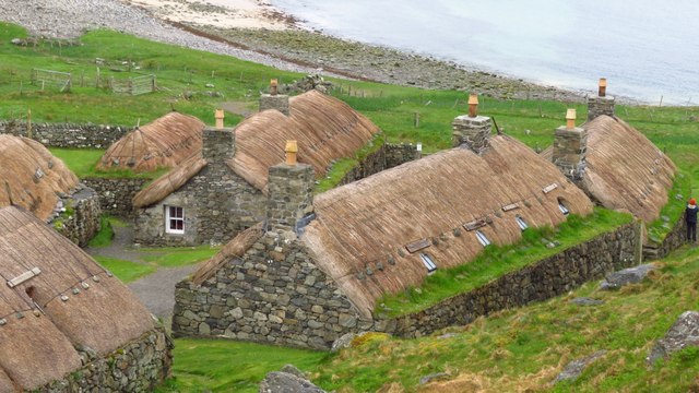
Buildings in Gearrannan Blackhouse Village
The road to Gearrannan Blackhouse Village
Loch Garenin Sea loch below the Black House Village.
Loch Garenin
Sea loch below the Black House Village.
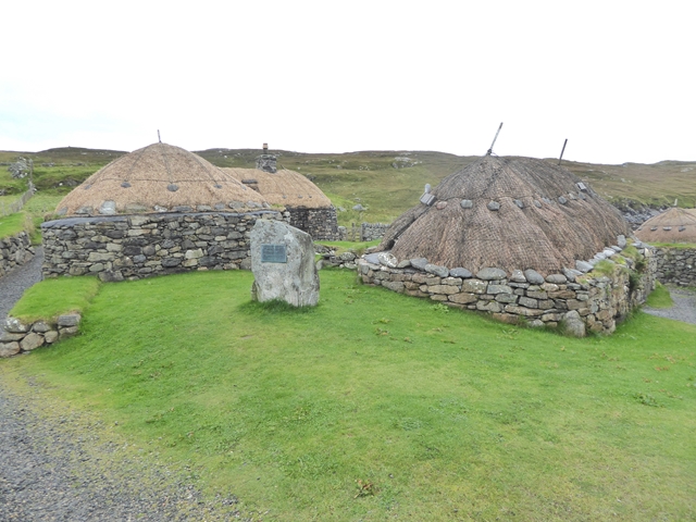
Blackhouse Village at Garenin The village was occupied until 1974. Restored in the later years of the Century. The plaque commemorates the opening of the village as a visitor attraction by Princess Anne. Most of the black houses are let as self-catering holiday accommodation.
Blackhouse Village at Garenin
The village was occupied until 1974. Restored in the later years of the Century. The plaque commemorates the opening of the village as a visitor attraction by Princess Anne. Most of the black houses are let as self-catering holiday accommodation.
Show me another place!

Mullach Charlabhaigh is located at Grid Ref: NB2043 (Lat: 58.286101, Lng: -6.7791773)

Unitary Authority: Na h-Eileanan an Iar

Police Authority: Highlands and Islands

Also known as: Upper Carloway

What 3 Words

///duty.habits.somebody. Near Carloway, Na h-Eileanan Siar

Related Wikis

Carloway

Carloway (Scottish Gaelic: Càrlabhagh [ˈkʰaːɾɫ̪ə.ɤː]) is a crofting township and a district on the west coast of the Isle of Lewis, in the Outer Hebrides...

Borrowston, Lewis

Borrowston (Scottish Gaelic: Borghastan), with a population of about 50, is a crofting township situated on the Isle of Lewis, on the Outer Hebrides of...

Garenin

Garenin (Scottish Gaelic: Na Gearrannan) is a crofting township on the west coast of the Isle of Lewis in the Outer Hebrides of Scotland. Garenin is in...

Dun Carloway

Dun Carloway (Scottish Gaelic: Dùn Chàrlabhaigh) is a broch situated in the district of Carloway, on the west coast of the Isle of Lewis, Scotland (grid...

Nearby Amenities

Located within 500m of 58.286101,-6.7791773
Passing Place
Lat/Long: 58.289428/-6.780239
Passing Place
Lat/Long: 58.2845001/-6.7757309
Passing Place
Lat/Long: 58.2862541/-6.7778764
Passing Place
Lat/Long: 58.2889864/-6.7735287
Passing Place
Lat/Long: 58.2878281/-6.7720465
Carloway
Naptan AtcoCode: 6010731593
Naptan Bearing: SE
Naptan BusStopType: CUS
Naptan CommonName: Carloway
Naptan Indicator: Upper Carloway
Naptan Landmark: Near house No 4
Naptan NaptanCode: 94723965
Naptan Street: Upper Carloway
Naptan Verified: no
Source: naptan_import
Lat/Long: 58.2890012/-6.7735474
Post Box
Collection Times: Mo-Fr 10:45; Sa 10:45
Operator: Royal Mail
Post Box Type: lamp
Ref: HS2 53
Royal Cypher: scottish_crown
Source: survey
Lat/Long: 58.2851607/-6.7768981
Barrier: cattle_grid
Lat/Long: 58.2847818/-6.7758809
Barrier: cattle_grid
Lat/Long: 58.2833316/-6.7730973
Barrier: cattle_grid
Lat/Long: 58.2830342/-6.77979
Barrier: cattle_grid
Lat/Long: 58.2902123/-6.7807427
Barrier: cattle_grid
Lat/Long: 58.2821173/-6.7780458
Power: pole
Lat/Long: 58.2903217/-6.7799964
Power: pole
Lat/Long: 58.2901312/-6.7790999
Power: pole
Lat/Long: 58.2899657/-6.7781732
Power: pole
Lat/Long: 58.2897891/-6.7772504
Power: pole
Lat/Long: 58.2893033/-6.7781696
Power: pole
Lat/Long: 58.2874801/-6.7711257
Power: pole
Lat/Long: 58.287759/-6.7720606
Power: pole
Lat/Long: 58.288094/-6.7724998
Power: pole
Lat/Long: 58.2884859/-6.7729182
Power: pole
Lat/Long: 58.2888511/-6.7733191
Power: pole
Lat/Long: 58.2892344/-6.7737458
Power: pole
Lat/Long: 58.2896471/-6.7741906
Power: pole
Lat/Long: 58.2842987/-6.7765168
Power: pole
Lat/Long: 58.2841503/-6.7778369
Power: pole
Lat/Long: 58.2837042/-6.778918
Power: pole
Lat/Long: 58.2832865/-6.7799488
Power: pole
Lat/Long: 58.2827788/-6.7810995
Power: pole
Lat/Long: 58.2825941/-6.7819176
Power: pole
Lat/Long: 58.2823313/-6.7831185
Power: pole
Lat/Long: 58.2831943/-6.7787251
Power: pole
Lat/Long: 58.2827694/-6.7781842
Power: pole
Lat/Long: 58.2823742/-6.7776937
Power: pole
Lat/Long: 58.2819421/-6.7775779
Power: pole
Lat/Long: 58.2858422/-6.7775826
Power: pole
Lat/Long: 58.2854303/-6.77754
Power: pole
Lat/Long: 58.2847692/-6.7766481
Power: pole
Lat/Long: 58.283794/-6.7758736
Power: pole
Lat/Long: 58.2839863/-6.7742443
Power: pole
Lat/Long: 58.2836441/-6.7735235
Power: pole
Lat/Long: 58.2841327/-6.7745141
Power: pole
Lat/Long: 58.289206/-6.7801781
Power: pole
Lat/Long: 58.2883616/-6.7757137
Power: pole
Lat/Long: 58.2879877/-6.7753033
Power: pole
Lat/Long: 58.2875738/-6.7748289
Power: pole
Lat/Long: 58.2848598/-6.7761902
Power: pole
Lat/Long: 58.2853853/-6.775473
Power: pole
Lat/Long: 58.2858448/-6.774639
Power: pole
Lat/Long: 58.2861297/-6.7741272
Power: pole
Lat/Long: 58.2865718/-6.7733397
Power: pole
Lat/Long: 58.2868048/-6.7729125
Power: pole
Lat/Long: 58.2871768/-6.7738838
Clach An Tursa
Alt Name: Stone of Sadness;Carloway Row;Clach an Trushal
Archaeological Site: megalith
Historic: archaeological_site
Historic Civilization: prehistoric
Historic Era: neolithic
Historic Period: stone-age;bronze-age
Megalith Type: alignment
Lat/Long: 58.285938/-6.771948
Passing Place
Lat/Long: 58.2841395/-6.7753604
Passing Place
Lat/Long: 58.2835574/-6.7746943
Barrier: cattle_grid
Lat/Long: 58.2891591/-6.7739581
Passing Place
Lat/Long: 58.2883914/-6.7794401
Power: pole
Lat/Long: 58.2893208/-6.7795067
Power: pole
Lat/Long: 58.2891111/-6.7771298
Power: pole
Lat/Long: 58.2889673/-6.7763606
Passing Place
Lat/Long: 58.2899425/-6.7806943
Passing Place
Lat/Long: 58.2873025/-6.7786452
Passing Place
Lat/Long: 58.2854272/-6.7770586
Barrier: cattle_grid
Lat/Long: 58.2853187/-6.776661
Passing Place
Lat/Long: 58.2896771/-6.7742788
Passing Place
Lat/Long: 58.2832474/-6.7736071
Passing Place
Lat/Long: 58.286483/-6.7780938
Passing Place
Lat/Long: 58.2838699/-6.7792556
The data included in this document is from www.openstreetmap.org. The data is made available under ODbL.

Have you been to Mullach Charlabhaigh?

Leave your review of Mullach Charlabhaigh below (or comments, questions and feedback).