Cnoc Beag Gille nan Naomh

Hill, Mountain in Ross-shire

Scotland

Cnoc Beag Gille nan Naomh

View towards Loch Chàrlabhaigh
View towards Loch Chàrlabhaigh Credit: David Dixon

Cnoc Beag Gille nan Naomh is a prominent hill located in Ross-shire, Scotland. It is situated in the northwest part of the country, near the village of Lochcarron. The hill stands at an elevation of approximately 568 meters (1,864 feet) and is part of the wider mountain range known as the Torridon Hills.

Cnoc Beag Gille nan Naomh is characterized by its rugged and steep slopes, which offer a challenging climb for hikers and mountaineers. The hill is predominantly composed of Torridonian sandstone, which gives it a distinctive red color. This geology, combined with the hill's position overlooking Loch Carron and the surrounding landscape, provides breathtaking panoramic views from its summit.

The ascent of Cnoc Beag Gille nan Naomh typically starts from the village of Lochcarron, where a well-marked trail leads towards the hill. The route takes hikers through diverse terrain, including heather-covered moorland, rocky outcrops, and grassy slopes. The final section of the climb involves negotiating steep and rocky terrain, requiring some scrambling skills.

Reaching the summit of Cnoc Beag Gille nan Naomh rewards climbers with stunning vistas of the surrounding Torridon Hills, Loch Carron, and the nearby Isle of Skye. On clear days, it is even possible to spot the distant peaks of the Cuillin Mountains.

Due to its accessibility and the challenge it presents, Cnoc Beag Gille nan Naomh is a popular destination for outdoor enthusiasts looking to explore the natural beauty of the Scottish Highlands.

If you have any feedback on the listing, please let us know in the comments section below.

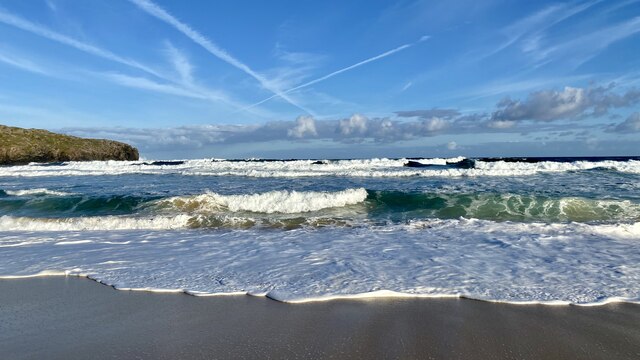
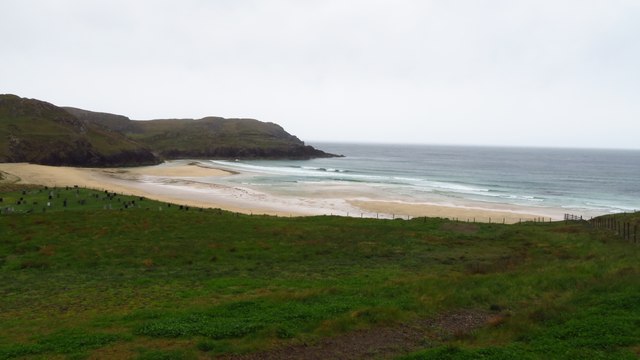
Cnoc Beag Gille nan Naomh Images

Images are sourced within 2km of 58.293066/-6.7714226 or Grid Reference NB2043. Thanks to Geograph Open Source API. All images are credited.

View towards Loch Chàrlabhaigh
Blackhouse Village at Garenin
Waves breaking at Dalmore View from the beach at Dalmore showing the headland at Rubha an Trilleachain.
Waves breaking at Dalmore
View from the beach at Dalmore showing the headland at Rubha an Trilleachain.
Bungalow, Upper Carloway
Abhainn Chàrlabhaigh
Carloway, Isle of Lewis
Byre, Carloway
Byre, Carloway
Hill near Carloway
Hill near Carloway
Bridge carrying A858 over Abhainn Charlabhaigh, Carloway
Bagh Dhail Mor, Dalmore
Ruin by Loch Garenin
Bus shelter near the Tweed Mill
Na Gearrannan The main road through the restored part of the old village of blackhouses. People lived in some of these houses up until 1974.
Na Gearrannan
The main road through the restored part of the old village of blackhouses. People lived in some of these houses up until 1974.
Buildings in Gearrannan Blackhouse Village
The road to Gearrannan Blackhouse Village
Loch Garenin Sea loch below the Black House Village.
Loch Garenin
Sea loch below the Black House Village.
Blackhouse Village at Garenin The village was occupied until 1974. Restored in the later years of the Century. The plaque commemorates the opening of the village as a visitor attraction by Princess Anne. Most of the black houses are let as self-catering holiday accommodation.
Blackhouse Village at Garenin
The village was occupied until 1974. Restored in the later years of the Century. The plaque commemorates the opening of the village as a visitor attraction by Princess Anne. Most of the black houses are let as self-catering holiday accommodation.
Show me another place!

Cnoc Beag Gille nan Naomh is located at Grid Ref: NB2043 (Lat: 58.293066, Lng: -6.7714226)

Unitary Authority: Na h-Eileanan an Iar

Police Authority: Highlands and Islands

What 3 Words

///milkman.testy.gambles. Near Carloway, Na h-Eileanan Siar

Related Wikis

Carloway

Carloway (Scottish Gaelic: Càrlabhagh [ˈkʰaːɾɫ̪ə.ɤː]) is a crofting township and a district on the west coast of the Isle of Lewis, in the Outer Hebrides...

Garenin

Garenin (Scottish Gaelic: Na Gearrannan) is a crofting township on the west coast of the Isle of Lewis in the Outer Hebrides of Scotland. Garenin is in...

Borrowston, Lewis

Borrowston (Scottish Gaelic: Borghastan), with a population of about 50, is a crofting township situated on the Isle of Lewis, on the Outer Hebrides of...

Dun Carloway

Dun Carloway (Scottish Gaelic: Dùn Chàrlabhaigh) is a broch situated in the district of Carloway, on the west coast of the Isle of Lewis, Scotland (grid...

Nearby Amenities

Located within 500m of 58.293066,-6.7714226
Passing Place
Lat/Long: 58.2924521/-6.7769916
Passing Place
Lat/Long: 58.2889864/-6.7735287
Carloway
Naptan AtcoCode: 6010731593
Naptan Bearing: SE
Naptan BusStopType: CUS
Naptan CommonName: Carloway
Naptan Indicator: Upper Carloway
Naptan Landmark: Near house No 4
Naptan NaptanCode: 94723965
Naptan Street: Upper Carloway
Naptan Verified: no
Source: naptan_import
Lat/Long: 58.2890012/-6.7735474
Power: pole
Lat/Long: 58.2897891/-6.7772504
Power: pole
Lat/Long: 58.2888511/-6.7733191
Power: pole
Lat/Long: 58.2892344/-6.7737458
Power: pole
Lat/Long: 58.2896471/-6.7741906
Power: pole
Lat/Long: 58.2900091/-6.7746141
Power: pole
Lat/Long: 58.2904647/-6.774898
Power: pole
Lat/Long: 58.2909387/-6.775198
Power: pole
Lat/Long: 58.2915489/-6.7751567
Passing Place
Lat/Long: 58.2920455/-6.775744
Barrier: cattle_grid
Lat/Long: 58.2891591/-6.7739581
Passing Place
Lat/Long: 58.2896771/-6.7742788
Barrier: cattle_grid
Lat/Long: 58.2927324/-6.7781469
Addr Housenumber: 2
Addr Street: Gead Gorm
Lat/Long: 58.2925218/-6.7794405
Addr Housenumber: 3
Addr Street: Gead Gorm
Lat/Long: 58.2924983/-6.7795771
Addr Housenumber: 4
Addr Street: Gead Gorm
Lat/Long: 58.2924769/-6.7797008
Addr Housenumber: 1
Addr Street: Gead Gorm
Lat/Long: 58.292543/-6.7793176
Addr Housenumber: 9
Addr Street: Gead Gorm
Lat/Long: 58.2927852/-6.7794193
Addr Housenumber: 10
Addr Street: Gead Gorm
Lat/Long: 58.2927622/-6.7795491
Addr Housenumber: 11
Addr Street: Gead Gorm
Lat/Long: 58.292734/-6.7797083
Addr Housenumber: 12
Addr Street: Gead Gorm
Lat/Long: 58.292705/-6.7798727
Addr Housenumber: 8
Addr Street: Gead Gorm
Lat/Long: 58.2928119/-6.7791417
Addr Housenumber: 7
Addr Street: Gead Gorm
Lat/Long: 58.2928682/-6.7790086
Addr Housenumber: 6
Addr Street: Gead Gorm
Lat/Long: 58.2929218/-6.7788801
Addr Housenumber: 5
Addr Street: Gead Gorm
Lat/Long: 58.2929738/-6.7787552
The data included in this document is from www.openstreetmap.org. The data is made available under ODbL.

Have you been to Cnoc Beag Gille nan Naomh?

Leave your review of Cnoc Beag Gille nan Naomh below (or comments, questions and feedback).