Garenin

Settlement in Ross-shire

Scotland

Garenin
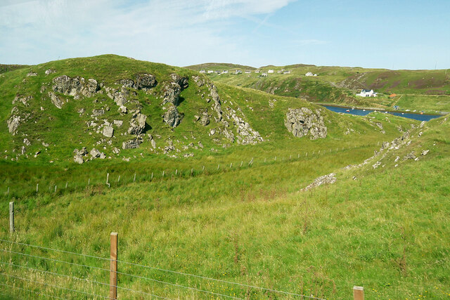
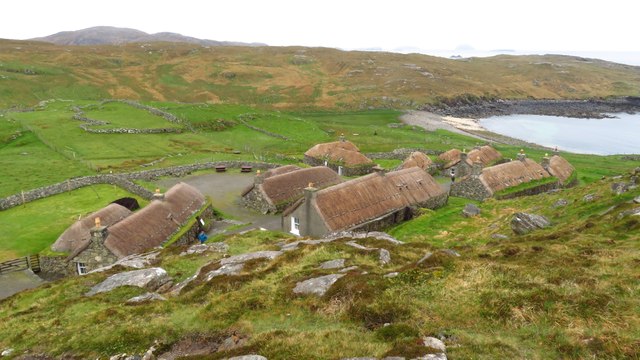
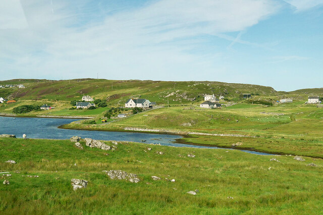
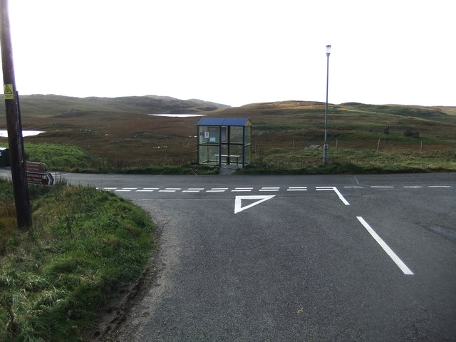
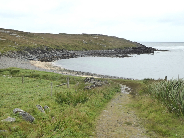
View towards Loch Chàrlabhaigh
View towards Loch Chàrlabhaigh Credit: David Dixon

Garenin is a small village located in the county of Ross-shire, in the Highland region of Scotland. Situated on the west coast of the country, Garenin offers breathtaking views of the Atlantic Ocean and the surrounding rugged landscapes.

The village is known for its picturesque setting, with traditional stone cottages and a close-knit community. Many of these cottages have been restored and maintained to preserve their original charm and character. Garenin is often referred to as a living museum, providing visitors with a glimpse into the past and the traditional way of life in the Highlands.

The main industry in Garenin was once crofting, a small-scale agricultural practice that involved farming and raising livestock on small plots of land. Today, tourism has become an important part of the local economy, with visitors attracted to the village's historic appeal and natural beauty.

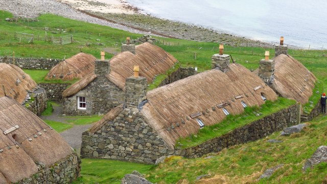
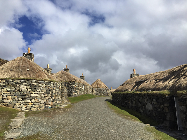
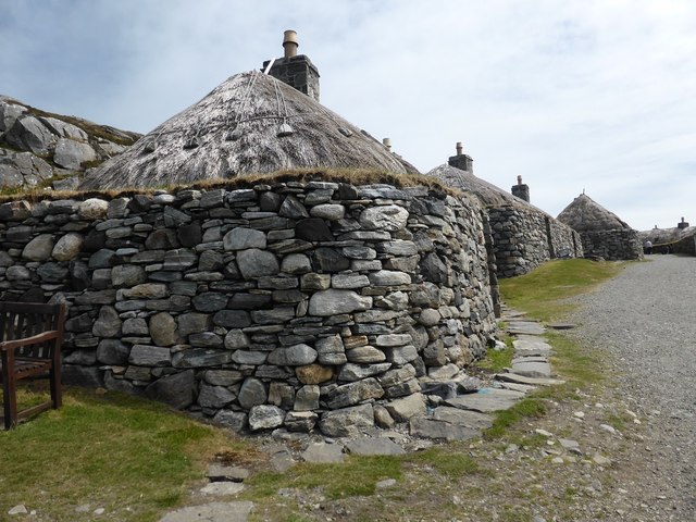
One of the highlights of Garenin is the Gearrannan Blackhouse Village, a preserved crofting township that showcases the traditional architecture and way of life of the region. Visitors can explore the thatched-roof blackhouses, which were once the typical dwellings of the local crofting community. The village also offers insights into traditional crafts, such as weaving and peat cutting.

Garenin is a popular destination for outdoor enthusiasts, with opportunities for hiking, fishing, and wildlife spotting in the surrounding area. The nearby beaches and coastline provide a scenic backdrop for leisurely walks and picnics.

Overall, Garenin is a captivating village that offers a glimpse into the rich cultural heritage and natural beauty of the Scottish Highlands.

If you have any feedback on the listing, please let us know in the comments section below.

Garenin Images

Images are sourced within 2km of 58.292256/-6.7798379 or Grid Reference NB2043. Thanks to Geograph Open Source API. All images are credited.

View towards Loch Chàrlabhaigh
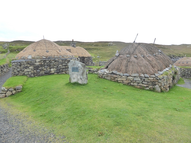
Blackhouse Village at Garenin
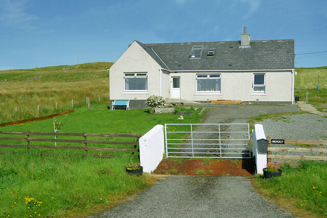
Bungalow, Upper Carloway
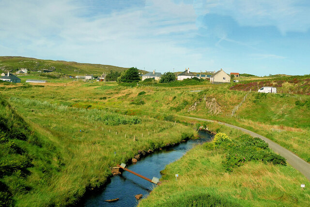
Abhainn Chàrlabhaigh
Carloway, Isle of Lewis
Byre, Carloway
Byre, Carloway
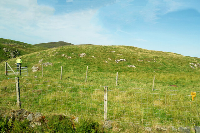
Hill near Carloway
Hill near Carloway
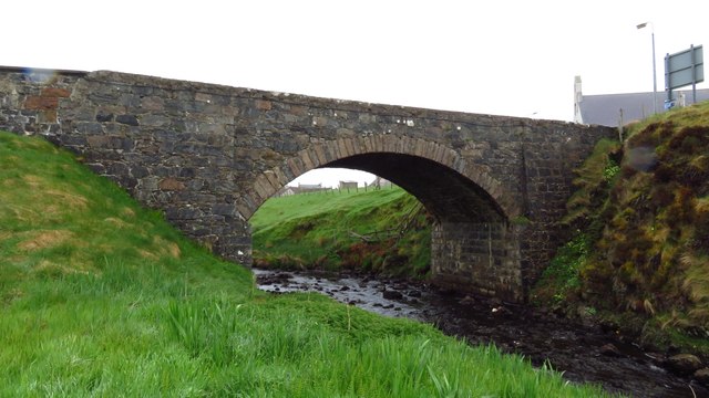
Bridge carrying A858 over Abhainn Charlabhaigh, Carloway
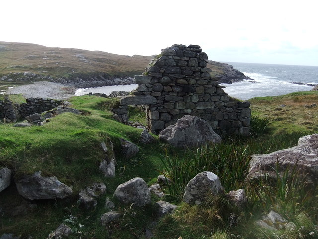
Ruin by Loch Garenin
Bus shelter near the Tweed Mill
Na Gearrannan The main road through the restored part of the old village of blackhouses. People lived in some of these houses up until 1974.
Na Gearrannan
The main road through the restored part of the old village of blackhouses. People lived in some of these houses up until 1974.
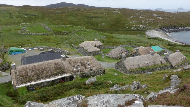
Buildings in Gearrannan Blackhouse Village
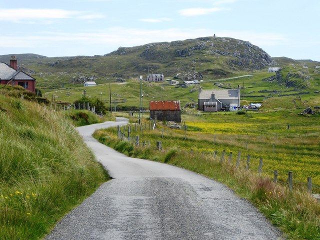
The road to Gearrannan Blackhouse Village
Loch Garenin Sea loch below the Black House Village.
Loch Garenin
Sea loch below the Black House Village.
Blackhouse Village at Garenin The village was occupied until 1974. Restored in the later years of the Century. The plaque commemorates the opening of the village as a visitor attraction by Princess Anne. Most of the black houses are let as self-catering holiday accommodation.
Blackhouse Village at Garenin
The village was occupied until 1974. Restored in the later years of the Century. The plaque commemorates the opening of the village as a visitor attraction by Princess Anne. Most of the black houses are let as self-catering holiday accommodation.
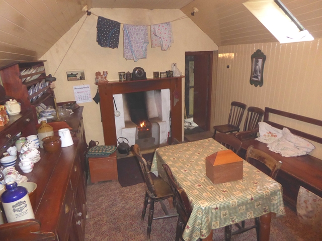
Cottage interior, Garenin Blackhouse Village
Garenin Blackhouses Museum Group of reconstructed blackhouses which give an excellent impression of what Hebridean hamlets would have looked like 200 years ago.
Garenin Blackhouses Museum
Group of reconstructed blackhouses which give an excellent impression of what Hebridean hamlets would have looked like 200 years ago.
Show me another place!

Garenin is located at Grid Ref: NB2043 (Lat: 58.292256, Lng: -6.7798379)

Unitary Authority: Na h-Eileanan an Iar

Police Authority: Highlands and Islands

Also known as: Na Gearrannan

What 3 Words

///nightlife.helps.diverged. Near Carloway, Na h-Eileanan Siar

Related Wikis

Garenin

Garenin (Scottish Gaelic: Na Gearrannan) is a crofting township on the west coast of the Isle of Lewis in the Outer Hebrides of Scotland. Garenin is in...

Carloway

Carloway (Scottish Gaelic: Càrlabhagh [ˈkʰaːɾɫ̪ə.ɤː]) is a crofting township and a district on the west coast of the Isle of Lewis, in the Outer Hebrides...

Borrowston, Lewis

Borrowston (Scottish Gaelic: Borghastan), with a population of about 50, is a crofting township situated on the Isle of Lewis, on the Outer Hebrides of...

Dun Carloway

Dun Carloway (Scottish Gaelic: Dùn Chàrlabhaigh) is a broch situated in the district of Carloway, on the west coast of the Isle of Lewis, Scotland (grid...

Nearby Amenities

Located within 500m of 58.292256,-6.7798379
Passing Place
Lat/Long: 58.2953925/-6.7846659
Passing Place
Lat/Long: 58.289428/-6.780239
Passing Place
Lat/Long: 58.2912359/-6.7814064
Passing Place
Lat/Long: 58.2939191/-6.7826288
Passing Place
Lat/Long: 58.2924521/-6.7769916
Carloway
Naptan AtcoCode: 6010731594
Naptan Bearing: N
Naptan BusStopType: CUS
Naptan CommonName: Carloway
Naptan Indicator: Uraghag
Naptan Landmark: Road at council houses
Naptan NaptanCode: 94723967
Naptan Street: Uraghag
Naptan Verified: no
Source: naptan_import
Lat/Long: 58.2922436/-6.7799299
Passing Place
Lat/Long: 58.2922166/-6.7798578
Barrier: cattle_grid
Lat/Long: 58.2902123/-6.7807427
Material: wood
Power: pole
Lat/Long: 58.2949638/-6.7862358
Material: wood
Power: pole
Lat/Long: 58.2935543/-6.7847592
Power: pole
Lat/Long: 58.2926867/-6.7831268
Power: pole
Lat/Long: 58.2955551/-6.7851351
Power: pole
Lat/Long: 58.2952242/-6.7844432
Power: pole
Lat/Long: 58.2947826/-6.783811
Power: pole
Lat/Long: 58.2943614/-6.7832157
Power: pole
Lat/Long: 58.2940233/-6.7826622
Power: pole
Lat/Long: 58.2936253/-6.7823459
Power: pole
Lat/Long: 58.2932585/-6.7821201
Power: pole
Lat/Long: 58.2928297/-6.7818332
Power: pole
Lat/Long: 58.2923459/-6.7815258
Power: pole
Lat/Long: 58.2916512/-6.7811657
Power: pole
Lat/Long: 58.2910785/-6.7808943
Power: pole
Lat/Long: 58.2905256/-6.7809946
Power: pole
Lat/Long: 58.2945658/-6.7849662
Power: pole
Lat/Long: 58.2940299/-6.784848
Power: pole
Lat/Long: 58.2930854/-6.7844388
Power: pole
Lat/Long: 58.2927725/-6.7823529
Power: pole
Lat/Long: 58.2925945/-6.7840762
Power: pole
Lat/Long: 58.2921433/-6.7837545
Power: pole
Lat/Long: 58.2916874/-6.783444
Power: pole
Lat/Long: 58.2912922/-6.783153
Power: pole
Lat/Long: 58.2908817/-6.782845
Power: pole
Lat/Long: 58.2906887/-6.7818917
Power: pole
Lat/Long: 58.2903217/-6.7799964
Power: pole
Lat/Long: 58.2901312/-6.7790999
Power: pole
Lat/Long: 58.2899657/-6.7781732
Power: pole
Lat/Long: 58.2897891/-6.7772504
Power: pole
Lat/Long: 58.2893033/-6.7781696
Power: pole
Lat/Long: 58.2892344/-6.7737458
Power: pole
Lat/Long: 58.2896471/-6.7741906
Power: pole
Lat/Long: 58.2900091/-6.7746141
Power: pole
Lat/Long: 58.2904647/-6.774898
Power: pole
Lat/Long: 58.2909387/-6.775198
Power: pole
Lat/Long: 58.2915489/-6.7751567
Power: pole
Lat/Long: 58.289206/-6.7801781
Power: pole
Lat/Long: 58.2883616/-6.7757137
Passing Place
Lat/Long: 58.2920455/-6.775744
Barrier: cattle_grid
Lat/Long: 58.2891591/-6.7739581
Passing Place
Lat/Long: 58.2883914/-6.7794401
Power: pole
Lat/Long: 58.2893208/-6.7795067
Power: pole
Lat/Long: 58.2891111/-6.7771298
Power: pole
Lat/Long: 58.2889673/-6.7763606
Passing Place
Lat/Long: 58.290484/-6.7811168
Passing Place
Lat/Long: 58.2899425/-6.7806943
Barrier: cattle_grid
Lat/Long: 58.2931525/-6.7820879
Passing Place
Lat/Long: 58.2935742/-6.7823887
Passing Place
Lat/Long: 58.2896771/-6.7742788
Man Made: mast
Tower Construction: lattice
Tower Type: communication
Lat/Long: 58.2923323/-6.7810172
Barrier: cattle_grid
Lat/Long: 58.2927324/-6.7781469
Passing Place
Lat/Long: 58.2927459/-6.7820797
Power: pole
Lat/Long: 58.2955996/-6.7847132
Addr Housenumber: 2
Addr Street: Gead Gorm
Lat/Long: 58.2925218/-6.7794405
Addr Housenumber: 3
Addr Street: Gead Gorm
Lat/Long: 58.2924983/-6.7795771
Addr Housenumber: 4
Addr Street: Gead Gorm
Lat/Long: 58.2924769/-6.7797008
Addr Housenumber: 1
Addr Street: Gead Gorm
Lat/Long: 58.292543/-6.7793176
Addr Housenumber: 1
Addr Street: Uraghag
Lat/Long: 58.29226/-6.7802937
Addr Housenumber: 2
Addr Street: Uraghag
Lat/Long: 58.2922867/-6.7803849
Addr Housenumber: 3
Addr Street: Uraghag
Lat/Long: 58.2923326/-6.7806155
Addr Housenumber: 4
Addr Street: Uraghag
Lat/Long: 58.2923643/-6.7807255
Addr Housenumber: 5
Addr Street: Uraghag
Lat/Long: 58.2925158/-6.7809119
Addr Housenumber: 6
Addr Street: Uraghag
Lat/Long: 58.2925701/-6.7808315
Addr Housenumber: 7
Addr Street: Uraghag
Lat/Long: 58.2926645/-6.7805525
Addr Housenumber: 8
Addr Street: Uraghag
Lat/Long: 58.2926385/-6.7804694
Addr Housenumber: 9
Addr Street: Uraghag
Lat/Long: 58.2925102/-6.7803473
Addr Housenumber: 10
Addr Street: Uraghag
Lat/Long: 58.2924827/-6.7802548
Addr Housenumber: 9
Addr Street: Gead Gorm
Lat/Long: 58.2927852/-6.7794193
Addr Housenumber: 10
Addr Street: Gead Gorm
Lat/Long: 58.2927622/-6.7795491
Addr Housenumber: 11
Addr Street: Gead Gorm
Lat/Long: 58.292734/-6.7797083
Addr Housenumber: 12
Addr Street: Gead Gorm
Lat/Long: 58.292705/-6.7798727
Addr Housenumber: 8
Addr Street: Gead Gorm
Lat/Long: 58.2928119/-6.7791417
Addr Housenumber: 7
Addr Street: Gead Gorm
Lat/Long: 58.2928682/-6.7790086
Addr Housenumber: 6
Addr Street: Gead Gorm
Lat/Long: 58.2929218/-6.7788801
Addr Housenumber: 5
Addr Street: Gead Gorm
Lat/Long: 58.2929738/-6.7787552
The data included in this document is from www.openstreetmap.org. The data is made available under ODbL.

Have you been to Garenin?

Leave your review of Garenin below (or comments, questions and feedback).