Round Plantation

Wood, Forest in Kirkcudbrightshire

Scotland

Round Plantation

Old railway Some of this building at Mossdale by the disused railway line was New Galloway Station.  New Galloway is 5 miles to the north but because of the terrain the railway line could not always go through larger settlements.   There are 4 milestones along the road from New Galloway giving the distance to the station.
Old railway Credit: Chris Minto

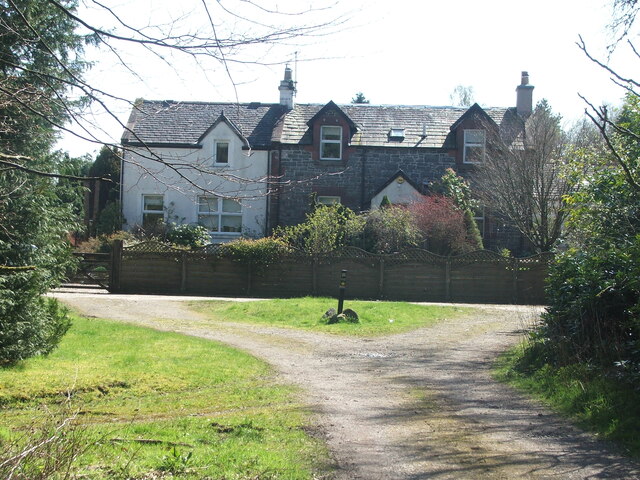
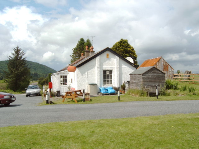
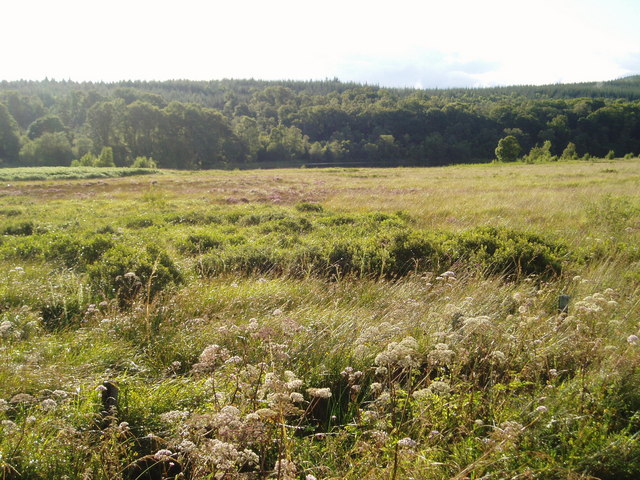
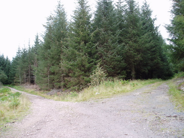
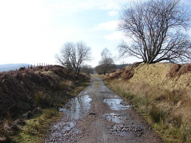
Round Plantation is a wood located in the historic county of Kirkcudbrightshire, Scotland. Situated in the rural countryside, it covers an area of approximately 50 hectares. The plantation is a mix of broadleaf and coniferous trees, providing a diverse and picturesque landscape.

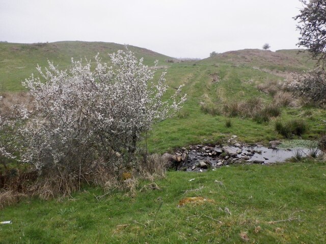
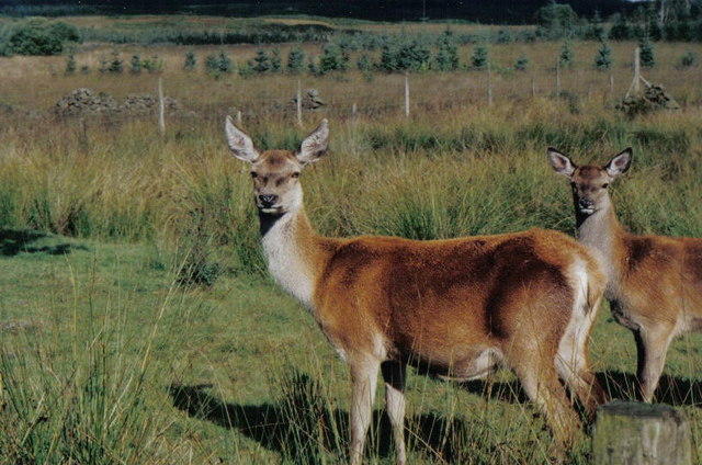
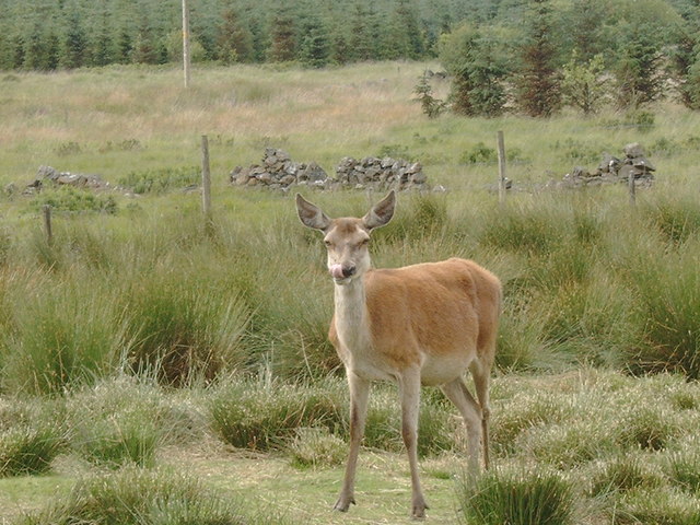
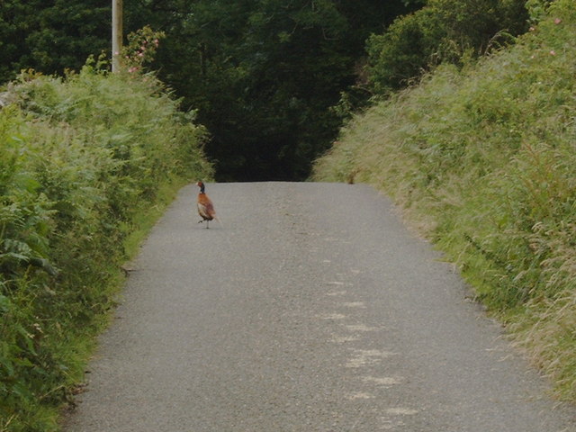
The wood is well-known for its circular shape, which gives it its name, and is a popular destination for nature lovers, hikers, and birdwatchers. The dense canopy provides a sheltered habitat for a variety of wildlife, including deer, squirrels, and a wide range of bird species.

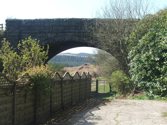
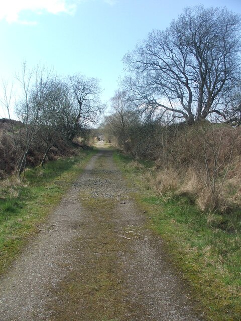
Visitors to Round Plantation can enjoy several well-maintained trails that wind through the wood, offering scenic views and opportunities for peaceful walks. The paths are suitable for all levels of fitness and are often used by locals for recreational activities such as jogging and cycling.

The wood is managed by local authorities, who ensure the preservation of the natural environment and the protection of its inhabitants. Conservation efforts are made to maintain the delicate ecosystem within the wood, including regular thinning and replanting of trees.

Round Plantation is not only a haven for wildlife but also a place of tranquility and relaxation for those seeking a break from the hustle and bustle of everyday life. Whether it's a leisurely stroll, a picnic among nature, or simply enjoying the sights and sounds of the forest, Round Plantation offers a serene escape into the heart of Kirkcudbrightshire's natural beauty.

If you have any feedback on the listing, please let us know in the comments section below.

Round Plantation Images

Images are sourced within 2km of 55.003323/-4.0829483 or Grid Reference NX6669. Thanks to Geograph Open Source API. All images are credited.

Old railway Some of this building at Mossdale by the disused railway line was New Galloway Station.  New Galloway is 5 miles to the north but because of the terrain the railway line could not always go through larger settlements.   There are 4 milestones along the road from New Galloway giving the distance to the station.
Old railway
Some of this building at Mossdale by the disused railway line was New Galloway Station. New Galloway is 5 miles to the north but because of the terrain the railway line could not always go through larger settlements. There are 4 milestones along the road from New Galloway giving the distance to the station.
Old railway This bridge carries the A762 over the disused railway line at Mossdale.   The railway between Castle Douglas and Port Patrick was built in 1863.
Old railway
This bridge carries the A762 over the disused railway line at Mossdale. The railway between Castle Douglas and Port Patrick was built in 1863.
Old railway Travelling generally westwards but following the contours, the next big town reached along this dismantled Castle Douglas to Port Patrick railway would be Newton Stewart.
Old railway
Travelling generally westwards but following the contours, the next big town reached along this dismantled Castle Douglas to Port Patrick railway would be Newton Stewart.
Burn by Woodhall Loch
Loch Ken Viaduct Former railway viaduct, now (sadly) in private hands and closed to walkers and cyclists.
Loch Ken Viaduct
Former railway viaduct, now (sadly) in private hands and closed to walkers and cyclists.
A group of kayakers paddling north on the Loch
Field with deer, Mossdale These deer were seen in a field at Mossdale, down a tiny lane to the right of the Post Office.
Field with deer, Mossdale
These deer were seen in a field at Mossdale, down a tiny lane to the right of the Post Office.
Gate entrance and gatehouse This is the main entrance to the Hensol estate.
Gate entrance and gatehouse
This is the main entrance to the Hensol estate.
Mossdale Post Office and Store
Oh Deer in a pen in Mossdale
Oh Deer
in a pen in Mossdale
Pheasant in the road at Airds of Kells
Mossdale Village Sign. Entering Mossdale from the north this sign is on the east verge.
Mossdale Village Sign.
Entering Mossdale from the north this sign is on the east verge.
The South End of Mossdale Loch. Looking from the A762 New Galloway-Kirkcudbright Road across marshy ground to the south end of Mossdale Loch just visible against the tree line.
The South End of Mossdale Loch.
Looking from the A762 New Galloway-Kirkcudbright Road across marshy ground to the south end of Mossdale Loch just visible against the tree line.
Track junctions in Rabbit Warren Forest, Mossdale
Glenlaggan - Loch Ken View NW up Loch Ken with Rhinns of Kells in distance. Photographer standing on W side of A713 at Glenlaggan.
Glenlaggan - Loch Ken
View NW up Loch Ken with Rhinns of Kells in distance. Photographer standing on W side of A713 at Glenlaggan.
New Galloway Station View from under the road bridge of the former New Galloway Station (1861-1965), now a private residence. The trackbed of the 'Port Line' (Stranraer-Dumfries) and the down platform are now covered by gardens. Although actually situated at Mossdale and 5 miles S of the royal burgh it was always known as New Galloway Station.
New Galloway Station
View from under the road bridge of the former New Galloway Station (1861-1965), now a private residence. The trackbed of the 'Port Line' (Stranraer-Dumfries) and the down platform are now covered by gardens. Although actually situated at Mossdale and 5 miles S of the royal burgh it was always known as New Galloway Station.
Mossdale: 'Port Line' trackbed Looking westward along the track bed of the 'Port Line' (Dumfries-Stranraer) just west of the site of New Galloway Station (1861-1965).
Mossdale: 'Port Line' trackbed
Looking westward along the track bed of the 'Port Line' (Dumfries-Stranraer) just west of the site of New Galloway Station (1861-1965).
Mossdale
Mossdale
Show me another place!

Round Plantation is located at Grid Ref: NX6669 (Lat: 55.003323, Lng: -4.0829483)

Unitary Authority: Dumfries and Galloway

Police Authority: Dumfries and Galloway

What 3 Words

///bleat.revise.ethic. Near Castle Douglas, Dumfries & Galloway

Related Wikis

Airds of Kells

Airds of Kells is a farm and small estate in the historical county of Kirkcudbrightshire in the parish of Kells, Dumfries and Galloway, Scotland. The...

New Galloway railway station

New Galloway railway station served the town of New Galloway in Dumfries and Galloway, Scotland, from 1861 to 1965 on the Portpatrick and Wigtownshire...
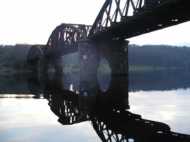
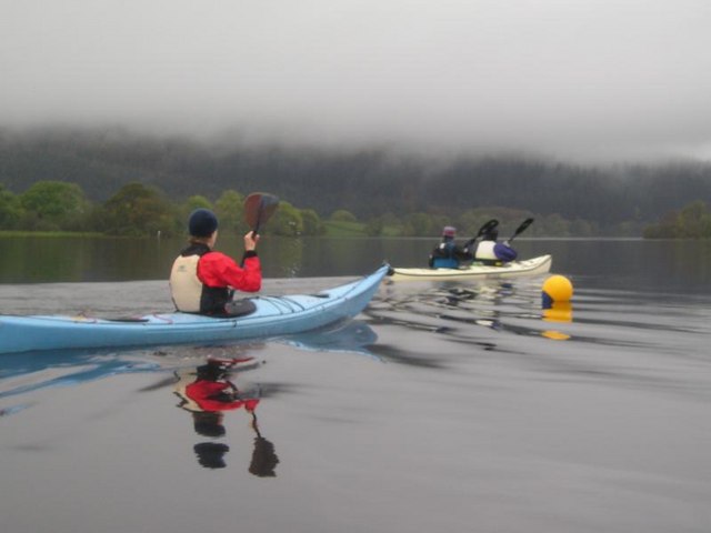
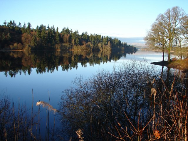
Loch Ken

Loch Ken is a 9 miles (14 km) long freshwater loch in the historic county of Kirkcudbrightshire in Dumfries and Galloway, Scotland. It lies in the Glenkens...

Parton railway station (Portpatrick and Wigtownshire Joint Railway)

Parton railway station served the hamlet of Parton, Dumfries and Galloway, Scotland, from 1861 to 1965 on the Portpatrick and Wigtownshire Joint Railway...

Parton, Dumfries and Galloway

Parton is a hamlet situated on the banks of the River Dee in the historical county of Kirkcudbrightshire, Dumfries and Galloway, Scotland. == Notable... ==

Kirkcudbrightshire

Kirkcudbrightshire ( kur-KOO-brish-ər, -⁠eer; Scots: [kərˈku(d)brəʃər]), or the County of Kirkcudbright or the Stewartry of Kirkcudbright is one of the...

Ironmacannie Mill

Ironmacannie Mill is a historic watermill near Balmaclellan in Dumfries and Galloway, Scotland. Built in the 18th and 19th centuries, on the site of an...

Skerrow

Skerrow was a burgh in Dumfries and Galloway, Scotland. Loch Skerrow Halt railway station, on the Portpatrick and Wigtownshire Joint Railway, served Skerrow...

Nearby Amenities

Located within 500m of 55.003323,-4.0829483
Power: pole
Lat/Long: 54.9988986/-4.0829398
Power: pole
Lat/Long: 54.999475/-4.0822961
Power: pole
Lat/Long: 55.0000538/-4.0816226
Power: pole
Lat/Long: 55.0006326/-4.080964
Power: pole
Lat/Long: 55.0010725/-4.0801588
Power: pole
Lat/Long: 55.001516/-4.0793834
Power: pole
Lat/Long: 55.0018084/-4.0788587
Power: pole
Lat/Long: 55.0025834/-4.0784274
Power: pole
Lat/Long: 55.0032682/-4.0780493
Power: pole
Lat/Long: 55.0040553/-4.077601
Power: pole
Lat/Long: 55.0046511/-4.0778411
Power: pole
Lat/Long: 55.0060339/-4.0783531
Power: pole
Lat/Long: 55.0053494/-4.0780996
Power: pole
Lat/Long: 55.0055758/-4.0767533
Power: pole
Lat/Long: 55.006397/-4.0803713
Power: pole
Lat/Long: 55.0062008/-4.0792241
Power: pole
Lat/Long: 55.0073631/-4.0797616
The data included in this document is from www.openstreetmap.org. The data is made available under ODbL.

Have you been to Round Plantation?

Leave your review of Round Plantation below (or comments, questions and feedback).