Alstonefield

Settlement in Staffordshire Staffordshire Moorlands

England

Alstonefield

The start of a footpath to Alstonefield A narrow flight of steps leads off a narrow back lane at the start of a footpath, which climbs steeply out of Milldale towards Alstonefield.
The start of a footpath to Alstonefield Credit: Ian Calderwood

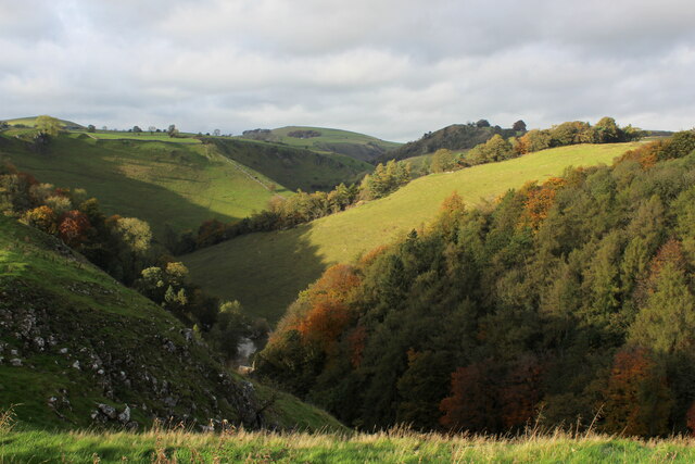
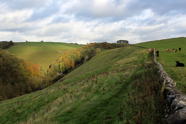
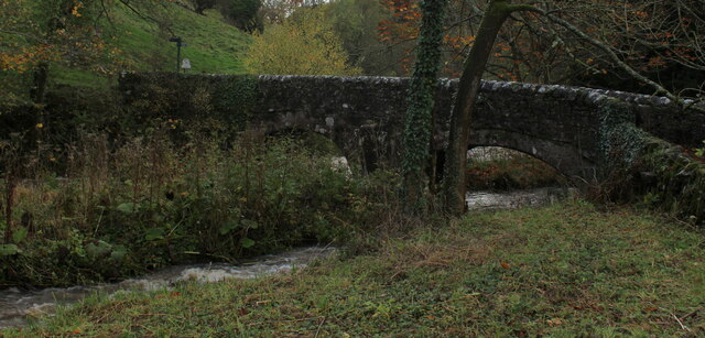
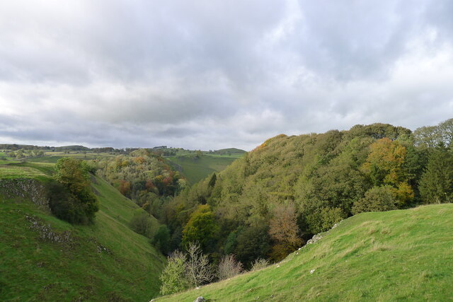
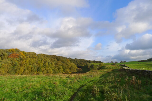
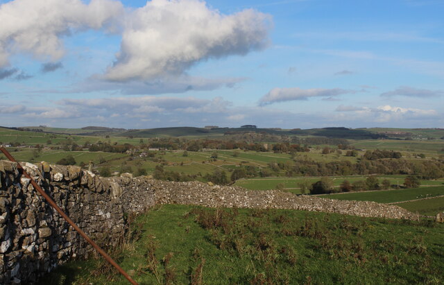
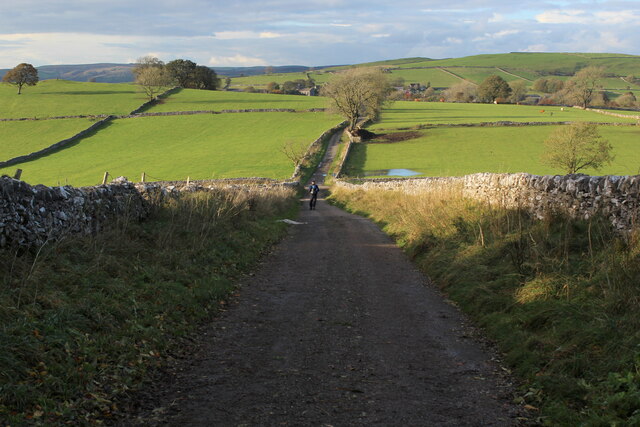
Alstonefield is a small village located in the Staffordshire Moorlands district of Staffordshire, England. Situated in the Peak District National Park, it is surrounded by picturesque countryside and offers stunning views of the nearby limestone hills.

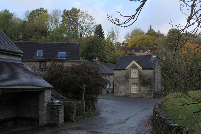
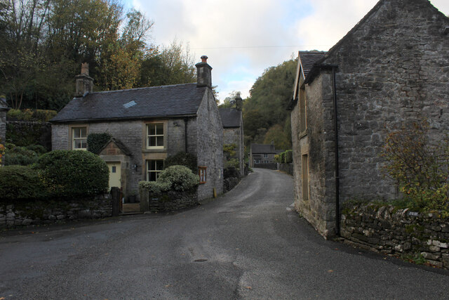
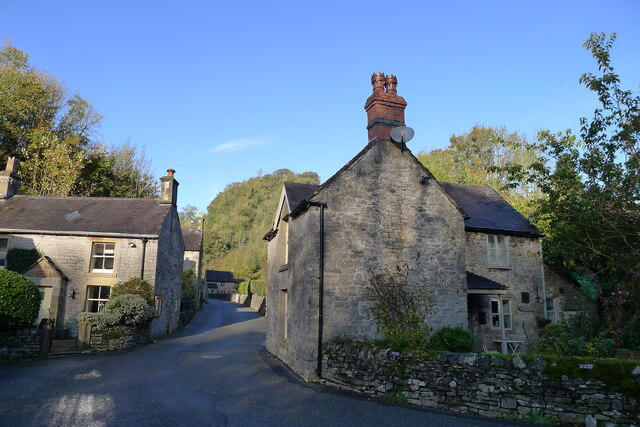
With a population of around 300 residents, Alstonefield is a tight-knit community that exudes a charming rural atmosphere. The village is known for its traditional stone-built houses, many of which date back to the 17th and 18th centuries, giving it a timeless and quintessentially English feel.

Alstonefield is renowned for its beautiful church, St. Peter's, which dates back to the 12th century. The church is a prominent landmark in the village and is surrounded by a well-maintained churchyard.

The village also boasts a vibrant pub, The George, which serves delicious food and local ales, making it a popular spot for both locals and visitors. Additionally, Alstonefield has a community-run village hall that hosts various events throughout the year, fostering a strong sense of community spirit.

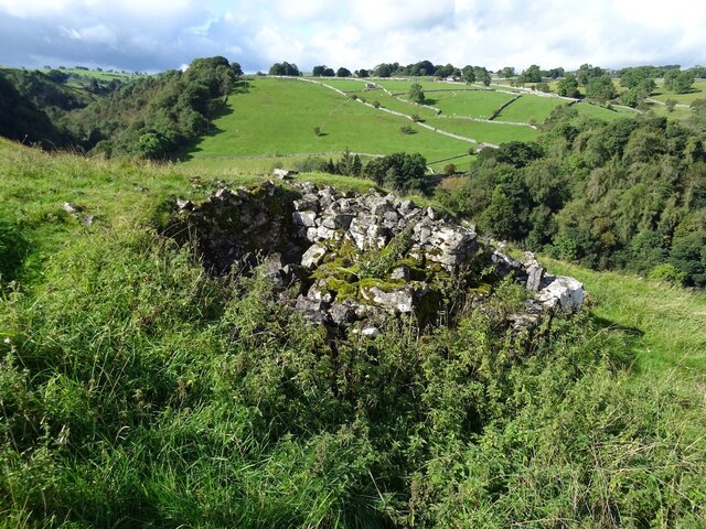
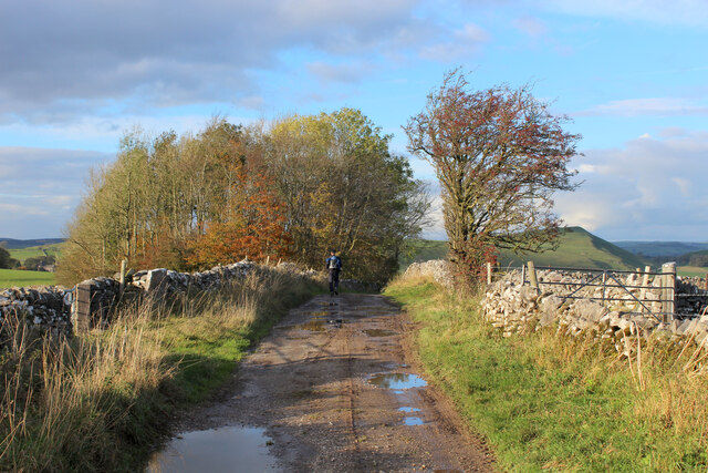
For outdoor enthusiasts, Alstonefield provides an excellent base for exploring the Peak District. There are numerous walking and cycling trails in the area, offering breathtaking views of the surrounding countryside and the opportunity to spot wildlife such as deer and birds of prey.

Overall, Alstonefield is a charming and idyllic village that offers a peaceful retreat in the heart of the Staffordshire countryside. Its rich history, stunning landscapes, and strong community spirit make it a truly special place to visit or call home.

If you have any feedback on the listing, please let us know in the comments section below.
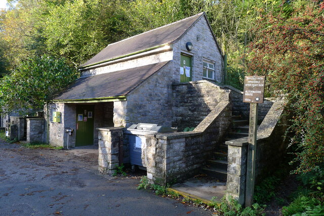
Alstonefield Images

Images are sourced within 2km of 53.098329/-1.807385 or Grid Reference SK1255. Thanks to Geograph Open Source API. All images are credited.

The start of a footpath to Alstonefield A narrow flight of steps leads off a narrow back lane at the start of a footpath, which climbs steeply out of Milldale towards Alstonefield.
The start of a footpath to Alstonefield
A narrow flight of steps leads off a narrow back lane at the start of a footpath, which climbs steeply out of Milldale towards Alstonefield.
Old dew pond by Millway Lane A neglected dew pond sits dry, neglected and overgrown at the edge of Alstonefield.
Old dew pond by Millway Lane
A neglected dew pond sits dry, neglected and overgrown at the edge of Alstonefield.
Old dew pond by Gratton Lane An old dew pond sits dry and neglected in a field by Gratton Lane.
Old dew pond by Gratton Lane
An old dew pond sits dry and neglected in a field by Gratton Lane.
Negotiating a narrow squeeze stile Some squeeze stiles are much narrower at the bottom than at the top, which is fine for humans but can be problematic for dogs.
Negotiating a narrow squeeze stile
Some squeeze stiles are much narrower at the bottom than at the top, which is fine for humans but can be problematic for dogs.
A ruin above Mill Dale The remains of some kind of small building, pen or fold, marked on old OS maps as a plain, unlabelled rectangle.
A ruin above Mill Dale
The remains of some kind of small building, pen or fold, marked on old OS maps as a plain, unlabelled rectangle.
Footpath to Pasture Lane The footpath from Hall Dale enters Stanshope via Pasture Lane.
Footpath to Pasture Lane
The footpath from Hall Dale enters Stanshope via Pasture Lane.
View from Above Shining Tor Overlooks the deep trench that is Dovedale
View from Above Shining Tor
Overlooks the deep trench that is Dovedale
Footpath High above Milldale The public footpath follows the wall, with ground falling away sharply to the left towards Milldale
Footpath High above Milldale
The public footpath follows the wall, with ground falling away sharply to the left towards Milldale
Milldale (1) Small village comprising several stone buildings, squeezed deep in the narrow valley of Dovedale - so narrow that sunshine finds difficulty in reaching the community.
Milldale (1)
Small village comprising several stone buildings, squeezed deep in the narrow valley of Dovedale - so narrow that sunshine finds difficulty in reaching the community.
Milldale (2) Delightful small village squeezed tightly between the valley sides of Dovedale - so tightly, that sunshine is at a premium.
A popular walk stretches south from here, running beside the River Dove to the stepping stones near Thorpe.
Milldale (2)
Delightful small village squeezed tightly between the valley sides of Dovedale - so tightly, that sunshine is at a premium. A popular walk stretches south from here, running beside the River Dove to the stepping stones near Thorpe.
Viator's Bridge Ancient packhorse bridge, which has been in use since medieval times. Izaak Walton wrote about this bridge in "The Compleat Angler" - referring to himself as Viator (Latin for traveller), which accounts for the structure's name.
Viator's Bridge
Ancient packhorse bridge, which has been in use since medieval times. Izaak Walton wrote about this bridge in "The Compleat Angler" - referring to himself as Viator (Latin for traveller), which accounts for the structure's name.
Mill Dale
Mill Dale
The path above Mill Dale After a steep climb up from the village of Milldale, the path here is running east on more level ground towards the A515 and the Tissington Trail
The path above Mill Dale
After a steep climb up from the village of Milldale, the path here is running east on more level ground towards the A515 and the Tissington Trail
Public conveniences, Milldale
Milldale in Mill Dale A small village nestled in steep-sided valleys next to the River Dove. Very popular with walkers, with a large car park further along this road (and just within Staffordshire, the car park is free!)
Milldale in Mill Dale
A small village nestled in steep-sided valleys next to the River Dove. Very popular with walkers, with a large car park further along this road (and just within Staffordshire, the car park is free!)
Looking North East from Stable Lane A fine view over part of the Staffordshire Peak District
Looking North East from Stable Lane
A fine view over part of the Staffordshire Peak District
Stable Lane It becomes metalled a little further on, becoming Ashbourne Lane after a crossroads en route for Wetton
Stable Lane
It becomes metalled a little further on, becoming Ashbourne Lane after a crossroads en route for Wetton
Stable Lane approaching a Crossroads All routes undergo a name change at these croosroads. Ashbourne Lane is a continuation of Stable Lane. Larkstone Lane flies to the left and Wall Ditch runs to the right.
Stable Lane approaching a Crossroads
All routes undergo a name change at these croosroads. Ashbourne Lane is a continuation of Stable Lane. Larkstone Lane flies to the left and Wall Ditch runs to the right.
Show me another place!

Alstonefield is located at Grid Ref: SK1255 (Lat: 53.098329, Lng: -1.807385)

Administrative County: Staffordshire

District: Staffordshire Moorlands

Police Authority: Staffordshire

What 3 Words

///family.likening.copes. Near Newhaven, Derbyshire

Nearby Locations

Hope Alstonefield

Related Wikis

Alstonefield

Alstonefield (alternative spelling: Alstonfield) is a village and civil parish in the Peak District National Park and the Staffordshire Moorlands district...

St Peter's Church, Alstonefield

The Church of St Peter in Alstonefield, Staffordshire Moorlands, England is a grade I listed Anglican parish church. The oldest parts are 12th century...

Long Low, Wetton

Long Low is a Neolithic and Bronze Age site in the English county of Staffordshire. It is about 2 km SE of Wetton (grid reference SK122539).It consists...

Wetton, Staffordshire

Wetton is a village in the Peak District National Park, North Staffordshire, at the top of the east side of the Manifold Valley. The population recorded...

Tissington Trail

The Tissington Trail is a bridleway, footpath and cycleway in Derbyshire, England, along part of the trackbed of the former railway line connecting Ashbourne...

Alsop en le Dale railway station

Alsop en le Dale railway station was opened in 1899 near Alsop en le Dale and Alstonefield, villages in Derbyshire southeast of Buxton. It was on the...

Wolfscote Hill

Wolfscote Hill is a limestone hill near the village of Hartington in the Derbyshire Peak District. The summit is 388 metres (1,273 ft) above sea level...

Castern Wood

Castern Wood is a nature reserve of the Staffordshire Wildlife Trust. It is an ancient woodland, with scrub and grassland, on the eastern slopes of the...

Nearby Amenities

Located within 500m of 53.098329,-1.807385
Alstonefield
Is In: Staffordshire, United Kingdom
Place: village
Wikidata: Q2263367
Wikipedia: en:Alstonefield
Lat/Long: 53.097268/-1.8058952
Bench
Backrest: yes
Material: wood
Lat/Long: 53.0975217/-1.805086
Barrier: stile
Foot: yes
Stile: squeezer
Lat/Long: 53.0954332/-1.8043641
Barrier: stile
Foot: yes
Material: stone
Source: survey
Stile: stepover
Lat/Long: 53.0947759/-1.8054375
Barrier: stile
Foot: yes
Lat/Long: 53.0957078/-1.80513
Barrier: stile
Foot: yes
Lat/Long: 53.0960352/-1.8051765
Barrier: stile
Foot: yes
Lat/Long: 53.0967466/-1.805104
Bus Stop
Memorial Hall
Bus: yes
Naptan AtcoCode: 3800C800000
Naptan Bearing: NE
Naptan CommonName: Memorial Hall
Naptan Indicator: Adj
Naptan Landmark: Memorial Hall
Naptan Street: Main Rd
Naptan Verified: no
Public Transport: platform
Source: naptan_import
Lat/Long: 53.0969719/-1.8073924
Bus Stop
Community Centre
Bus: yes
Naptan AtcoCode: 3800C800001
Naptan Bearing: SW
Naptan CommonName: Community Centre
Naptan Indicator: Adj
Naptan Landmark: Community Centre
Naptan Street: Main Rd
Naptan Verified: no
Public Transport: platform
Source: naptan_import
Lat/Long: 53.0968731/-1.8074227
Bus Stop
Post Office
Bus: yes
Naptan AtcoCode: 3800C800100
Naptan Bearing: E
Naptan CommonName: Post Office
Naptan Indicator: Adj
Naptan Landmark: Post Office
Naptan Street: Main Rd
Naptan Verified: no
Public Transport: platform
Source: naptan_import
Lat/Long: 53.0970207/-1.8057415
Bus Stop
Car Park
Bus: yes
Naptan AtcoCode: 3800C800200
Naptan Bearing: SE
Naptan CommonName: Car Park
Naptan Indicator: Adj
Naptan Landmark: Car Park
Naptan Street: Mill Dale
Naptan Verified: no
Public Transport: platform
Source: naptan_import
Lat/Long: 53.097893/-1.806523
Post Box
Brand: Royal Mail
Brand Wikidata: Q638098
Operator: Royal Mail
Operator Wikidata: Q638098
Post Box Type: wall
Ref: DE6 827
Royal Cypher: GR
Lat/Long: 53.0970208/-1.80579
Addr Housename: Old Post Office Stores
Source: survey
Lat/Long: 53.097051/-1.8056596
Old Phone: +44 1335 310301
Removed Amenity: telephone
Source: survey
Lat/Long: 53.0971473/-1.8063825
Addr Housename: Hambleton House
Source: survey
Lat/Long: 53.0970503/-1.8054904
Top of Hope
Place: locality
Source: OS_OpenData_StreetView
Lat/Long: 53.0951452/-1.8105398
Bench
Source: survey
Lat/Long: 53.0970491/-1.804939
Addr Housename: The Cottage
Source: survey
Lat/Long: 53.0970715/-1.8054085
Barrier: stile
Foot: yes
Lat/Long: 53.1006065/-1.8061209
Barrier: stile
Foot: yes
Material: stone
Stile: stepover
Lat/Long: 53.099563/-1.8061966
Barrier: stile
Foot: yes
Lat/Long: 53.1024253/-1.8080102
Barrier: stile
Foot: yes
Lat/Long: 53.1000681/-1.8060916
Barrier: stile
Foot: yes
Lat/Long: 53.1018345/-1.8074118
Barrier: stile
Foot: yes
Lat/Long: 53.0998584/-1.8059985
Barrier: stile
Foot: yes
Lat/Long: 53.101405/-1.8068707
Barrier: stile
Foot: yes
Lat/Long: 53.1027607/-1.8084348
Barrier: stile
Source: survey;gps
Lat/Long: 53.0983054/-1.8065428
Barrier: stile
Foot: yes
Material: stone
Source: survey;bing
Stile: squeezer
Lat/Long: 53.0981321/-1.8068191
Note: Presumably the public_footpath goes east from here
Lat/Long: 53.0993797/-1.8080631
Barrier: stile
Material: stone
Source: survey;gps
Stile: squeezer
Lat/Long: 53.0995349/-1.8130221
Barrier: stile
Lat/Long: 53.1001838/-1.8035639
Barrier: stile
Lat/Long: 53.0998928/-1.8055083
Bench
Lat/Long: 53.0988735/-1.8078946
Barrier: cattle_grid
Bicycle: yes
Foot: yes
Motorcar: yes
Motorcycle: yes
Lat/Long: 53.0961928/-1.8083161
Information: board
Tourism: information
Lat/Long: 53.0962858/-1.8089427
Bench
Lat/Long: 53.0970639/-1.806591
Information: board
Tourism: information
Lat/Long: 53.0969595/-1.8057316
Barrier: stile
Material: stone
Source: survey;gps
Stile: squeezer
Lat/Long: 53.0949852/-1.8066433
Barrier: stile
Material: stone
Source: survey;gps
Stile: squeezer
Lat/Long: 53.0956172/-1.8039574
Bench
Lat/Long: 53.0968299/-1.8044489
Addr Housename: Hope Villa
Lat/Long: 53.0953059/-1.8101888
Addr Housename: Hope Mount Farm
Lat/Long: 53.0950338/-1.8107993
Addr Housename: Hope Villa
Lat/Long: 53.0952113/-1.8103341
Addr Housename: Top Of Hope
Lat/Long: 53.0950604/-1.81061
Addr Housenumber: 4
Addr Street: Harpur Crewe Cottages
Source: survey
Lat/Long: 53.0956312/-1.8087394
Addr Housenumber: 3
Addr Street: Harpur Crewe Cottages
Source: survey
Lat/Long: 53.0956904/-1.8087776
Addr Housenumber: 2
Addr Street: Harpur Crewe Cottages
Source: survey
Lat/Long: 53.0957725/-1.8088195
Addr Housenumber: 1
Addr Street: Harpur Crewe Cottages
Source: survey
Lat/Long: 53.0958427/-1.808854
Addr Housenumber: 5
Addr Street: Harpur Crewe Cottages
Source: survey
Lat/Long: 53.0955388/-1.808615
Addr Housenumber: 6
Addr Street: Harpur Crewe Cottages
Source: survey
Lat/Long: 53.0955159/-1.8087357
Recycling
Recycling Batteries: no
Recycling Cans: no
Recycling Clothes: yes
Recycling Glass: yes
Recycling Paper: yes
Recycling Scrap Metal: no
Recycling Type: container
Lat/Long: 53.0963596/-1.8086741
Post Office
Alstonefield Post Office
Addr City: Ashbourne
Addr Housename: The Village Hall
Addr Postcode: DE6 2FX
Addr Village: Alstonefield
Ref Pol Id: 128263
Lat/Long: 53.0972187/-1.8075027
Man Made: water_pump
Lat/Long: 53.0982517/-1.8073055
Green Well
Man Made: water_well
Lat/Long: 53.0985425/-1.8080868
Barrier: stile
Foot: yes
Material: stone
Stile: squeezer
Lat/Long: 53.0985775/-1.8078155
Addr Housename: Michael Griffin
Lat/Long: 53.0979795/-1.8041307
Barrier: stile
Foot: yes
Material: stone
Source: survey
Stile: stepover
Lat/Long: 53.0979313/-1.8066203
Addr Housename: East View
Lat/Long: 53.0990276/-1.8080818
Addr Housename: Greenside Cottage
Lat/Long: 53.0991922/-1.8079865
Barrier: cattle_grid
Bicycle: yes
Foot: yes
Motorcar: yes
Motorcycle: yes
Lat/Long: 53.0994021/-1.8074288
Addr Housename: Aldwyn Cottage
Lat/Long: 53.1015878/-1.8109019
Addr Housename: Raikes Leigh
Lat/Long: 53.1016022/-1.8110375
Alstonefield Parish Council Green Well
Board Type: board
Information: board
Tourism: information
Lat/Long: 53.0986094/-1.8078067
Addr Housename: The Coach House
Lat/Long: 53.099035/-1.8081844
Addr Housename: Rest Cottage
Lat/Long: 53.0969364/-1.8068979
Addr Housename: Riverdales
Lat/Long: 53.096948/-1.8067801
Addr Housename: Sunnyside
Lat/Long: 53.0969603/-1.806635
Addr Housename: The Hermitage
Lat/Long: 53.0969505/-1.8067331
Waste Basket
Lat/Long: 53.096964/-1.8058764
Waste Basket
Lat/Long: 53.0970389/-1.8063289
Addr Housename: Burton Cottage
Addr Housenumber: 1
Lat/Long: 53.0965901/-1.8044461
Addr Housename: Burton Cottage
Addr Housenumber: 2
Lat/Long: 53.0966421/-1.8044686
Addr Housename: Burton Cottage
Addr Housenumber: 3
Lat/Long: 53.0966908/-1.8045413
Barrier: stile
Source: survey;gps
Stile: squeezer
Lat/Long: 53.0948793/-1.8099696
Barrier: stile
Material: stone
Source: survey
Stile: squeezer
Lat/Long: 53.0950487/-1.8066749
Barrier: stile
Material: stone
Source: survey;gps
Stile: squeezer
Lat/Long: 53.0987795/-1.8147222
Barrier: stile
Material: stone
Source: survey;gps
Stile: squeezer
Lat/Long: 53.1009562/-1.811795
Barrier: entrance
Source: survey;gps
Lat/Long: 53.1009796/-1.8048755
Barrier: stile
Material: stone
Source: survey;gps
Stile: squeezer
Lat/Long: 53.0978022/-1.8073114
Barrier: entrance
Source: survey;gps
Lat/Long: 53.095544/-1.8036665
Information: route_marker
Tourism: information
Lat/Long: 53.098478/-1.807634
Information: route_marker
Tourism: information
Lat/Long: 53.0985515/-1.8075701
Information: route_marker
Tourism: information
Lat/Long: 53.0967442/-1.8076125
Information: route_marker
Tourism: information
Lat/Long: 53.0950521/-1.8067039
Barrier: entrance
Lat/Long: 53.0972875/-1.8074492
Entrance: yes
Lat/Long: 53.0972953/-1.8075721
Bicycle Parking
Bicycle Parking: stands
Capacity: 10
Covered: no
Supervised: no
Lat/Long: 53.0973435/-1.8075065
Bench
Lat/Long: 53.0970085/-1.8099479
Give Way
Direction: backward
Lat/Long: 53.0970659/-1.8067902
The data included in this document is from www.openstreetmap.org. The data is made available under ODbL.

Have you been to Alstonefield?

Leave your review of Alstonefield below (or comments, questions and feedback).