Hope

Settlement in Staffordshire Staffordshire Moorlands

England

Hope

The start of a footpath to Alstonefield A narrow flight of steps leads off a narrow back lane at the start of a footpath, which climbs steeply out of Milldale towards Alstonefield.
The start of a footpath to Alstonefield Credit: Ian Calderwood

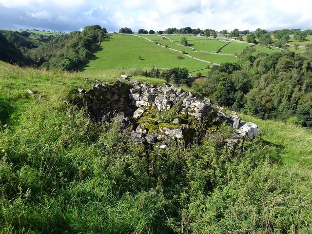
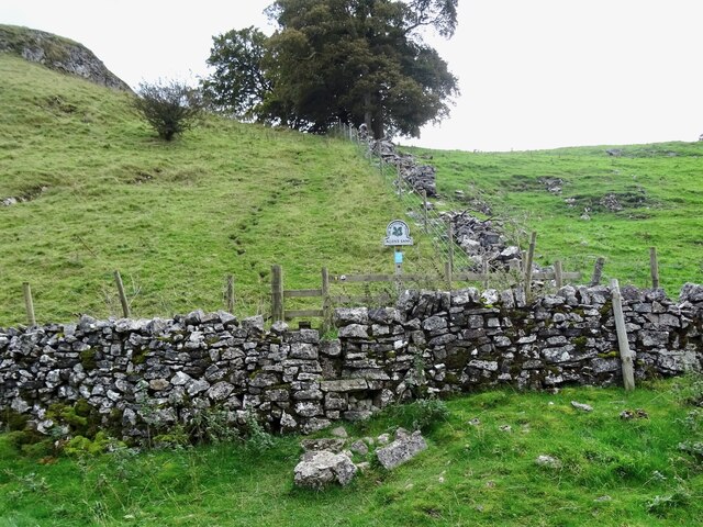
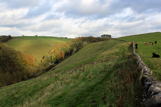
Hope is a small village located in the county of Staffordshire, England. Situated in the picturesque countryside, it is part of the Staffordshire Moorlands district. The village is nestled within the Peak District National Park, renowned for its stunning landscapes and outdoor recreational activities.

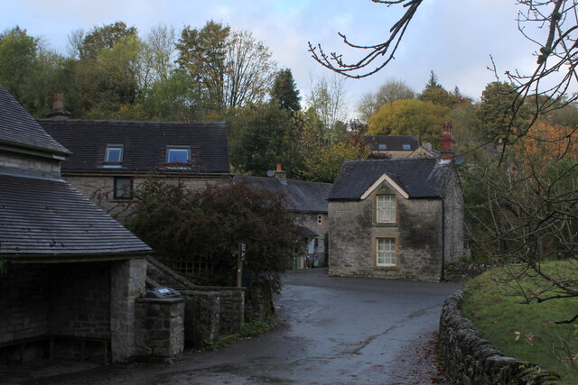
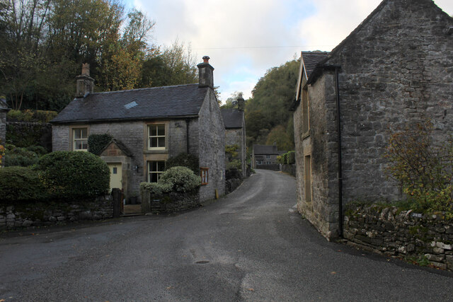
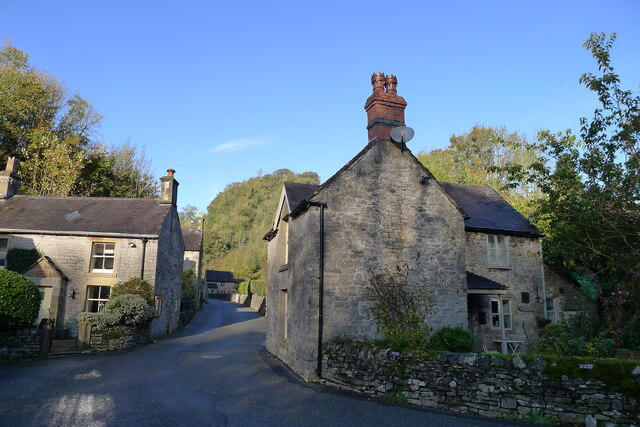
Hope has a rich history dating back to the medieval times, with evidence of settlements in the area from as early as the 11th century. The village is known for its quaint charm and traditional architecture, with numerous stone cottages and historic buildings dotting its streets.

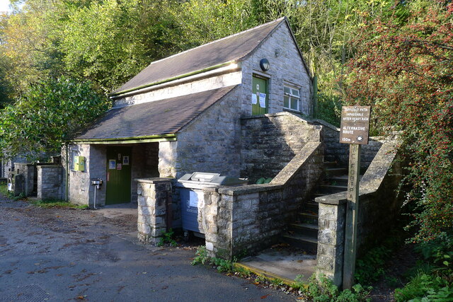
Despite its small size, Hope offers a range of amenities and services to its residents and visitors. There is a local primary school, a community center, and a few shops and pubs that cater to the needs of the villagers. The village also has a strong sense of community spirit, with various events and activities organized throughout the year, including the annual Hope Carnival, which attracts people from neighboring areas.

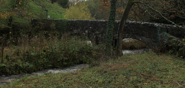
Nature enthusiasts are drawn to Hope due to its proximity to the Peak District National Park. The village serves as an excellent base for exploring the park's scenic hiking trails, cycling routes, and rock-climbing spots. The nearby Hope Valley is particularly popular among outdoor enthusiasts, offering breathtaking views of rolling hills, lush valleys, and charming villages.

In conclusion, Hope, Staffordshire is a picturesque village with a rich history and a strong sense of community. Its ideal location within the Peak District National Park makes it an attractive destination for nature lovers and outdoor enthusiasts.

If you have any feedback on the listing, please let us know in the comments section below.
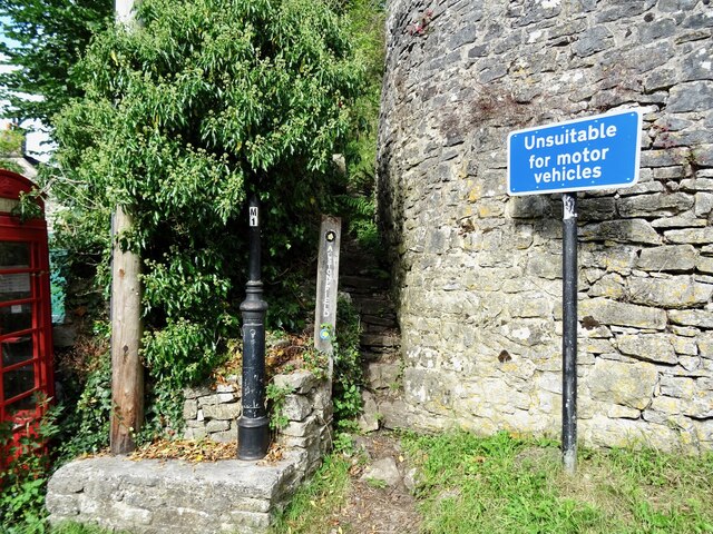
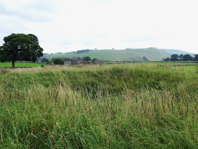
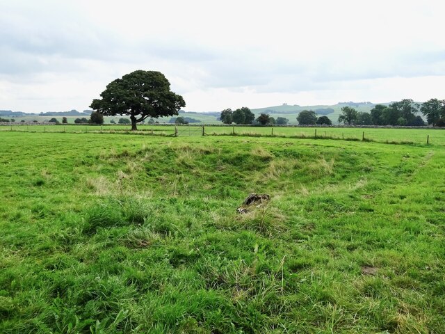
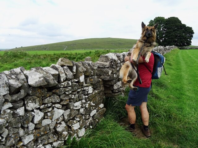
Hope Images

Images are sourced within 2km of 53.093758/-1.815544 or Grid Reference SK1255. Thanks to Geograph Open Source API. All images are credited.

The start of a footpath to Alstonefield A narrow flight of steps leads off a narrow back lane at the start of a footpath, which climbs steeply out of Milldale towards Alstonefield.
The start of a footpath to Alstonefield
A narrow flight of steps leads off a narrow back lane at the start of a footpath, which climbs steeply out of Milldale towards Alstonefield.
Old dew pond by Millway Lane A neglected dew pond sits dry, neglected and overgrown at the edge of Alstonefield.
Old dew pond by Millway Lane
A neglected dew pond sits dry, neglected and overgrown at the edge of Alstonefield.
Old dew pond by Gratton Lane An old dew pond sits dry and neglected in a field by Gratton Lane.
Old dew pond by Gratton Lane
An old dew pond sits dry and neglected in a field by Gratton Lane.
Negotiating a narrow squeeze stile Some squeeze stiles are much narrower at the bottom than at the top, which is fine for humans but can be problematic for dogs.
Negotiating a narrow squeeze stile
Some squeeze stiles are much narrower at the bottom than at the top, which is fine for humans but can be problematic for dogs.
A ruin above Mill Dale The remains of some kind of small building, pen or fold, marked on old OS maps as a plain, unlabelled rectangle.
A ruin above Mill Dale
The remains of some kind of small building, pen or fold, marked on old OS maps as a plain, unlabelled rectangle.
Step stile and sign at Allen's Bank in Hall Dale
Footpath to Pasture Lane The footpath from Hall Dale enters Stanshope via Pasture Lane.
Footpath to Pasture Lane
The footpath from Hall Dale enters Stanshope via Pasture Lane.
The remains of Highfields Lead Mine
Footpath High above Milldale The public footpath follows the wall, with ground falling away sharply to the left towards Milldale
Footpath High above Milldale
The public footpath follows the wall, with ground falling away sharply to the left towards Milldale
Milldale (1) Small village comprising several stone buildings, squeezed deep in the narrow valley of Dovedale - so narrow that sunshine finds difficulty in reaching the community.
Milldale (1)
Small village comprising several stone buildings, squeezed deep in the narrow valley of Dovedale - so narrow that sunshine finds difficulty in reaching the community.
Milldale (2) Delightful small village squeezed tightly between the valley sides of Dovedale - so tightly, that sunshine is at a premium.
A popular walk stretches south from here, running beside the River Dove to the stepping stones near Thorpe.
Milldale (2)
Delightful small village squeezed tightly between the valley sides of Dovedale - so tightly, that sunshine is at a premium. A popular walk stretches south from here, running beside the River Dove to the stepping stones near Thorpe.
Viator's Bridge Ancient packhorse bridge, which has been in use since medieval times. Izaak Walton wrote about this bridge in "The Compleat Angler" - referring to himself as Viator (Latin for traveller), which accounts for the structure's name.
Viator's Bridge
Ancient packhorse bridge, which has been in use since medieval times. Izaak Walton wrote about this bridge in "The Compleat Angler" - referring to himself as Viator (Latin for traveller), which accounts for the structure's name.
Public conveniences, Milldale
Milldale in Mill Dale A small village nestled in steep-sided valleys next to the River Dove. Very popular with walkers, with a large car park further along this road (and just within Staffordshire, the car park is free!)
Milldale in Mill Dale
A small village nestled in steep-sided valleys next to the River Dove. Very popular with walkers, with a large car park further along this road (and just within Staffordshire, the car park is free!)
Gate and Walls above the Manifold Valley
Approaching Stable Lane
Looking up Stable Lane Walled track heading north west, eventually becoming a tarmac surface as it approaches the village of Wetton
Looking up Stable Lane
Walled track heading north west, eventually becoming a tarmac surface as it approaches the village of Wetton
Series of Pastures above the Manifold Valley
Show me another place!

Hope is located at Grid Ref: SK1255 (Lat: 53.093758, Lng: -1.815544)

Administrative County: Staffordshire

District: Staffordshire Moorlands

Police Authority: Staffordshire

What 3 Words

///broom.steadier.array. Near Newhaven, Derbyshire

Nearby Locations

Alstonefield Hope

Related Wikis

Alstonefield

Alstonefield (alternative spelling: Alstonfield) is a village and civil parish in the Peak District National Park and the Staffordshire Moorlands district...

St Peter's Church, Alstonefield

The Church of St Peter in Alstonefield, Staffordshire Moorlands, England is a grade I listed Anglican parish church. The oldest parts are 12th century...

Long Low, Wetton

Long Low is a Neolithic and Bronze Age site in the English county of Staffordshire. It is about 2 km SE of Wetton (grid reference SK122539).It consists...

Wetton, Staffordshire

Wetton is a village in the Peak District National Park, North Staffordshire, at the top of the east side of the Manifold Valley. The population recorded...

Castern Wood

Castern Wood is a nature reserve of the Staffordshire Wildlife Trust. It is an ancient woodland, with scrub and grassland, on the eastern slopes of the...
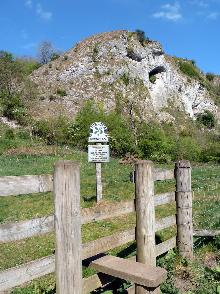
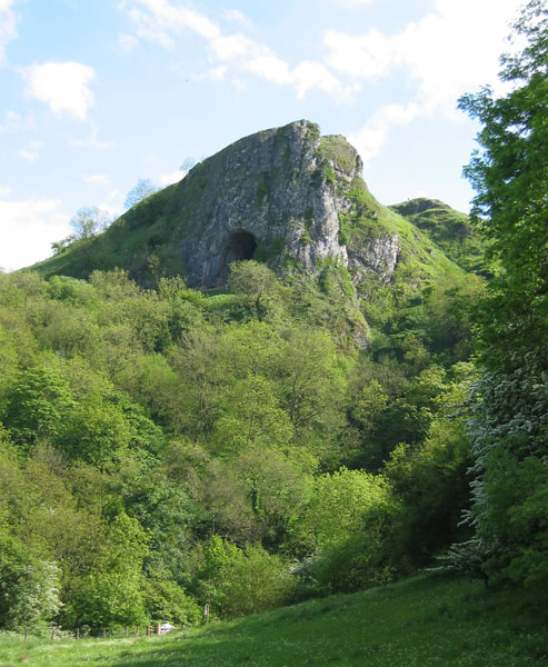
Beeston Tor

Beeston Tor (grid reference SK105540) is a limestone cliff in Staffordshire. It overlooks the confluence of the River Hamps with the River Manifold, and...

Beeston Tor railway station

Beeston Tor railway station was a minor station which served the Beeston Tor in Grindon, Staffordshire. The site is now part of the Manifold Way. ��2...

Thor's Cave

Thor's Cave (also known as Thor's House Cavern and Thyrsis's Cave) is a natural cavern located at SK09865496 in the Manifold Valley of the White Peak in...

Nearby Amenities

Located within 500m of 53.093758,-1.815544
Hope
Is In: Staffordshire Moorlands
Place: hamlet
Lat/Long: 53.09357/-1.8150456
Hopedale
Place: hamlet
Lat/Long: 53.0915824/-1.8175041
Barrier: stile
Foot: yes
Stile: squeezer
Lat/Long: 53.0915414/-1.8091534
Bus Stop
The Watts Russell
Bus: yes
Naptan AtcoCode: 3800C845601
Naptan Bearing: N
Naptan CommonName: The Watts Russell
Naptan Indicator: Adj
Naptan Landmark: The Watts Russell
Naptan Street: Main Rd
Naptan Verified: no
Public Transport: platform
Source: naptan_import
Lat/Long: 53.0916943/-1.818242
Post Box
Brand: Royal Mail
Brand Wikidata: Q638098
Operator: Royal Mail
Operator Wikidata: Q638098
Ref: DE6 815
Lat/Long: 53.0923062/-1.818135
Top of Hope
Place: locality
Source: OS_OpenData_StreetView
Lat/Long: 53.0951452/-1.8105398
Barrier: kissing_gate
Source: survey;gps
Lat/Long: 53.0959318/-1.8199115
Barrier: stile
Material: stone
Source: survey;gps
Stile: squeezer
Lat/Long: 53.0959382/-1.8218724
Barrier: stile
Material: stone
Source: survey;gps
Stile: squeezer
Lat/Long: 53.0956376/-1.8141636
Barrier: stile
Material: stone
Source: survey;gps
Stile: squeezer
Lat/Long: 53.09568/-1.8158165
Barrier: stile
Material: stone
Source: survey;bing;gps
Stile: squeezer
Lat/Long: 53.0968016/-1.8166942
Barrier: stile
Material: stone
Source: survey;bing;gps
Stile: squeezer
Lat/Long: 53.0968503/-1.8166452
Barrier: stile
Steps: 1
Stile: stepover
Lat/Long: 53.0971877/-1.8182361
Barrier: stile
Material: stone
Source: survey;gps
Stile: squeezer
Lat/Long: 53.0956824/-1.8157002
Barrier: stile
Stile: squeezer
Lat/Long: 53.0921951/-1.8225635
Barrier: stile
Material: wood
Source: survey
Stile: stepover
Lat/Long: 53.0934764/-1.8170805
Barrier: stile
Material: stone
Stile: squeezer
Lat/Long: 53.0915965/-1.8201913
Barrier: stile
Stile: squeezer
Lat/Long: 53.0920424/-1.8220829
Addr Housename: Hope Villa
Lat/Long: 53.0953059/-1.8101888
Addr Housename: Hope Mount Farm
Lat/Long: 53.0950338/-1.8107993
Addr Housename: Hope Villa
Lat/Long: 53.0952113/-1.8103341
Addr Housename: Top Of Hope
Lat/Long: 53.0950604/-1.81061
Addr Housenumber: 4
Addr Street: Harpur Crewe Cottages
Source: survey
Lat/Long: 53.0956312/-1.8087394
Addr Housenumber: 3
Addr Street: Harpur Crewe Cottages
Source: survey
Lat/Long: 53.0956904/-1.8087776
Addr Housenumber: 6
Addr Street: Harpur Crewe Cottages
Source: survey
Lat/Long: 53.0955159/-1.8087357
Barrier: kissing_gate
Source: survey;gps
Lat/Long: 53.0958777/-1.8175314
Barrier: stile
Material: stone
Source: survey;gps
Stile: squeezer
Lat/Long: 53.095905/-1.8175611
Barrier: kissing_gate
Source: survey;gps
Lat/Long: 53.0959396/-1.819248
Barrier: kissing_gate
Source: survey;gps
Lat/Long: 53.0959432/-1.8181884
Barrier: kissing_gate
Source: survey;gps
Lat/Long: 53.0960114/-1.8208279
Addr Housename: The Cottage
Source: survey;bing
Lat/Long: 53.0923767/-1.817851
Barrier: stile
Material: stone
Source: survey;gps
Stile: stepover
Lat/Long: 53.0919295/-1.8140595
Bench
Source: survey
Lat/Long: 53.0926596/-1.8177782
Barrier: stile
Material: stone
Source: survey;gps
Stile: squeezer
Lat/Long: 53.0928213/-1.817464
Barrier: stile
Material: stone
Source: survey;gps
Stile: squeezer
Lat/Long: 53.0929486/-1.8151821
Barrier: stile
Source: survey;gps
Stile: squeezer
Lat/Long: 53.0948793/-1.8099696
Barrier: stile
Lat/Long: 53.093334/-1.8185351
Information: route_marker
Tourism: information
Lat/Long: 53.0914848/-1.809134
The data included in this document is from www.openstreetmap.org. The data is made available under ODbL.

Have you been to Hope?

Leave your review of Hope below (or comments, questions and feedback).