Braefindon Strip

Wood, Forest in Ross-shire

Scotland

Braefindon Strip

Track through young forestry at Culbo
Track through young forestry at Culbo Credit: Mike Pennington

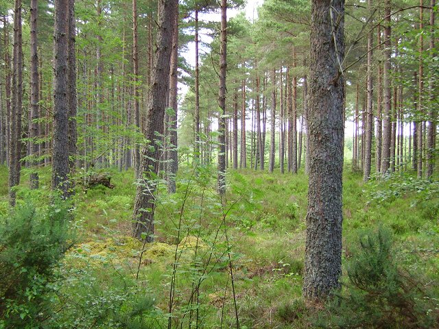
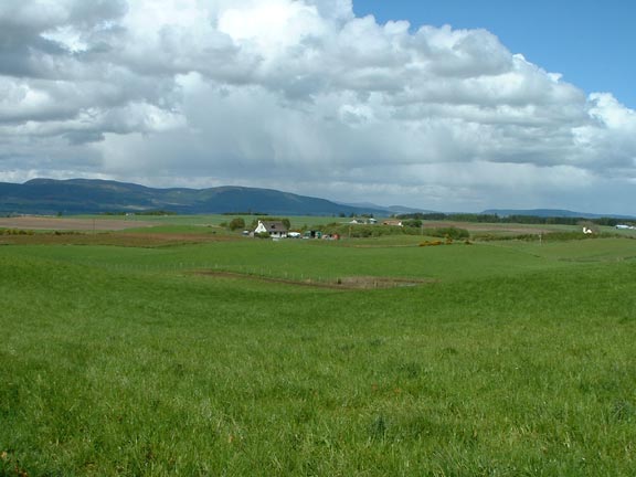
Braefindon Strip is a picturesque woodland area located in Ross-shire, Scotland. Situated amidst the stunning Scottish Highlands, this forested region spans over a considerable area of approximately 200 acres. The landscape is characterized by dense woodlands, with towering trees and a rich diversity of flora and fauna.

The woodlands of Braefindon Strip are predominantly composed of native Scottish tree species, including oak, birch, and pine. The forest floor is adorned with a vibrant carpet of mosses, ferns, and wildflowers, creating a captivating and serene environment. The area is also home to numerous wildlife species, such as red squirrels, roe deer, and a variety of bird species, making it a paradise for nature enthusiasts and wildlife lovers.

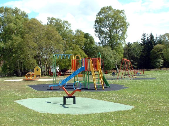
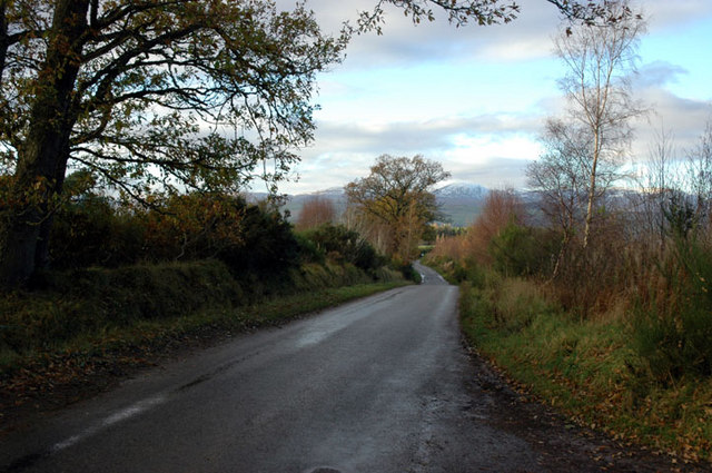
Visitors to Braefindon Strip can explore the forest through a network of well-maintained walking trails. These trails offer breathtaking views of the surrounding countryside and allow visitors to immerse themselves in the tranquil beauty of the woodlands. The forest is also a popular spot for birdwatching, as it provides a habitat for a diverse range of bird species.

Braefindon Strip is not only a haven for nature lovers but also serves as an important ecological site. The woodlands contribute to the conservation of local biodiversity and provide valuable ecosystem services, such as carbon sequestration and water regulation.

Overall, Braefindon Strip in Ross-shire is a treasure trove of natural beauty and biodiversity. With its stunning woodlands, diverse wildlife, and peaceful atmosphere, it offers a truly immersive experience for those seeking solace in nature.

If you have any feedback on the listing, please let us know in the comments section below.

Braefindon Strip Images

Images are sourced within 2km of 57.600505/-4.2962314 or Grid Reference NH6259. Thanks to Geograph Open Source API. All images are credited.

Track through young forestry at Culbo
Forestry road into Wester Culbo Wood
Minor road past Wester Culbo Wood
Farmland There is lots of really nice pasture land in this area.
Farmland
There is lots of really nice pasture land in this area.
Culbokie area Lots of nice green pasture land.
Culbokie area
Lots of nice green pasture land.
Children's Playground I thought this would make a good geograph because it shows the sort of play equipment used for children at this time.  When I first passed by this playground there were children playing so waited until there were no children before taking the photograph.  People can get very worried about their child's photograph on the internet.
Children's Playground
I thought this would make a good geograph because it shows the sort of play equipment used for children at this time. When I first passed by this playground there were children playing so waited until there were no children before taking the photograph. People can get very worried about their child's photograph on the internet.
Countryside near Inverness Open views an with an unusual shaped house
Countryside near Inverness
Open views an with an unusual shaped house
Communication Mast Looking from the gate of the mast.
Communication Mast
Looking from the gate of the mast.
Mount Eagle Grand name, but remember "Mount" in Scotland is a rather derogatory name for a hill, it's a corruption of Monadh and is usually applied to heathery lumps. This was once a huge moor, one that dominated the centre of the Black Isle, but has now been forested. Since this picture was taken the trees here have been felled.

Note, the trig is almost on a grid line, this may possibly be taken from just out of square.
Mount Eagle
Grand name, but remember "Mount" in Scotland is a rather derogatory name for a hill, it's a corruption of Monadh and is usually applied to heathery lumps. This was once a huge moor, one that dominated the centre of the Black Isle, but has now been forested. Since this picture was taken the trees here have been felled. Note, the trig is almost on a grid line, this may possibly be taken from just out of square.
Fields, trees and heather A typical view of summer in the Brae of Badrain - a group of houses, moorland and farmland, nestled among the pine forests of Mulbuie Ridge
Fields, trees and heather
A typical view of summer in the Brae of Badrain - a group of houses, moorland and farmland, nestled among the pine forests of Mulbuie Ridge
Sunset over the Cromarty Firth A view on a winter's sunset down a gorse-lined Forestry Commission track over the Cromarty Firth and towards An Cabar, part of the Ben Wyvis massif.
Sunset over the Cromarty Firth
A view on a winter's sunset down a gorse-lined Forestry Commission track over the Cromarty Firth and towards An Cabar, part of the Ben Wyvis massif.
Black Isle cycle trail Part of the Black Isle off road cycle route.  These forest roads run straight as an arrow for miles.
Black Isle cycle trail
Part of the Black Isle off road cycle route. These forest roads run straight as an arrow for miles.
Pile of logs Very large diameter logs by the forest track.  Much of the forest on the Black Isle has been felled recently.
Pile of logs
Very large diameter logs by the forest track. Much of the forest on the Black Isle has been felled recently.
Mount Eagle trig point The highest point on the Black Isle.  Interesting to compare to Richard's earlier photo <a href="https://www.geograph.org.uk/photo/32675">NH6459 : Mount Eagle</a>.  The trig point is now in an area of felled trees, fortunately it has survived the cull.  Looking east.
Mount Eagle trig point
The highest point on the Black Isle. Interesting to compare to Richard's earlier photo NH6459 : Mount Eagle. The trig point is now in an area of felled trees, fortunately it has survived the cull. Looking east.
Bogbuie Wood Part of the large forest in the infertile middle of the Black Isle.
Bogbuie Wood
Part of the large forest in the infertile middle of the Black Isle.
View towards Ben Wyvis View over the Brae of Badrain, Black Isle, and Cromarty Firth to Ben Wyvis.
View towards Ben Wyvis
View over the Brae of Badrain, Black Isle, and Cromarty Firth to Ben Wyvis.
Near Braefindon Munlochy to Culbokie road
Near Braefindon
Munlochy to Culbokie road
Junction off Munlochy to Culbokie road Road sign says Greenleonachs
Junction off Munlochy to Culbokie road
Road sign says Greenleonachs
Show me another place!

Braefindon Strip is located at Grid Ref: NH6259 (Lat: 57.600505, Lng: -4.2962314)

Unitary Authority: Highland

Police Authority: Highlands and Islands

What 3 Words

///stormy.clotting.retina. Near Evanton, Highland

Related Wikis

Mounteagle transmitting station

The Mounteagle transmitting station is a broadcasting and telecommunications facility, situated close to the town of Fortrose, Scotland, in Highland (grid...

Culbokie

Culbokie (An Cùil Bhàicidh in Gaelic, meaning 'the haunted nook') is a small village in Ross and Cromarty, Highland, Scotland. It is located on the north...

Utopia Experiment

The Utopia Experiment was an experiment by Dylan Evans, set up in 2006 at Netherton Farm, near Culbokie on the Black Isle peninsula in the Scottish highlands...

Black Isle

The Black Isle (Scottish Gaelic: an t-Eilean Dubh, pronounced [ən̪ˠ ˈtʲʰelan ˈt̪uh]) is a peninsula within Ross and Cromarty, in the Scottish Highlands...

Nearby Amenities

Located within 500m of 57.600505,-4.2962314
Power: pole
Lat/Long: 57.5965881/-4.2997114
Power: pole
Lat/Long: 57.5967827/-4.2991249
The data included in this document is from www.openstreetmap.org. The data is made available under ODbL.

Have you been to Braefindon Strip?

Leave your review of Braefindon Strip below (or comments, questions and feedback).