Careghofa

Settlement in Montgomeryshire

Wales

Careghofa

Shropshire Union Canal (Montgomery Branch) at the Vyrnwy Aqueduct
Shropshire Union Canal (Montgomery Branch) at the Vyrnwy Aqueduct Credit: Colin Park

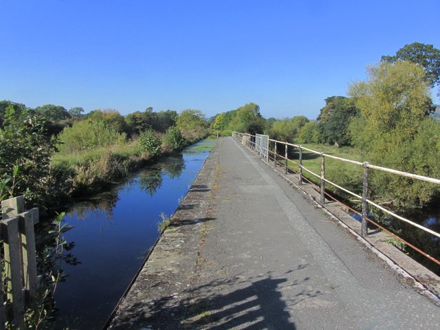
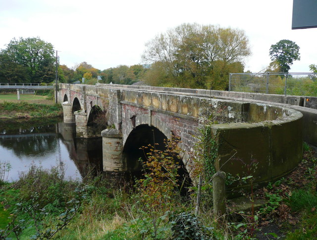
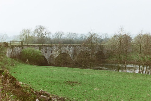
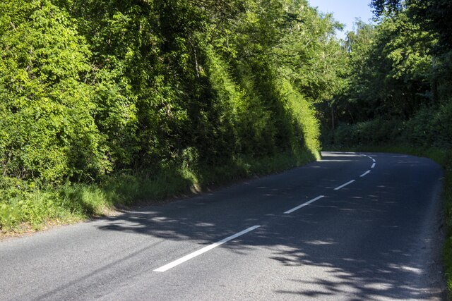
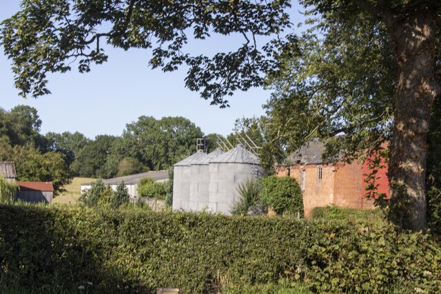
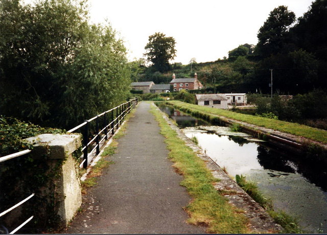
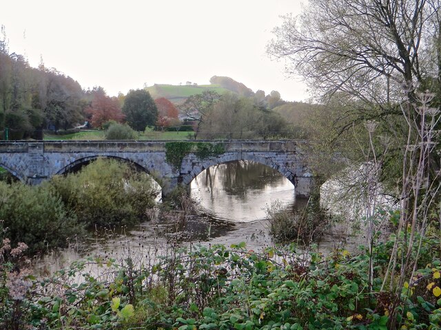
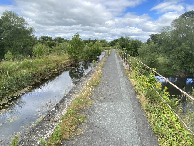
Careghofa is a small village located in the county of Montgomeryshire, Wales. Situated in the beautiful Welsh countryside, it is surrounded by rolling hills and picturesque landscapes. The village is nestled along the banks of the River Vrynwy, which adds to its scenic charm.

Despite its small size, Careghofa boasts a rich history that dates back centuries. The village is home to the historic Careghofa Castle, a medieval fortress that was once a stronghold of the local lords. Today, the castle ruins serve as a reminder of the area's past and attract visitors interested in exploring its history.

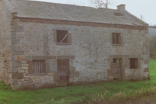
The village itself is characterized by its quaint and peaceful atmosphere. It has a close-knit community, and residents often engage in various social activities and events, such as local festivals and gatherings. The village also has a primary school, a church, and a few local businesses that serve the needs of the community.

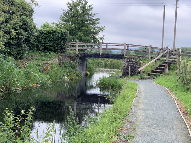
Nature enthusiasts will find plenty to enjoy in Careghofa and its surrounding areas. The village is located near the stunning Berwyn Mountains, providing ample opportunities for hiking, cycling, and other outdoor activities. The River Vrynwy also offers fishing and boating activities for those seeking a more leisurely experience.

Overall, Careghofa is a charming village that offers a peaceful and scenic setting for its residents and visitors. Its rich history, natural beauty, and strong sense of community make it a delightful place to visit or call home.

If you have any feedback on the listing, please let us know in the comments section below.

Careghofa Images

Images are sourced within 2km of 52.781349/-3.1133789 or Grid Reference SJ2521. Thanks to Geograph Open Source API. All images are credited.

Shropshire Union Canal (Montgomery Branch) at the Vyrnwy Aqueduct
New Bridge over the River Vyrnwy This carries the B4398, which goes to the A483 at Llanymynech.
New Bridge over the River Vyrnwy
This carries the B4398, which goes to the A483 at Llanymynech.
The Old Salt Warehouse, Pentreheylin, 1988 A look at Google Street View in 2018 shows that the building has since been restored into a private house. Not only was the building made habitable again, but the crane at the right-hand side of the building was also restored.
The Old Salt Warehouse, Pentreheylin, 1988
A look at Google Street View in 2018 shows that the building has since been restored into a private house. Not only was the building made habitable again, but the crane at the right-hand side of the building was also restored.
Vyrnwy Aqueduct, 1988
Old Milepost by the B4393, Waen Turner Arrow Casting by the B4393, in parish of Llansantffraidd-ym-Mechain (Powys District), Waen, by bungalow "Wind Chimes", on verge.

Inscription reads:-
: LLANFYLLIN / 7 - M / {arrow} : : SHREWSBURY / {arrow} / 18 - M : : OSWESTRY / 8 - M / {arrow} :

Grade II listed by Cadw. Reference Number: 82555
<span class="nowrap"><a title="https://cadwpublic-api.azurewebsites.net/reports/listedbuilding/FullReport?lang=&id=82555" rel="nofollow ugc noopener" href="https://cadwpublic-api.azurewebsites.net/reports/listedbuilding/FullReport?lang=&id=82555">Link</a><img style="margin-left:2px;" alt="External link" title="External link - shift click to open in new window" src="https://s1.geograph.org.uk/img/external.png" width="10" height="10"/></span>

Surveyed

Milestone Society National ID: MOT_LFOW07.
Old Milepost by the B4393, Waen
Turner Arrow Casting by the B4393, in parish of Llansantffraidd-ym-Mechain (Powys District), Waen, by bungalow "Wind Chimes", on verge. Inscription reads:- : LLANFYLLIN / 7 - M / {arrow} : : SHREWSBURY / {arrow} / 18 - M : : OSWESTRY / 8 - M / {arrow} : Grade II listed by Cadw. Reference Number: 82555 LinkExternal link Surveyed Milestone Society National ID: MOT_LFOW07.
Canal milemarker by the Montgomery Canal, Vyrnwy Viaduct Replica Milemarker by the Montgomery Canal, in parish of Carreghofa (Powys District), near the  Vyrnwy Aqueduct.

Inscription reads:
: NEWTOWN / 23 / MILES : : MONTGOMERY / CANAL : : WELSH / FRANKTON / 12 MILES :
Sponsor:-
: MWRT / 1984 :
(Montgomery Waterway Restoration Trust)

Milestone Society National ID: MGY-12R
Canal milemarker by the Montgomery Canal, Vyrnwy Viaduct
Replica Milemarker by the Montgomery Canal, in parish of Carreghofa (Powys District), near the Vyrnwy Aqueduct. Inscription reads: : NEWTOWN / 23 / MILES : : MONTGOMERY / CANAL : : WELSH / FRANKTON / 12 MILES : Sponsor:- : MWRT / 1984 : (Montgomery Waterway Restoration Trust) Milestone Society National ID: MGY-12R
Canal bridge at Pentreheylin Carrying a minor road over the Montgomery Canal. The towpath here is used by Offa's Dyke Path.
Canal bridge at Pentreheylin
Carrying a minor road over the Montgomery Canal. The towpath here is used by Offa's Dyke Path.
Road B4393 Woodland next to B4393
Road B4393
Woodland next to B4393
Waen Farm Modern and vernacular farm buildings at Waen farm
Waen Farm
Modern and vernacular farm buildings at Waen farm
Vyrnwy road bridge Bridge over the River Vyrnwy near Four Crosses
Vyrnwy road bridge
Bridge over the River Vyrnwy near Four Crosses
Pont Ddwr / Aqueduct Llwybr Clawdd Offa yn croesi pont ddwr y gamlas a rychwanta Afon Efyrnwy.

The Offa's Dyke Path following the canal over the aqueduct which spans the Vyrnwy River < Efyrnwy.
Pont Ddwr / Aqueduct
Llwybr Clawdd Offa yn croesi pont ddwr y gamlas a rychwanta Afon Efyrnwy. The Offa's Dyke Path following the canal over the aqueduct which spans the Vyrnwy River < Efyrnwy.
Vyrnwy road bridge A view to the B4398 crossing of the Afon Vyrnwy, taken from the aqueduct of the Montgomery Canal.
Vyrnwy road bridge
A view to the B4398 crossing of the Afon Vyrnwy, taken from the aqueduct of the Montgomery Canal.
Ordnance Survey Cut Mark This OS cut mark can be found on the west parapet of the bridge. It marks a point 69.770m above mean sea level.
Ordnance Survey Cut Mark
This OS cut mark can be found on the west parapet of the bridge. It marks a point 69.770m above mean sea level.
Canal aqueduct Carrying the Montgomery Canal over the River Vyrnwy.
Canal aqueduct
Carrying the Montgomery Canal over the River Vyrnwy.
Aqueduct crossing the River Vyrnwy The aqueduct carrying the Montgomery Canal over the River Vyrnwy.  Here the canal is also the route of Offa&amp;#039;s Dyke Path.
Aqueduct crossing the River Vyrnwy
The aqueduct carrying the Montgomery Canal over the River Vyrnwy. Here the canal is also the route of Offa's Dyke Path.
The New Vyrnwy Bridge The New Vyrnwy Bridge carrying the B4398 over the River Vyrnwy.
The New Vyrnwy Bridge
The New Vyrnwy Bridge carrying the B4398 over the River Vyrnwy.
Mile Marker, Montgomery Canal  Llandysilio Montgomery Waterway Restoration Trust replica Milemarker in parish of Carreghofa,
near the Vyrnwy Aqueduct across the River Vyrnwy.
See older image &lt;a href=&quot;https://www.geograph.org.uk/photo/6126453&quot;&gt;SJ2519 : Canal milemarker by the Montgomery Canal, Vyrnwy Viaduct&lt;/a&gt;


Inscription: NEWTOWN / 23 / MILES // MONTGOMERY / CANAL // WELSH / FRANKTON / 12 MILES // MWRT / 1984 :

Milestone Society National ID: MGY-12R
Mile Marker, Montgomery Canal Llandysilio
Montgomery Waterway Restoration Trust replica Milemarker in parish of Carreghofa, near the Vyrnwy Aqueduct across the River Vyrnwy. See older image SJ2519 : Canal milemarker by the Montgomery Canal, Vyrnwy Viaduct Inscription: NEWTOWN / 23 / MILES // MONTGOMERY / CANAL // WELSH / FRANKTON / 12 MILES // MWRT / 1984 : Milestone Society National ID: MGY-12R
Llanymynech entrance sign
Show me another place!

Careghofa is located at Grid Ref: SJ2521 (Lat: 52.781349, Lng: -3.1133789)

Unitary Authority: Powys

Police Authority: Dyfed Powys

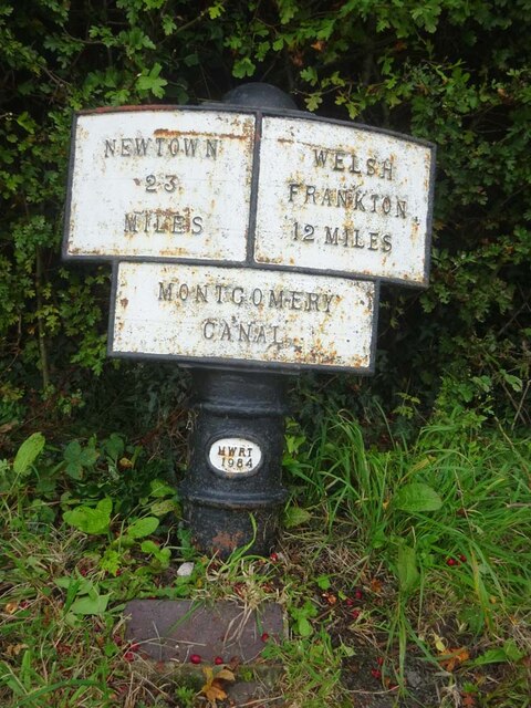
Also known as: Carreghwfa

What 3 Words

///makeovers.opposite.graver. Near Pant, Shropshire

Nearby Locations

Carreghwfa Careghofa

Related Wikis

Afon Tanat

Afon Tanat is a river in northern Powys, Wales. Its source is close to the Cyrniau Nod mountain, to the north of Lake Vyrnwy. The river flows in a generally...

Carreghofa

Carreghofa (Welsh: Carreghwfa) is a community in Montgomeryshire, Powys, Wales, and is 89.6 miles (144.2 km) from Cardiff and 153.6 miles (247.2 km) from...

Carreghofa Halt railway station

Carreghofa Halt railway station is a disused station in Carreghofa, Powys, Wales. The station opened in 1938 and closed in 1965. == References == ��2...

Carreghofa Castle

Carreghofa Castle (Welsh: Castell Carreghwfa) was a Norman timber and masonry castle located in the Welsh village of Carreghofa, Powys. Between its construction...

Nearby Amenities

Located within 500m of 52.781349,-3.1133789
The data included in this document is from www.openstreetmap.org. The data is made available under ODbL.

Have you been to Careghofa?

Leave your review of Careghofa below (or comments, questions and feedback).