Boggrie Moss

Wood, Forest in Kirkcudbrightshire

Scotland

Boggrie Moss

Forestry road near Loch Skerrow
Forestry road near Loch Skerrow Credit: Steven Brown

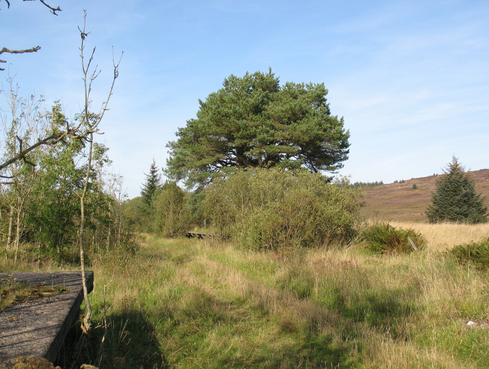
Boggrie Moss is a notable wood located in Kirkcudbrightshire, Scotland. Situated near the village of Balmaclellan, it covers an area of approximately 100 acres. The wood is part of a larger forested area, creating a stunning natural landscape that attracts visitors from near and far.

Boggrie Moss is characterized by its diverse flora and fauna, making it a significant habitat for various wildlife species. The wood is home to numerous native trees, including oak, birch, and rowan, which create a dense canopy, providing shelter and food for a range of bird species such as woodpeckers, owls, and warblers. The forest floor is adorned with a carpet of mosses, ferns, and wildflowers, adding to the area's enchanting beauty.

The wood offers several walking trails, making it a popular destination for nature enthusiasts and hikers. These trails wind through the towering trees, offering glimpses of picturesque streams and small ponds that are abundant with aquatic life. Visitors can also explore the wood's diverse ecosystem, which includes wetland areas and heathland.

Boggrie Moss is not only a haven for wildlife but also a place of tranquility and natural beauty. Its peaceful atmosphere and breathtaking scenery make it an ideal spot for relaxation and reflection. The wood provides a respite from the hustle and bustle of daily life, allowing visitors to immerse themselves in the serenity of nature.

Overall, Boggrie Moss in Kirkcudbrightshire offers a unique and captivating woodland experience, inviting individuals to explore its enchanting trails, marvel at its diverse wildlife, and appreciate the wonders of nature.

If you have any feedback on the listing, please let us know in the comments section below.

Boggrie Moss Images

Images are sourced within 2km of 54.964485/-4.2151162 or Grid Reference NX5865. Thanks to Geograph Open Source API. All images are credited.

Forestry road near Loch Skerrow
Clearing, Cullendoch View from the railway trackbed where there is a break in the conifers.
Clearing, Cullendoch
View from the railway trackbed where there is a break in the conifers.
Portpatrick and Wigtownshire  Railway trackbed Now used as the main timber haul road out of the Big Water of Fleet area, timber traffic uses the line until just east of the site of the Little Water of Fleet viaduct where it heads south.
Portpatrick and Wigtownshire Railway trackbed
Now used as the main timber haul road out of the Big Water of Fleet area, timber traffic uses the line until just east of the site of the Little Water of Fleet viaduct where it heads south.
Replanted block South of the railway trackbed/forest road.
Replanted block
South of the railway trackbed/forest road.
Log stack Timber is being stacked on the old road that runs parallel to the railway (much of this mapped track has now gone). There was felling in progress some distance away down the Little Water of Fleet.
Log stack
Timber is being stacked on the old road that runs parallel to the railway (much of this mapped track has now gone). There was felling in progress some distance away down the Little Water of Fleet.
Portpatrick and Wigtownshire  Railway trackbed Now used as the main timber extraction route for the Waters of Fleet area.
Portpatrick and Wigtownshire Railway trackbed
Now used as the main timber extraction route for the Waters of Fleet area.
Unplanted strip A break from the trees between a disused track and the main logging road on the railway trackbed.
Unplanted strip
A break from the trees between a disused track and the main logging road on the railway trackbed.
Portpatrick and Wigtownshire  Railway trackbed Now used as the main timber extraction route for the Waters of Fleet area.
Portpatrick and Wigtownshire Railway trackbed
Now used as the main timber extraction route for the Waters of Fleet area.
Demolished bridge, Portpatrick and Wigtownshire Railway The trackbed is now the main southbound timber haul road from the forest.
Demolished bridge, Portpatrick and Wigtownshire Railway
The trackbed is now the main southbound timber haul road from the forest.
Little Water of Fleet Upstream of the road and viaduct site.
Little Water of Fleet
Upstream of the road and viaduct site.
Little Water of Fleet Downstream view towards the site of the viaduct.
Little Water of Fleet
Downstream view towards the site of the viaduct.
Logging road, Darncree At the crossing of the Little Water of Fleet. The outbound timber haul road has now left the railway trackbed (the Little Water of Fleet Viaduct has been demolished) and will head southwards.
Logging road, Darncree
At the crossing of the Little Water of Fleet. The outbound timber haul road has now left the railway trackbed (the Little Water of Fleet Viaduct has been demolished) and will head southwards.
Little Water of Fleet embankment The western approach to the Little Water of Fleet Viaduct, which was demolished in the 1980s.
Little Water of Fleet embankment
The western approach to the Little Water of Fleet Viaduct, which was demolished in the 1980s.
"Paddy Line" bridge View from the logging road which has taken a different route due to the demolition of the viaduct over the Little Water of Fleet - not that the shoogly Fleet viaducts were ever suitable for that purpose. The railway was closed in 1965.

An older photograph:<a href="https://www.geograph.org.uk/photo/512381">NX5967 : "Paddy Line" bridge.</a>
"Paddy Line" bridge
View from the logging road which has taken a different route due to the demolition of the viaduct over the Little Water of Fleet - not that the shoogly Fleet viaducts were ever suitable for that purpose. The railway was closed in 1965. An older photograph:NX5967 : "Paddy Line" bridge.
Unplanted strip Between a track and the remains of the railway. Typical Galloway tussocks, a glimpse of what it was like before the conifer plantations.
Unplanted strip
Between a track and the remains of the railway. Typical Galloway tussocks, a glimpse of what it was like before the conifer plantations.
Portpatrick and Wigtownshire  Railway trackbed From here to the Airie woodlands the railway trackbed has not been upgraded to a road. It is promoted as a through route between Gatehouse Station and Mossford and from here on eastwards it is a delight.  The white things are closure signs, left from Autumn 2019. Unfortunately there were closure signs nearer Mossford, too late for another route.  Due to forestry work, its best to do the railway at the weekend.
Portpatrick and Wigtownshire Railway trackbed
From here to the Airie woodlands the railway trackbed has not been upgraded to a road. It is promoted as a through route between Gatehouse Station and Mossford and from here on eastwards it is a delight. The white things are closure signs, left from Autumn 2019. Unfortunately there were closure signs nearer Mossford, too late for another route. Due to forestry work, its best to do the railway at the weekend.
Logging road The main road out of the forest has left the railway and is now heading south.
Logging road
The main road out of the forest has left the railway and is now heading south.
Portpatrick and Wigtownshire  Railway trackbed This is a very pleasant stretch of track which has not been turned into a logging road. There is a real feel of remoteness along here.  It is a promoted path, but there will almost certainly be forestry work taking place somewhere along the way with the inevitable keep out signs. Best done on a weekend.
Portpatrick and Wigtownshire Railway trackbed
This is a very pleasant stretch of track which has not been turned into a logging road. There is a real feel of remoteness along here. It is a promoted path, but there will almost certainly be forestry work taking place somewhere along the way with the inevitable keep out signs. Best done on a weekend.
Show me another place!

Boggrie Moss is located at Grid Ref: NX5865 (Lat: 54.964485, Lng: -4.2151162)

Unitary Authority: Dumfries and Galloway

Police Authority: Dumfries and Galloway

What 3 Words

///rebounds.trembles.ample. Near Newton Stewart, Dumfries & Galloway

Nearby Locations

Boggrie Moss

Related Wikis

Skerrow

Skerrow was a burgh in Dumfries and Galloway, Scotland. Loch Skerrow Halt railway station, on the Portpatrick and Wigtownshire Joint Railway, served Skerrow...

Loch Skerrow Halt railway station

Loch Skerrow Halt railway station served the burgh of Skerrow, Dumfries and Galloway, Scotland on the Portpatrick and Wigtownshire Joint Railway. ��2...

Gatehouse of Fleet railway station

Gatehouse of Fleet railway station served the town of Gatehouse of Fleet, Dumfries and Galloway, Scotland from 1861 to 1965 on the Portpatrick and Wigtownshire...
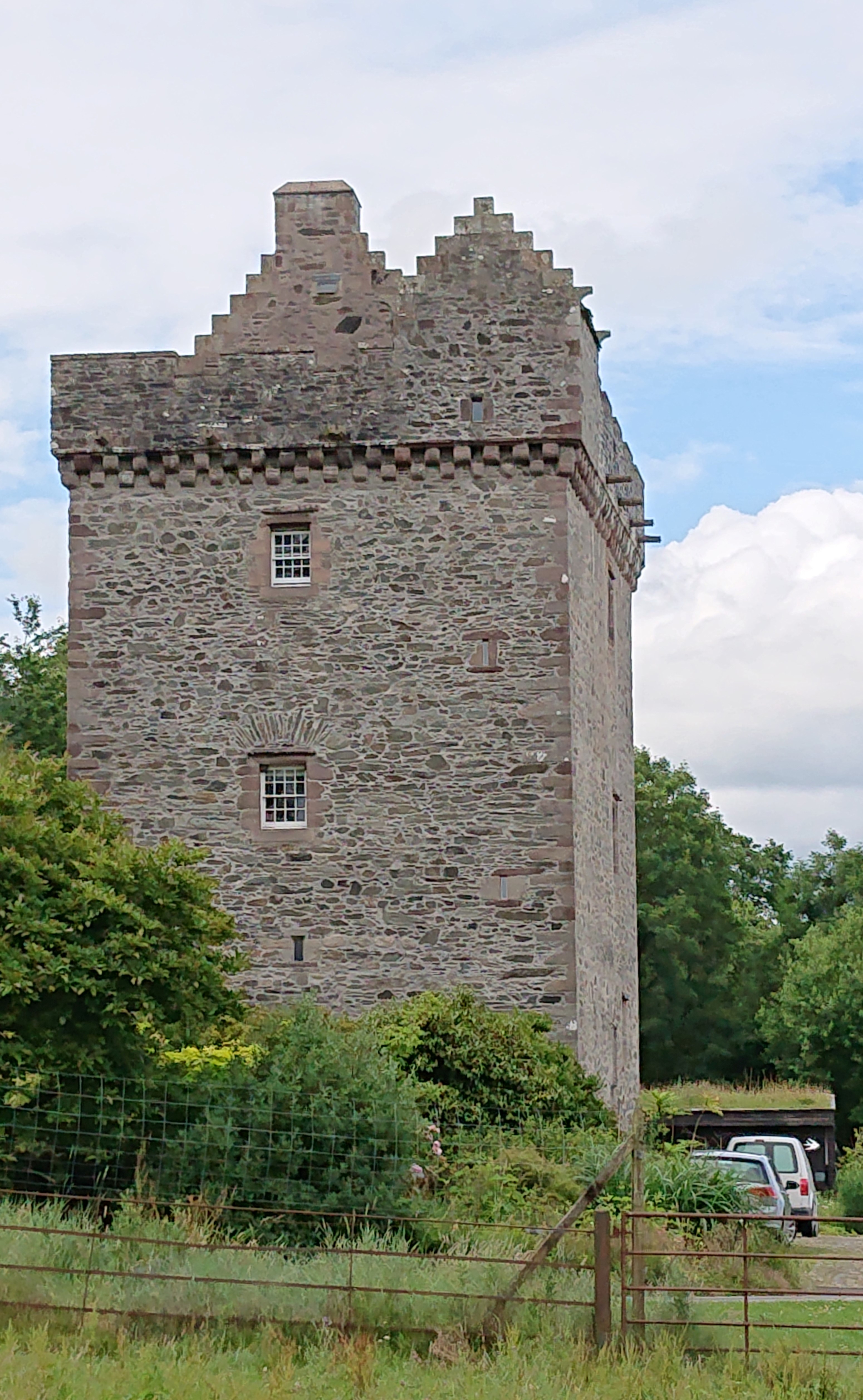
Rusco Tower

Rusco Tower, sometimes called Rusco Castle, is a tower house near Gatehouse of Fleet in Dumfries and Galloway, Scotland. Built around 1500 for Mariota...

Have you been to Boggrie Moss?

Leave your review of Boggrie Moss below (or comments, questions and feedback).