Floors Wood

Wood, Forest in Renfrewshire

Scotland

Floors Wood

West Titwood Near Newton Mearns.
West Titwood Credit: Stephen Sweeney

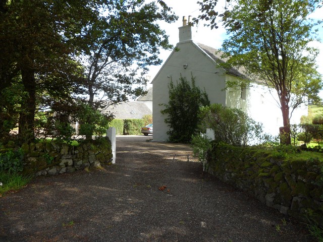
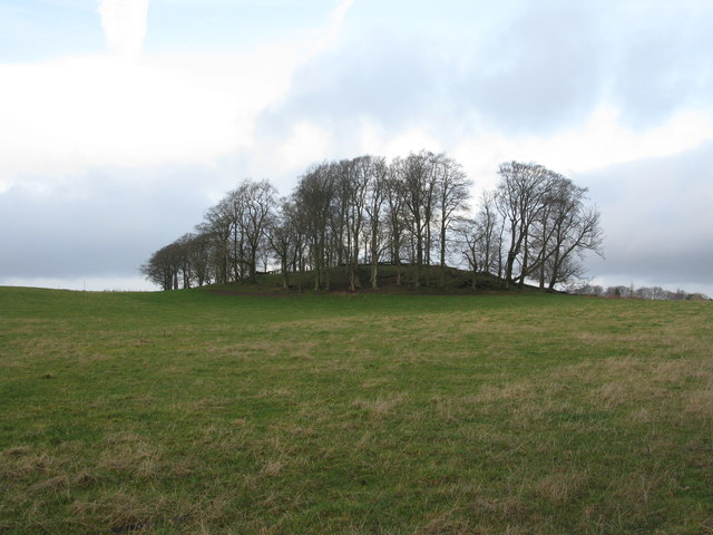
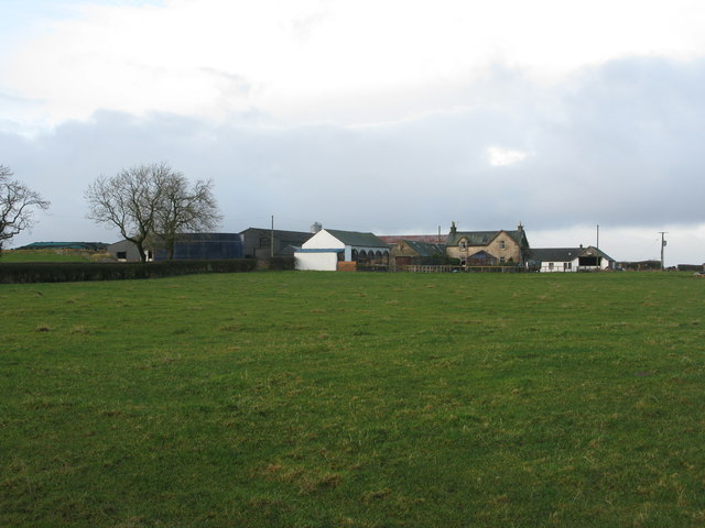
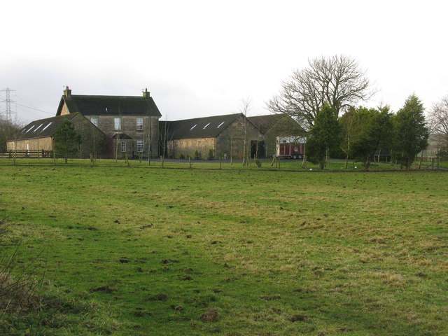
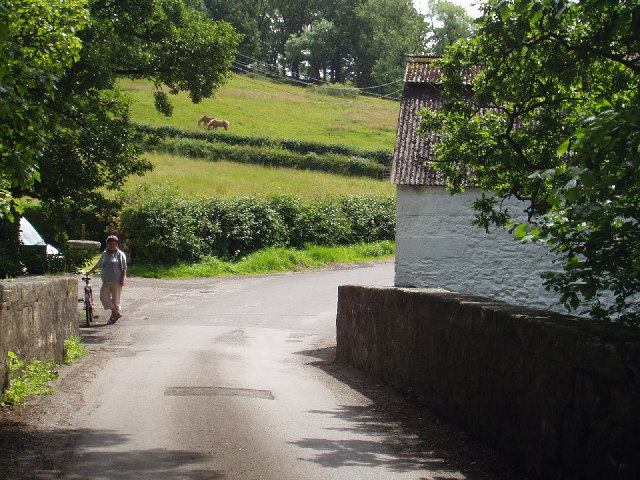
Floors Wood is a picturesque forest located in Renfrewshire, Scotland. Covering an area of approximately 100 hectares, it is a popular destination for nature lovers and outdoor enthusiasts. The wood is situated near the town of Bridge of Weir, offering easy accessibility to visitors.

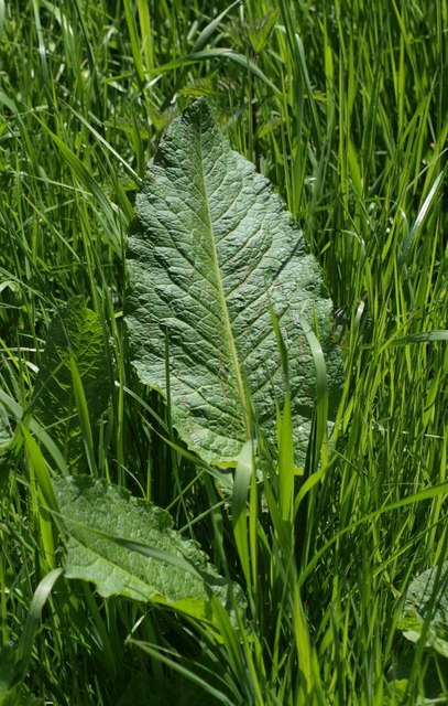
The forest is predominantly composed of native broadleaf trees, such as oak, birch, and beech, which create a diverse and vibrant canopy. The woodland floor is adorned with a rich variety of flora, including bluebells, primroses, and wild garlic, providing a colorful and fragrant experience during springtime.

Floors Wood offers various walking trails, providing visitors with the opportunity to explore the forest at their own pace. The paths are well-maintained and clearly signposted, ensuring a safe and enjoyable experience for all. The forest is home to an abundance of wildlife, including deer, squirrels, and a wide variety of bird species. Birdwatchers can spot species such as woodpeckers, owls, and thrushes throughout the year.

In addition to its natural beauty, Floors Wood also offers recreational facilities, including picnic areas, making it an ideal spot for family outings or a peaceful lunch amid nature. The forest is also a popular destination for photography enthusiasts, as it provides stunning backdrops for capturing the beauty of the woodland.

With its tranquil atmosphere, diverse wildlife, and scenic trails, Floors Wood is a must-visit destination for anyone seeking a peaceful escape into nature in Renfrewshire.

If you have any feedback on the listing, please let us know in the comments section below.

Floors Wood Images

Images are sourced within 2km of 55.756971/-4.2974891 or Grid Reference NS5553. Thanks to Geograph Open Source API. All images are credited.

West Titwood Near Newton Mearns.
West Titwood
Near Newton Mearns.
Waterfoot Bridge Narrow road bridge carrying the minor road to Thorntonhall across the White Cart Water.
Waterfoot Bridge
Narrow road bridge carrying the minor road to Thorntonhall across the White Cart Water.
Crossroads in Waterfoot Looking along the B767 in the direction of Busby at the intersection with Waterfoot Road.
Crossroads in Waterfoot
Looking along the B767 in the direction of Busby at the intersection with Waterfoot Road.
Mearns Castle High School Mearns Castle High School is a secondary school situated on Waterfoot Road in Newton Mearns.
Mearns Castle High School
Mearns Castle High School is a secondary school situated on Waterfoot Road in Newton Mearns.
Mearns Castle Trig Point The trig point is situated beside Mearns Castle High School and from here there is a good view over Newton Mearns towards the Campsie Fells in the distance.
Mearns Castle Trig Point
The trig point is situated beside Mearns Castle High School and from here there is a good view over Newton Mearns towards the Campsie Fells in the distance.
Belle Craig Roundabout The intersection of the A726, East Kilbride to Kimarnock road, and the B767, Eaglesham to Busby road, from which the photograph is taken.
Belle Craig Roundabout
The intersection of the A726, East Kilbride to Kimarnock road, and the B767, Eaglesham to Busby road, from which the photograph is taken.
Small copse of trees at Waterfoot At the corner of Glasgow Road (B767) and Floors Road (a minor road).
Small copse of trees at Waterfoot
At the corner of Glasgow Road (B767) and Floors Road (a minor road).
Floors Farm South of Newton Mearns and just north of the minor road Floors Road.
Floors Farm
South of Newton Mearns and just north of the minor road Floors Road.
Bonnyton Farm On Bonnyton Moor Road just south of the A726.
Bonnyton Farm
On Bonnyton Moor Road just south of the A726.
Burn on Bonnyton Golf Course Also 4 bridges across the burn.
Burn on Bonnyton Golf Course
Also 4 bridges across the burn.
Bonnyton Golf Course - Hole 1 (Moor Yett) Looking up the 375 yard par 4 Hole 1 from the tee. The tee shot has to be played over a small ornamental loch.
Bonnyton Golf Course - Hole 1 (Moor Yett)
Looking up the 375 yard par 4 Hole 1 from the tee. The tee shot has to be played over a small ornamental loch.
Road Bridge over the Borland Burn On Humbie Road just outside Eaglesham.
Road Bridge over the Borland Burn
On Humbie Road just outside Eaglesham.
Entrance to Castlehill Farm On Humbie Road near Eaglesham.
Entrance to Castlehill Farm
On Humbie Road near Eaglesham.
Farm track The track starts from a sharp bend on the public road. It is bordered by a hedgerow and a sparse row of trees.
Farm track
The track starts from a sharp bend on the public road. It is bordered by a hedgerow and a sparse row of trees.
Small wood and minor road The small wood sits beside the minor road, just across the fields to the east of Waterfoot.
Small wood and minor road
The small wood sits beside the minor road, just across the fields to the east of Waterfoot.
Dock leaf Rubbing the leaf or juicy stem of a dock on a nettle sting soothes the pain. They were called "docken" when I was wee. I haven't discussed them with anybody for a long time but I expect this is still the case in rural Scotland at least.
Dock leaf
Rubbing the leaf or juicy stem of a dock on a nettle sting soothes the pain. They were called "docken" when I was wee. I haven't discussed them with anybody for a long time but I expect this is still the case in rural Scotland at least.
Dead tree by minor road The farming land around Eaglesham lies a few hundred feet above sea level, enough to offer vistas north across Glasgow to the Campsies and beyond.
Dead tree by minor road
The farming land around Eaglesham lies a few hundred feet above sea level, enough to offer vistas north across Glasgow to the Campsies and beyond.
Entrance to Eaglesham
Show me another place!

Floors Wood is located at Grid Ref: NS5553 (Lat: 55.756971, Lng: -4.2974891)

Unitary Authority: East Renfrewshire

Police Authority: Greater Glasgow

What 3 Words

///sparks.strike.pays. Near Waterfoot, East Renfrewshire

Related Wikis

Waterfoot, East Renfrewshire

Waterfoot (Scots: Watterfit) is a village in East Renfrewshire, Scotland. It is on the B767 road between Clarkston and Eaglesham, which are 1 mile (1.6...

A726 road

The A726 road in Scotland is a major route with several distinct sections with different characteristics and names; owing to its stages of construction...

Mearns Castle

Mearns Castle is a 15th-century tower house in Newton Mearns, East Renfrewshire, south of Glasgow, Scotland. It is a Category A listed building. The castle...

Mearns Castle High School

Mearns Castle High School is a secondary school situated on Waterfoot Road in Newton Mearns, East Renfrewshire, Scotland roughly seven miles from Glasgow...

Eaglesham

Eaglesham ( EE-gəl-səm) is a village in East Renfrewshire, Scotland, situated about 10 miles (16 km) south of Glasgow, 3 miles (5 km) southeast of Newton...

Williamwood High School

Williamwood High School is a non-denominational comprehensive secondary school in Clarkston, East Renfrewshire, Scotland, with a roll of around 1700 pupils...

Glasgow Reform Synagogue

Glasgow Reform Synagogue is a synagogue in Newton Mearns, East Renfrewshire, Scotland. It is a member of the Movement for Reform Judaism and is the only...

Newton Mearns

Newton Mearns (Scots: The Mearns; Scottish Gaelic: Baile Ùr na Maoirne [ˈpalə ˈuːɾ nə ˈmɯːrˠɲə]) is a suburban town and the largest settlement in East...

Nearby Amenities

Located within 500m of 55.756971,-4.2974891
Power: tower
Lat/Long: 55.7531518/-4.2977246
Power: tower
Lat/Long: 55.7537062/-4.292158
Power: pole
Lat/Long: 55.7533377/-4.3016156
Power: pole
Lat/Long: 55.753754/-4.3005321
Power: pole
Lat/Long: 55.7593093/-4.2985817
Power: pole
Lat/Long: 55.759729/-4.2986109
Power: pole
Lat/Long: 55.7605063/-4.2986797
Power: pole
Lat/Long: 55.7611359/-4.2986318
Power: pole
Lat/Long: 55.7603879/-4.2975378
Power: pole
Lat/Long: 55.7598322/-4.2964772
Power: pole
Lat/Long: 55.7593703/-4.2955146
Power: pole
Lat/Long: 55.7588767/-4.2945269
Power: pole
Lat/Long: 55.7582166/-4.2936184
Power: pole
Lat/Long: 55.7575811/-4.2927516
Power: pole
Lat/Long: 55.7569538/-4.291891
The data included in this document is from www.openstreetmap.org. The data is made available under ODbL.

Have you been to Floors Wood?

Leave your review of Floors Wood below (or comments, questions and feedback).