Castlehill Wood

Wood, Forest in Renfrewshire

Scotland

Castlehill Wood

National Trust for Scotland small houses restoration plaque A cottage <a title="https://www.geograph.org.uk/photo/1871213" href="https://www.geograph.org.uk/photo/1871213">Link</a> in Polnoon Street was one of the first houses to be restored in Eaglesham.  A plaque indicates that this single-storey cottage was restored in association with the National Trust for Scotland.
National Trust for Scotland small houses restoration plaque Credit: Kenneth Mallard

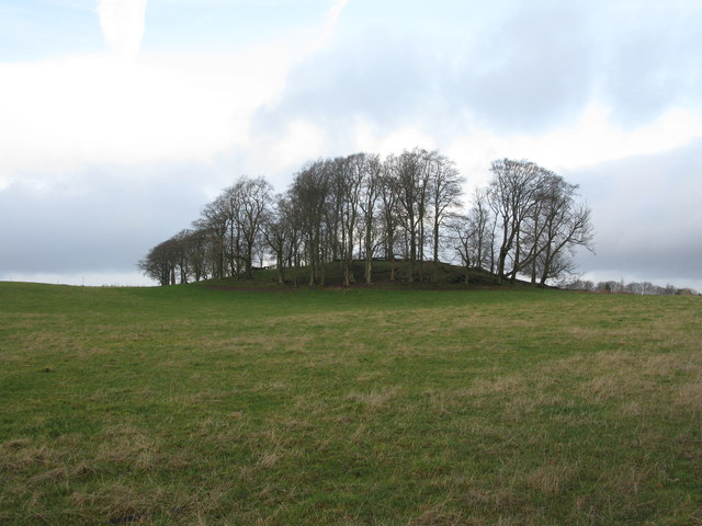
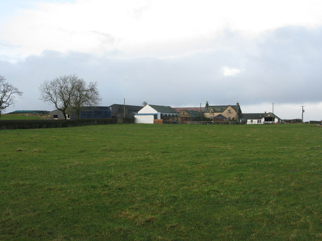
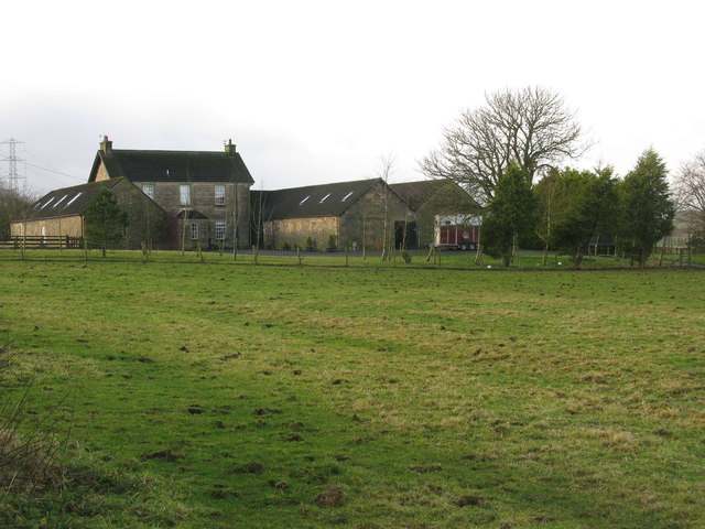
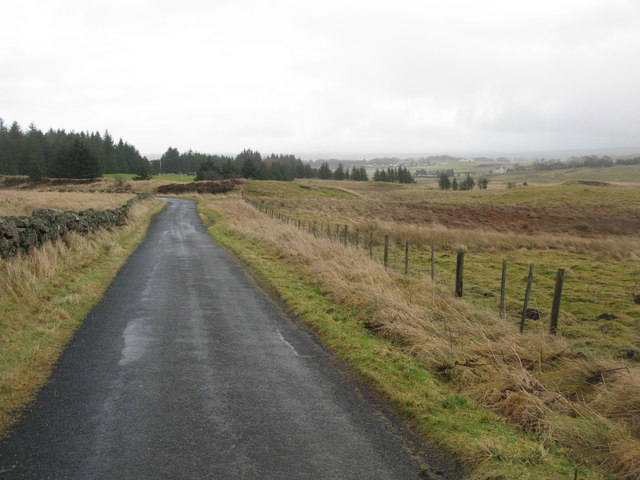
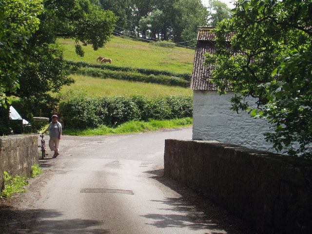
Castlehill Wood is a 22-acre woodland located in Renfrewshire, Scotland. Situated on the outskirts of the town of Paisley, it offers a tranquil retreat for nature lovers and outdoor enthusiasts alike. The wood is easily accessible, with a network of well-maintained paths that wind through the forest, providing visitors with the opportunity to explore its diverse flora and fauna.

The wood is a mixture of ancient and young trees, creating a rich and varied habitat for wildlife. Oak, birch, and beech trees dominate the landscape, interspersed with pockets of coniferous trees. This variety of tree species attracts a wide range of birdlife, including woodpeckers, owls, and various songbirds.

Visitors to Castlehill Wood can expect to encounter a carpet of bluebells in the spring, creating a stunning display of color. In addition to its natural beauty, the wood also holds historical significance. The remains of an ancient motte-and-bailey castle can be found within its boundaries, dating back to the 12th century. This adds an element of intrigue and interest to the woodland, allowing visitors to delve into its past.

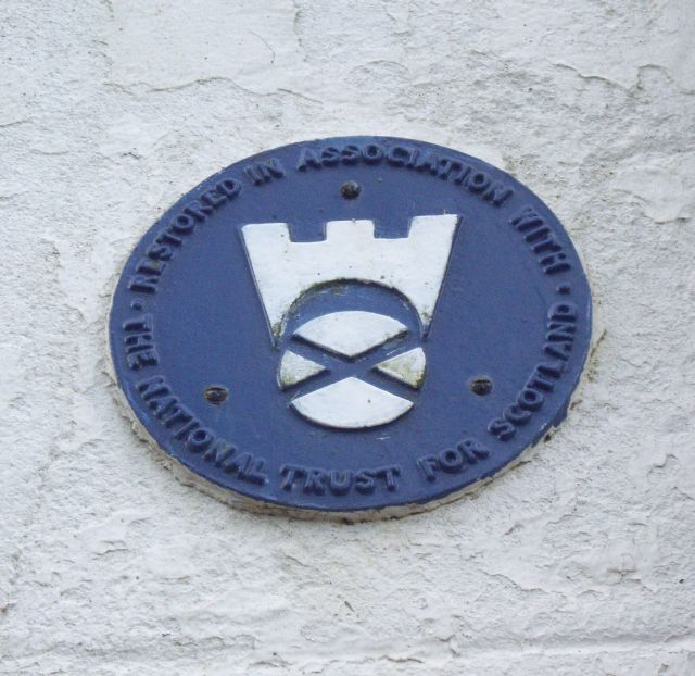
The wood is managed by the local council, ensuring its preservation and maintenance for future generations. Facilities such as benches, picnic areas, and information boards are provided, making it an ideal destination for families and individuals seeking a peaceful and educational day out. Castlehill Wood truly offers a slice of nature in the heart of Renfrewshire, providing a welcome escape from the hustle and bustle of urban life.

If you have any feedback on the listing, please let us know in the comments section below.

Castlehill Wood Images

Images are sourced within 2km of 55.749193/-4.3039634 or Grid Reference NS5553. Thanks to Geograph Open Source API. All images are credited.

National Trust for Scotland small houses restoration plaque A cottage <a title="https://www.geograph.org.uk/photo/1871213" href="https://www.geograph.org.uk/photo/1871213">Link</a> in Polnoon Street was one of the first houses to be restored in Eaglesham.  A plaque indicates that this single-storey cottage was restored in association with the National Trust for Scotland.
National Trust for Scotland small houses restoration plaque
A cottage Link in Polnoon Street was one of the first houses to be restored in Eaglesham. A plaque indicates that this single-storey cottage was restored in association with the National Trust for Scotland.
Coo Lane Coo Lane once led to the pastures behind Polnoon Street. The building in the foreground was once a United Presbyterian Church before the congregation moved to a new building in Montgomery Street. Click on these links to discover about the churches and Covenanters <a title="https://www.geograph.org.uk/photo/1424798" href="https://www.geograph.org.uk/photo/1424798">Link</a> <a title="https://www.geograph.org.uk/photo/1897780" href="https://www.geograph.org.uk/photo/1897780">Link</a> <a title="https://www.geograph.org.uk/photo/1432415" href="https://www.geograph.org.uk/photo/1432415">Link</a> <a title="https://www.geograph.org.uk/photo/2385555" href="https://www.geograph.org.uk/photo/2385555">Link</a> .
Coo Lane
Coo Lane once led to the pastures behind Polnoon Street. The building in the foreground was once a United Presbyterian Church before the congregation moved to a new building in Montgomery Street. Click on these links to discover about the churches and Covenanters Link Link Link Link .
Glendinning Place The Secession Church broke away from the established church in 1733 and established a church of the Burgher Faction, the Cameronian Church in Glendinning Place. Sometime after the church closed, the meeting house became the Old Concert Hall for a time before being converted to a private residence. Click on these links to discover about the churches and Covenanters <a title="https://www.geograph.org.uk/photo/1424798" href="https://www.geograph.org.uk/photo/1424798">Link</a> <a title="https://www.geograph.org.uk/photo/1897780" href="https://www.geograph.org.uk/photo/1897780">Link</a> <a title="https://www.geograph.org.uk/photo/1432415" href="https://www.geograph.org.uk/photo/1432415">Link</a> .
Glendinning Place
The Secession Church broke away from the established church in 1733 and established a church of the Burgher Faction, the Cameronian Church in Glendinning Place. Sometime after the church closed, the meeting house became the Old Concert Hall for a time before being converted to a private residence. Click on these links to discover about the churches and Covenanters Link Link Link .
West Titwood Near Newton Mearns.
West Titwood
Near Newton Mearns.
Masonic Lodge, Eaglesham, Scotland. Lodge Eaglesham No.1265, Eaglesham, Scotland.
Masonic Lodge, Eaglesham, Scotland.
Lodge Eaglesham No.1265, Eaglesham, Scotland.
Polnoon Street, Eaglesham Looking up Polnoon Street from Gilmour Street.
Polnoon Street, Eaglesham
Looking up Polnoon Street from Gilmour Street.
Belle Craig Roundabout The intersection of the A726, East Kilbride to Kimarnock road, and the B767, Eaglesham to Busby road, from which the photograph is taken.
Belle Craig Roundabout
The intersection of the A726, East Kilbride to Kimarnock road, and the B767, Eaglesham to Busby road, from which the photograph is taken.
Small copse of trees at Waterfoot At the corner of Glasgow Road (B767) and Floors Road (a minor road).
Small copse of trees at Waterfoot
At the corner of Glasgow Road (B767) and Floors Road (a minor road).
Floors Farm South of Newton Mearns and just north of the minor road Floors Road.
Floors Farm
South of Newton Mearns and just north of the minor road Floors Road.
Bonnyton Farm On Bonnyton Moor Road just south of the A726.
Bonnyton Farm
On Bonnyton Moor Road just south of the A726.
Kirkton Moor Road Heading towards Bonnyton Golf Course with the mist beginning to settle in on the Eaglesham Moors.
Kirkton Moor Road
Heading towards Bonnyton Golf Course with the mist beginning to settle in on the Eaglesham Moors.
Burn on Bonnyton Golf Course Also 4 bridges across the burn.
Burn on Bonnyton Golf Course
Also 4 bridges across the burn.
Bonnyton Golf Course - Hole 1 (Moor Yett) Looking up the 375 yard par 4 Hole 1 from the tee. The tee shot has to be played over a small ornamental loch.
Bonnyton Golf Course - Hole 1 (Moor Yett)
Looking up the 375 yard par 4 Hole 1 from the tee. The tee shot has to be played over a small ornamental loch.
North Kirktonmoor Farm West of Eaglesham on Kirkton Moor Road.
North Kirktonmoor Farm
West of Eaglesham on Kirkton Moor Road.
Mini-Roundabout at the southern end of Eaglesham Looking from Moor Road towards the junction with Polnoon Street (left) and Montgomery Street (right).
Mini-Roundabout at the southern end of Eaglesham
Looking from Moor Road towards the junction with Polnoon Street (left) and Montgomery Street (right).
Road Bridge over the Borland Burn On Humbie Road just outside Eaglesham.
Road Bridge over the Borland Burn
On Humbie Road just outside Eaglesham.
Entrance to Castlehill Farm On Humbie Road near Eaglesham.
Entrance to Castlehill Farm
On Humbie Road near Eaglesham.
Entrance to Eaglesham
Show me another place!

Castlehill Wood is located at Grid Ref: NS5553 (Lat: 55.749193, Lng: -4.3039634)

Unitary Authority: East Renfrewshire

Police Authority: Greater Glasgow

What 3 Words

///wisdom.waddle.mess. Near Eaglesham, East Renfrewshire

Related Wikis

A726 road

The A726 road in Scotland is a major route with several distinct sections with different characteristics and names; owing to its stages of construction...

Waterfoot, East Renfrewshire

Waterfoot (Scots: Watterfit) is a village in East Renfrewshire, Scotland. It is on the B767 road between Clarkston and Eaglesham, which are 1 mile (1.6...
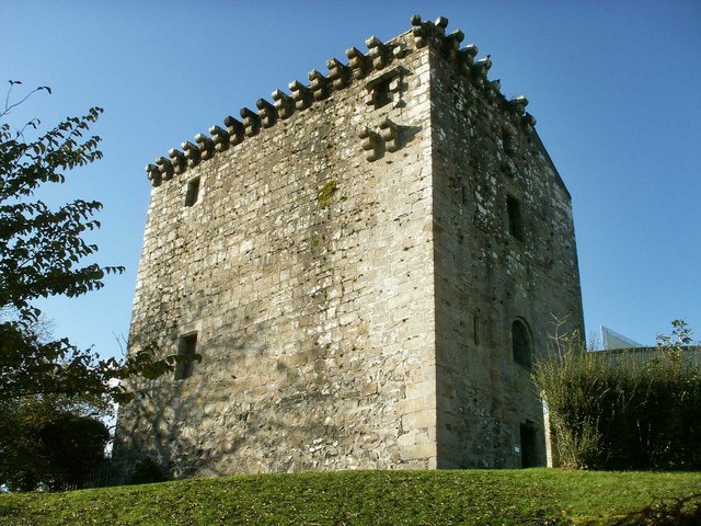
Mearns Castle

Mearns Castle is a 15th-century tower house in Newton Mearns, East Renfrewshire, south of Glasgow, Scotland. It is a Category A listed building. The castle...

Eaglesham

Eaglesham ( EE-gəl-səm) is a village in East Renfrewshire, Scotland, situated about 10 miles (16 km) south of Glasgow, 3 miles (5 km) southeast of Newton...

Mearns Castle High School

Mearns Castle High School is a secondary school situated on Waterfoot Road in Newton Mearns, East Renfrewshire, Scotland roughly seven miles from Glasgow...

Glasgow Reform Synagogue

Glasgow Reform Synagogue is a synagogue in Newton Mearns, East Renfrewshire, Scotland. It is a member of the Movement for Reform Judaism and is the only...

Newton Mearns

Newton Mearns (Scots: The Mearns; Scottish Gaelic: Baile Ùr na Maoirne [ˈpalə ˈuːɾ nə ˈmɯːrˠɲə]) is a suburban town and the largest settlement in East...

Williamwood High School

Williamwood High School is a non-denominational comprehensive secondary school in Clarkston, East Renfrewshire, Scotland, with a roll of around 1700 pupils...

Nearby Amenities

Located within 500m of 55.749193,-4.3039634
Power: tower
Lat/Long: 55.75227/-4.3063563
Power: tower
Lat/Long: 55.7526458/-4.3027747
Power: pole
Lat/Long: 55.7527021/-4.3045181
Power: pole
Lat/Long: 55.7529824/-4.3047974
Power: pole
Lat/Long: 55.753258/-4.305062
Power: pole
Lat/Long: 55.7535159/-4.3052745
Power: pole
Lat/Long: 55.7528112/-4.3036138
Power: pole
Lat/Long: 55.752912/-4.3027158
Power: pole
Lat/Long: 55.7533377/-4.3016156
The data included in this document is from www.openstreetmap.org. The data is made available under ODbL.

Have you been to Castlehill Wood?

Leave your review of Castlehill Wood below (or comments, questions and feedback).