Bible Wood

Wood, Forest in Ayrshire

Scotland

Bible Wood

Entrance to pasture above Barneight Burn
Entrance to pasture above Barneight Burn Credit: Alan Reid

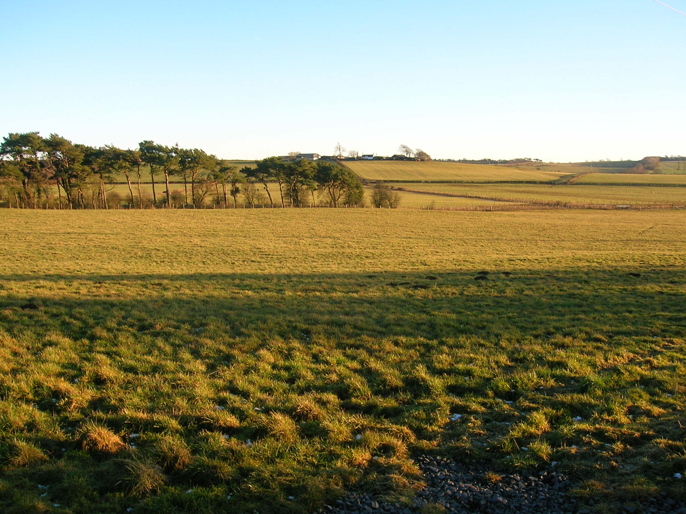
Bible Wood is a picturesque forest located in Ayrshire, Scotland. Covering an area of approximately 100 hectares, it is a popular destination for nature enthusiasts and hikers alike. The wood is situated near the village of Straiton, known for its natural beauty and historical significance.

The name "Bible Wood" is believed to have originated from the presence of a small stone cross within the forest, which was often used as a place of worship in the past. This cross, along with a nearby well, became important pilgrimage sites, attracting visitors from far and wide.

The wood is predominantly composed of native tree species, including oak, birch, and beech, which create a diverse and vibrant ecosystem. The dense foliage provides a habitat for numerous bird species, such as woodpeckers, owls, and various songbirds. Additionally, the forest is home to an array of wildlife, including deer, foxes, and squirrels.

Several well-marked trails wind through Bible Wood, offering visitors the opportunity to explore the enchanting surroundings. These paths vary in length and difficulty, ensuring there is something suitable for all ages and fitness levels. Along the trails, visitors can enjoy breathtaking views of the surrounding countryside, as well as discover hidden gems like small streams and waterfalls.

Bible Wood is not only a haven for nature lovers but also a place of tranquility and reflection. Its historical significance, natural beauty, and diverse wildlife make it a must-visit destination for those seeking a peaceful escape in the heart of Ayrshire.

If you have any feedback on the listing, please let us know in the comments section below.
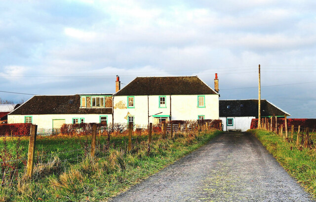
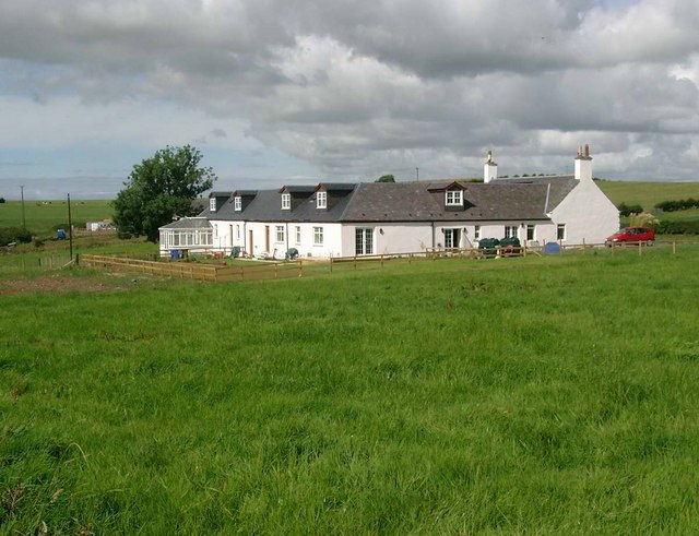
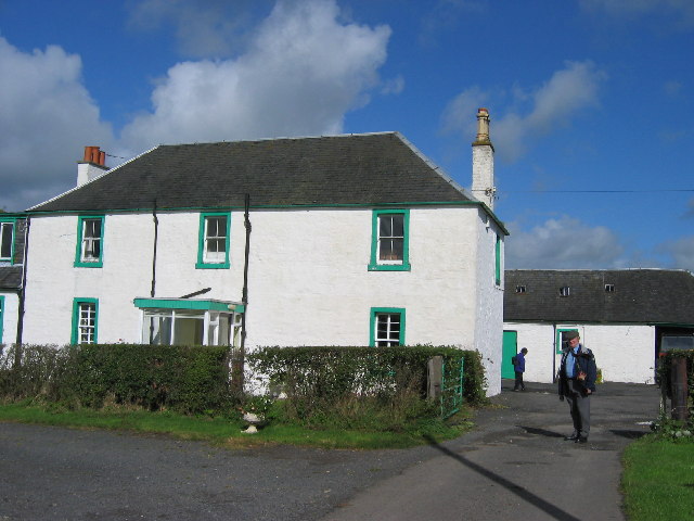
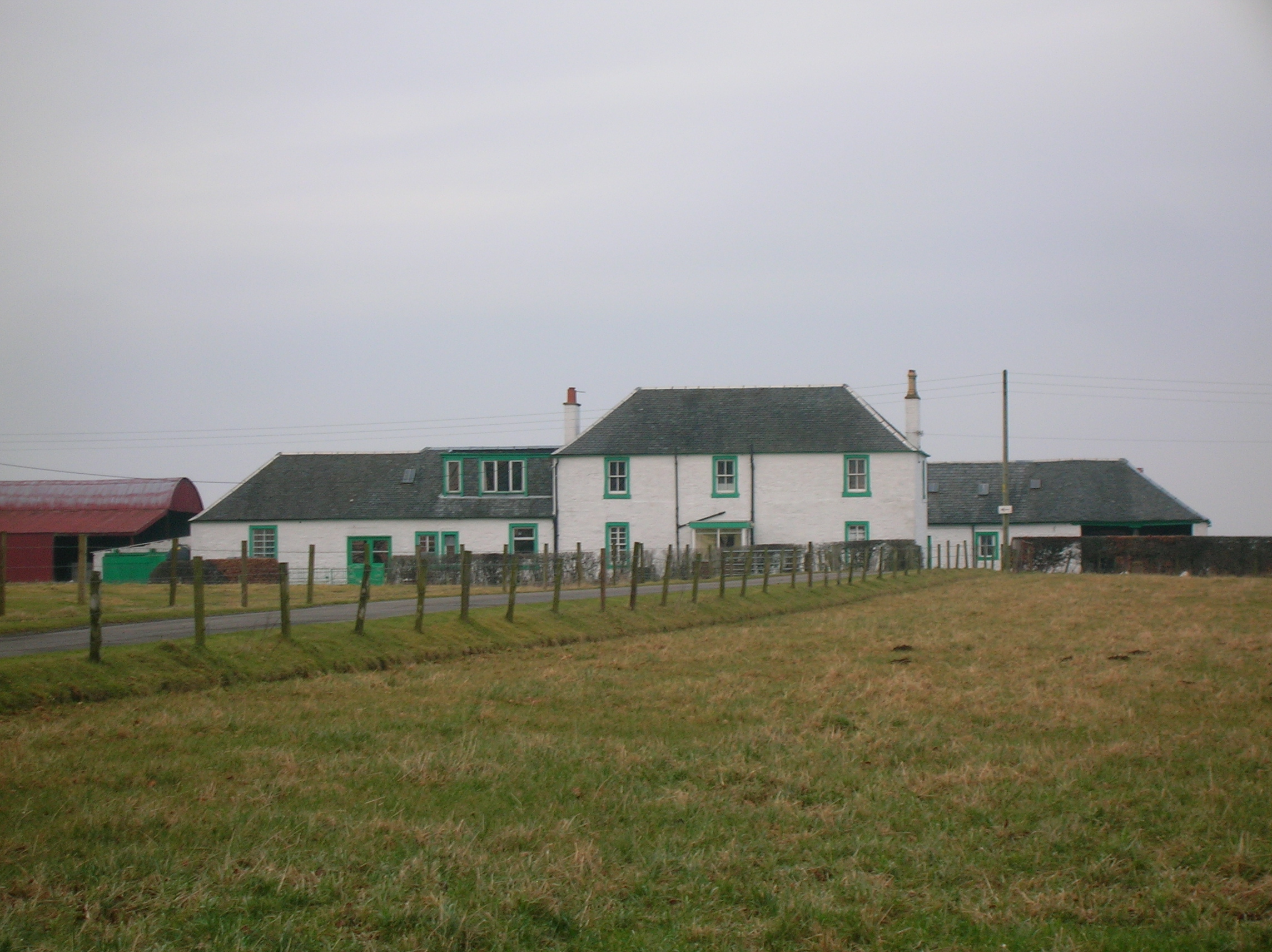
Bible Wood Images

Images are sourced within 2km of 55.536712/-4.3749471 or Grid Reference NS5029. Thanks to Geograph Open Source API. All images are credited.

Entrance to pasture above Barneight Burn
Farm track at Barneight
Killoch Burn
Killoch Burn
A welcome bench at Hillhead
Agricultural machinery supply at Knowehead
Rusty gate at Hollybush
National Burns Memorial - Mauchline The National Burns Memorial Tower was built to mark the centenary of the death of Robert Burns. The tower was built in Mauchline as Robert Burns lived at Mossgiel Farm and Mauchline between 1784 -1788. It was during this period that he composed many of his best works and became a national figure.

 The Glasgow Mauchline Society  proposal to erect a Memorial to the poet and organised a national appeal to raise £5,000 for the building costs. The design for the memorial was won by William Fraser with his Scots Baronial tower submission.
 
The foundation stone of the Memorial Tower was laid on 26 July 1896 and was formally opened on the 7th May 1898.
National Burns Memorial - Mauchline
The National Burns Memorial Tower was built to mark the centenary of the death of Robert Burns. The tower was built in Mauchline as Robert Burns lived at Mossgiel Farm and Mauchline between 1784 -1788. It was during this period that he composed many of his best works and became a national figure. The Glasgow Mauchline Society proposal to erect a Memorial to the poet and organised a national appeal to raise £5,000 for the building costs. The design for the memorial was won by William Fraser with his Scots Baronial tower submission. The foundation stone of the Memorial Tower was laid on 26 July 1896 and was formally opened on the 7th May 1898.
Mossgeil Farm - Mauchline Farmed by poet Robert Burns and his brother Gilbert between 1784 and 1786.

Robert and  Gilbert took the farm of Mossgiel, consisting of 118 acres, at the rent of £90 per annum, from Mr Gavin Hamilton.

 In Burns' day Mossgiel was a single storey cottage with a garret containing three small rooms, the centre room was occupied by Robert and Gilbert.

Today Mossgiel is a two storey house and the thatched roof has been replaced by a slated roof.
Mossgeil Farm - Mauchline
Farmed by poet Robert Burns and his brother Gilbert between 1784 and 1786. Robert and Gilbert took the farm of Mossgiel, consisting of 118 acres, at the rent of £90 per annum, from Mr Gavin Hamilton. In Burns' day Mossgiel was a single storey cottage with a garret containing three small rooms, the centre room was occupied by Robert and Gilbert. Today Mossgiel is a two storey house and the thatched roof has been replaced by a slated roof.
Minor road near Auchmillan
Road junction near Barneight
Minor road near Barneight
Minor road near Killoch
Cessnock Water A bonny bit of the burn.
Cessnock Water
A bonny bit of the burn.
Friendlesshead Sad name for a pleasant house.
Friendlesshead
Sad name for a pleasant house.
Boghead
Boghead
Mossgiel Farm, Mauchline The poet Robert Burns farmed at Mossgiel from 1784 and wrote poems such as To a Mouse, and To a Mountain Daisy, while farming here
Mossgiel Farm, Mauchline
The poet Robert Burns farmed at Mossgiel from 1784 and wrote poems such as To a Mouse, and To a Mountain Daisy, while farming here
Crosshands, Ayrshire The burn by Roughdyke Farm, Crosshands, Ayrshire.
Crosshands, Ayrshire
The burn by Roughdyke Farm, Crosshands, Ayrshire.
National Burns Memorial Mauchline
Show me another place!

Bible Wood is located at Grid Ref: NS5029 (Lat: 55.536712, Lng: -4.3749471)

Unitary Authority: East Ayrshire

Police Authority: Ayrshire

What 3 Words

///required.stoops.recruiter. Near Mauchline, East Ayrshire

Nearby Locations

Bible Wood

Related Wikis

Auchmillan

Auchmillan is a village in East Ayrshire, Scotland. == References ==

Mossgiel Farm

Mossgiel Farm (Mossgaville Farm or Mossgavel Farm in Old Scots) is an organic farm in Mauchline, East Ayrshire, Scotland. It was the home of Robert Burns...

Mossgiel Tunnel Platform railway station

Mossgiel Tunnel Platform railway station (NS480292) was not a station constructed for public use. It stood close to the northern portal of the 680 yard...

Loch Brown

Loch Brown, also known in Scots as Loch Broun, Broon or Broom, was situated in a kettle hole in the mid-Ayrshire clayland near Crosshands. It is nowadays...
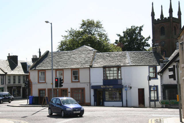
Mauchline

Mauchline (; Scottish Gaelic: Maghlinn) is a town and civil parish in East Ayrshire, Scotland. In the 2001 census Mauchline had a recorded population of...
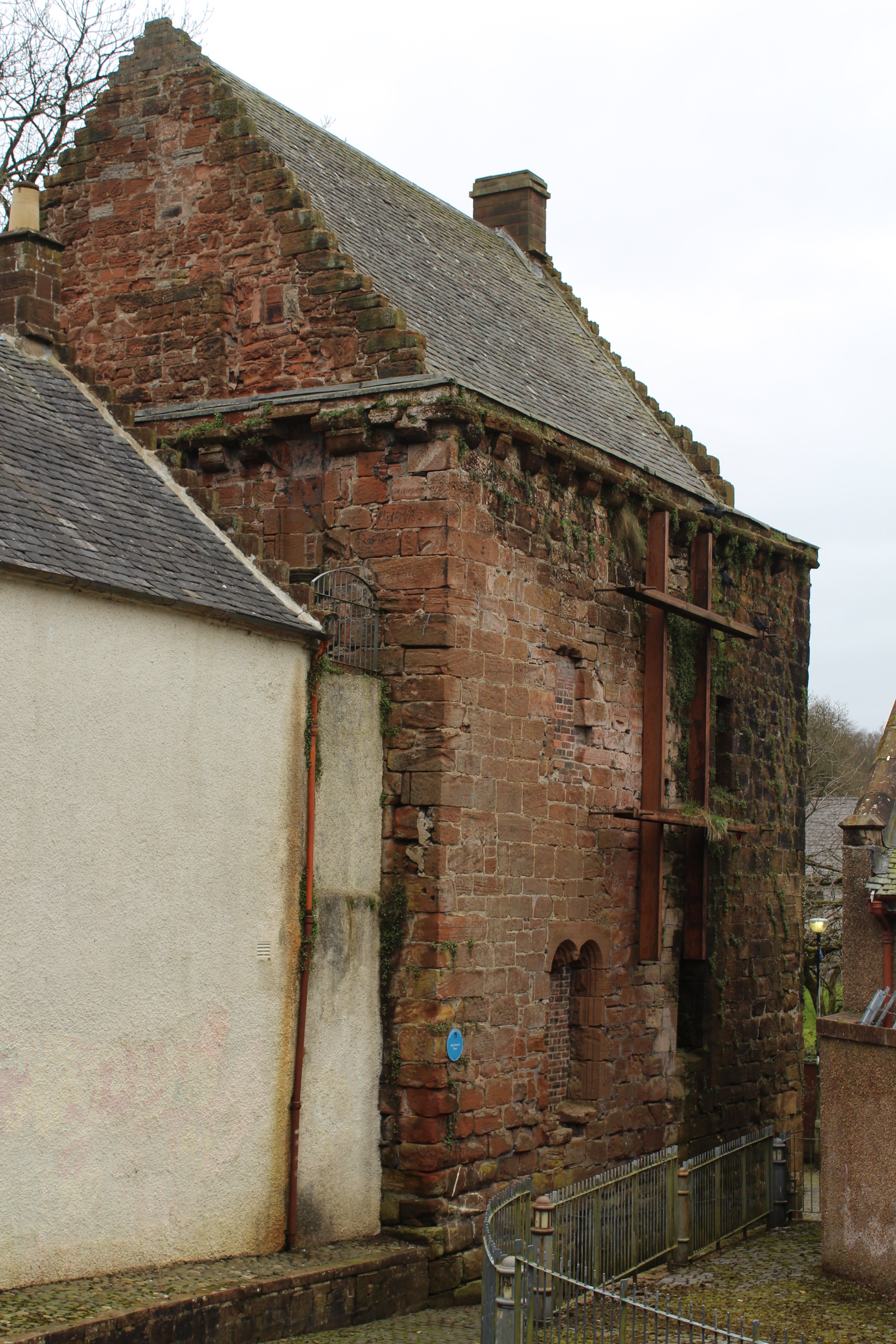
Mauchline Castle

Mauchline Castle, also known as Abbot Hunter's Tower, is a rectangular tower house dating from the fifteenth century, in Mauchline, East Ayrshire, Scotland...

Garrochburn Goods Depot

Garrochburn Goods Depot or Garrochburn Siding was a railway freight facility located off the B744 near the hamlet of Crosshands that lies north-west of...

Kays of Scotland

Kays of Scotland is the only remaining UK manufacturer and supplier of curling stones. Founded in 1851, it retains exclusive rights to harvest granite...

Nearby Amenities

Located within 500m of 55.536712,-4.3749471
Power: pole
Lat/Long: 55.5348696/-4.3818383
Power: pole
Lat/Long: 55.5355762/-4.3815126
Power: pole
Lat/Long: 55.5363621/-4.3808272
Power: pole
Lat/Long: 55.5371736/-4.3801283
Power: pole
Lat/Long: 55.5377394/-4.3796125
Power: pole
Lat/Long: 55.5383218/-4.3791036
Power: pole
Lat/Long: 55.539004/-4.3784928
Power: pole
Lat/Long: 55.5396286/-4.3779658
Power: pole
Lat/Long: 55.5401393/-4.3774975
Power: pole
Lat/Long: 55.5408548/-4.3768619
Power: pole
Lat/Long: 55.5345431/-4.3806372
Power: pole
Lat/Long: 55.534826/-4.3794678
Power: pole
Lat/Long: 55.540083/-4.3771311
Power: pole
Lat/Long: 55.5400344/-4.3768099
Power: pole
Lat/Long: 55.5398718/-4.3757377
Power: pole
Lat/Long: 55.5396657/-4.3743624
Power: pole
Lat/Long: 55.5394622/-4.3730007
Power: pole
Lat/Long: 55.5392741/-4.3717679
Power: pole
Lat/Long: 55.5390859/-4.3705283
Power: pole
Lat/Long: 55.538844/-4.3688906
Power: pole
Lat/Long: 55.5389285/-4.3680921
The data included in this document is from www.openstreetmap.org. The data is made available under ODbL.

Have you been to Bible Wood?

Leave your review of Bible Wood below (or comments, questions and feedback).