Byresbank Plantation

Wood, Forest in Ayrshire

Scotland

Byresbank Plantation

End-terrace on Maxwood Road
End-terrace on Maxwood Road Credit: Alan Reid

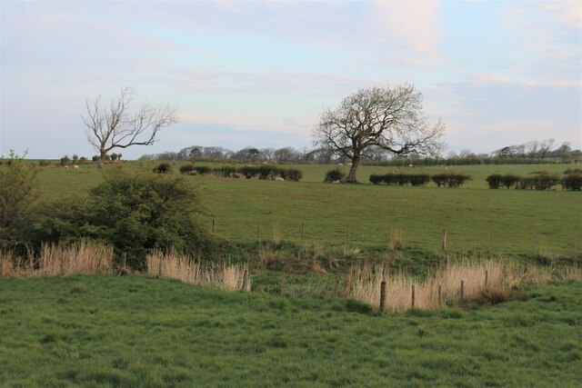
Byresbank Plantation is a picturesque woodland located in Ayrshire, Scotland. Spanning over a vast area, this forest is a cherished natural asset of the region. The plantation is predominantly composed of native trees, including oak, beech, and ash, which create a diverse and vibrant ecosystem.

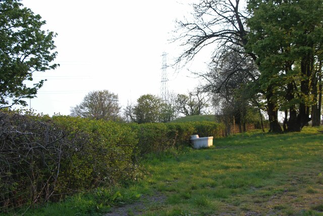
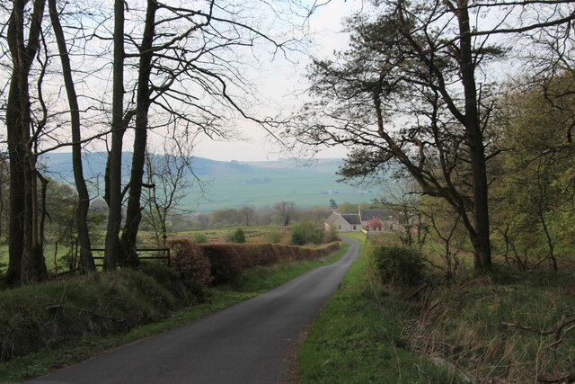
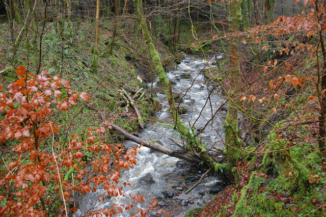
The woodland is well-maintained, with clearly marked paths that meander through its lush surroundings. These paths offer visitors the opportunity to explore and appreciate the beauty of the forest, while also ensuring that the fragile ecosystem remains undisturbed. The forest floor is adorned with a carpet of ferns, wildflowers, and mosses, providing a haven for various species of birds, insects, and small mammals.

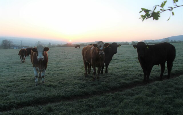
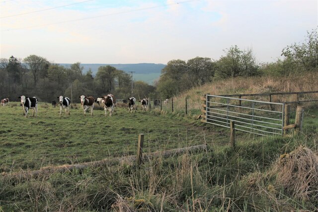
Byresbank Plantation is a haven for nature enthusiasts, providing ample opportunities for birdwatching, photography, and tranquility. The forest is home to a wide variety of bird species, including woodpeckers, owls, and thrushes, making it a popular spot for birdwatchers. Additionally, the woodland is visited by deer, foxes, and badgers, adding to the charm and diversity of the area.

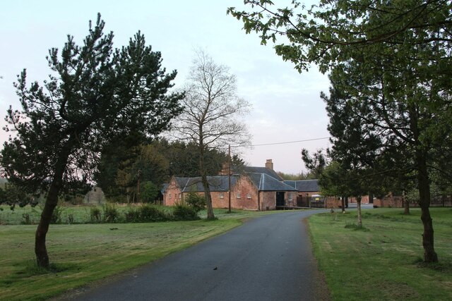
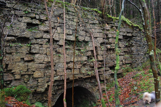
The plantation is also of historical significance, as it was once part of the larger estate of Byresbank House. The remnants of the house can still be seen within the woodland, adding an element of intrigue and nostalgia to the area.

Overall, Byresbank Plantation is a natural gem in Ayrshire, offering visitors a chance to immerse themselves in the beauty of a well-preserved forest. Its lush vegetation, diverse wildlife, and historical significance make it an ideal destination for nature lovers and history enthusiasts alike.

If you have any feedback on the listing, please let us know in the comments section below.

Byresbank Plantation Images

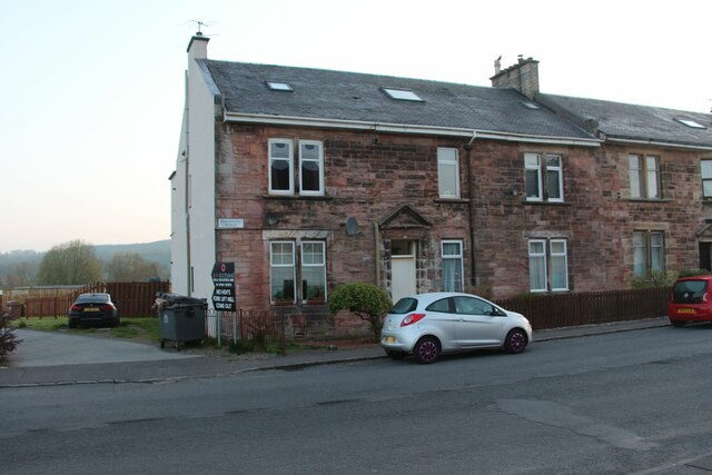
Images are sourced within 2km of 55.611331/-4.3795846 or Grid Reference NS5037. Thanks to Geograph Open Source API. All images are credited.

End-terrace on Maxwood Road
Sunrise over a herd of Ayrshires
Waterside, Galston
Waterside, Galston
Sheltered corner at Castle Hill
Alton Burn Running to the left through the rushes.
Alton Burn
Running to the left through the rushes.
Downhill to East Newton
Cattle grazing on Judge's Hill
Barr Castle - Galston, East Ayrshire The present tower dates from the 16th century and was the family seat of the Lockhart family until 1670. It passed to the Campbell's of Cessnock and was used as a domicile. It has been used as a barn, a grain store, a town jail, a cholera hospital, a wool store, a school and a religious meeting house.
It was acquired by the Duke of Portland for the local Masonic  Lodge, St Peter 331 in 1894, who have maintained it until the present day.
Barr Castle used to be known as Lockhart’s Tower. One of the Lockharts of Barr is reputed to have been one of the men associated with returning Robert the Bruce's heart to Scotland after it had been lost in a battle abroad by James Douglas who carried it to the Crusades as a dying wish of the famous King.
The Scottish Reformers William Wishart and John Knox preached in this place A.D. 1545 and 1556 respectively.
Barr Castle - Galston, East Ayrshire
The present tower dates from the 16th century and was the family seat of the Lockhart family until 1670. It passed to the Campbell's of Cessnock and was used as a domicile. It has been used as a barn, a grain store, a town jail, a cholera hospital, a wool store, a school and a religious meeting house. It was acquired by the Duke of Portland for the local Masonic Lodge, St Peter 331 in 1894, who have maintained it until the present day. Barr Castle used to be known as Lockhart’s Tower. One of the Lockharts of Barr is reputed to have been one of the men associated with returning Robert the Bruce's heart to Scotland after it had been lost in a battle abroad by James Douglas who carried it to the Crusades as a dying wish of the famous King. The Scottish Reformers William Wishart and John Knox preached in this place A.D. 1545 and 1556 respectively.
St Sophia's Church - Galston, East Ayrshire St Sophia's church was constructed 1885-6 and designed by architect Sir Robert Rowand Anderson. The third Marquess of Bute commissioned Anderson to bring to Galston this echo of the Byzantine Empire.
 The church is a distinctive building based on Hagia Sophia in Istanbul, which the Marquess had visited and in memory of his mother Lady Sophia Hastings of Loudoun Castle.
 Built in red brick the church is cruciform in shape with a central round tower topped with a conical roof of red tiles.
St Sophia's Church - Galston, East Ayrshire
St Sophia's church was constructed 1885-6 and designed by architect Sir Robert Rowand Anderson. The third Marquess of Bute commissioned Anderson to bring to Galston this echo of the Byzantine Empire. The church is a distinctive building based on Hagia Sophia in Istanbul, which the Marquess had visited and in memory of his mother Lady Sophia Hastings of Loudoun Castle. Built in red brick the church is cruciform in shape with a central round tower topped with a conical roof of red tiles.
Barr Castle - Galston, East Ayrshire The present tower dates from the 16th century and was the family seat of the Lockhart family until 1670. It passed to the Campbell's of Cessnock and was used as a domicile. It has been used as a barn, a grain store, a town jail, a cholera hospital, a wool store, a school and a religious meeting house.
It was acquired in 1894 by the Duke of Portland for the local Masonic Lodge, St Peter 331, who have maintained it until the present day.
Barr Castle used to be known as Lockhart’s Tower. One of the Lockharts of Barr is reputed to have been one of the men associated with returning Robert the Bruce's heart to Scotland after it had been lost in a battle abroad by James Douglas who carried it to the Crusades as a dying wish of the famous King.
The Scottish Reformers William Wishart and John Knox preached in this place A.D. 1545 and 1556 respectively.
Barr Castle - Galston, East Ayrshire
The present tower dates from the 16th century and was the family seat of the Lockhart family until 1670. It passed to the Campbell's of Cessnock and was used as a domicile. It has been used as a barn, a grain store, a town jail, a cholera hospital, a wool store, a school and a religious meeting house. It was acquired in 1894 by the Duke of Portland for the local Masonic Lodge, St Peter 331, who have maintained it until the present day. Barr Castle used to be known as Lockhart’s Tower. One of the Lockharts of Barr is reputed to have been one of the men associated with returning Robert the Bruce's heart to Scotland after it had been lost in a battle abroad by James Douglas who carried it to the Crusades as a dying wish of the famous King. The Scottish Reformers William Wishart and John Knox preached in this place A.D. 1545 and 1556 respectively.
Ruined building, not on map Remains of a lime kiln, or similar, not sure.
Ruined building, not on map
Remains of a lime kiln, or similar, not sure.
Remains of Loudoun Castle   c 2003 This view used to greet visitors to the now closed Loudoun Castle Theme Park.
Image shows the castle as it was in 2003.
Remains of Loudoun Castle c 2003
This view used to greet visitors to the now closed Loudoun Castle Theme Park. Image shows the castle as it was in 2003.
Small Burn Small burn in Big Wood.
Small Burn
Small burn in Big Wood.
Site of Galston station, 1997 View NW approaching Galston village. The station had been on the right, on the ex-GSWR line which ran from Kilmarnock (to left) to Darvel (to right) under the road and was closed 6/4/64 to passengers, 6/7/64 to goods.
Site of Galston station, 1997
View NW approaching Galston village. The station had been on the right, on the ex-GSWR line which ran from Kilmarnock (to left) to Darvel (to right) under the road and was closed 6/4/64 to passengers, 6/7/64 to goods.
Church Lane at Cross Street, Galston
Portland Arms Hotel, Galston On the corner of Brewland Street and Cross Street
Portland Arms Hotel, Galston
On the corner of Brewland Street and Cross Street
Buck's Head, Bridge Street, Galston
Bridge Street, Galston
Show me another place!

Byresbank Plantation is located at Grid Ref: NS5037 (Lat: 55.611331, Lng: -4.3795846)

Unitary Authority: East Ayrshire

Police Authority: Ayrshire

What 3 Words

///curls.reduction.usages. Near Galston, East Ayrshire

Related Wikis

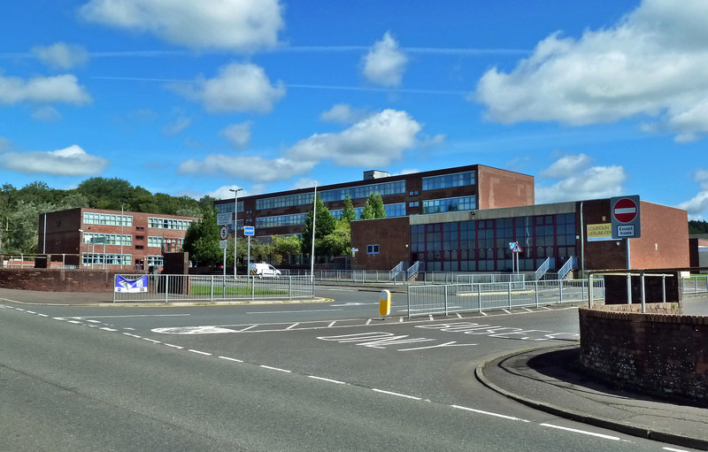
Loudoun Academy, Galston

Loudoun Academy is a secondary school in the outskirts of Galston, East Ayrshire, in Scotland serving the Loudoun district which includes the Irvine Valley...

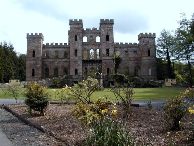
Loudoun Castle (theme park)

Loudoun Castle was a theme park set around the ruins of the 19th century Loudoun Castle near Galston, in the Loudoun area of Ayrshire, Scotland, United...

Loudoun Castle

Loudoun Castle is a ruined 19th-century country house near Galston, in the Loudoun area of Ayrshire, Scotland. The ruins are protected as a category A...

Twist n' Shout

Twist n' Shout is a steel looping roller coaster located at Loudoun Castle Theme Park in Galston, south-west Scotland. It opened in 2003 as a part of the...

Loudoun Kirk

Loudoun Kirk is a disused church located about one mile west of Loudoun Castle, East Ayrshire. It served as Loudoun's parish church until some point after...

Portland Park, Galston

Portland Park was a football ground in Galston, Scotland. It was the home ground of Galston F.C. == History == Galston were playing at Portland Park when...

Galston parish

Galston Parish is situated in East Ayrshire, Scotland, some five to ten miles east of Kilmarnock and roughly encompasses the southern half of the Upper...

Galston, East Ayrshire

Galston (Lowland Scots: Gauston, Scottish Gaelic: Baile nan Gall) is a municipality in East Ayrshire, Scotland, which has a population of 5,001 (2001)...

Nearby Amenities

Located within 500m of 55.611331,-4.3795846
Barrier: block
Lat/Long: 55.6153261/-4.3776983
Turning Circle
Lat/Long: 55.6135998/-4.3828712
Barrier: cattle_grid
Lat/Long: 55.6139514/-4.3814513
Power: pole
Lat/Long: 55.6086071/-4.3852462
Power: pole
Lat/Long: 55.6084388/-4.3837459
Power: pole
Lat/Long: 55.6082858/-4.3824499
Power: pole
Lat/Long: 55.6084411/-4.3810913
Power: pole
Lat/Long: 55.6086636/-4.3801307
Power: pole
Lat/Long: 55.608906/-4.379041
Power: pole
Lat/Long: 55.6091485/-4.3780221
Power: pole
Lat/Long: 55.6093944/-4.3769615
Power: pole
Lat/Long: 55.6073242/-4.3777178
Power: pole
Lat/Long: 55.6080056/-4.3774678
Power: pole
Lat/Long: 55.6086977/-4.3772157
Power: pole
Lat/Long: 55.6100912/-4.3767052
Power: pole
Lat/Long: 55.610775/-4.376451
Power: pole
Lat/Long: 55.6139842/-4.3810371
Power: pole
Lat/Long: 55.6141442/-4.380412
Power: pole
Lat/Long: 55.6143196/-4.379714
Power: pole
Lat/Long: 55.6144843/-4.3790431
The data included in this document is from www.openstreetmap.org. The data is made available under ODbL.

Have you been to Byresbank Plantation?

Leave your review of Byresbank Plantation below (or comments, questions and feedback).