Cample Plantation

Wood, Forest in Dunbartonshire

Scotland

Cample Plantation

East Cambusmoon Farm
East Cambusmoon Farm Credit: John Ferguson

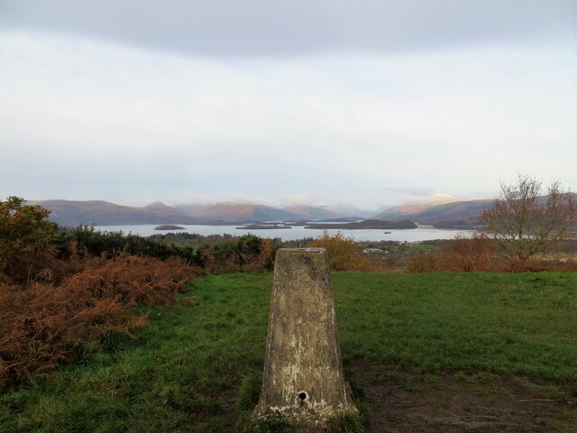
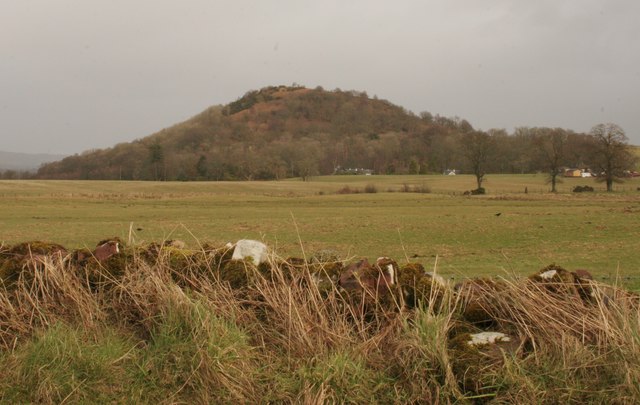
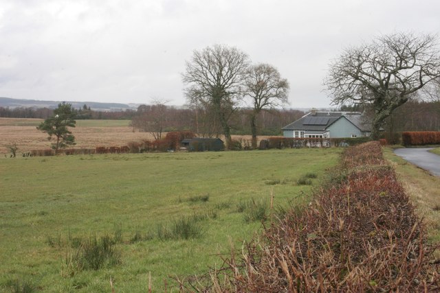
Cample Plantation is a sprawling woodland located in Dunbartonshire, Scotland. Covering an extensive area, it is known for its diverse range of trees and serene natural beauty. The plantation is situated near the village of Cample, and its close proximity to Loch Lomond and The Trossachs National Park adds to its allure.

The woodland consists primarily of coniferous trees, including Scots pine, Douglas fir, and Sitka spruce, among others. These tall evergreens create a dense canopy, providing shade and shelter for a variety of wildlife species. The forest floor is adorned with a carpet of mosses, ferns, and wildflowers, adding a touch of vibrancy to the landscape.

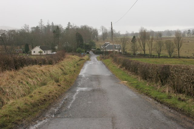
Cample Plantation offers numerous walking trails that wind their way through the forest, catering to both casual strollers and seasoned hikers. These paths provide opportunities to explore the woodland's hidden corners, glimpse rare bird species, and encounter occasional deer or red squirrels. The plantation is also home to a diverse array of fungi, with mushroom enthusiasts often making their way here to study and photograph these fascinating organisms.

The serene atmosphere of Cample Plantation makes it an ideal destination for nature lovers seeking peace and tranquility. Its picturesque setting, combined with the soothing sounds of birdsong and rustling leaves, creates a truly immersive experience in the heart of nature. Whether it's for a leisurely stroll, birdwatching, or simply appreciating the beauty of the Scottish woodlands, Cample Plantation offers a memorable retreat for all.

If you have any feedback on the listing, please let us know in the comments section below.

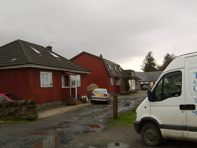
Cample Plantation Images

Images are sourced within 2km of 56.024267/-4.5078735 or Grid Reference NS4384. Thanks to Geograph Open Source API. All images are credited.

East Cambusmoon Farm
Trig pillar on Duncryne Hill Great views over Loch Lomond
Trig pillar on Duncryne Hill
Great views over Loch Lomond
Track in Duncryne Wood, leading to Duncryne Hill
Loch Lomond from the air Looking over Gallangad Glen which is at the bottom of the photo, the entire southern shore of the loch can be seen. Balloch is on the left, Balmaha on the right, with Endrick Water visible entering the loch nearby. Gartocharn and Ross Priory are visible in the foreground.
Loch Lomond from the air
Looking over Gallangad Glen which is at the bottom of the photo, the entire southern shore of the loch can be seen. Balloch is on the left, Balmaha on the right, with Endrick Water visible entering the loch nearby. Gartocharn and Ross Priory are visible in the foreground.
Road junction The road ahead leads to Croftamie; the road to the right to Caldarvan Station. In fact there hasn't been a station there for a long time. The line closed in 1959.
Road junction
The road ahead leads to Croftamie; the road to the right to Caldarvan Station. In fact there hasn't been a station there for a long time. The line closed in 1959.
Lea Rig The white building in the distance on the right is Lea Rig.
Lea Rig
The white building in the distance on the right is Lea Rig.
Wetland at the corner of the field Close to Meikle Finnery.
Wetland at the corner of the field
Close to Meikle Finnery.
Geese above the fields A large flock of geese flies around in a circle before settling down in the fields to continue feeding on the grass.
Geese above the fields
A large flock of geese flies around in a circle before settling down in the fields to continue feeding on the grass.
Hill up to High Duncryne Farm The farm is just round the corner at the top of the hill.
Hill up to High Duncryne Farm
The farm is just round the corner at the top of the hill.
Three Views and North Lodge Three views is on the left; North Lodge is in the centre of the photograph, where the road turns sharply to the right.
Three Views and North Lodge
Three views is on the left; North Lodge is in the centre of the photograph, where the road turns sharply to the right.
Roadworks, School Road, Gartocharn Working on the minor road running south from Gartocharn.
Roadworks, School Road, Gartocharn
Working on the minor road running south from Gartocharn.
Duncryne from the west The wooded slopes of Duncryne, seen from School Road.
Duncryne from the west
The wooded slopes of Duncryne, seen from School Road.
Lochend, Caldarvan Caldarvan Loch is just behind the buildings.
Lochend, Caldarvan
Caldarvan Loch is just behind the buildings.
Spittal, Caldarvan On a wet day.
Spittal, Caldarvan
On a wet day.
Farmland near Lochend Cottage Looking towards Ardgate.
Farmland near Lochend Cottage
Looking towards Ardgate.
Lochend Cottage
Lochend Cottage
Lochend Cottage
Lochend Cottage
Duncryne from the south The distinctive hill of Duncryne stands out above the surrounding farmland.
Duncryne from the south
The distinctive hill of Duncryne stands out above the surrounding farmland.
Show me another place!

Cample Plantation is located at Grid Ref: NS4384 (Lat: 56.024267, Lng: -4.5078735)

Unitary Authority: West Dunbartonshire

Police Authority: Argyll and West Dunbartonshire

What 3 Words

///plotter.classic.banks. Near Balloch, West Dunbartonshire

Nearby Locations

Cample Plantation

Related Wikis

Caldarvan railway station

Caldarvan railway station served the estate of Caldarvan, in the historical county of Dunbartonshire, Scotland, from 1856 to 1934 on the Forth and Clyde...

Gartocharn

Gartocharn (; Scottish Gaelic: Gart a’ Chàirn [ˈkarˠʃt̪ ə ˈxaːrˠɲ]) is a village in West Dunbartonshire in Scotland, United Kingdom. It is the only village...
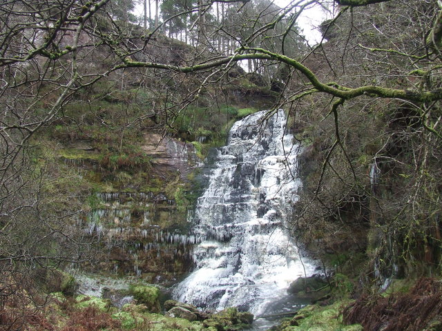
Ishneich

Ishneich is a waterfall of Scotland.This stunning waterfall can be reached by following the John Muir trail past the Burncrooks reservoir and through the...

West Dunbartonshire

West Dunbartonshire (Scots: Wast Dunbairtonshire; Scottish Gaelic: Siorrachd Dhùn Breatann an Iar, pronounced [ˈʃirˠəxk ɣum ˈpɾʲɛht̪ən̪ˠ əɲ ˈiəɾ]) is one...

Ross Priory

Ross Priory is an early 19th-century country house located west of Gartocharn, West Dunbartonshire, on the south shore of Loch Lomond, Scotland. From the...

Croftamie

Croftamie (Scottish Gaelic Croit Sheumaidh) is a small village and community council area in the Stirling council area in Scotland. It lies to the south...

Drymen railway station

Drymen railway station served the village of Croftamie, Stirling, Scotland, from 1856 to 1934 on the Forth and Clyde Junction Railway. == History == The...

Balloch Castle

Balloch Castle is an early 19th-century country house situated at the southern tip of Loch Lomond, in West Dunbartonshire, Scotland. Balloch was a property...

Nearby Amenities

Located within 500m of 56.024267,-4.5078735
Power: pole
Lat/Long: 56.0204502/-4.5075284
Power: pole
Lat/Long: 56.0212627/-4.5076769
Power: pole
Lat/Long: 56.0220319/-4.5078275
Power: pole
Lat/Long: 56.0228034/-4.5079844
Power: pole
Lat/Long: 56.0253085/-4.5084718
Power: pole
Lat/Long: 56.026156/-4.5086412
Power: pole
Lat/Long: 56.0269859/-4.5087939
Power: pole
Lat/Long: 56.0278386/-4.5089707
Power: pole
Lat/Long: 56.0286626/-4.5091276
Power: pole
Lat/Long: 56.024845/-4.5008715
Power: pole
Lat/Long: 56.024499/-4.5023482
Power: pole
Lat/Long: 56.023945/-4.5032309
Power: pole
Lat/Long: 56.0234213/-4.5041011
Power: pole
Lat/Long: 56.0228964/-4.5049776
Power: pole
Lat/Long: 56.0223493/-4.5058833
Power: pole
Lat/Long: 56.021808/-4.5067681
The data included in this document is from www.openstreetmap.org. The data is made available under ODbL.

Have you been to Cample Plantation?

Leave your review of Cample Plantation below (or comments, questions and feedback).