Auchingyle Wood

Wood, Forest in Stirlingshire

Scotland

Auchingyle Wood

Loch Lomond at Balmaha Looking towards Inchcailloch.
Loch Lomond at Balmaha Credit: Richard Webb

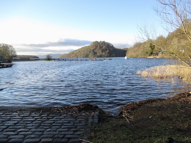
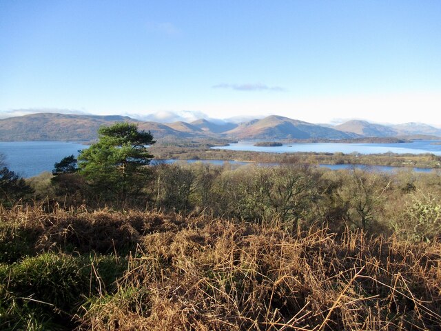
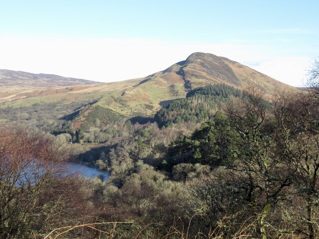
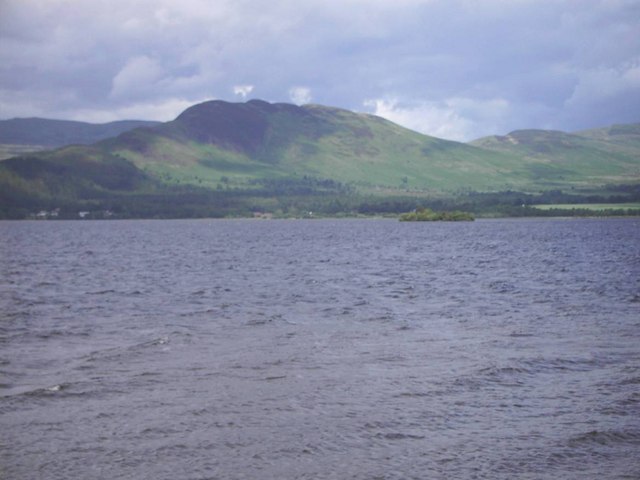
Auchingyle Wood is a picturesque forest located in Stirlingshire, Scotland. Covering an area of approximately 150 acres, it is a popular destination for nature enthusiasts and those seeking tranquility amidst natural surroundings. The wood is situated near the village of Thornhill, offering easy access to visitors from nearby towns and cities.

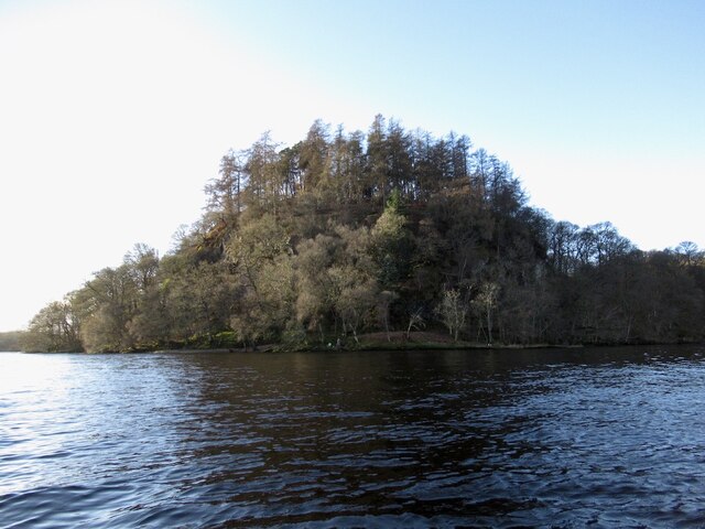
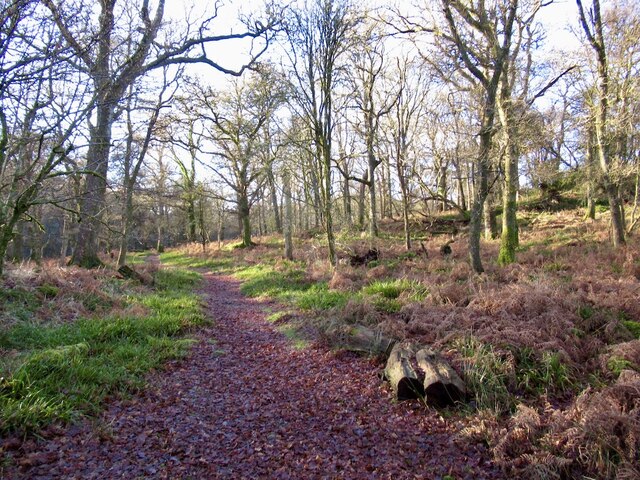
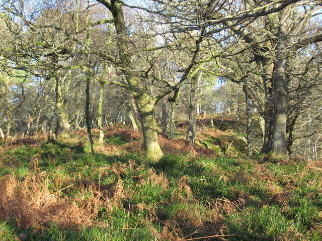
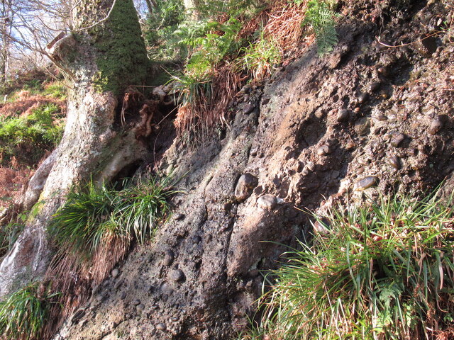
The woodland is predominantly made up of native Scottish trees, including oak, birch, and rowan, which create a dense and diverse canopy. The forest floor is adorned with a rich carpet of ferns, mosses, and wildflowers, adding to its enchanting beauty. Throughout the year, the wood undergoes a stunning transformation as the seasons change, providing visitors with a unique experience each time they visit.

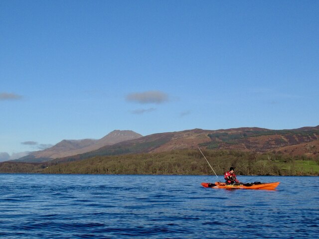
Auchingyle Wood is home to a variety of wildlife, making it an ideal spot for birdwatching and wildlife photography. Visitors may be lucky enough to spot species such as red squirrels, roe deer, and a wide range of birdlife, including woodpeckers, owls, and various songbirds.

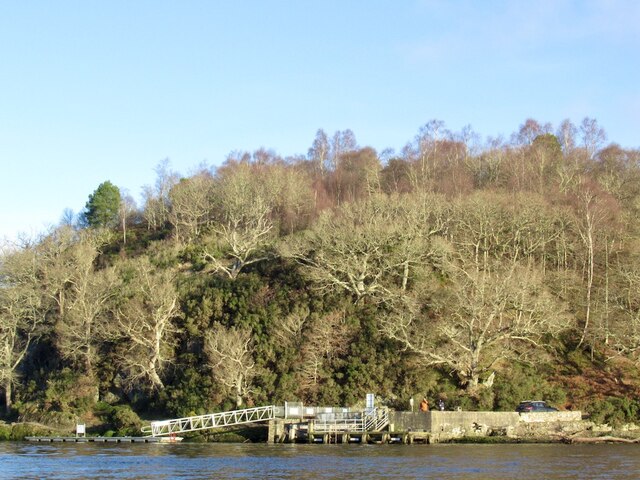
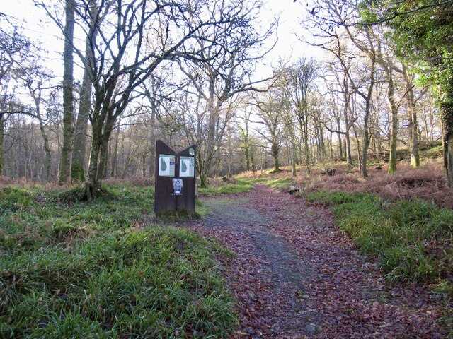
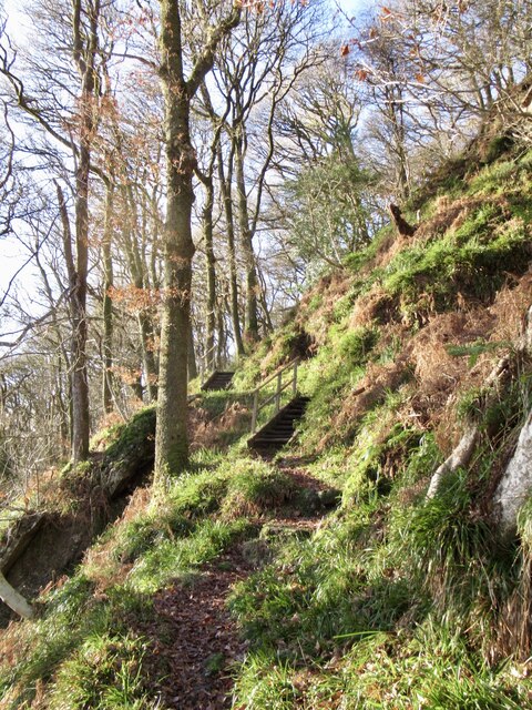
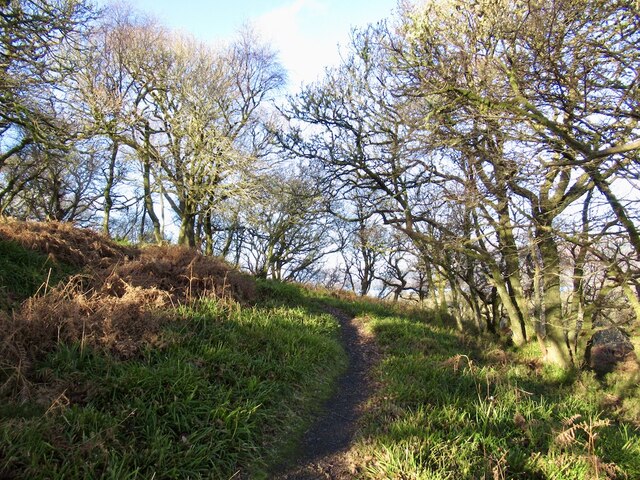
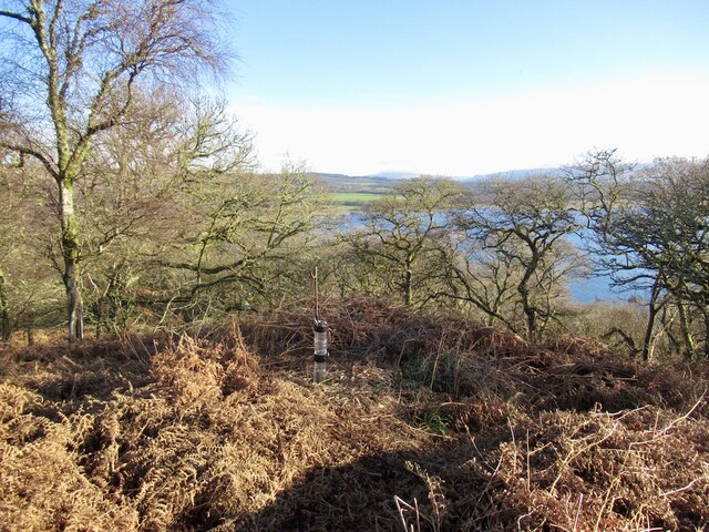
The wood features several well-maintained trails and paths, allowing visitors to explore its natural wonders at their own pace. These paths provide access to the different areas of the woodland and offer breathtaking views of the surrounding countryside. Auchingyle Wood also has picnic areas and benches, providing visitors with the opportunity to relax and enjoy a picnic amidst the peacefulness of the forest.

Overall, Auchingyle Wood in Stirlingshire is a haven of tranquility, offering visitors the chance to immerse themselves in the beauty of nature and enjoy the serenity of the Scottish countryside.

If you have any feedback on the listing, please let us know in the comments section below.

Auchingyle Wood Images

Images are sourced within 2km of 56.078104/-4.5255467 or Grid Reference NS4290. Thanks to Geograph Open Source API. All images are credited.

Loch Lomond at Balmaha Looking towards Inchcailloch.
Loch Lomond at Balmaha
Looking towards Inchcailloch.
Fishing of Inchcailloch Away from the waves in the lee of Inchcailloch. View towards Ben Lomond.
Fishing of Inchcailloch
Away from the waves in the lee of Inchcailloch. View towards Ben Lomond.
Pier, Balmaha Below Craigie Fort.
Pier, Balmaha
Below Craigie Fort.
North end of Inchcailloch The conglomerate hills of the Highland Boundary Fault continue through Loch Lomond.
North end of Inchcailloch
The conglomerate hills of the Highland Boundary Fault continue through Loch Lomond.
Information boards, Inchcailloch With a ferry from Balmaha the island is a popular place and there are maps posted near the northern landing. One in English, the other Gaelic.  Being Winter there were no boats and nobody else walking the paths.
Information boards, Inchcailloch
With a ferry from Balmaha the island is a popular place and there are maps posted near the northern landing. One in English, the other Gaelic. Being Winter there were no boats and nobody else walking the paths.
Path, Inchcailloch With its ease of access, there is a good path network on the island.
Path, Inchcailloch
With its ease of access, there is a good path network on the island.
Oakwood, North Hill The slopes of the northern most hill on Inchcailloch.
Oakwood, North Hill
The slopes of the northern most hill on Inchcailloch.
Summit, North Hill One of a pair of steep hills on the Highland Boundary fault at Inchcailloch. There is no path up this one, but in Winter with less vegetation a way can be made using the odd fallow deer path. The deer appear to like this hill, they were there today and there is a lot of evidence of their use of the area.
Summit, North Hill
One of a pair of steep hills on the Highland Boundary fault at Inchcailloch. There is no path up this one, but in Winter with less vegetation a way can be made using the odd fallow deer path. The deer appear to like this hill, they were there today and there is a lot of evidence of their use of the area.
Conglomerate exposure, Inchcailloch Inchcailloch is one of a line of steep conglomerate hills along the Highland Boundary Fault.
Conglomerate exposure, Inchcailloch
Inchcailloch is one of a line of steep conglomerate hills along the Highland Boundary Fault.
Path, Tom na Nigheanan A path crossing Inchcailloch via the summit of Tom na Nigheanan. There are several flights of steps.
Path, Tom na Nigheanan
A path crossing Inchcailloch via the summit of Tom na Nigheanan. There are several flights of steps.
Path, Tom na Nigheanan Approaching the summit through oak woods.
Path, Tom na Nigheanan
Approaching the summit through oak woods.
View across Loch Lomond A view from Tom na Nigheanan on Inchcailloch across the forested islands towards the hills above Luss.
View across Loch Lomond
A view from Tom na Nigheanan on Inchcailloch across the forested islands towards the hills above Luss.
The Highland Boundary Fault Looking along the conglomerate hills from Inchcailloch towards Conic Hill. The hills form a line of islands across Loch Lomond.
The Highland Boundary Fault
Looking along the conglomerate hills from Inchcailloch towards Conic Hill. The hills form a line of islands across Loch Lomond.
Summit, Tom na Nigheanan The island highpoint, marked by a home made tree shelter. A very easily accessible summit when the ferry is running with a good path. Highly recommended.  No ferry today and little traffic on the loch, all very quiet.
Summit, Tom na Nigheanan
The island highpoint, marked by a home made tree shelter. A very easily accessible summit when the ferry is running with a good path. Highly recommended. No ferry today and little traffic on the loch, all very quiet.
Woodland, Inchcailloch
Beach, Loch Lomond Landing point rapidly approaching thanks to the wind and waves on my back. Conic Hill in the background. The West Highland Way uses the beach.
Beach, Loch Lomond
Landing point rapidly approaching thanks to the wind and waves on my back. Conic Hill in the background. The West Highland Way uses the beach.
Craigie Fort and Inchcailloch, Loch Lomond The Highland Boundary Fault conglomerate ridge, breached by the loch.
Craigie Fort and Inchcailloch, Loch Lomond
The Highland Boundary Fault conglomerate ridge, breached by the loch.
West Highland Way After transition from water to land between Inchcailloch and my next summit Craig an Eoin. The packraft and kit are now in the rucksac.  It is also possible to put the raft on a bike and the bike on the raft.
West Highland Way
After transition from water to land between Inchcailloch and my next summit Craig an Eoin. The packraft and kit are now in the rucksac. It is also possible to put the raft on a bike and the bike on the raft.
Show me another place!

Auchingyle Wood is located at Grid Ref: NS4290 (Lat: 56.078104, Lng: -4.5255467)

Unitary Authority: Stirling

Police Authority: Forth Valley

What 3 Words

///sides.ourselves.camera. Near Balloch, West Dunbartonshire

Nearby Locations

Auchingyle Wood

Related Wikis

Endrick Water

The Endrick Water or River Endrick (Scottish Gaelic: Eunarag) is a river which flows into the eastern end of Loch Lomond, Scotland. Its drainage basin...

Buchanan, Stirling

Buchanan is a historic parish in Stirlingshire in Scotland. It includes a large part of the eastern shore of Loch Lomond. The most populated village in...

Balmaha

Balmaha (Gaelic: Baile Mo Thatha) is a village on the eastern shore of Loch Lomond in the council area of Stirling, Scotland. The village is a popular...

Aber Isle

Aber Isle or Aber Inch is a small island in Loch Lomond, in west central Scotland. It is near the mouth of the River Endrick, by the abandoned village...

Have you been to Auchingyle Wood?

Leave your review of Auchingyle Wood below (or comments, questions and feedback).