Balmaha Plantation

Wood, Forest in Stirlingshire

Scotland

Balmaha Plantation

Loch Lomond at Balmaha Looking towards Inchcailloch.
Loch Lomond at Balmaha Credit: Richard Webb

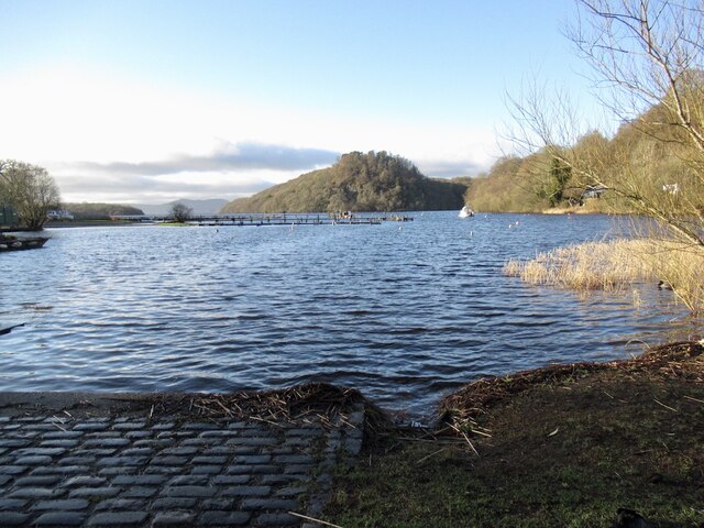
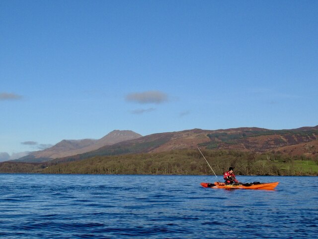
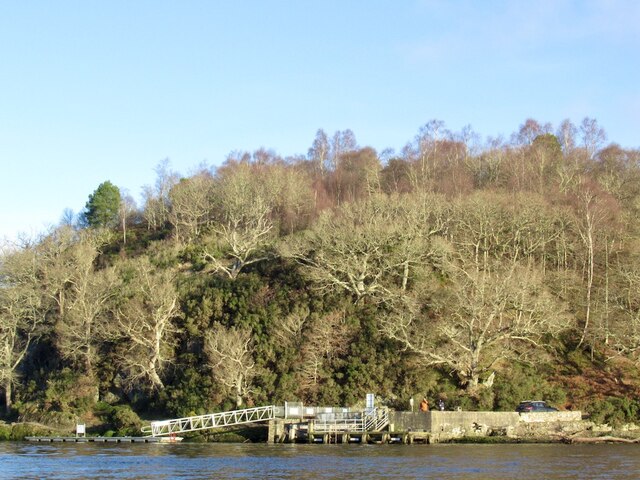
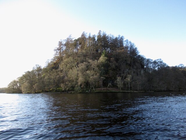
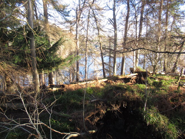
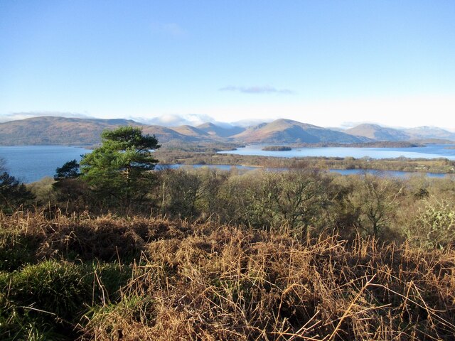
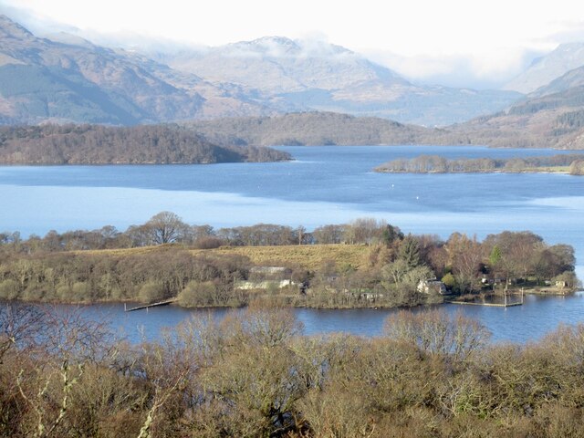
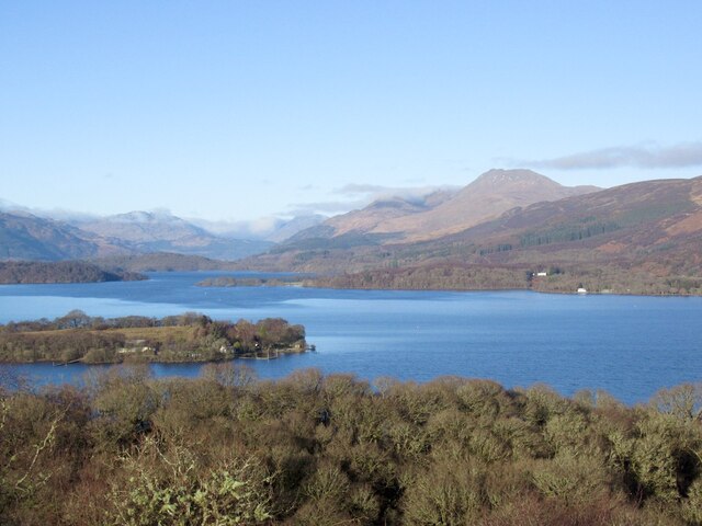
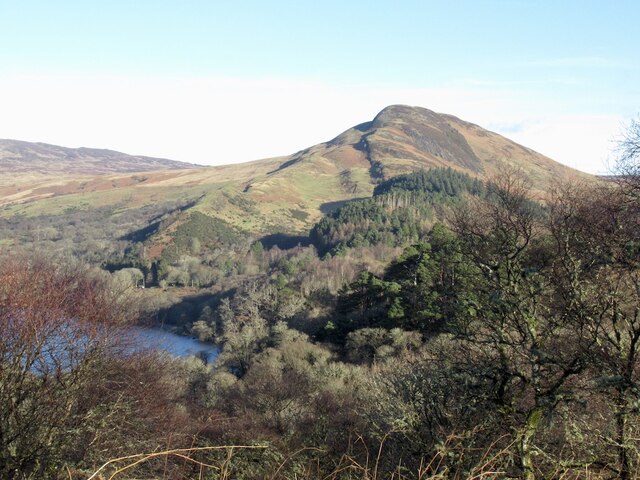
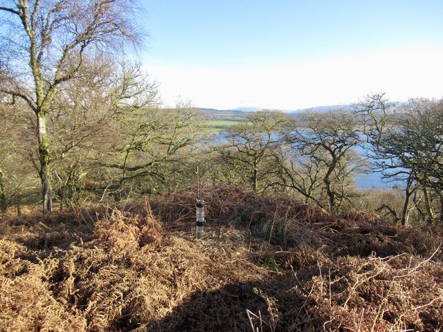
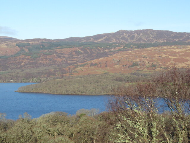
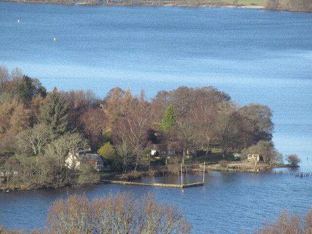
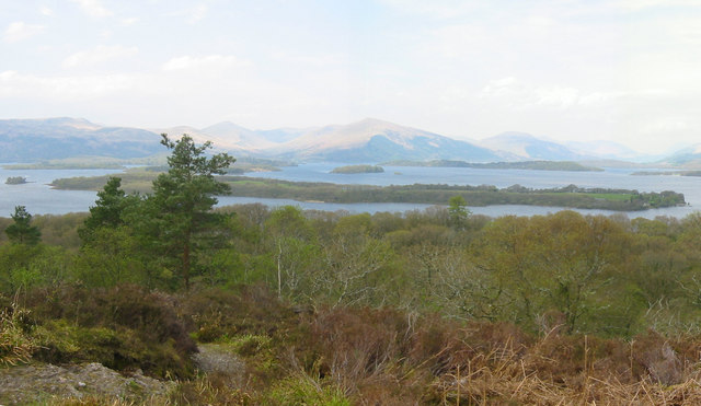
Balmaha Plantation is a picturesque woodland located in Stirlingshire, Scotland. Covering an area of approximately 500 acres, this plantation is known for its dense forest and stunning natural beauty. It is situated on the eastern shore of Loch Lomond, providing visitors with breathtaking views of the surrounding landscape.

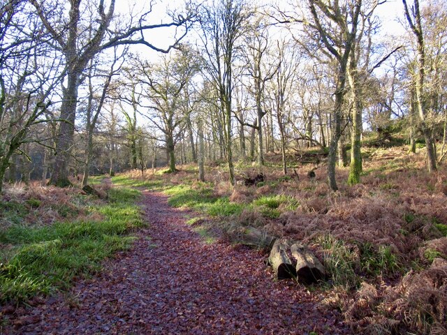
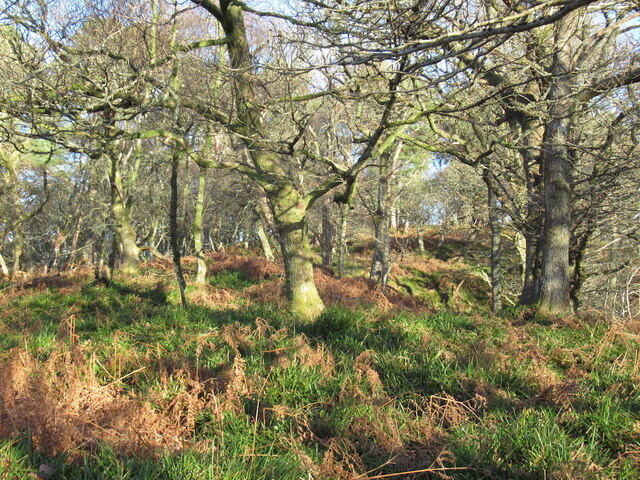
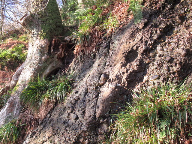
The woodland in Balmaha Plantation comprises a mixture of native and non-native trees, including oak, beech, Scots pine, and Douglas fir. These trees create a diverse and vibrant ecosystem, providing habitat for a variety of wildlife species. Visitors to the plantation can often spot red squirrels, deer, and a wide range of bird species.

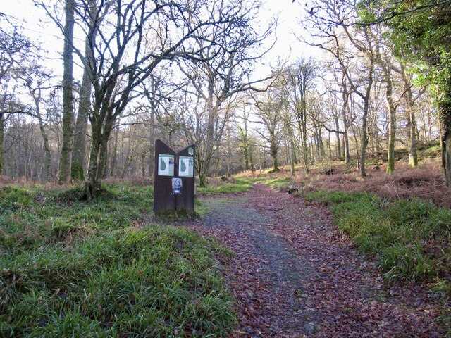
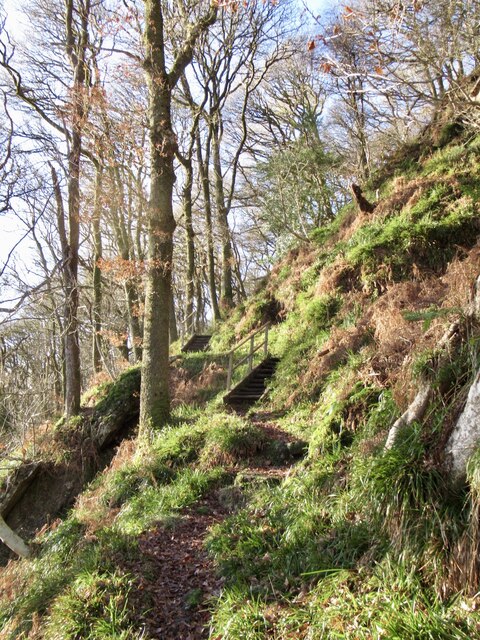
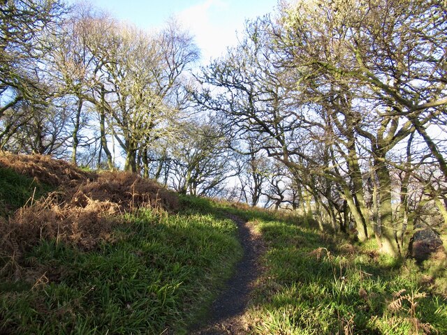
The plantation is a popular destination for nature enthusiasts, hikers, and birdwatchers, offering numerous trails and paths that wind through the forest. These trails provide an excellent opportunity to explore the woodland and observe its flora and fauna up close. The most famous trail in the area is the West Highland Way, which passes through Balmaha Plantation.

Additionally, the plantation is equipped with several picnic areas and viewpoints, allowing visitors to relax and enjoy the stunning scenery. The tranquil atmosphere and peaceful surroundings make Balmaha Plantation an ideal spot for nature lovers seeking to escape the hustle and bustle of city life.

Overall, Balmaha Plantation in Stirlingshire is a captivating woodland, offering a rich and diverse natural environment for visitors to explore and appreciate.

If you have any feedback on the listing, please let us know in the comments section below.

Balmaha Plantation Images

Images are sourced within 2km of 56.086721/-4.53529 or Grid Reference NS4291. Thanks to Geograph Open Source API. All images are credited.

Loch Lomond at Balmaha Looking towards Inchcailloch.
Loch Lomond at Balmaha
Looking towards Inchcailloch.
Fishing of Inchcailloch Away from the waves in the lee of Inchcailloch. View towards Ben Lomond.
Fishing of Inchcailloch
Away from the waves in the lee of Inchcailloch. View towards Ben Lomond.
Pier, Balmaha Below Craigie Fort.
Pier, Balmaha
Below Craigie Fort.
North end of Inchcailloch The conglomerate hills of the Highland Boundary Fault continue through Loch Lomond.
North end of Inchcailloch
The conglomerate hills of the Highland Boundary Fault continue through Loch Lomond.
Information boards, Inchcailloch With a ferry from Balmaha the island is a popular place and there are maps posted near the northern landing. One in English, the other Gaelic.  Being Winter there were no boats and nobody else walking the paths.
Information boards, Inchcailloch
With a ferry from Balmaha the island is a popular place and there are maps posted near the northern landing. One in English, the other Gaelic. Being Winter there were no boats and nobody else walking the paths.
Path, Inchcailloch With its ease of access, there is a good path network on the island.
Path, Inchcailloch
With its ease of access, there is a good path network on the island.
Oakwood, North Hill The slopes of the northern most hill on Inchcailloch.
Oakwood, North Hill
The slopes of the northern most hill on Inchcailloch.
Summit, North Hill One of a pair of steep hills on the Highland Boundary fault at Inchcailloch. There is no path up this one, but in Winter with less vegetation a way can be made using the odd fallow deer path. The deer appear to like this hill, they were there today and there is a lot of evidence of their use of the area.
Summit, North Hill
One of a pair of steep hills on the Highland Boundary fault at Inchcailloch. There is no path up this one, but in Winter with less vegetation a way can be made using the odd fallow deer path. The deer appear to like this hill, they were there today and there is a lot of evidence of their use of the area.
Conglomerate exposure, Inchcailloch Inchcailloch is one of a line of steep conglomerate hills along the Highland Boundary Fault.
Conglomerate exposure, Inchcailloch
Inchcailloch is one of a line of steep conglomerate hills along the Highland Boundary Fault.
Path, Tom na Nigheanan A path crossing Inchcailloch via the summit of Tom na Nigheanan. There are several flights of steps.
Path, Tom na Nigheanan
A path crossing Inchcailloch via the summit of Tom na Nigheanan. There are several flights of steps.
Path, Tom na Nigheanan Approaching the summit through oak woods.
Path, Tom na Nigheanan
Approaching the summit through oak woods.
View across Loch Lomond A view from Tom na Nigheanan on Inchcailloch across the forested islands towards the hills above Luss.
View across Loch Lomond
A view from Tom na Nigheanan on Inchcailloch across the forested islands towards the hills above Luss.
Inchfad, Loch Lomond A view north up the length of Loch Lomond from Tom na Nigheanan on Inchcailloch. Winter is the best season on the loch if you need to cross water due to the lack of traffic.  Very peaceful today in a rare conjunction of mild and sunny weather.
Inchfad, Loch Lomond
A view north up the length of Loch Lomond from Tom na Nigheanan on Inchcailloch. Winter is the best season on the loch if you need to cross water due to the lack of traffic. Very peaceful today in a rare conjunction of mild and sunny weather.
Inchfad and Ben Lomond seen from Inchcailloch View up Loch Lomond from Tom na Nigheanan on Inchcailloch
Inchfad and Ben Lomond seen from Inchcailloch
View up Loch Lomond from Tom na Nigheanan on Inchcailloch
The Highland Boundary Fault Looking along the conglomerate hills from Inchcailloch towards Conic Hill. The hills form a line of islands across Loch Lomond.
The Highland Boundary Fault
Looking along the conglomerate hills from Inchcailloch towards Conic Hill. The hills form a line of islands across Loch Lomond.
Summit, Tom na Nigheanan The island highpoint, marked by a home made tree shelter. A very easily accessible summit when the ferry is running with a good path. Highly recommended.  No ferry today and little traffic on the loch, all very quiet.
Summit, Tom na Nigheanan
The island highpoint, marked by a home made tree shelter. A very easily accessible summit when the ferry is running with a good path. Highly recommended. No ferry today and little traffic on the loch, all very quiet.
Arrochymore Point, Loch Lomond View towards the nearer shore from Tom na Nigheanan on Inchcailloch
Arrochymore Point, Loch Lomond
View towards the nearer shore from Tom na Nigheanan on Inchcailloch
Houses, Inchfad Inchfad is one of the inhabited islands on Loch Lomond. View from Tom na Nigheanan on neighbouring Inchcailoch.
Houses, Inchfad
Inchfad is one of the inhabited islands on Loch Lomond. View from Tom na Nigheanan on neighbouring Inchcailoch.
Show me another place!

Balmaha Plantation is located at Grid Ref: NS4291 (Lat: 56.086721, Lng: -4.53529)

Unitary Authority: Stirling

Police Authority: Forth Valley

What 3 Words

///stick.bouncing.expecting. Near Balloch, West Dunbartonshire

Nearby Locations

Balmaha Plantation

Related Wikis

Buchanan, Stirling

Buchanan is a historic parish in Stirlingshire in Scotland. It includes a large part of the eastern shore of Loch Lomond. The most populated village in...

Balmaha

Balmaha (Gaelic: Baile Mo Thatha) is a village on the eastern shore of Loch Lomond in the council area of Stirling, Scotland. The village is a popular...

Loch Lomond National Nature Reserve

Loch Lomond National Nature Reserve (NNR) (Scottish Gaelic: Tèarmann Nàdair Nàiseanta Loch Laomainn) encompasses 430 hectares of land at the southeastern...
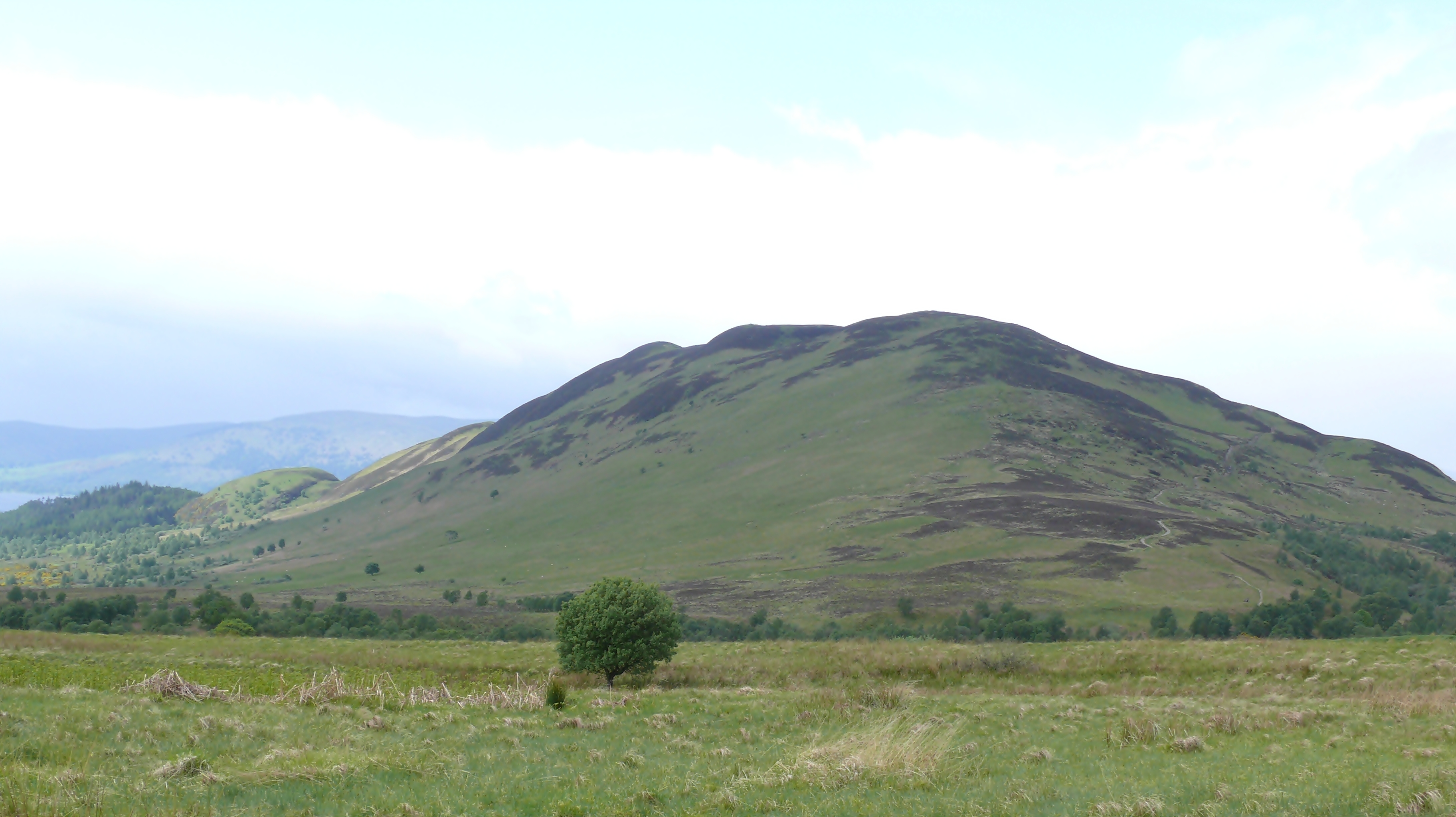
Conic Hill

Conic Hill (from Gaelic "còinneach" meaning moss) is a prominent hill in Stirling, Scotland. == Location and description == It is on the east bank of Loch...

Nearby Amenities

Located within 500m of 56.086721,-4.53529
Balmaha
Is In: Stirlingshire, Scotland, UK
Name En: Balmaha
Name Gd: Baile MoChatha
Place: village
Wikidata: Q805465
Wikipedia: en:Balmaha
Lat/Long: 56.0842055/-4.5395408
Barrier: kissing_gate
Source: survey
Lat/Long: 56.0901632/-4.5331143
Leisure: slipway
Lat/Long: 56.0844786/-4.5417515
Telephone
Booth: KX100
Check Date: 2022-03-04
Covered: booth
Payment Credit Cards: yes
Lat/Long: 56.0846018/-4.5416138
Bus Stop
Balmaha Car Park
Bench: yes
Bin: no
Lit: no
Naptan AtcoCode: 66005370001
Naptan NaptanCode: 78423597
Shelter: yes
Tactile Paving: no
Lat/Long: 56.0846273/-4.5395918
Tom Weir
Artist Name: Sean Hedges-Quinn
Artwork Type: sculpture
Description: A tribute in memory of Tom's major contribution to introducing generations to Scotland's great outdoors through his adventures as a climber, writer, broadcaster, naturalist and pioneer campaigner for the protection of the Scottish environment.
Direction: 085
Start Date: 2014-12-29
Subject Wikidata: Q7818012
Tourism: artwork
Lat/Long: 56.0843481/-4.5413696
Post Box
Brand: Royal Mail
Brand Wikidata: Q638098
Brand Wikipedia: en:Royal Mail
Collection Times: Mo-Fr 09:00; Sa 07:00
Operator: Royal Mail
Operator Wikidata: Q638098
Post Box Type: pillar
Ref: G63 1241D
Royal Cypher: scottish_crown
Lat/Long: 56.0846068/-4.5415561
Cafe
St. Mocha
Contact Facebook: stmocha
Contact Instagram: stmochacoffee
Diet Gluten Free: yes
Diet Vegan: yes
Diet Vegetarian: yes
Opening Hours: Mo-Su 08:30-17:00
Website: https://www.stmocha.co.uk/balmaha
Lat/Long: 56.0841127/-4.5395596
Village Shop
Check Date Opening Hours: 2023-09-05
Contact Phone: +44 1360 870357
Contact Website: https://www.theoaktreeinn.co.uk/balmaha-village-shop
Opening Hours: Mo-Su 08:00-20:00
Opening Hours Signed: no
Shop: convenience
Lat/Long: 56.084121/-4.5396763
Birchwood
Addr City: Balmaha
Addr Housename: Birchwood
Addr Postcode: G63 0JQ
Lat/Long: 56.08361/-4.5300299
Bench
Backrest: no
Lat/Long: 56.0845095/-4.5400095
Bench
Backrest: yes
Material: concrete
Lat/Long: 56.0847182/-4.5418548
Bench
Backrest: yes
Material: concrete
Lat/Long: 56.0846358/-4.5416423
Tourism: picnic_site
Lat/Long: 56.0854955/-4.5391031
Marker: yes
Lat/Long: 56.0901745/-4.5330363
Drinking Water
Top Up Tap
Access: yes
Bottle: yes
Fee: no
Man Made: water_tap
Operator: Scottish Water
Operator Wikidata: Q7438022
Lat/Long: 56.084511/-4.5412937
Power: pole
Lat/Long: 56.0851862/-4.5424308
Power: pole
Lat/Long: 56.0857336/-4.5380599
Power: pole
Lat/Long: 56.0854032/-4.5364191
Power: pole
Lat/Long: 56.0851287/-4.533164
Power: pole
Lat/Long: 56.0850778/-4.5323746
Power: pole
Lat/Long: 56.085035/-4.5312728
Power: pole
Lat/Long: 56.084915/-4.5304996
Power: pole
Lat/Long: 56.0846586/-4.5289442
Toilets
Charge: 0.50 GBP
Fee: yes
Payment Coins: yes
Payment Contactless: yes
Wheelchair: yes
Lat/Long: 56.0849197/-4.5388969
Arrochoile B&B
Phone: +441360870231
Tourism: hostel
Website: https://www.whw-bb-lochlomond.com/
Lat/Long: 56.0834282/-4.5306443
Defibrillator
Emergency: defibrillator
Lat/Long: 56.0841524/-4.5396512
Bench
Backrest: yes
Lat/Long: 56.0845863/-4.5397111
Balmaha Lodges
Contact Facebook: balmahalodges
Contact Instagram: balmahalodgeslifestyle
Tourism: apartment
Website: https://www.balmahalodges.com/
Lat/Long: 56.0849648/-4.5406887
Bench
Backrest: no
Material: wood
Lat/Long: 56.0843533/-4.5411059
Bench
Backrest: no
Material: wood
Lat/Long: 56.0843802/-4.5411488
The data included in this document is from www.openstreetmap.org. The data is made available under ODbL.

Have you been to Balmaha Plantation?

Leave your review of Balmaha Plantation below (or comments, questions and feedback).