Cairn Plantation

Wood, Forest in Wigtownshire

Scotland

Cairn Plantation

War Memorial Glasserton The war memorial at Glasserton, situated on the Junction for the A747 and the A746.
War Memorial Glasserton Credit: Steve Houldsworth

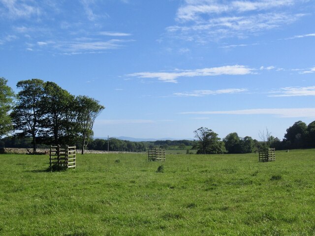
Cairn Plantation is a picturesque woodland located in Wigtownshire, a region in southwest Scotland. Covering an area of approximately 500 acres, this forested area is known for its diverse range of flora and fauna, making it a haven for nature enthusiasts and outdoor enthusiasts alike.

The plantation is characterized by its dense stands of native broadleaf trees, including oak, birch, and beech, which provide a stunning display of colors throughout the year. The forest floor is adorned with a rich carpet of wildflowers, ferns, and mosses, creating a vibrant and enchanting atmosphere.

Cairn Plantation offers a variety of walking trails and paths, allowing visitors to explore the natural beauty of the area at their own pace. The well-maintained trails wind through the woodland, leading to hidden glens, gushing streams, and tranquil ponds. These peaceful spots provide an ideal setting for picnics, birdwatching, or simply enjoying the serene ambiance.

The plantation is also home to a diverse range of wildlife, including deer, foxes, badgers, and a plethora of bird species. Birdwatchers can spot woodpeckers, owls, and various migratory birds throughout the year. With luck, visitors may even catch a glimpse of the elusive red squirrel, a rare sight in many parts of Scotland.

Overall, Cairn Plantation offers a serene and idyllic escape from the bustling city life, providing a sanctuary for those seeking solace in nature's embrace. Its breathtaking beauty, abundant wildlife, and well-maintained trails make it a must-visit destination for anyone who appreciates the wonders of the natural world.

If you have any feedback on the listing, please let us know in the comments section below.

Cairn Plantation Images

Images are sourced within 2km of 54.725845/-4.4558175 or Grid Reference NX4139. Thanks to Geograph Open Source API. All images are credited.

War Memorial Glasserton The war memorial at Glasserton, situated on the Junction for the A747 and the A746.
War Memorial Glasserton
The war memorial at Glasserton, situated on the Junction for the A747 and the A746.
Old milestone Another of the quadrant shaped milestones typical of the old Wigtownshire.  Often painted white this one has had its legends newly picked out in black as well as having vegetation cleared.  It is on the north side of the road opposite the entrance to Glasserton Manse and just east of the A746 junction.  The other face is inscribed I/3 with a right pointing arrow.
Old milestone
Another of the quadrant shaped milestones typical of the old Wigtownshire. Often painted white this one has had its legends newly picked out in black as well as having vegetation cleared. It is on the north side of the road opposite the entrance to Glasserton Manse and just east of the A746 junction. The other face is inscribed I/3 with a right pointing arrow.
Parkland, Glasserton
New Lodge Plantation Woodland, Glasserton
New Lodge Plantation
Woodland, Glasserton
A747, Glasserton
A747, Glasserton
Main Lodge, Glasserton A ruin beside the A747.
Main Lodge, Glasserton
A ruin beside the A747.
A747, Glasserton
A747, Glasserton
A field between roads After taking a silage cut.
A field between roads
After taking a silage cut.
Ruin, Craiglemine
Ruin, Craiglemine
A747, Craiglemine Passing an observatory making use of the dark skies and probable lower cloud incidence being on a low lying peninsula.
A747, Craiglemine
Passing an observatory making use of the dark skies and probable lower cloud incidence being on a low lying peninsula.
Horse Chestnut (Aesculus hippocastanum) The leaves are just developing in Enoch Plantation.
Horse Chestnut (Aesculus hippocastanum)
The leaves are just developing in Enoch Plantation.
The Bridge in New England Plantation Looking down from Enoch Plantation and the bridge over Ersock Burn.
The Bridge in New England Plantation
Looking down from Enoch Plantation and the bridge over Ersock Burn.
Leaving the Churchyard The start of a 'new' footpath that borders Shrubbery Park and ends at Claymoddie. This is part of a project carried out by "All Roads Lead to Whithorn" over the Summer of 2023 to provide an 18km network of paths that eventually take walkers to St Ninian's cave.
Leaving the Churchyard
The start of a 'new' footpath that borders Shrubbery Park and ends at Claymoddie. This is part of a project carried out by "All Roads Lead to Whithorn" over the Summer of 2023 to provide an 18km network of paths that eventually take walkers to St Ninian's cave.
Looking Back Looking down the new footpath towards the new bridge over the stream, the high wall in the background is the walled garden belonging to Woodfall.
Looking Back
Looking down the new footpath towards the new bridge over the stream, the high wall in the background is the walled garden belonging to Woodfall.
Rose Hips A potential food source for overwintering birds.
Rose Hips
A potential food source for overwintering birds.
Robin's Pincushion or Bedeguar Gall Robin's Pincushion, or Bedeguar Gall, is a gall that appears almost exclusively on Dog Rose stems. It is caused by a gall wasp (Diplolepis rosae) which lays its eggs in either the leaves or stem of the dog rose, and one gall may contain several grubs with each one in an individual chamber. Other insects may invade the gall, some of which may be innocent tenants simply taking advantage of the gall causing an enlargement of the structure. But others may be parasites of these inhabitants and others may be hyperparasites preying on the parasites. It has been estimated that as many as 14 different species may be found within Diplolepis rosae galls. All the gall grubs will overwinter inside the 'apparently' dead gall, to emerge next Spring.
Robin's Pincushion or Bedeguar Gall
Robin's Pincushion, or Bedeguar Gall, is a gall that appears almost exclusively on Dog Rose stems. It is caused by a gall wasp (Diplolepis rosae) which lays its eggs in either the leaves or stem of the dog rose, and one gall may contain several grubs with each one in an individual chamber. Other insects may invade the gall, some of which may be innocent tenants simply taking advantage of the gall causing an enlargement of the structure. But others may be parasites of these inhabitants and others may be hyperparasites preying on the parasites. It has been estimated that as many as 14 different species may be found within Diplolepis rosae galls. All the gall grubs will overwinter inside the 'apparently' dead gall, to emerge next Spring.
Glasserton Church The former Glasserton estate church was first built in 1722 then rebuilt in 1732 and later enlarged in 1837 with a north aisle and tower added, designed by J B Papworth. Ministry is recorded at Glasserton from 1567 in the person of Rodolph Peirson. Glasserton united with the parish of the Isle Whithorn on the 13th January 1946 to form Glasserton and Isle of Whithorn. In 2023 the church was deconsecrated and is now in the ownership of the local Laird.
Glasserton Church
The former Glasserton estate church was first built in 1722 then rebuilt in 1732 and later enlarged in 1837 with a north aisle and tower added, designed by J B Papworth. Ministry is recorded at Glasserton from 1567 in the person of Rodolph Peirson. Glasserton united with the parish of the Isle Whithorn on the 13th January 1946 to form Glasserton and Isle of Whithorn. In 2023 the church was deconsecrated and is now in the ownership of the local Laird.
WWII War Graves Tucked away in a corner of the peaceful Glasserton Kirkyard are two military gravestones:

On the left is the last resting place of Corporal Edward William Ashfield (335254) of the Royal Air Force who died on the 3rd of November 1942 at the age of 40 whilst serving with 651 Squadron.  He was injured in a motor vehicle accident on the 2nd of November on the road to Glasserton House, he died of his injuries on the following day.

The headstone on the right is for Pilot Officer Kenneth Joseph Howson who was from the crew of Wellington IC HD984 21 OTU lost on the 20/21 October 1942.  His body was recovered from the shore of nearby Luce Bay at Carleton on the 7th November 1940 and his death was recorded as being due to 'multiple injuries presumed to be due to an aircraft accident'.
WWII War Graves
Tucked away in a corner of the peaceful Glasserton Kirkyard are two military gravestones: On the left is the last resting place of Corporal Edward William Ashfield (335254) of the Royal Air Force who died on the 3rd of November 1942 at the age of 40 whilst serving with 651 Squadron. He was injured in a motor vehicle accident on the 2nd of November on the road to Glasserton House, he died of his injuries on the following day. The headstone on the right is for Pilot Officer Kenneth Joseph Howson who was from the crew of Wellington IC HD984 21 OTU lost on the 20/21 October 1942. His body was recovered from the shore of nearby Luce Bay at Carleton on the 7th November 1940 and his death was recorded as being due to 'multiple injuries presumed to be due to an aircraft accident'.
Show me another place!

Cairn Plantation is located at Grid Ref: NX4139 (Lat: 54.725845, Lng: -4.4558175)

Unitary Authority: Dumfries and Galloway

Police Authority: Dumfries and Galloway

What 3 Words

///melons.pickup.driftwood. Near Whithorn, Dumfries & Galloway

Related Wikis

Glasserton

Glasserton is a civil parish in Dumfries and Galloway, south-west Scotland. It is on the Machars peninsula, in the traditional county of Wigtownshire....

Rispain Camp

Rispain Camp is the remains of a fortified farmstead 1 mile west of Whithorn, Dumfries and Galloway, Scotland. It is one of the major Iron Age archaeological...

Whithorn Priory

Whithorn Priory was a medieval Scottish monastery that also served as a cathedral, located at 6 Bruce Street in Whithorn, Wigtownshire, Dumfries and Galloway...

Candida Casa

Candida Casa was the name given to the church established by St Ninian in Whithorn, Galloway, southern Scotland, in the mid fifth century AD. The name...

Nearby Amenities

Located within 500m of 54.725845,-4.4558175
Power: pole
Lat/Long: 54.7298011/-4.4525166
Power: pole
Lat/Long: 54.7292825/-4.451741
Power: pole
Lat/Long: 54.7287224/-4.4509273
Power: pole
Lat/Long: 54.7281854/-4.45012
Power: pole
Lat/Long: 54.7276997/-4.4494057
Power: pole
Lat/Long: 54.7270895/-4.4485034
The data included in this document is from www.openstreetmap.org. The data is made available under ODbL.

Have you been to Cairn Plantation?

Leave your review of Cairn Plantation below (or comments, questions and feedback).