Loch Shore Wood

Wood, Forest in Dunbartonshire

Scotland

Loch Shore Wood

Inchmurrin Largest island in Loch Lomond and one of a chain along the Highland Boundary Fault. There was a fire beside Conic Hill.
Inchmurrin Credit: Richard Webb

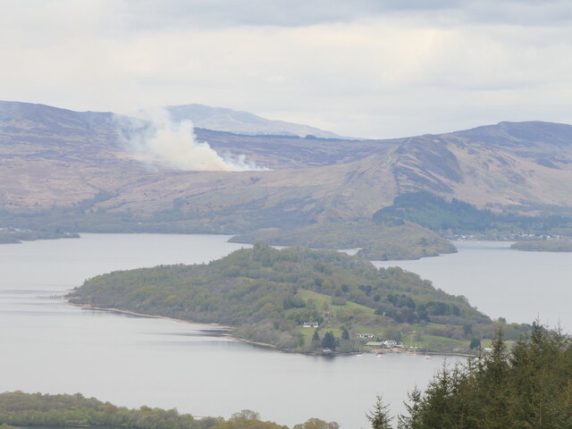
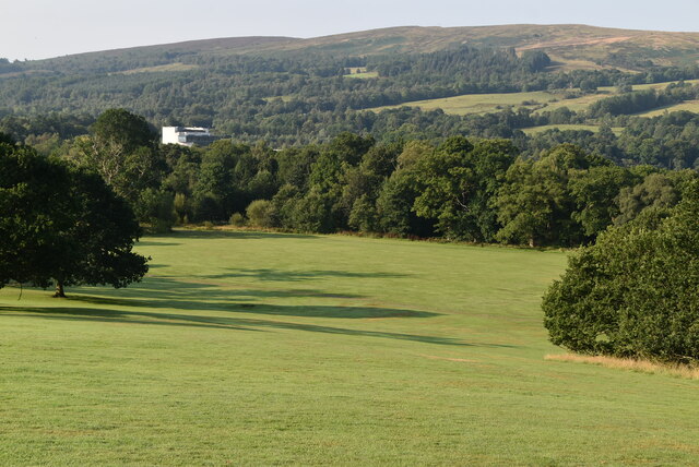
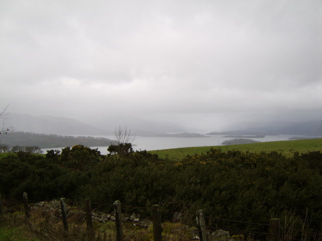
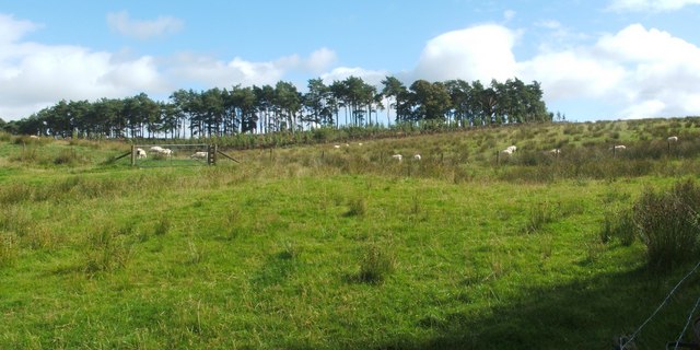
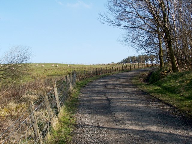
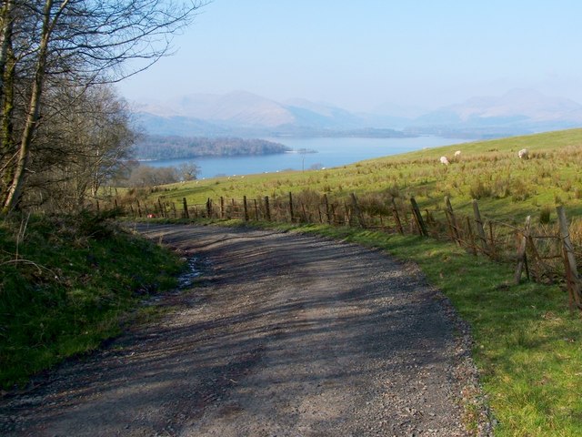
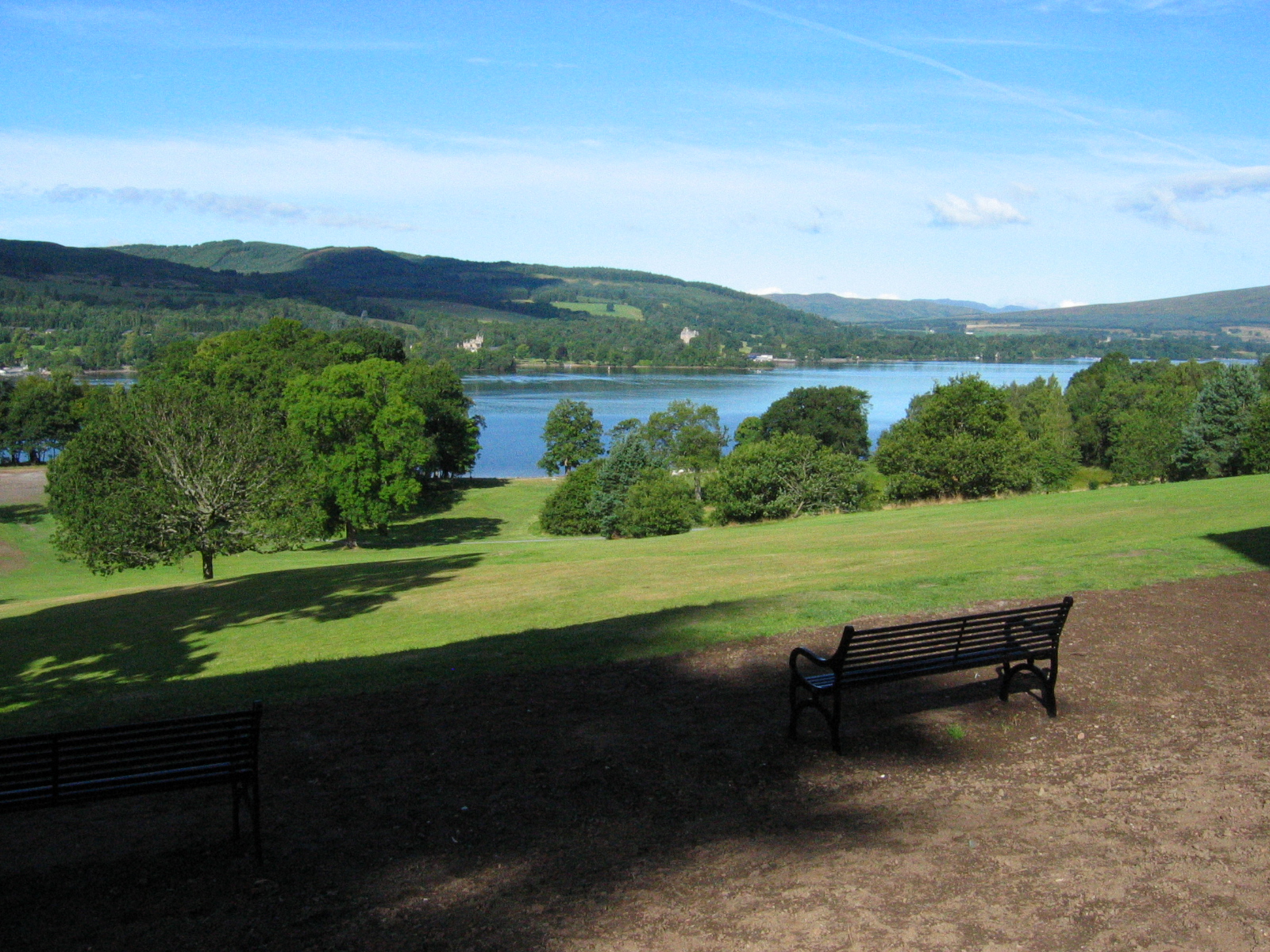
Loch Shore Wood is a picturesque woodland located in Dunbartonshire, Scotland. Covering an area of approximately 100 acres, this tranquil forest is situated on the shores of the stunning Loch Lomond, offering visitors breathtaking views and a serene atmosphere.

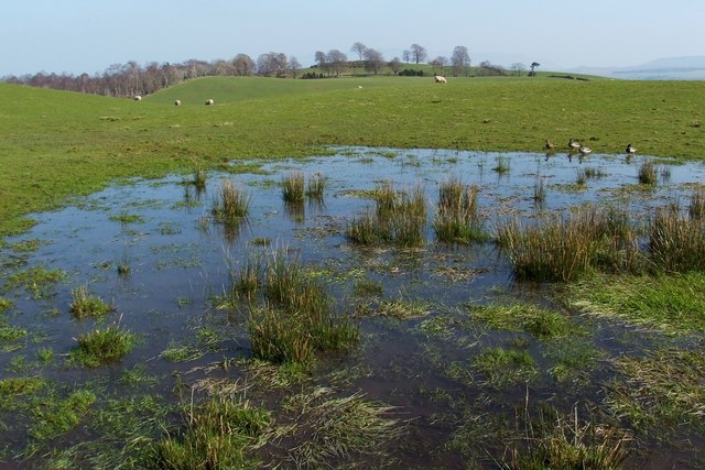
The wood is mainly composed of native deciduous trees such as oak, birch, and rowan, creating a diverse and vibrant ecosystem. The dense foliage provides habitat for a variety of wildlife, including red squirrels, roe deer, and a wide array of bird species. Nature enthusiasts and birdwatchers will find this woodland a haven for observing and appreciating Scotland's natural beauty.

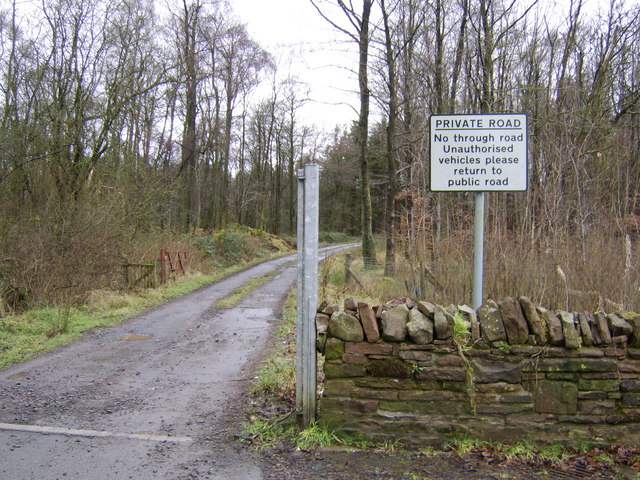
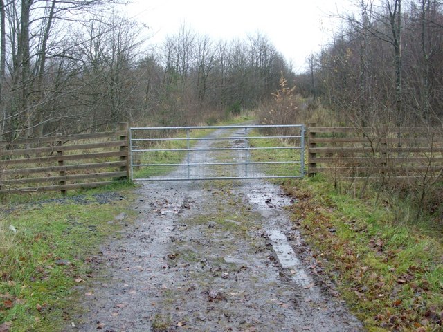
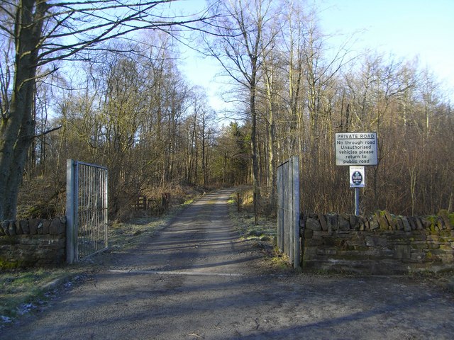
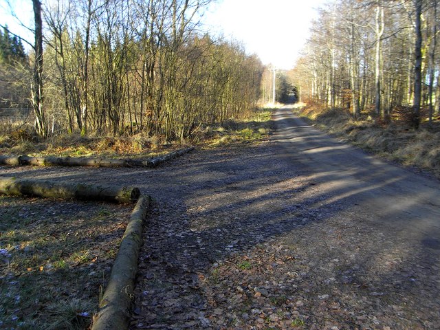
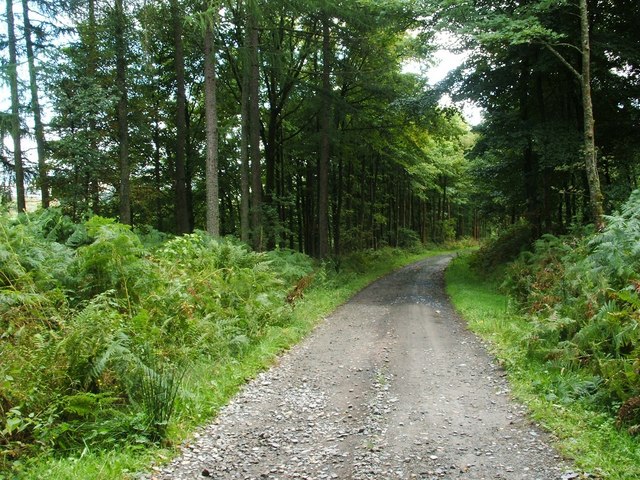
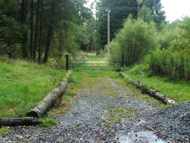
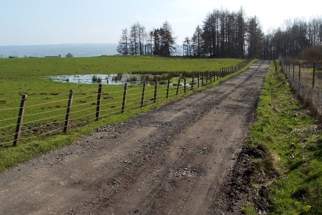
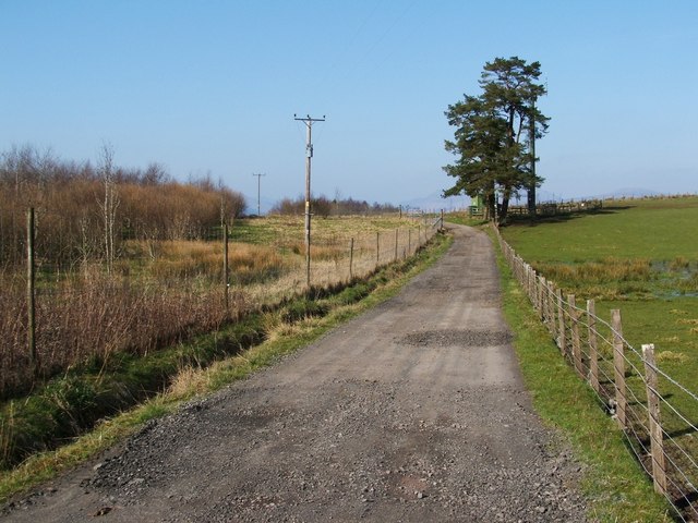
A network of well-maintained trails winds through the forest, allowing visitors to explore the wood at their own pace. These pathways range from easy strolls to more challenging hikes, catering to all levels of fitness and ability. Along the trails, informative signs provide interesting facts about the local flora and fauna, enhancing the educational experience.

Loch Shore Wood also has designated picnic areas, where families and friends can enjoy a peaceful lunch surrounded by nature. The tranquil atmosphere and stunning loch views make it an ideal spot for relaxation and rejuvenation.

The wood is easily accessible, with a car park located nearby and public transportation options available. Whether for a leisurely stroll, a birdwatching trip, or a family outing, Loch Shore Wood offers a delightful and enchanting experience for nature lovers and outdoor enthusiasts alike.

If you have any feedback on the listing, please let us know in the comments section below.

Loch Shore Wood Images

Images are sourced within 2km of 56.031831/-4.5923675 or Grid Reference NS3885. Thanks to Geograph Open Source API. All images are credited.

Inchmurrin Largest island in Loch Lomond and one of a chain along the Highland Boundary Fault. There was a fire beside Conic Hill.
Inchmurrin
Largest island in Loch Lomond and one of a chain along the Highland Boundary Fault. There was a fire beside Conic Hill.
Loch Lomond Haymaking A Ford Super Major Tractor and Claas Rollant 46 round-bale Hay Baler on Loch Lomond. 
Having set off from Arden jetty, they are being towed on a pontoon, presumably for haymaking on Inchfad or Inchmurrin Islands.
Loch Lomond Haymaking
A Ford Super Major Tractor and Claas Rollant 46 round-bale Hay Baler on Loch Lomond. Having set off from Arden jetty, they are being towed on a pontoon, presumably for haymaking on Inchfad or Inchmurrin Islands.
Balloch Castle Country Park Balloch Country Park is a 200-acre country park on the southern tip of Loch Lomond. It was recognised as a country park in 1980, and it is the only country park in the Loch Lomond and the Trossachs National Park. Balloch Country Park features nature trails, guided walks, a walled garden, and picnic lawns with views of the Loch. It was originally developed in the early 19th century by John Buchanan, a partner in the Glasgow and Ship Bank, and the gardens were significantly improved by the Dennistoun-Browns, who bought the estate in 1851. Buchanan also built Balloch Castle, which now serves as the park's visitors' centre.
Wikipedia: <span class="nowrap"><a title="https://en.wikipedia.org/wiki/Balloch_Country_Park" rel="nofollow ugc noopener" href="https://en.wikipedia.org/wiki/Balloch_Country_Park">Link</a><img style="margin-left:2px;" alt="External link" title="External link - shift click to open in new window" src="https://s1.geograph.org.uk/img/external.png" width="10" height="10"/></span>
Balloch Castle Country Park
Balloch Country Park is a 200-acre country park on the southern tip of Loch Lomond. It was recognised as a country park in 1980, and it is the only country park in the Loch Lomond and the Trossachs National Park. Balloch Country Park features nature trails, guided walks, a walled garden, and picnic lawns with views of the Loch. It was originally developed in the early 19th century by John Buchanan, a partner in the Glasgow and Ship Bank, and the gardens were significantly improved by the Dennistoun-Browns, who bought the estate in 1851. Buchanan also built Balloch Castle, which now serves as the park's visitors' centre. Wikipedia: LinkExternal link
Private road to Lorn A road to a small farm near Loch Lomond.
Private road to Lorn
A road to a small farm near Loch Lomond.
Woodland near Loch Lomond With a beautiful view to the loch in the background, despite the typical Scottish weather!
Woodland near Loch Lomond
With a beautiful view to the loch in the background, despite the typical Scottish weather!
Loop walk (return leg) - turning west Previous section of the route: <a href="https://www.geograph.org.uk/photo/1045980">NS3984 : Loop walk (return leg) - gap in dry-stone wall</a>.

The gravel track shown in that photograph leads southwards to the gate that is shown here; the track is part of a waymarked circular route through Whinny Hill Woods, and it can be seen entering at the left of the photo (the track visible on the other side of the fence is not a part of this route, but leads, instead, to the point shown in <a href="https://www.geograph.org.uk/photo/2067651">NS4084 : Track to Whinny Hill</a>).

The track then turns to the west (i.e., towards the photographer's position), and soon leads back to the T-junction shown in <a href="https://www.geograph.org.uk/photo/1045745">NS3984 : Whinny Hill Woods - start of the loop walk</a>. That junction was the start of the outward leg of the circular walk; arriving there completes the circular part of the walk.
Loop walk (return leg) - turning west
Previous section of the route: NS3984 : Loop walk (return leg) - gap in dry-stone wall. The gravel track shown in that photograph leads southwards to the gate that is shown here; the track is part of a waymarked circular route through Whinny Hill Woods, and it can be seen entering at the left of the photo (the track visible on the other side of the fence is not a part of this route, but leads, instead, to the point shown in NS4084 : Track to Whinny Hill). The track then turns to the west (i.e., towards the photographer's position), and soon leads back to the T-junction shown in NS3984 : Whinny Hill Woods - start of the loop walk. That junction was the start of the outward leg of the circular walk; arriving there completes the circular part of the walk.
Private Road and Gate Private Road between Blairlinnans Water Treatment Plant and Lorn House, near the Old military Road A811
Private Road and Gate
Private Road between Blairlinnans Water Treatment Plant and Lorn House, near the Old military Road A811
Private Road and Logs Private Road between A811 and Lorn Mill Cottages
Private Road and Logs
Private Road between A811 and Lorn Mill Cottages
Field near Lorn The field is associated with Lorn Farm. The trees in the background correspond to the strip of woodland that is shown on the map.
Field near Lorn
The field is associated with Lorn Farm. The trees in the background correspond to the strip of woodland that is shown on the map.
Track through Boturich Estate There were many beech trees alongside this section of the track, between Lorn Farm and Blairlinnans Water Treatment Works.
Track through Boturich Estate
There were many beech trees alongside this section of the track, between Lorn Farm and Blairlinnans Water Treatment Works.
Track to Whinny Hill The track leads to the gate shown in <a href="https://www.geograph.org.uk/photo/1046034">NS4084 : Loop walk (return leg) - turning west</a>, and is shown here from the point where it branches off from the main <a href="https://www.geograph.org.uk/photo/2067612">NS4085 : Track through Boturich Estate</a>.

The gate is shown from a little further away in <a href="https://www.geograph.org.uk/photo/5405674">NS4084 : Track to Whinny Hill Woodland</a>, and from the other side in <a href="https://www.geograph.org.uk/photo/5567054">NS4084 : Gate on woodland path</a>.
Track to Whinny Hill
The track leads to the gate shown in NS4084 : Loop walk (return leg) - turning west, and is shown here from the point where it branches off from the main NS4085 : Track through Boturich Estate. The gate is shown from a little further away in NS4084 : Track to Whinny Hill Woodland, and from the other side in NS4084 : Gate on woodland path.
Track through Boturich Estate Shortly after passing Lorn (<a href="https://www.geograph.org.uk/photo/466036">NS3985 : Lorn Mill Cottages</a>), the road swings sharply to the south at this bend. See <a href="https://www.geograph.org.uk/photo/2890688">NS4085 : Track through Boturich Estate</a> for a view from the other side.
Track through Boturich Estate
Shortly after passing Lorn (NS3985 : Lorn Mill Cottages), the road swings sharply to the south at this bend. See NS4085 : Track through Boturich Estate for a view from the other side.
Track through Boturich Estate This is the same bend as shown in <a href="https://www.geograph.org.uk/photo/2890674">NS4085 : Track through Boturich Estate</a>, but viewed from the other side. It provides a fine view out over Loch Lomond.
Track through Boturich Estate
This is the same bend as shown in NS4085 : Track through Boturich Estate, but viewed from the other side. It provides a fine view out over Loch Lomond.
Field near Lorn The trees in the background, on the left, form an area of woodland called Tullochan Strip. The photograph was taken from a <a href="https://www.geograph.org.uk/photo/2890723">NS4085 : Track through Boturich Estate</a>; the same waterlogged area can be seen in both pictures.
Field near Lorn
The trees in the background, on the left, form an area of woodland called Tullochan Strip. The photograph was taken from a NS4085 : Track through Boturich Estate; the same waterlogged area can be seen in both pictures.
Track through Boturich Estate For the field to the left of the track, see <a href="https://www.geograph.org.uk/photo/2890710">NS4085 : Field near Lorn</a>. In the background, on the left, the tops of the buildings of Blairlinnans Water Treatment Works can be seen.
Track through Boturich Estate
For the field to the left of the track, see NS4085 : Field near Lorn. In the background, on the left, the tops of the buildings of Blairlinnans Water Treatment Works can be seen.
Track through Boturich Estate The same section of track, viewed in the opposite direction, is shown in <a href="https://www.geograph.org.uk/photo/2890723">NS4085 : Track through Boturich Estate</a>. For the mast that is among the trees just to the right of the track, see <a href="https://www.geograph.org.uk/photo/2890767">NS4085 : TETRA Mast (detail)</a>.
Track through Boturich Estate
The same section of track, viewed in the opposite direction, is shown in NS4085 : Track through Boturich Estate. For the mast that is among the trees just to the right of the track, see NS4085 : TETRA Mast (detail).
TETRA Mast (detail) This is the top of the mast that can be seen among the trees in <a href="https://www.geograph.org.uk/photo/2890744">NS4085 : Track through Boturich Estate</a>.

The mast that is marked on the 1:25000 OS map is a different one: it is taller, and is located about 200 metres to the south.
TETRA Mast (detail)
This is the top of the mast that can be seen among the trees in NS4085 : Track through Boturich Estate. The mast that is marked on the 1:25000 OS map is a different one: it is taller, and is located about 200 metres to the south.
Blairlinnans Water Treatment Works The photograph was taken from the edge of the woods. A little burn (visible in the foreground) flows through a clearing in the woods; it heads NNE from here towards Tullochan Dam.

See <a href="https://www.geograph.org.uk/photo/2890826">NS4084 : Blairlinnans Water Treatment Works</a> for the main description of the water treatment works.
Blairlinnans Water Treatment Works
The photograph was taken from the edge of the woods. A little burn (visible in the foreground) flows through a clearing in the woods; it heads NNE from here towards Tullochan Dam. See NS4084 : Blairlinnans Water Treatment Works for the main description of the water treatment works.
Show me another place!

Loch Shore Wood is located at Grid Ref: NS3885 (Lat: 56.031831, Lng: -4.5923675)

Unitary Authority: West Dunbartonshire

Police Authority: Argyll and West Dunbartonshire

What 3 Words

///point.develop.equivocal. Near Balloch, West Dunbartonshire

Nearby Locations

Loch Shore Wood

Related Wikis

Inchmurrin

Inchmurrin (Scottish Gaelic: Innis Mhearain) is an island in Loch Lomond in Scotland. It is the largest fresh water island in the British Isles. ��2�...

Balloch Castle

Balloch Castle is an early 19th-century country house situated at the southern tip of Loch Lomond, in West Dunbartonshire, Scotland. Balloch was a property...

Balloch Country Park

Balloch Country Park is a 200-acre (0.81 km2) country park on the southern tip of Loch Lomond in West Dunbartonshire, Scotland. It was recognised as a...

Cameron House

Cameron House, located on Loch Lomond near Balloch, Scotland, was first built in the mid-1700s, and later purchased by Sir James Smollett. The modern...

Have you been to Loch Shore Wood?

Leave your review of Loch Shore Wood below (or comments, questions and feedback).