Coille Bhlàraidh

Wood, Forest in Inverness-shire

Scotland

Coille Bhlàraidh

Eas larairidh leaving Drundreggan Dam
Eas larairidh leaving Drundreggan Dam Credit: Sarah McGuire

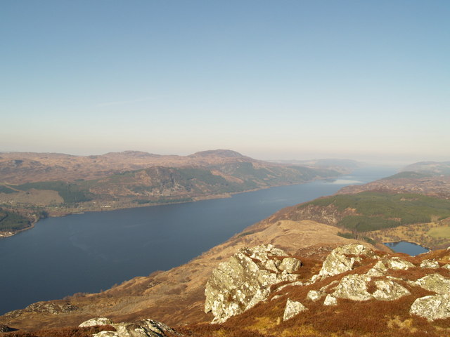
Coille Bhlàraidh, located in Inverness-shire, Scotland, is a stunning and diverse woodland area that covers a vast expanse of approximately 1,500 acres. Nestled in the heart of the Scottish Highlands, it is renowned for its natural beauty and is a popular destination for nature lovers and outdoor enthusiasts.

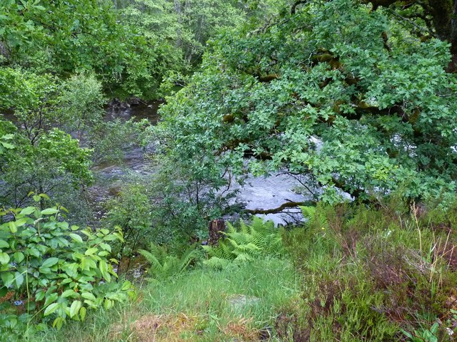
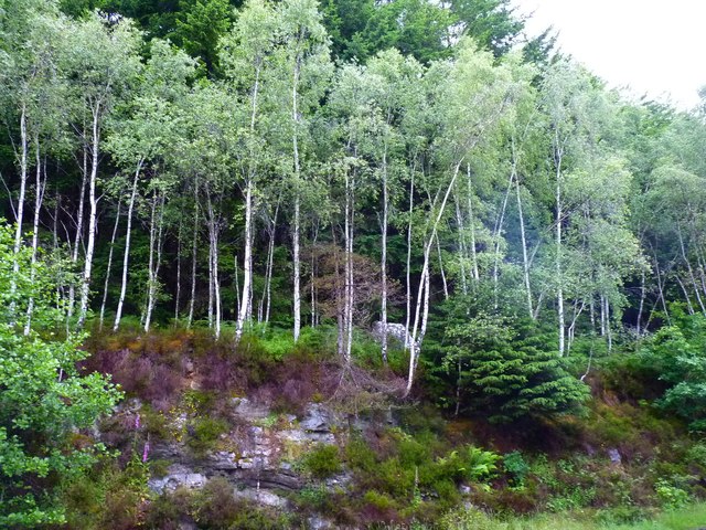
The forest is characterized by a rich variety of tree species, including native Scots pine, birch, and oak trees, which create a dense and lush canopy overhead. This varied habitat provides a haven for a wide range of wildlife, from red squirrels and pine martens to deer and a plethora of bird species.

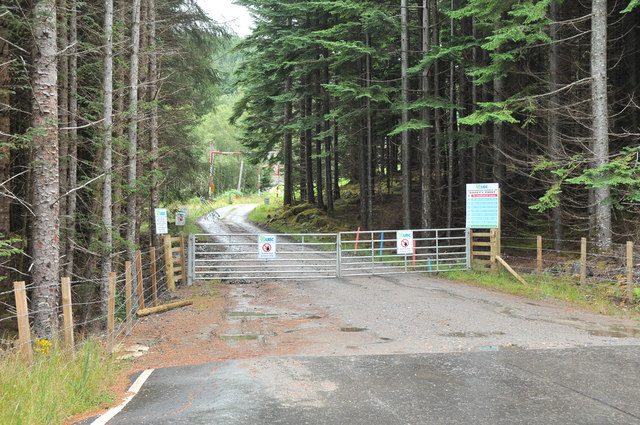
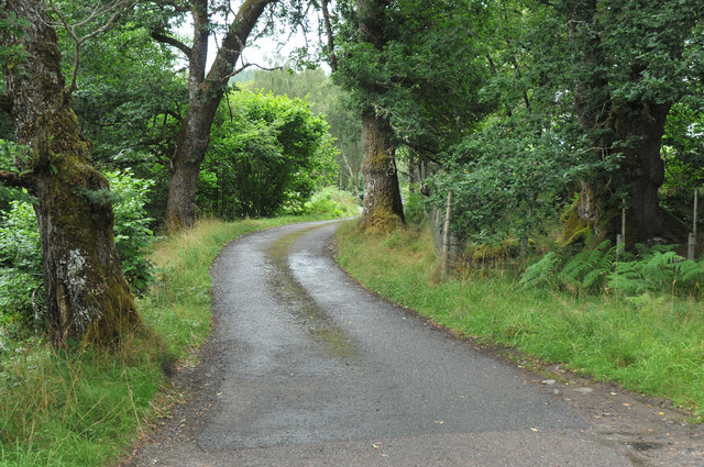
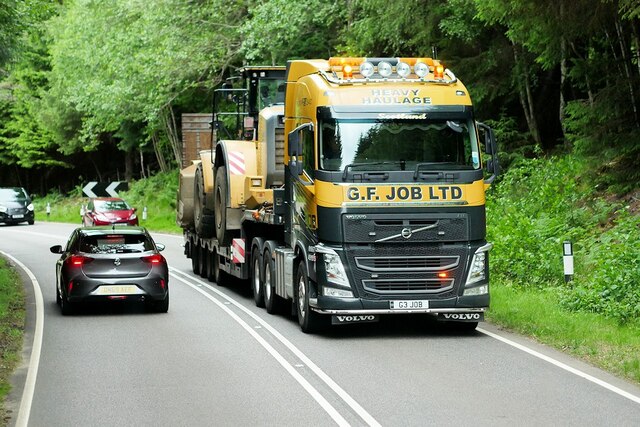
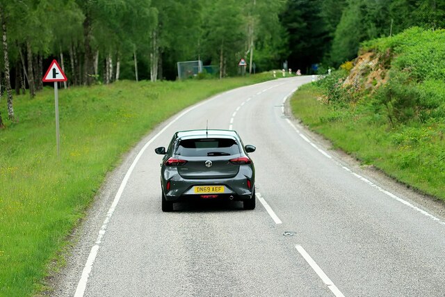
Visitors to Coille Bhlàraidh can explore its numerous walking trails, which wind through the forest and offer breathtaking views of the surrounding landscape. The trails are well-maintained and cater to different levels of fitness, making them suitable for casual strollers or more adventurous hikers.

In addition to its natural beauty, Coille Bhlàraidh also boasts a rich cultural history. The area has been inhabited for centuries, and remnants of ancient settlements, such as stone circles and burial cairns, can still be found throughout the forest. These archaeological sites provide a fascinating insight into the lives of the people who once called this place home.

Overall, Coille Bhlàraidh is a haven of tranquility and natural wonders. Whether it is the vibrant colors of the autumn foliage, the delicate songs of the woodland birds, or the breathtaking views from its hilltops, this enchanting forest offers an unforgettable experience for those who venture into its depths.

If you have any feedback on the listing, please let us know in the comments section below.

Coille Bhlàraidh Images

Images are sourced within 2km of 57.207657/-4.7066652 or Grid Reference NH3616. Thanks to Geograph Open Source API. All images are credited.

Eas larairidh leaving Drundreggan Dam
River through trees The river Moriston seen from the roadside above it.
River through trees
The river Moriston seen from the roadside above it.
Spindly silver birches Birch trees growing alongside the A887 road above the river Moriston.
Spindly silver birches
Birch trees growing alongside the A887 road above the river Moriston.
Dundreggan dam The business end of Dundreggan Reservoir, with the dam and power station.
Dundreggan dam
The business end of Dundreggan Reservoir, with the dam and power station.
Gravel pit entrance road Currently an active site.
Gravel pit entrance road
Currently an active site.
Lay-by on the A887
Lay-by on the A887
Road to private houses at Blaraidh
Dundreggan Dam
Dundreggan Dam
Upper Moriston during Wet West Paddlefest The river from Dundreggan dam down to Invermoriston (where it meets Loch Ness) is normally too low to paddle, as only a minimal compensation flow is maintained. But during releases, the level is almost ideal, and provides kayakers with an excellent run on days when the normal summer levels of other rivers are too low to indulge their sport. Summer releases are normally midweek, but for the annual Wet West Paddlefest, usually held on a weekend in mid-September, a release is specially arranged to welcome water-starved paddlers to Scotland at the start of the whitewater season.

The river can be paddled all the way from the dam to the Loch, but most of it is low-gradient and just two sections provide harder runs at grade 4 or so. This is the end of the slightly easier upper section (starting right below the dam) at a busy time on the Saturday morning of the 2013 WWPF, taken from the rocks at the take-out, a favoured spot for camera-wielding vultures in search of quality carnage. I've chosen a shot in which no-one has suffered an upset, let alone found themselves swimming, but almost all the water in the photo sees its share of kayakers rolling up and occasionally swimming during the day, at least partly because it does get so crowded during this immensely popular event run by the Scottish Canoeing Association in memory of its late Access Officer, Andy Jackson.
Upper Moriston during Wet West Paddlefest
The river from Dundreggan dam down to Invermoriston (where it meets Loch Ness) is normally too low to paddle, as only a minimal compensation flow is maintained. But during releases, the level is almost ideal, and provides kayakers with an excellent run on days when the normal summer levels of other rivers are too low to indulge their sport. Summer releases are normally midweek, but for the annual Wet West Paddlefest, usually held on a weekend in mid-September, a release is specially arranged to welcome water-starved paddlers to Scotland at the start of the whitewater season. The river can be paddled all the way from the dam to the Loch, but most of it is low-gradient and just two sections provide harder runs at grade 4 or so. This is the end of the slightly easier upper section (starting right below the dam) at a busy time on the Saturday morning of the 2013 WWPF, taken from the rocks at the take-out, a favoured spot for camera-wielding vultures in search of quality carnage. I've chosen a shot in which no-one has suffered an upset, let alone found themselves swimming, but almost all the water in the photo sees its share of kayakers rolling up and occasionally swimming during the day, at least partly because it does get so crowded during this immensely popular event run by the Scottish Canoeing Association in memory of its late Access Officer, Andy Jackson.
River Moriston, below Dundreggan A short distance below Dundreggan Dam. With a mixture of woodland alongside the river, as well as trees growing on rocks and small islands in the river.
River Moriston, below Dundreggan
A short distance below Dundreggan Dam. With a mixture of woodland alongside the river, as well as trees growing on rocks and small islands in the river.
Stone wall, by the Allt Iarairidh The remains of a stone wall in a forest clearing, next to the Allt Iarairidh. Probably the remains of an enclosure.
Some details on the Heighland Council HER: <span class="nowrap"><a title="http://her.highland.gov.uk/SingleResult.aspx?uid=MHG22974" rel="nofollow ugc noopener" href="http://her.highland.gov.uk/SingleResult.aspx?uid=MHG22974">Link</a><img style="margin-left:2px;" alt="External link" title="External link - shift click to open in new window" src="https://s1.geograph.org.uk/img/external.png" width="10" height="10"/></span>
Stone wall, by the Allt Iarairidh
The remains of a stone wall in a forest clearing, next to the Allt Iarairidh. Probably the remains of an enclosure. Some details on the Heighland Council HER: LinkExternal link
River Moriston
River Moriston
Volvo FH on the A887 near Coille Bhlàraidh GF Job's Volvo FH (G3 JOB) with flatbed trailer on the A887.
Volvo FH on the A887 near Coille Bhlàraidh
GF Job's Volvo FH (G3 JOB) with flatbed trailer on the A887.
A887 near Coille Bhlàraidh The A887 is essentially a link road through Glen Moriston from the A82 to the A87 for traffic travelling between Inverness and Kyle of Lochalsh and the Isle of Skye. Although a trunk route, traffic volumes are relatively low.

The A887 runs for 14½ miles from a turning off the A82 at the small village of Invermoriston near the shore of Loch Ness to the A87 junction at Bunloyne. Traffic for Skye continues along the A87.
A887 near Coille Bhlàraidh
The A887 is essentially a link road through Glen Moriston from the A82 to the A87 for traffic travelling between Inverness and Kyle of Lochalsh and the Isle of Skye. Although a trunk route, traffic volumes are relatively low. The A887 runs for 14½ miles from a turning off the A82 at the small village of Invermoriston near the shore of Loch Ness to the A87 junction at Bunloyne. Traffic for Skye continues along the A87.
A887 near Dundreggan The A887 is essentially a link road through Glen Moriston from the A82 to the A87 for traffic travelling between Inverness and Kyle of Lochalsh and the Isle of Skye. Although a trunk route, traffic volumes are relatively low.

The A887 runs for 14½ miles from a turning off the A82 at the small village of Invermoriston near the shore of Loch Ness to the A87 junction at Bunloyne. Traffic for Skye continues along the A87.
A887 near Dundreggan
The A887 is essentially a link road through Glen Moriston from the A82 to the A87 for traffic travelling between Inverness and Kyle of Lochalsh and the Isle of Skye. Although a trunk route, traffic volumes are relatively low. The A887 runs for 14½ miles from a turning off the A82 at the small village of Invermoriston near the shore of Loch Ness to the A87 junction at Bunloyne. Traffic for Skye continues along the A87.
Layby on the A887 near Dundreggan The A887 is essentially a link road through Glen Moriston from the A82 to the A87 for traffic travelling between Inverness and Kyle of Lochalsh and the Isle of Skye. Although a trunk route, traffic volumes are relatively low.

The A887 runs for 14½ miles from a turning off the A82 at the small village of Invermoriston near the shore of Loch Ness to the A87 junction at Bunloyne. Traffic for Skye continues along the A87.
Layby on the A887 near Dundreggan
The A887 is essentially a link road through Glen Moriston from the A82 to the A87 for traffic travelling between Inverness and Kyle of Lochalsh and the Isle of Skye. Although a trunk route, traffic volumes are relatively low. The A887 runs for 14½ miles from a turning off the A82 at the small village of Invermoriston near the shore of Loch Ness to the A87 junction at Bunloyne. Traffic for Skye continues along the A87.
A887 Layby near Dundreggan Reservoir The A887 is essentially a link road through Glen Moriston from the A82 to the A87 for traffic travelling between Inverness and Kyle of Lochalsh and the Isle of Skye. Although a trunk route, traffic volumes are relatively low.

The A887 runs for 14½ miles from a turning off the A82 at the small village of Invermoriston near the shore of Loch Ness to the A87 junction at Bunloyne. Traffic for Skye continues along the A87.
A887 Layby near Dundreggan Reservoir
The A887 is essentially a link road through Glen Moriston from the A82 to the A87 for traffic travelling between Inverness and Kyle of Lochalsh and the Isle of Skye. Although a trunk route, traffic volumes are relatively low. The A887 runs for 14½ miles from a turning off the A82 at the small village of Invermoriston near the shore of Loch Ness to the A87 junction at Bunloyne. Traffic for Skye continues along the A87.
Wooden Hut next to the A887 near Dundreggan Reservoir
Show me another place!

Coille Bhlàraidh is located at Grid Ref: NH3616 (Lat: 57.207657, Lng: -4.7066652)

Unitary Authority: Highland

Police Authority: Highlands and Islands

What 3 Words

///trial.skidding.badly. Near Cannich, Highland

Related Wikis

Loch a' Bhainne

Loch a' Bhainne is a small, upland freshwater loch approximately 2 miles (3.2 km) north of the east end of Loch Garry and 3.5 miles (5.6 km) north-west...

Achnaconeran

Achnaconeran is a remote crofting settlement in the Inverness committee area of Highland and is in the Scottish council area of Highland. Achnaconeran...

Invermoriston

Invermoriston (Inbhir Mhoireastain in Gaelic) (grid reference NH420167) is a small village 11 kilometres (7 miles) north of Fort Augustus, Highland, Scotland...

River Moriston

The River Moriston (Scottish Gaelic: Abhainn Mhoireastain) is a river in Inverness-shire, Scotland. It flows broadly east-north-east from the outfall of...

Nearby Amenities

Located within 500m of 57.207657,-4.7066652
Parking
Source: survey
Lat/Long: 57.206194/-4.6992563
Power: pole
Lat/Long: 57.2061685/-4.7006102
Power: pole
Lat/Long: 57.2066777/-4.7001401
Power: pole
Lat/Long: 57.2077903/-4.6990397
Power: pole
Lat/Long: 57.2083303/-4.6985666
The data included in this document is from www.openstreetmap.org. The data is made available under ODbL.

Have you been to Coille Bhlàraidh?

Leave your review of Coille Bhlàraidh below (or comments, questions and feedback).