Parkhill Wood

Wood, Forest in Renfrewshire

Scotland

Parkhill Wood

Kilbarchan Loop trackbed The Kilbarchan Loop, a late addition to the Glasgow and Southwest Railway was closed in 1966. It is now a very popular rails to trails conversion.
Kilbarchan Loop trackbed Credit: Richard Webb

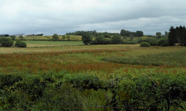
Parkhill Wood is a picturesque woodland located in the historic county of Renfrewshire, Scotland. Spread over an area of approximately 40 acres, it is a haven for nature enthusiasts and offers a tranquil escape from the hustle and bustle of urban life.

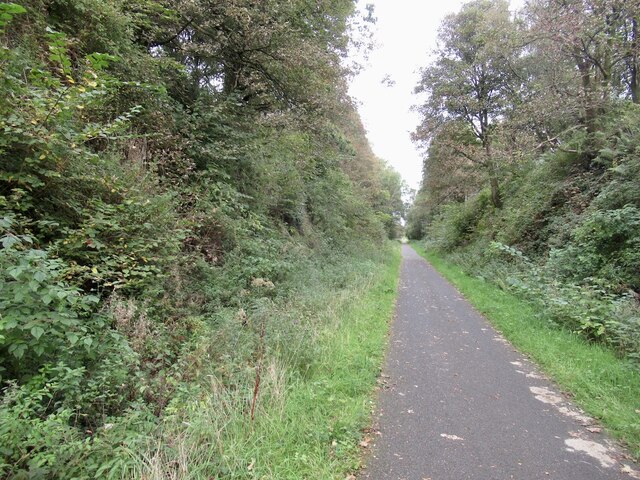
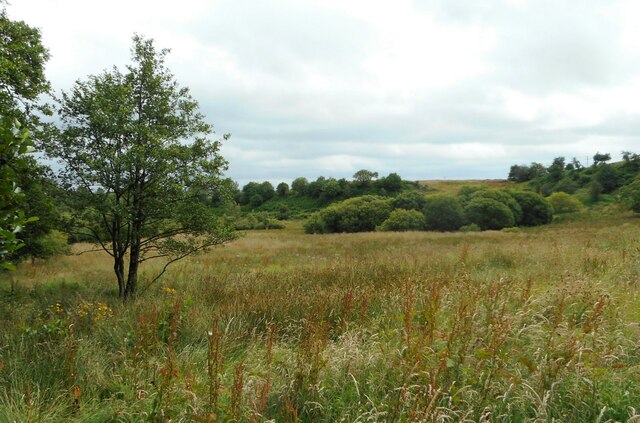
The wood is characterized by a diverse range of tree species, including oak, birch, and beech, which create a lush green canopy. The forest floor is adorned with an array of wildflowers, adding vibrant colors to the scenery. Walking through Parkhill Wood, visitors can easily spot various types of fungi, providing a fascinating insight into the ecosystem's intricate workings.

The wood is home to a rich variety of wildlife, making it a popular spot for birdwatching and nature photography. Visitors may catch sight of woodpeckers, buzzards, and various species of small songbirds. Additionally, the wood is inhabited by mammals such as red squirrels, badgers, and foxes, adding to its charm.

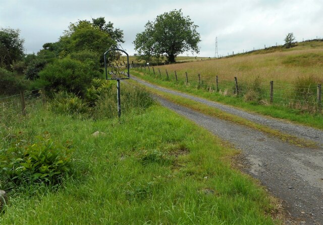
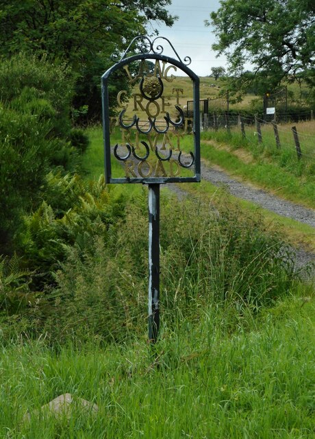
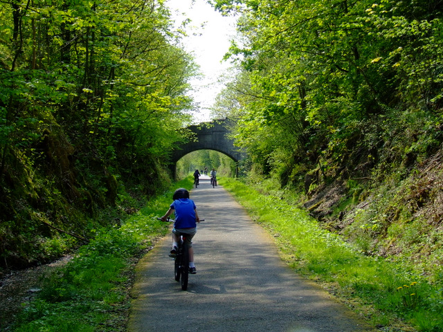
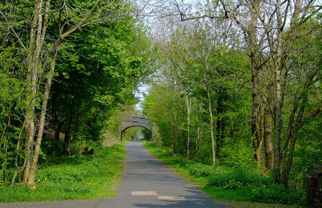
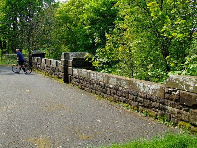
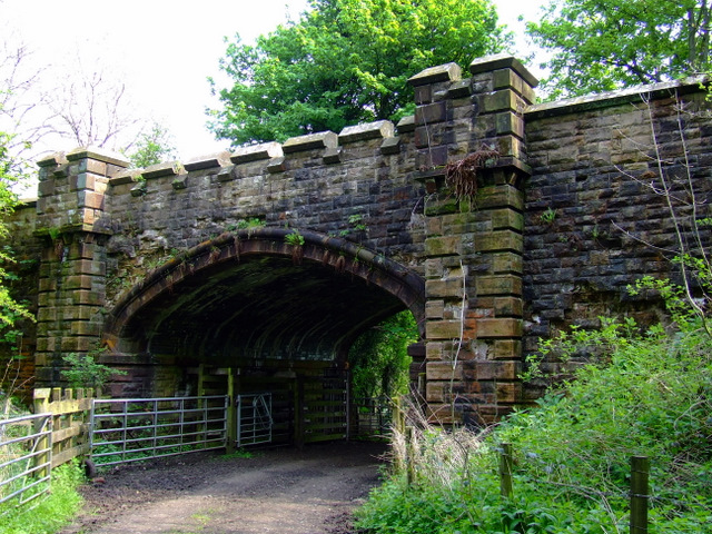
A network of well-maintained trails weaves through Parkhill Wood, allowing visitors to explore the area at their own pace. These paths are suitable for walkers of all ages and abilities, providing a gentle introduction to the beauty of the woodland. Interpretation boards along the trails offer information about the flora, fauna, and history of the area, enhancing the overall experience.

Parkhill Wood is a treasured natural gem in Renfrewshire, offering a peaceful retreat for those seeking solace in nature. Its accessibility and diverse ecosystem make it an ideal destination for a leisurely stroll, birdwatching, or simply taking in the enchanting sights and sounds of the woodland.

If you have any feedback on the listing, please let us know in the comments section below.

Parkhill Wood Images

Images are sourced within 2km of 55.805549/-4.6082445 or Grid Reference NS3659. Thanks to Geograph Open Source API. All images are credited.

Kilbarchan Loop trackbed The Kilbarchan Loop, a late addition to the Glasgow and Southwest Railway was closed in 1966. It is now a very popular rails to trails conversion.
Kilbarchan Loop trackbed
The Kilbarchan Loop, a late addition to the Glasgow and Southwest Railway was closed in 1966. It is now a very popular rails to trails conversion.
The Temple, Kenmure Hill The folly seen from the summit.
The Temple, Kenmure Hill
The folly seen from the summit.
Pond and trackbed The Lochwinnoch cycle path seen from Kenmure Hill.
Pond and trackbed
The Lochwinnoch cycle path seen from Kenmure Hill.
Lochview Lodges Beechwood on the left, Oakwood on the right.
Lochview Lodges
Beechwood on the left, Oakwood on the right.
Lochview Lodges Oakwood, one of two holiday lodges, and the view towards Castle Semple Loch in the distance.
Lochview Lodges
Oakwood, one of two holiday lodges, and the view towards Castle Semple Loch in the distance.
Road to Lang Croft With a name sign made using horseshoes.
Road to Lang Croft
With a name sign made using horseshoes.
Lang Croft sign Name sign for Lang Croft, made using horseshoes. It reads:

LANG
CROFT
PRIVATE
ROAD
Lang Croft sign
Name sign for Lang Croft, made using horseshoes. It reads: LANG CROFT PRIVATE ROAD
Rough grassland With lots of flowering dock plants.
Rough grassland
With lots of flowering dock plants.
Rough grassland With lots of flowering dock plants. The trees in the centre of the image follow the Kaim Burn. Sandieston Farm is top left.
Rough grassland
With lots of flowering dock plants. The trees in the centre of the image follow the Kaim Burn. Sandieston Farm is top left.
Kenmure Hill Temple An octagonal structure on a hill between Howwood and Lochwinnoch. It was built in 1760 by William McDowall of Castle Sempill and is now a ruin. Viewed from National Cycle Network Route 7.
Kenmure Hill Temple
An octagonal structure on a hill between Howwood and Lochwinnoch. It was built in 1760 by William McDowall of Castle Sempill and is now a ruin. Viewed from National Cycle Network Route 7.
Rock climbing on Kenmure Hill Viewed from National Cycle Network Route 7.
Rock climbing on Kenmure Hill
Viewed from National Cycle Network Route 7.
National Cycle Network Route 7 A busy scene near Castle Semple Collegiate Church.
National Cycle Network Route 7
A busy scene near Castle Semple Collegiate Church.
National Cycle Network Route 7 Near Castle Semple Collegiate Church.
National Cycle Network Route 7
Near Castle Semple Collegiate Church.
National Cycle Network Route 7 The bridge near Castle Semple Collegiate Church which is behind the trees.
National Cycle Network Route 7
The bridge near Castle Semple Collegiate Church which is behind the trees.
National Cycle Network Route 7 This rather grand bridge carries the route over a track near Castle Semple Collegiate Church. See the deck of the bridge here <a href="https://www.geograph.org.uk/photo/2395432">NS3760 : National Cycle Network Route 7</a>.
National Cycle Network Route 7
This rather grand bridge carries the route over a track near Castle Semple Collegiate Church. See the deck of the bridge here NS3760 : National Cycle Network Route 7.
Castle Semple Collegiate Church At the northeast end of Castle Semple Loch, by National Cycle Network Route 7. Castle Semple Collegiate Church was built in 1504 by John, Lord Sempill, in the grounds of Castle Semple.
Castle Semple Collegiate Church
At the northeast end of Castle Semple Loch, by National Cycle Network Route 7. Castle Semple Collegiate Church was built in 1504 by John, Lord Sempill, in the grounds of Castle Semple.
Castle Semple Collegiate Church Coat of arms above the tomb of John, Lord Sempill who was killed at the Battle of Flodden in 1513.
Castle Semple Collegiate Church
Coat of arms above the tomb of John, Lord Sempill who was killed at the Battle of Flodden in 1513.
Castle Semple Collegiate Church The tomb of John, Lord Sempill who was killed at the Battle of Flodden in 1513.
Castle Semple Collegiate Church
The tomb of John, Lord Sempill who was killed at the Battle of Flodden in 1513.
Show me another place!

Parkhill Wood is located at Grid Ref: NS3659 (Lat: 55.805549, Lng: -4.6082445)

Unitary Authority: Renfrewshire

Police Authority: Renfrewshire and Inverclyde

What 3 Words

///satin.hedgehog.pockets. Near Lochwinnoch, Renfrewshire

Related Wikis

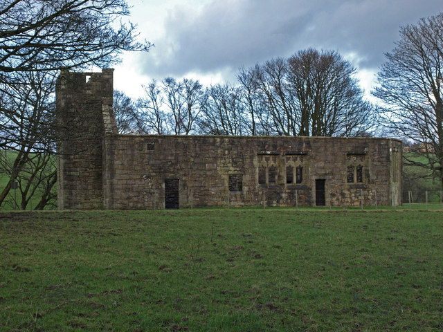
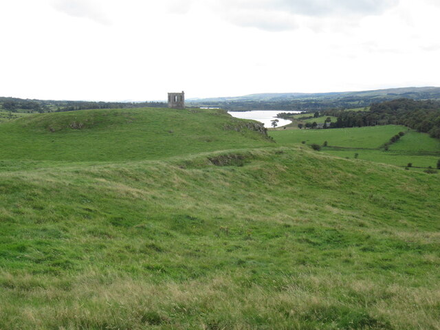
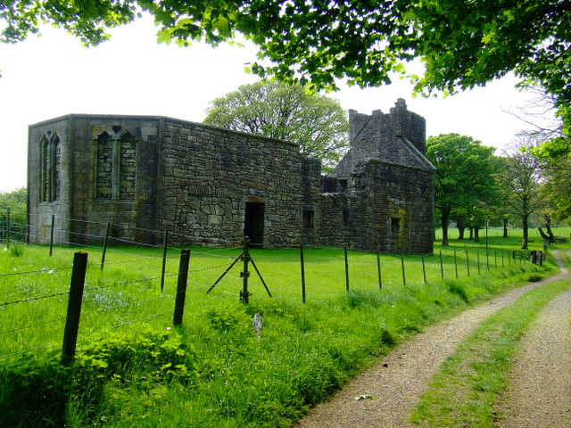
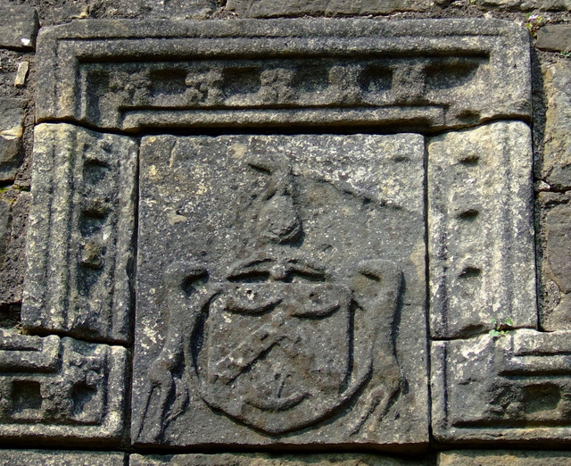
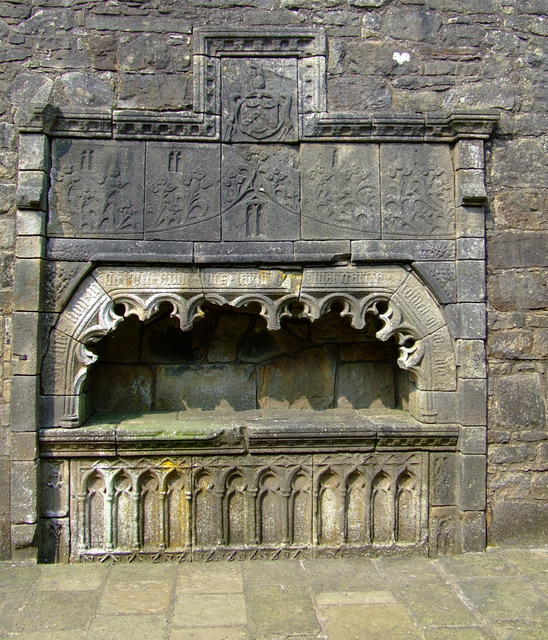
Castle Semple Church

Castle Semple Collegiate Church is located in Renfrewshire, Scotland. It is situated near the eastern end of Castle Semple Loch, within Clyde Muirshiel...

Castle Semple

Castle Semple (previously Castletoun) is a former mansion house located in Renfrewshire, Scotland. It is situated near the eastern end of Castle Semple...

Castle Semple Rowing Club

Castle Semple Rowing Club is a rowing club on the Castle Semple Loch, based at Lochwinnoch, Renfrewshire, Central Lowlands, Scotland. The club is affiliated...

Clyde Muirshiel Regional Park

Clyde Muirshiel Regional Park is the collective name for areas of countryside set aside for conservation and recreation on the South Clyde estuary in Scotland...

Nearby Amenities

Located within 500m of 55.805549,-4.6082445
Grotto
Historic: ruins
Lat/Long: 55.804966/-4.6116045
Parkhill
Natural: peak
Lat/Long: 55.8044957/-4.6132782
Power: pole
Lat/Long: 55.8070033/-4.6141478
Power: pole
Lat/Long: 55.8073801/-4.6133539
Power: pole
Lat/Long: 55.8078685/-4.6122918
Power: pole
Lat/Long: 55.8083162/-4.6113449
Power: pole
Lat/Long: 55.8087563/-4.6103284
Power: pole
Lat/Long: 55.8098189/-4.608027
Power: pole
Lat/Long: 55.8091512/-4.6037355
Power: pole
Lat/Long: 55.8095733/-4.6049666
Power: pole
Lat/Long: 55.8098159/-4.6076837
Power: pole
Lat/Long: 55.8086825/-4.6101755
Power: pole
Lat/Long: 55.8081594/-4.6112832
Power: pole
Lat/Long: 55.807763/-4.6121764
Power: pole
Lat/Long: 55.8072701/-4.6132815
Power: pole
Lat/Long: 55.806931/-4.6139976
Power: pole
Lat/Long: 55.8064682/-4.6149954
Power: pole
Lat/Long: 55.8059135/-4.6162158
Power: pole
Lat/Long: 55.8065466/-4.6151483
Power: pole
Lat/Long: 55.8071014/-4.6153994
Power: pole
Lat/Long: 55.807565/-4.6143599
Power: pole
Lat/Long: 55.8080263/-4.6132933
Power: pole
Lat/Long: 55.8085707/-4.6120663
Power: pole
Lat/Long: 55.8089382/-4.6112205
Power: pole
Lat/Long: 55.809492/-4.6103497
Leisure: picnic_table
Lit: no
Lat/Long: 55.8012817/-4.606443
Leisure: picnic_table
Lit: no
Lat/Long: 55.8012674/-4.6063724
Bench
Backrest: yes
Material: wood
Lat/Long: 55.8012014/-4.6063802
Bench
Backrest: yes
Material: plastic
Lat/Long: 55.8011863/-4.606657
Bench
Backrest: yes
Material: wood
Seats: 1
Lat/Long: 55.8011972/-4.6064775
Bench
Backrest: yes
Material: wood
Lat/Long: 55.801253/-4.606429
Bench
Backrest: yes
Material: wood
Lat/Long: 55.8012308/-4.6063977
Bench
Backrest: yes
Material: wood
Seats: 1
Lat/Long: 55.8012122/-4.6064882
The data included in this document is from www.openstreetmap.org. The data is made available under ODbL.

Have you been to Parkhill Wood?

Leave your review of Parkhill Wood below (or comments, questions and feedback).