Campton

Settlement in Bedfordshire

England

Campton

High Street, Meppershall Looking south-westward.
High Street, Meppershall Credit: Peter Wood

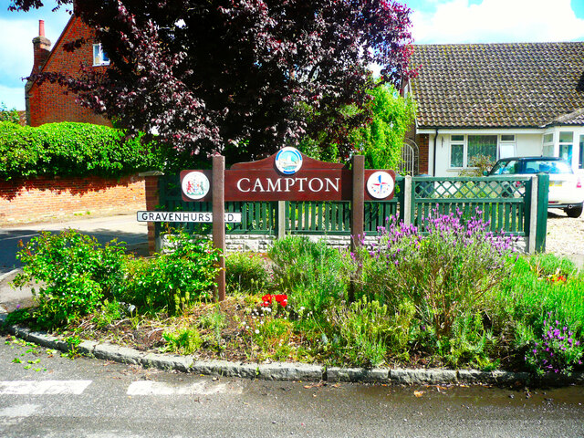
Campton is a small village located in the county of Bedfordshire, England. Situated approximately 45 miles north of London, it falls within the Central Bedfordshire district. The village is nestled in a rural setting, surrounded by picturesque countryside and charming landscapes.

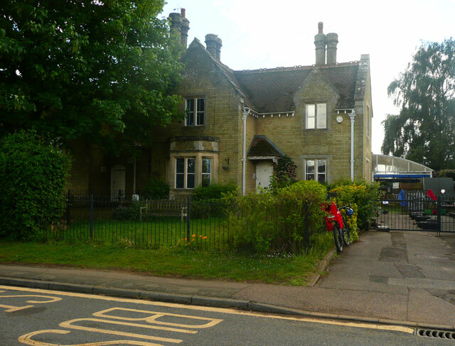
Campton has a rich history dating back to medieval times, with evidence of human settlement in the area from as early as the 12th century. The village is known for its quaint and traditional architecture, including a number of historic buildings and thatched cottages that add to its charm.

Despite its small size, Campton offers a range of amenities to its residents. These include a primary school, a village hall, and a local pub, which serves as a social hub for the community. The village is also well-connected, with good transport links to nearby towns and cities.

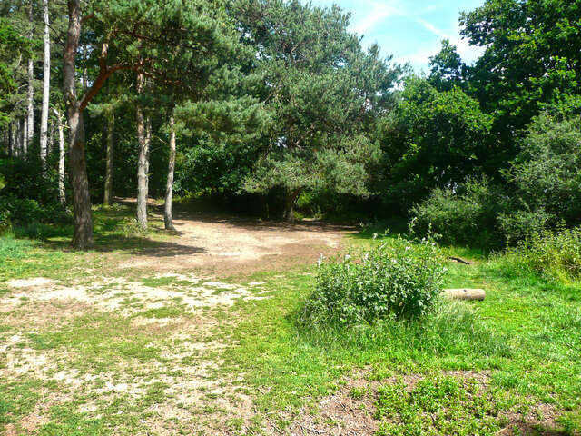
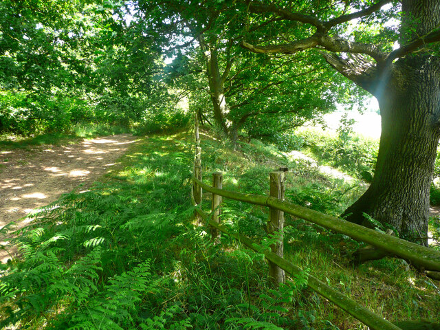
For nature enthusiasts, Campton is an ideal location. The village is surrounded by beautiful countryside, making it a popular spot for outdoor activities such as hiking, cycling, and birdwatching. The nearby Campton Plantation, a local nature reserve, provides a tranquil escape for those seeking to explore the area's flora and fauna.

Overall, Campton is a peaceful and idyllic village that offers a close-knit community, a rich history, and stunning natural surroundings. It is a place that allows residents to enjoy a slower pace of life while still benefiting from the conveniences of nearby urban areas.

If you have any feedback on the listing, please let us know in the comments section below.
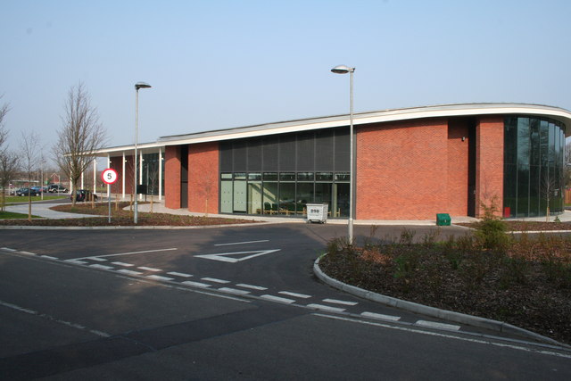
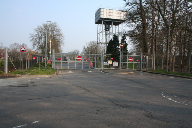
Campton Images

Images are sourced within 2km of 52.030341/-0.35631485 or Grid Reference TL1238. Thanks to Geograph Open Source API. All images are credited.

High Street, Meppershall Looking south-westward.
High Street, Meppershall
Looking south-westward.
Dalchini Spice, Shefford An award winning Indian restaurant
Dalchini Spice, Shefford
An award winning Indian restaurant
Roundabout on  Ivel Road, Shefford Oak Manor care home is on the right
Roundabout on Ivel Road, Shefford
Oak Manor care home is on the right
Hitchin Road at the corner of Ivel Road
Campton Village Hall
Brookside, Campton A cul-de-sac in the village, off Gravenhurst Road.
Brookside, Campton
A cul-de-sac in the village, off Gravenhurst Road.
The school house, Rectory Road, Campton
Mill Lane, Campton
Mill Lane, Campton
Gate at the end of Mill Lane, Campton This is on the drive to the former mill, which is now a house. A public footpath goes along the drive.
Gate at the end of Mill Lane, Campton
This is on the drive to the former mill, which is now a house. A public footpath goes along the drive.
Village sign, Campton This has the emblem for the 1951 Festival of Britain exhibition.
Village sign, Campton
This has the emblem for the 1951 Festival of Britain exhibition.
The White Hart, Mill Lane, Campton
Greenway, Campton Passing the churchyard wall.
Greenway, Campton
Passing the churchyard wall.
Poste Cottage, Greenway A thatched house, listed, Grade II.
Poste Cottage, Greenway
A thatched house, listed, Grade II.
Poste Cottage, Greenway, Campton A thatched house, listed Grade II.
Poste Cottage, Greenway, Campton
A thatched house, listed Grade II.
Trees in a field, seen from Greenway, Campton These are typical of parkland trees.
Trees in a field, seen from Greenway, Campton
These are typical of parkland trees.
Greenway, Campton Glebe Farm is on the left. The footway has been resurfaced with a very black material.
Greenway, Campton
Glebe Farm is on the left. The footway has been resurfaced with a very black material.
Track in Rowney Warren Wood, Southill This track is along the southern edge of the wood.
Track in Rowney Warren Wood, Southill
This track is along the southern edge of the wood.
Track in Rowney Warren Wood, Southill This track goes along the southern edge of the wood, and over the boundary fence at a lower level there is a bridleway, which is part of the John Bunyan Trail. Along the length of the track that I walked there was no connection between the two paths.
Track in Rowney Warren Wood, Southill
This track goes along the southern edge of the wood, and over the boundary fence at a lower level there is a bridleway, which is part of the John Bunyan Trail. Along the length of the track that I walked there was no connection between the two paths.
Show me another place!

Campton is located at Grid Ref: TL1238 (Lat: 52.030341, Lng: -0.35631485)

Unitary Authority: Central Bedfordshire

Police Authority: Bedfordshire

What 3 Words

///increased.strut.flown. Near Shefford, Bedfordshire

Related Wikis

Church of All Saints, Campton

The Church of All Saints is the Anglican parish church in the village of Campton, Shefford, Bedfordshire, England. Its official title is Campton and Chicksands...

Campton, Bedfordshire

Campton is a village and former civil parish, now in the parish of Campton and Chicksands, in the Central Bedfordshire district of Bedfordshire, England...

Chicksands

Chicksands is a village and former civil parish, now in the parish of Campton and Chicksands in the Central Bedfordshire district of Bedfordshire, England...

Campton and Chicksands

Campton and Chicksands is a civil parish in the Central Bedfordshire district, in the ceremonial county of Bedfordshire, England. Its main settlements...

River Flit

The River Flit is a short river in Bedfordshire, England. Its name is not ancient, but rather a back formation from Flitton which originally meant that...

HMS Ferret (1982 shore establishment)

HMS Ferret is a training unit of the Royal Naval Reserve based at MOD Chicksands in Bedfordshire. == History == HMS Ferret was initially established at...

RAF Chicksands

Royal Air Force Chicksands or more simply RAF Chicksands, was a Royal Air Force station located 7.7 miles (12.4 km) south east of Bedford, Bedfordshire...

Shefford railway station

Shefford was a railway station on the Bedford to Hitchin Line which served the town of Shefford in Bedfordshire, England. Opened in 1857, it gave more...

Related Videos

The Beauty of Ireland | 10 Must-Visit Places and Landmarks | Travel Video

The Beauty of Ireland: 10 Must-Visit Places and Landmarks Welcome to my channel, where we're about to embark on a ...

【海外旅行】アイルランド

アイルランド7日間の様子 成田☞ドバイ☞アイルランド 約18時間のフライト #成田空港 #ドバイ #アイルランド #ダブリン #海外 ...

Nearby Amenities

Located within 500m of 52.030341,-0.35631485
Campton
Place: village
Source Name: local knowledge
Wikidata: Q1520170
Lat/Long: 52.0293565/-0.3535435
Turning Circle
Turning Circle: knuckle
Lat/Long: 52.0296585/-0.3558652
Power: pole
Lat/Long: 52.0313511/-0.3497712
Power: pole
Lat/Long: 52.0294016/-0.3517902
Power: pole
Lat/Long: 52.0308294/-0.3510385
Power: pole
Lat/Long: 52.0286577/-0.3512098
Pub
The White Hart
Addr City: Shefford
Addr Country: GB
Addr Postcode: SG17 5NX
Addr Street: Mill Lane
Addr Suburb: Campton
Fhrs Authority: Central Bedfordshire
Fhrs Id: 743426
Fhrs Local Authority Id: 1688
Wikidata: Q26407583
Lat/Long: 52.0289144/-0.3538987
Communication Mobile Phone: yes
Man Made: mast
Tower Type: communication
Lat/Long: 52.0319065/-0.3612288
Fixme: solar panel?
Lat/Long: 52.031593/-0.359481
Direction: 120
Generator Method: photovoltaic
Generator Output Electricity: yes
Generator Solar Modules: 8
Generator Source: solar
Generator Type: solar_photovoltaic_panel
Location: roof
Power: generator
Lat/Long: 52.031049/-0.3584124
Bus Stop
Bus: yes
Naptan AtcoCode: 021024505
Naptan NaptanCode: ahlamagt
Public Transport: platform
Lat/Long: 52.0304994/-0.3565665
Direction: 130
Generator Method: photovoltaic
Generator Output Electricity: yes
Generator Solar Modules: 16
Generator Source: solar
Generator Type: solar_photovoltaic_panel
Location: roof
Power: generator
Lat/Long: 52.0288392/-0.3541078
Direction: 220
Generator Method: photovoltaic
Generator Output Electricity: yes
Generator Solar Modules: 12
Generator Source: solar
Generator Type: solar_photovoltaic_panel
Location: roof
Power: generator
Lat/Long: 52.0333348/-0.3512508
Street Lamp
Lat/Long: 52.03446/-0.3592272
Marker: post
Utility: oil
Lat/Long: 52.0344014/-0.3591357
Street Lamp
Lat/Long: 52.0343232/-0.3593456
The data included in this document is from www.openstreetmap.org. The data is made available under ODbL.

Have you been to Campton?

Leave your review of Campton below (or comments, questions and feedback).