Campton Plantation

Wood, Forest in Bedfordshire

England

Campton Plantation

Dalchini Spice, Shefford An award winning Indian restaurant
Dalchini Spice, Shefford Credit: David Howard

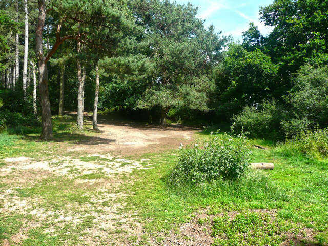
Campton Plantation, located in Bedfordshire, is a picturesque woodland area known for its natural beauty and rich history. This vast plantation covers an area of approximately 400 hectares and is predominantly made up of dense forest and woodlands.

The plantations' history can be traced back to medieval times when it was primarily used for timber production and hunting. Over the years, the woodland has been carefully managed to maintain its ecological balance and preserve its diverse range of flora and fauna.

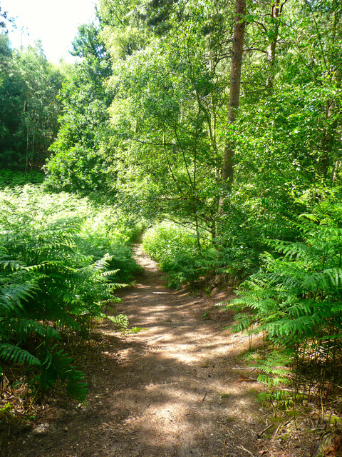
The forest is home to a wide variety of tree species, including oak, beech, and silver birch, creating a stunning and vibrant landscape throughout the year. The woodland floor is adorned with an array of wildflowers, mosses, and ferns, creating a magical atmosphere for visitors.

Campton Plantation is also a haven for wildlife, with numerous species calling it home. Visitors may spot deer, foxes, and various bird species, making it a popular destination for nature enthusiasts and wildlife photographers.

For those seeking outdoor activities, the plantation offers several walking trails and cycling routes, allowing visitors to explore the woodland at their leisure. The well-maintained paths provide easy access for all, ensuring a pleasant experience for families and individuals alike.

Overall, Campton Plantation is a hidden gem in Bedfordshire, offering a peaceful retreat from the hustle and bustle of city life. Its natural beauty, diverse wildlife, and rich history make it a must-visit destination for anyone looking to immerse themselves in nature.

If you have any feedback on the listing, please let us know in the comments section below.

Campton Plantation Images

Images are sourced within 2km of 52.035979/-0.35574357 or Grid Reference TL1238. Thanks to Geograph Open Source API. All images are credited.

Dalchini Spice, Shefford An award winning Indian restaurant
Dalchini Spice, Shefford
An award winning Indian restaurant
Roundabout on  Ivel Road, Shefford Oak Manor care home is on the right
Roundabout on Ivel Road, Shefford
Oak Manor care home is on the right
Hitchin Road at the corner of Ivel Road
Campton Village Hall
Brookside, Campton A cul-de-sac in the village, off Gravenhurst Road.
Brookside, Campton
A cul-de-sac in the village, off Gravenhurst Road.
The school house, Rectory Road, Campton
Mill Lane, Campton
Mill Lane, Campton
Gate at the end of Mill Lane, Campton This is on the drive to the former mill, which is now a house. A public footpath goes along the drive.
Gate at the end of Mill Lane, Campton
This is on the drive to the former mill, which is now a house. A public footpath goes along the drive.
Village sign, Campton This has the emblem for the 1951 Festival of Britain exhibition.
Village sign, Campton
This has the emblem for the 1951 Festival of Britain exhibition.
The White Hart, Mill Lane, Campton
Greenway, Campton Passing the churchyard wall.
Greenway, Campton
Passing the churchyard wall.
Poste Cottage, Greenway A thatched house, listed, Grade II.
Poste Cottage, Greenway
A thatched house, listed, Grade II.
Poste Cottage, Greenway, Campton A thatched house, listed Grade II.
Poste Cottage, Greenway, Campton
A thatched house, listed Grade II.
Trees in a field, seen from Greenway, Campton These are typical of parkland trees.
Trees in a field, seen from Greenway, Campton
These are typical of parkland trees.
Greenway, Campton Glebe Farm is on the left. The footway has been resurfaced with a very black material.
Greenway, Campton
Glebe Farm is on the left. The footway has been resurfaced with a very black material.
Part of the car park for Rowney Warren Wood, Southill The car park is also a picnic area.
Part of the car park for Rowney Warren Wood, Southill
The car park is also a picnic area.
Track in Rowney Warren Wood, Southill This track is along the southern edge of the wood.
Track in Rowney Warren Wood, Southill
This track is along the southern edge of the wood.
Path in Rowney Warren Wood, Southill It is all too easy to lose one's sense of direction in this wood, and also my GPS readings did not always indicate a position on one of the paths shown on the 1:25000 map.
Path in Rowney Warren Wood, Southill
It is all too easy to lose one's sense of direction in this wood, and also my GPS readings did not always indicate a position on one of the paths shown on the 1:25000 map.
Show me another place!

Campton Plantation is located at Grid Ref: TL1238 (Lat: 52.035979, Lng: -0.35574357)

Unitary Authority: Central Bedfordshire

Police Authority: Bedfordshire

What 3 Words

///gossiping.reading.lucky. Near Chicksands, Bedfordshire

Related Wikis

Chicksands

Chicksands is a village and former civil parish, now in the parish of Campton and Chicksands in the Central Bedfordshire district of Bedfordshire, England...

Campton and Chicksands

Campton and Chicksands is a civil parish in the Central Bedfordshire district, in the ceremonial county of Bedfordshire, England. Its main settlements...

HMS Ferret (1982 shore establishment)

HMS Ferret is a training unit of the Royal Naval Reserve based at MOD Chicksands in Bedfordshire. == History == HMS Ferret was initially established at...

RAF Chicksands

Royal Air Force Chicksands or more simply RAF Chicksands, was a Royal Air Force station located 7.7 miles (12.4 km) south east of Bedford, Bedfordshire...

River Flit

The River Flit is a short river in Bedfordshire, England. Its name is not ancient, but rather a back formation from Flitton which originally meant that...

Church of All Saints, Campton

The Church of All Saints is the Anglican parish church in the village of Campton, Shefford, Bedfordshire, England. Its official title is Campton and Chicksands...

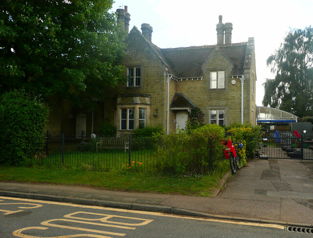
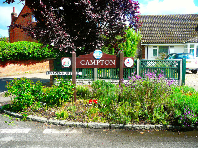
Campton, Bedfordshire

Campton is a village and former civil parish, now in the parish of Campton and Chicksands, in the Central Bedfordshire district of Bedfordshire, England...

Shefford railway station

Shefford was a railway station on the Bedford to Hitchin Line which served the town of Shefford in Bedfordshire, England. Opened in 1857, it gave more...

Nearby Amenities

Located within 500m of 52.035979,-0.35574357
Traffic Calming: island
Lat/Long: 52.0351602/-0.3498554
Mini Roundabout
Lat/Long: 52.0353952/-0.3593937
Turning Circle
Lat/Long: 52.0385208/-0.3608555
Turning Circle
Lat/Long: 52.0380348/-0.3582934
Turning Circle
Lat/Long: 52.0372923/-0.3573096
Chicksands
Place: locality
Wikidata: Q1522731
Lat/Long: 52.0374672/-0.3619193
Direction: 170
Generator Method: photovoltaic
Generator Output Electricity: yes
Generator Solar Modules: 376
Generator Source: solar
Generator Type: solar_photovoltaic_panel
Location: roof
Power: generator
Tilt: 10
Lat/Long: 52.0357287/-0.3608979
Traffic Calming: island
Lat/Long: 52.0345371/-0.3488161
Direction: 130
Generator Method: photovoltaic
Generator Output Electricity: yes
Generator Solar Modules: 12
Generator Source: solar
Generator Type: solar_photovoltaic_panel
Location: roof
Power: generator
Lat/Long: 52.0344245/-0.3494031
Direction: 220
Generator Method: photovoltaic
Generator Output Electricity: yes
Generator Solar Modules: 12
Generator Source: solar
Generator Type: solar_photovoltaic_panel
Location: roof
Power: generator
Lat/Long: 52.0333348/-0.3512508
Bus Stop
Bus: yes
Public Transport: platform
Shelter: no
Lat/Long: 52.0361722/-0.3492283
Direction: 180
Generator Method: photovoltaic
Generator Output Electricity: yes
Generator Solar Modules: 14
Generator Source: solar
Generator Type: solar_photovoltaic_panel
Location: roof
Power: generator
Lat/Long: 52.0368013/-0.3494415
Bus Stop
Bus: yes
Naptan AtcoCode: 021022000
Naptan NaptanCode: ahlagmjp
Public Transport: platform
Lat/Long: 52.0360313/-0.3497872
Direction: 115
Generator Method: photovoltaic
Generator Output Electricity: yes
Generator Solar Modules: 15
Generator Source: solar
Generator Type: solar_photovoltaic_panel
Location: roof
Power: generator
Lat/Long: 52.0368898/-0.349906
Street Lamp
Lat/Long: 52.03446/-0.3592272
Marker: post
Utility: oil
Lat/Long: 52.0344014/-0.3591357
Marker: aerial
Material: concrete
Utility: oil
Lat/Long: 52.0360603/-0.3507689
Marker: aerial
Utility: oil
Lat/Long: 52.0357171/-0.35125
Colour: white
Marker: post
Material: concrete
Utility: oil
Lat/Long: 52.0357225/-0.3512431
Man Made: surveillance
Surveillance: outdoor
Surveillance Type: camera
Lat/Long: 52.0355304/-0.3593939
Barrier: lift_gate
Lat/Long: 52.0356115/-0.3594754
Street Lamp
Lat/Long: 52.0343232/-0.3593456
Bicycle Repair Station
Fee: no
Lat/Long: 52.0349687/-0.3590667
The data included in this document is from www.openstreetmap.org. The data is made available under ODbL.

Have you been to Campton Plantation?

Leave your review of Campton Plantation below (or comments, questions and feedback).