Admiral's Wood

Wood, Forest in Ayrshire

Scotland

Admiral's Wood

Old mine shaft at Hawkhill Farm A closer look at the old mine shaft at Hawkhill Farm. Killochan Castle is shown in the background on the other side of the Water of Girvan. The top of the strange boulder <a href="https://www.geograph.org.uk/photo/7024967">NS2300 : The strange boulder at Hawkhill Farm</a> is just visible on the left.
Old mine shaft at Hawkhill Farm Credit: Mary and Angus Hogg

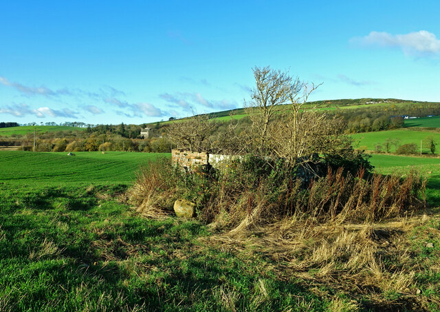
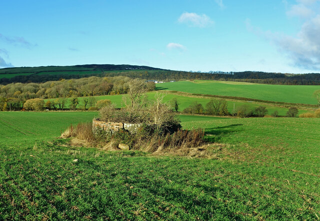
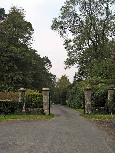
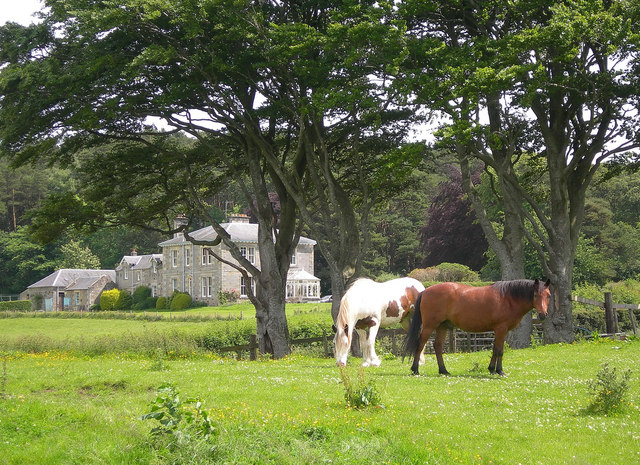
Admiral's Wood, located in Ayrshire, Scotland, is a picturesque forest known for its natural beauty and rich history. Covering an area of approximately 300 acres, the wood is a haven for nature enthusiasts, hikers, and those seeking tranquility amidst the rugged landscape.

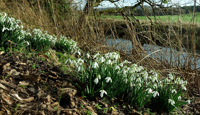
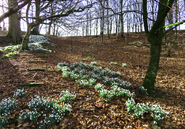
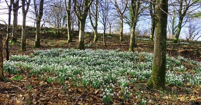
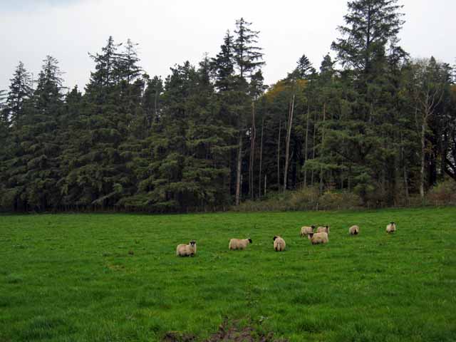
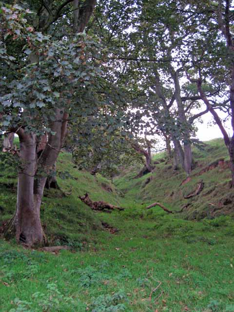
The woodland is predominantly composed of native tree species, including oak, birch, and beech trees, which create a diverse and vibrant ecosystem. The dense canopy provides shade and shelter for a wide range of flora and fauna, making it a haven for birdwatchers and wildlife enthusiasts. Visitors may spot species such as red squirrels, roe deer, and a variety of woodland birds, adding to the charm and allure of the woodland.

Admiral's Wood is also steeped in history and folklore. It gets its name from Admiral Lord Rodney, a British naval officer who owned the land in the late 18th century. The wood was extensively used for timber during the Victorian era, contributing to the local economy and providing materials for construction.

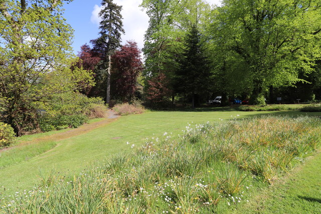
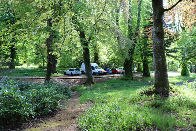
Within the wood, there are several walking trails and paths that allow visitors to explore the area at their own pace. These trails range from easy strolls to more challenging hikes, catering to different fitness levels and interests. As visitors meander through the woodland, they can enjoy the serene atmosphere, listen to the sounds of nature, and appreciate the natural beauty that surrounds them.

Overall, Admiral's Wood in Ayrshire offers a fantastic opportunity to immerse oneself in nature, explore the diverse flora and fauna, and delve into the rich history of the area.

If you have any feedback on the listing, please let us know in the comments section below.

Admiral's Wood Images

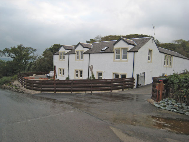
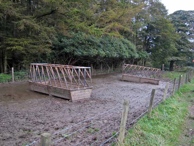
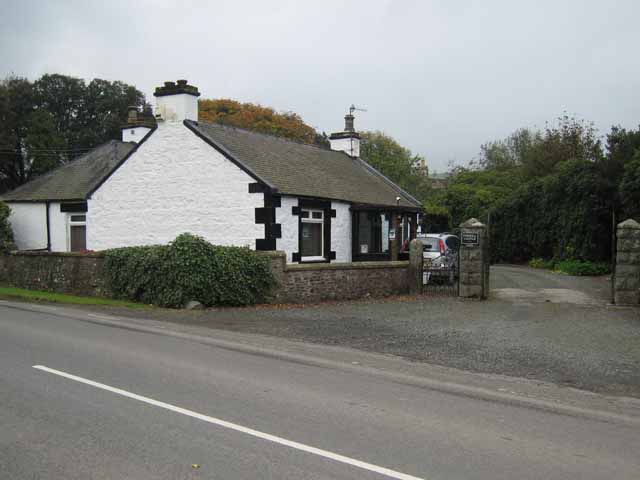
Images are sourced within 2km of 55.261808/-4.7608663 or Grid Reference NX2499. Thanks to Geograph Open Source API. All images are credited.

Old mine shaft at Hawkhill Farm A closer look at the old mine shaft at Hawkhill Farm. Killochan Castle is shown in the background on the other side of the Water of Girvan. The top of the strange boulder <a href="https://www.geograph.org.uk/photo/7024967">NS2300 : The strange boulder at Hawkhill Farm</a> is just visible on the left.
Old mine shaft at Hawkhill Farm
A closer look at the old mine shaft at Hawkhill Farm. Killochan Castle is shown in the background on the other side of the Water of Girvan. The top of the strange boulder NS2300 : The strange boulder at Hawkhill Farm is just visible on the left.
The old mine shaft at Hawkhill Farm The strange circular structure in the field at Hawkhill Farm is a shaft from an old coal mine, walled off for protection. The main part of the mine was on the other side of the road on Bargany Estate. See <a href="https://www.geograph.org.uk/photo/6783144">NX2399 : Old colliery site near Lovestone</a>
The old mine shaft at Hawkhill Farm
The strange circular structure in the field at Hawkhill Farm is a shaft from an old coal mine, walled off for protection. The main part of the mine was on the other side of the road on Bargany Estate. See NX2399 : Old colliery site near Lovestone
Snowdrops beside the Water of Girvan Occasional patches of snowdrops enjoy the sunshine alongside the Water of Girvan at Killochan Estate. The flowers have to fight their way through the previous year’s brambles and nettles.
Snowdrops beside the Water of Girvan
Occasional patches of snowdrops enjoy the sunshine alongside the Water of Girvan at Killochan Estate. The flowers have to fight their way through the previous year’s brambles and nettles.
Snowdrops in Lovestone woods My previous visit to this site in March 2021 was too late to see the flowers in bloom. The snowdrops were lovely this time though the February sun was only just reaching the slope.
Snowdrops in Lovestone woods
My previous visit to this site in March 2021 was too late to see the flowers in bloom. The snowdrops were lovely this time though the February sun was only just reaching the slope.
Snowdrops near Lovestone These snowdrops were spreading out in the woodland near the old colliery site. My previous visit to this spot <a href="https://www.geograph.org.uk/photo/6783144">NX2399 : Old colliery site near Lovestone</a> was too late to see the flowers in bloom. It was worth the return visit.
Snowdrops near Lovestone
These snowdrops were spreading out in the woodland near the old colliery site. My previous visit to this spot NX2399 : Old colliery site near Lovestone was too late to see the flowers in bloom. It was worth the return visit.
Picnic Area, Bargany Gardens Beautiful Garden but only open for the Month of May.
Picnic Area, Bargany Gardens
Beautiful Garden but only open for the Month of May.
Car Park, Bargany Gardens This is the main car park but there is also and overflow car park. Beautiful Garden but only open for the Month of May.
Car Park, Bargany Gardens
This is the main car park but there is also and overflow car park. Beautiful Garden but only open for the Month of May.
Penkill, near Old Dailly
Garryloop, Old Dailly Garryloop is the Anglicized form of "Gearaidh Lub" meaning "The Shieling at the bend between arable and hill ground". Notice how succinct Gaelic is compared with English? An old barn and cobbler's cottage, now rebuilt as comfortable modern accommodation, which operates as a well-appointed bed-and-breakfast and base for deer-stalking holidays. <span class="nowrap"><a title="http://www.ayrstalk.co.uk/accomodation.asp" rel="nofollow ugc noopener" href="http://www.ayrstalk.co.uk/accomodation.asp">Link</a><img style="margin-left:2px;" alt="External link" title="External link - shift click to open in new window" src="https://s1.geograph.org.uk/img/external.png" width="10" height="10"/></span>
Garryloop, Old Dailly
Garryloop is the Anglicized form of "Gearaidh Lub" meaning "The Shieling at the bend between arable and hill ground". Notice how succinct Gaelic is compared with English? An old barn and cobbler's cottage, now rebuilt as comfortable modern accommodation, which operates as a well-appointed bed-and-breakfast and base for deer-stalking holidays. LinkExternal link
Bargany Estate, near Old Dailly The tall trees line the southern driveway into the estate.
Bargany Estate, near Old Dailly
The tall trees line the southern driveway into the estate.
Cattle troughs near Dailly
Lodge to Penkill Castle
Gateway to the Bargany Estate Off the Dailly to Old Dailly road.
Gateway to the Bargany Estate
Off the Dailly to Old Dailly road.
Small wooded valley near Dailly
Hawkhill Farm This shot shows a field of barley beside the Water of Girvan, with Hawkhill Farm behind.
Hawkhill Farm
This shot shows a field of barley beside the Water of Girvan, with Hawkhill Farm behind.
Towards Killochan Castle Looking across the Girvan Valley at a barley field near Hawkhill Farm.  The Saltire is flying over Killochan Castle.
Towards Killochan Castle
Looking across the Girvan Valley at a barley field near Hawkhill Farm. The Saltire is flying over Killochan Castle.
Lovestone House Formerly living accommodation for workers on Bargany Estate.
Now a private house.
Lovestone House
Formerly living accommodation for workers on Bargany Estate. Now a private house.
Trig Point on Maxwellston Hill Looking west towards Ailsa Craig and the Firth of Clyde. For an updated view, see <a href="https://www.geograph.org.uk/photo/6545938">NX2598 : From Maxwellston Hill</a>
Trig Point on Maxwellston Hill
Looking west towards Ailsa Craig and the Firth of Clyde. For an updated view, see NX2598 : From Maxwellston Hill
Show me another place!

Admiral's Wood is located at Grid Ref: NX2499 (Lat: 55.261808, Lng: -4.7608663)

Unitary Authority: South Ayrshire

Police Authority: Ayrshire

What 3 Words

///crockery.reckons.marked. Near Girvan, South Ayrshire

Related Wikis

Killochan Castle

Killochan Castle is a 16th-century L-plan tower house about 3 miles (4.8 km) north east of Girvan, South Ayrshire, Scotland, north of the Water of Girvan...

Penkill Castle

Penkill Castle is a 16th-century castle with later additions. It is around 1⁄2 mile (800 metres) south of Old Dailly, northeast of Girvan in south Ayrshire...

Killochan railway station

Killochan railway station was located in a rural part of South Ayrshire, Scotland and mainly served the nearby Killochan Castle estate. The Killochan bank...

Dailly railway station

Dailly railway station served the village of Dailly, South Ayrshire, Scotland, from 1860 to 1965 on the Maybole and Girvan Railway. == History == The station...

Have you been to Admiral's Wood?

Leave your review of Admiral's Wood below (or comments, questions and feedback).