Blackwood Plantation

Wood, Forest in Ayrshire

Scotland

Blackwood Plantation

Old mine shaft at Hawkhill Farm A closer look at the old mine shaft at Hawkhill Farm. Killochan Castle is shown in the background on the other side of the Water of Girvan. The top of the strange boulder <a href="https://www.geograph.org.uk/photo/7024967">NS2300 : The strange boulder at Hawkhill Farm</a> is just visible on the left.
Old mine shaft at Hawkhill Farm Credit: Mary and Angus Hogg

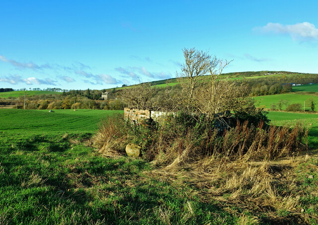
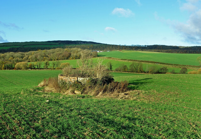
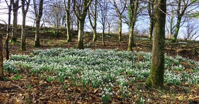
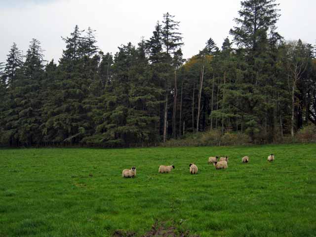
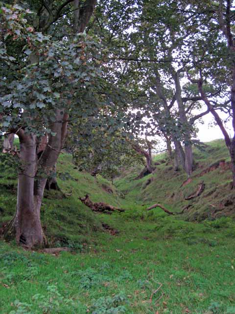
Blackwood Plantation is a picturesque forest located in Ayrshire, Scotland. Covering a vast area of land, this woodland offers a serene and tranquil environment for visitors to explore. The plantation is known for its dense growth of blackwood trees, which lend the area its name. These trees, also known as ebony wattle, are native to Australia and were introduced to Scotland in the 19th century.

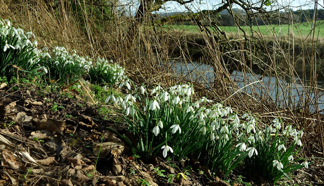
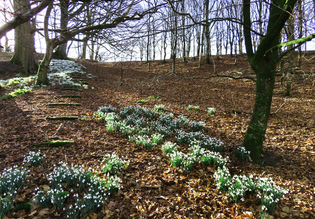
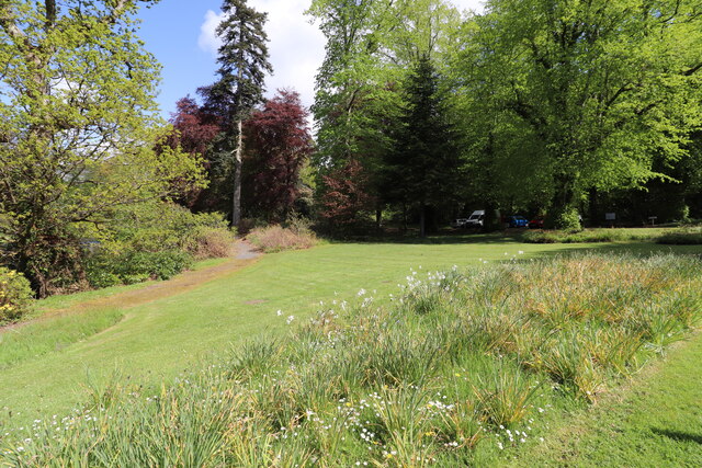
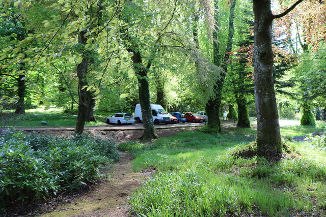
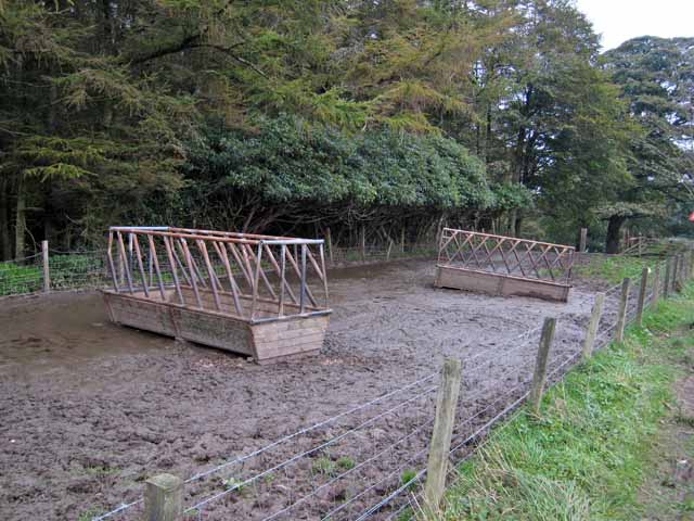
The forest is home to a diverse range of flora and fauna, making it a popular spot for nature enthusiasts and wildlife lovers. Walking trails wind through the plantation, allowing visitors to immerse themselves in the natural beauty of the surroundings. The peaceful atmosphere and the sound of birdsong create a soothing ambiance, providing a much-needed escape from the hustle and bustle of everyday life.

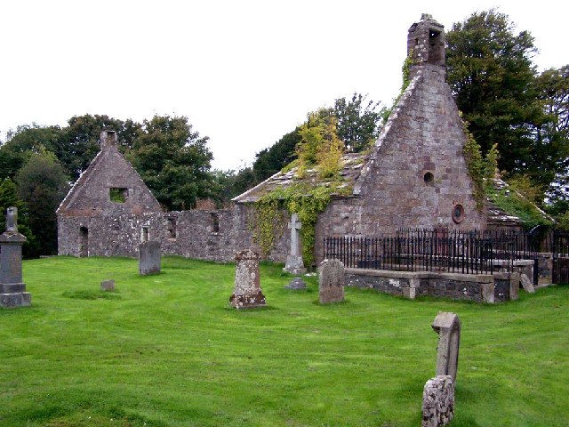
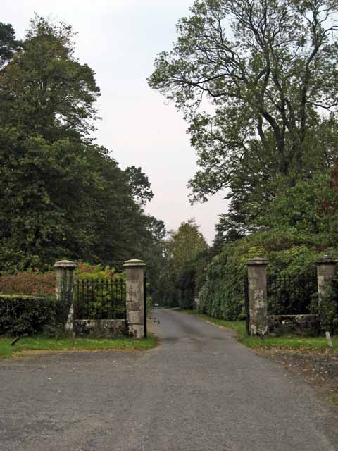
Blackwood Plantation is also of historical significance, as it was once part of the estate of a local noble family. The remnants of a grand mansion, which once stood in the heart of the forest, can still be seen today. These ruins serve as a reminder of the area's rich past and add a touch of mystery to the overall experience.

Whether it's a leisurely hike, a picnic amidst nature, or simply a quiet moment of reflection, Blackwood Plantation offers something for everyone. Its natural beauty, combined with its historical charm, makes it a must-visit destination for those seeking to connect with the beauty of the Scottish countryside.

If you have any feedback on the listing, please let us know in the comments section below.

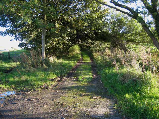
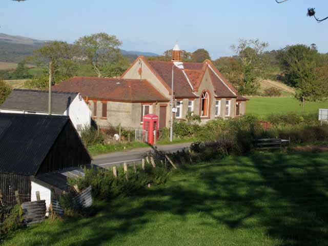
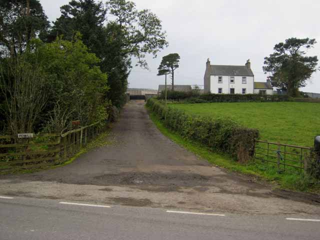
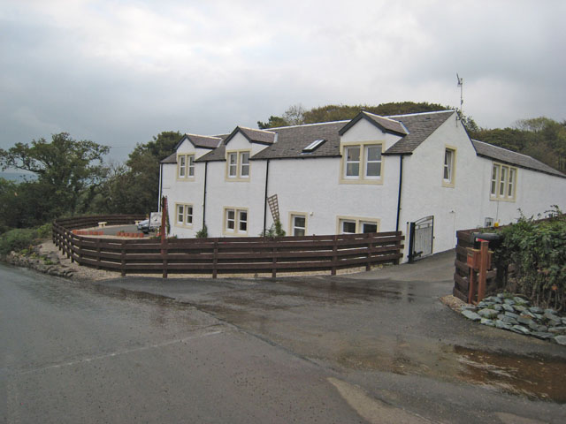
Blackwood Plantation Images

Images are sourced within 2km of 55.26109/-4.7667666 or Grid Reference NX2499. Thanks to Geograph Open Source API. All images are credited.

Old mine shaft at Hawkhill Farm A closer look at the old mine shaft at Hawkhill Farm. Killochan Castle is shown in the background on the other side of the Water of Girvan. The top of the strange boulder <a href="https://www.geograph.org.uk/photo/7024967">NS2300 : The strange boulder at Hawkhill Farm</a> is just visible on the left.
Old mine shaft at Hawkhill Farm
A closer look at the old mine shaft at Hawkhill Farm. Killochan Castle is shown in the background on the other side of the Water of Girvan. The top of the strange boulder NS2300 : The strange boulder at Hawkhill Farm is just visible on the left.
The old mine shaft at Hawkhill Farm The strange circular structure in the field at Hawkhill Farm is a shaft from an old coal mine, walled off for protection. The main part of the mine was on the other side of the road on Bargany Estate. See <a href="https://www.geograph.org.uk/photo/6783144">NX2399 : Old colliery site near Lovestone</a>
The old mine shaft at Hawkhill Farm
The strange circular structure in the field at Hawkhill Farm is a shaft from an old coal mine, walled off for protection. The main part of the mine was on the other side of the road on Bargany Estate. See NX2399 : Old colliery site near Lovestone
Snowdrops beside the Water of Girvan Occasional patches of snowdrops enjoy the sunshine alongside the Water of Girvan at Killochan Estate. The flowers have to fight their way through the previous year’s brambles and nettles.
Snowdrops beside the Water of Girvan
Occasional patches of snowdrops enjoy the sunshine alongside the Water of Girvan at Killochan Estate. The flowers have to fight their way through the previous year’s brambles and nettles.
Snowdrops in Lovestone woods My previous visit to this site in March 2021 was too late to see the flowers in bloom. The snowdrops were lovely this time though the February sun was only just reaching the slope.
Snowdrops in Lovestone woods
My previous visit to this site in March 2021 was too late to see the flowers in bloom. The snowdrops were lovely this time though the February sun was only just reaching the slope.
Snowdrops near Lovestone These snowdrops were spreading out in the woodland near the old colliery site. My previous visit to this spot <a href="https://www.geograph.org.uk/photo/6783144">NX2399 : Old colliery site near Lovestone</a> was too late to see the flowers in bloom. It was worth the return visit.
Snowdrops near Lovestone
These snowdrops were spreading out in the woodland near the old colliery site. My previous visit to this spot NX2399 : Old colliery site near Lovestone was too late to see the flowers in bloom. It was worth the return visit.
Picnic Area, Bargany Gardens Beautiful Garden but only open for the Month of May.
Picnic Area, Bargany Gardens
Beautiful Garden but only open for the Month of May.
Car Park, Bargany Gardens This is the main car park but there is also and overflow car park. Beautiful Garden but only open for the Month of May.
Car Park, Bargany Gardens
This is the main car park but there is also and overflow car park. Beautiful Garden but only open for the Month of May.
Old Dailly Church Built on the site of a 13th century chapel, this is known as the "Covenanter's Church" as it contains the graves of five 17th century Covenanters. <span class="nowrap"><a title="http://www.ayrshirepaths.org.uk/histdailly.htm" rel="nofollow ugc noopener" href="http://www.ayrshirepaths.org.uk/histdailly.htm">Link</a><img style="margin-left:2px;" alt="External link" title="External link - shift click to open in new window" src="https://s1.geograph.org.uk/img/external.png" width="10" height="10"/></span>
Old Dailly Church
Built on the site of a 13th century chapel, this is known as the "Covenanter's Church" as it contains the graves of five 17th century Covenanters. LinkExternal link
Back lane in the Girvan valley
Old school at Old Dailly
Penkill, near Old Dailly
Garryloop, Old Dailly Garryloop is the Anglicized form of "Gearaidh Lub" meaning "The Shieling at the bend between arable and hill ground". Notice how succinct Gaelic is compared with English? An old barn and cobbler's cottage, now rebuilt as comfortable modern accommodation, which operates as a well-appointed bed-and-breakfast and base for deer-stalking holidays. <span class="nowrap"><a title="http://www.ayrstalk.co.uk/accomodation.asp" rel="nofollow ugc noopener" href="http://www.ayrstalk.co.uk/accomodation.asp">Link</a><img style="margin-left:2px;" alt="External link" title="External link - shift click to open in new window" src="https://s1.geograph.org.uk/img/external.png" width="10" height="10"/></span>
Garryloop, Old Dailly
Garryloop is the Anglicized form of "Gearaidh Lub" meaning "The Shieling at the bend between arable and hill ground". Notice how succinct Gaelic is compared with English? An old barn and cobbler's cottage, now rebuilt as comfortable modern accommodation, which operates as a well-appointed bed-and-breakfast and base for deer-stalking holidays. LinkExternal link
Bargany Estate, near Old Dailly The tall trees line the southern driveway into the estate.
Bargany Estate, near Old Dailly
The tall trees line the southern driveway into the estate.
Cattle troughs near Dailly
Lodge to Penkill Castle
Gateway to the Bargany Estate Off the Dailly to Old Dailly road.
Gateway to the Bargany Estate
Off the Dailly to Old Dailly road.
Small wooded valley near Dailly
Hawkhill Farm This shot shows a field of barley beside the Water of Girvan, with Hawkhill Farm behind.
Hawkhill Farm
This shot shows a field of barley beside the Water of Girvan, with Hawkhill Farm behind.
Show me another place!

Blackwood Plantation is located at Grid Ref: NX2499 (Lat: 55.26109, Lng: -4.7667666)

Unitary Authority: South Ayrshire

Police Authority: Ayrshire

What 3 Words

///cubic.sprouting.elevator. Near Girvan, South Ayrshire

Related Wikis

Killochan Castle

Killochan Castle is a 16th-century L-plan tower house about 3 miles (4.8 km) north east of Girvan, South Ayrshire, Scotland, north of the Water of Girvan...

Penkill Castle

Penkill Castle is a 16th-century castle with later additions. It is around 1⁄2 mile (800 metres) south of Old Dailly, northeast of Girvan in south Ayrshire...

Killochan railway station

Killochan railway station was located in a rural part of South Ayrshire, Scotland and mainly served the nearby Killochan Castle estate. The Killochan bank...

Old Dailly

Old Dailly is a hamlet in South Ayrshire, Scotland. It is located west of Dailly (or "New Dailly"). The Charter or Blue stones of Old Dailly in Ayrshire...

Nearby Amenities

Located within 500m of 55.26109,-4.7667666
Bargany
Place: hamlet
Lat/Long: 55.2645903/-4.7674248
Barrier: yes
Lat/Long: 55.2603004/-4.7744218
The data included in this document is from www.openstreetmap.org. The data is made available under ODbL.

Have you been to Blackwood Plantation?

Leave your review of Blackwood Plantation below (or comments, questions and feedback).