Leapmoor Forest

Wood, Forest in Renfrewshire

Scotland

Leapmoor Forest

Heading north along the Kelly Cut path at White Hill
Heading north along the Kelly Cut path at White Hill Credit: Colin Park

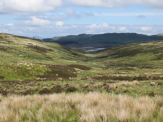
Leapmoor Forest is a stunning woodland area located in Renfrewshire, Scotland. Covering an expansive area of approximately 500 acres, it is a haven for nature lovers and outdoor enthusiasts alike.

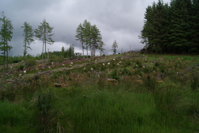
The forest is characterized by its diverse range of tree species, including oak, birch, beech, and pine, which create a vibrant and picturesque landscape throughout the year. The lush vegetation provides a habitat for a wide variety of wildlife, making it an ideal spot for birdwatching and animal spotting.

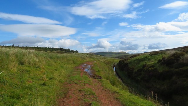
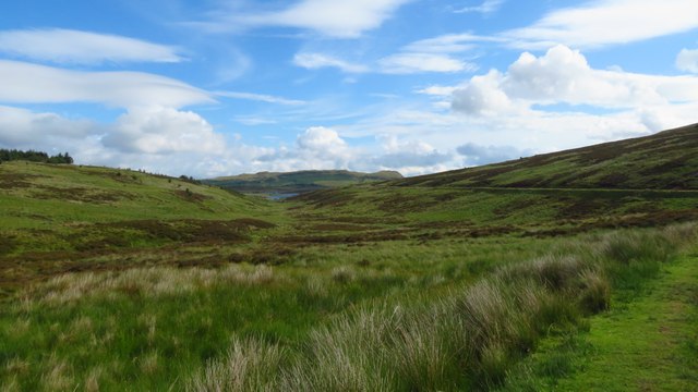
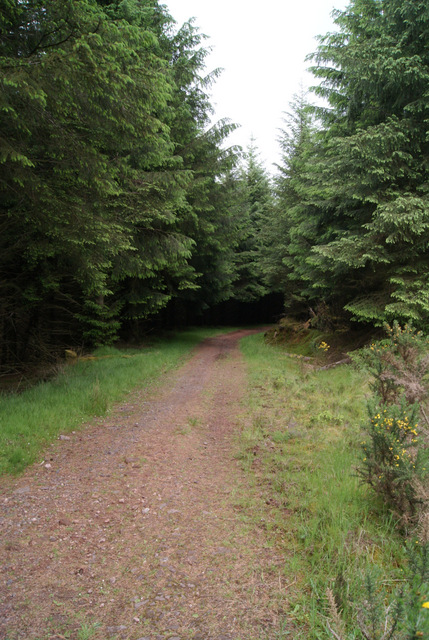
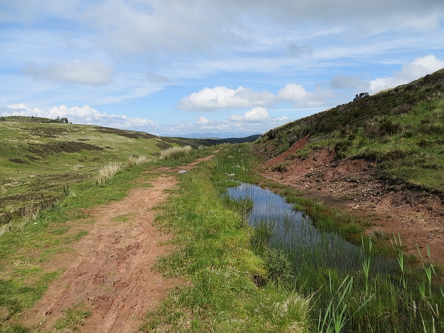
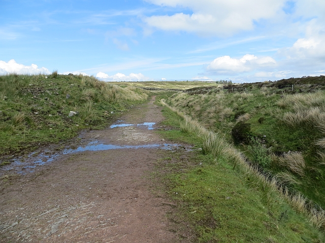
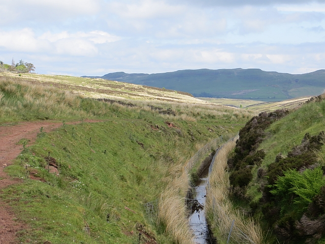
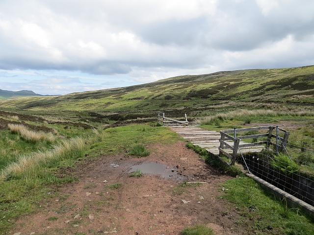
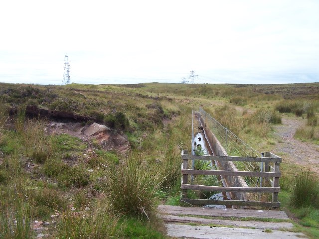
Trails and paths wind their way through the forest, offering visitors the opportunity to explore the area on foot or by bike. These routes cater to all levels of fitness and provide breathtaking views of the surrounding countryside. The forest is also intersected by a small river, adding to its scenic beauty.

Leapmoor Forest is a popular destination for outdoor activities such as hiking, picnicking, and camping. The peaceful atmosphere and serene surroundings make it an ideal place for relaxation and connecting with nature. There are designated camping areas with basic facilities available for those who wish to spend the night under the stars.

The forest is easily accessible, located just a short drive from nearby towns and villages. It offers a peaceful escape from the hustle and bustle of everyday life, allowing visitors to immerse themselves in the tranquility of nature. Leapmoor Forest is a true gem in Renfrewshire, providing a haven for wildlife and a place of solace for those seeking a connection with the natural world.

If you have any feedback on the listing, please let us know in the comments section below.

Leapmoor Forest Images

Images are sourced within 2km of 55.897156/-4.8448551 or Grid Reference NS2270. Thanks to Geograph Open Source API. All images are credited.

Heading north along the Kelly Cut path at White Hill
Following the Kelly Cut at the head of Glenshilloch Burn
Leapmoor Forest Looking towards the top of the hill on the main track through the forest.
Leapmoor Forest
Looking towards the top of the hill on the main track through the forest.
Leapmoor Forest On the downhill section towards Hill Farm Estate.
Leapmoor Forest
On the downhill section towards Hill Farm Estate.
Kelly Cut The cut at about halfway between Wemyss Bay and Cornalees. The path is very red and there is some sandstone exposed.
Kelly Cut
The cut at about halfway between Wemyss Bay and Cornalees. The path is very red and there is some sandstone exposed.
Kelly Cut Earthen track beside the old aqueduct, an 1840s extension to the Greenock Cut.
Kelly Cut
Earthen track beside the old aqueduct, an 1840s extension to the Greenock Cut.
Kelly Cut The aqueduct breaches a watershed between the Kelly Glen and Daff Glen. There is a deep cutting here.
Kelly Cut
The aqueduct breaches a watershed between the Kelly Glen and Daff Glen. There is a deep cutting here.
Bridge, Kelly Cut An overflow from the cut, it feeds the Glenshilloch Burn.
Bridge, Kelly Cut
An overflow from the cut, it feeds the Glenshilloch Burn.
Glenshilloch Burn A view down the course of the Glenshilloch Burn from the Kelly Cut.
Glenshilloch Burn
A view down the course of the Glenshilloch Burn from the Kelly Cut.
Half way sign, Kelly Cut Half way from Cornalees to Wemyss Bay.
Half way sign, Kelly Cut
Half way from Cornalees to Wemyss Bay.
Footbridge Over Glenshilloch burn on the Kelly Cut Trail not recommended for a cycle.
Footbridge
Over Glenshilloch burn on the Kelly Cut Trail not recommended for a cycle.
The Kelly Cut Stretches from Kelly Reservoir to Compensation Reservoir.
The Kelly Cut
Stretches from Kelly Reservoir to Compensation Reservoir.
Farmland and Leapmoor Forest Taken from the NW corner of the square looking SW, the southern tip of Leapmoor forest can be seen in the background.
Farmland and Leapmoor Forest
Taken from the NW corner of the square looking SW, the southern tip of Leapmoor forest can be seen in the background.
Trig Point on Blood Moss There are spectacular views in every direction from this point. Looking north, this view includes Dunoon and part of the Cowal Peninsula across the Firth of Clyde to the left and a snow capped Ben Lomond to the right.
Trig Point on Blood Moss
There are spectacular views in every direction from this point. Looking north, this view includes Dunoon and part of the Cowal Peninsula across the Firth of Clyde to the left and a snow capped Ben Lomond to the right.
Trig Point on Blood Moss Looking west with Inverkip Power Station chimney, Firth of Clyde and the Cowal Peninsula in the background.
Trig Point on Blood Moss
Looking west with Inverkip Power Station chimney, Firth of Clyde and the Cowal Peninsula in the background.
Pylons from Blood Moss Looking east from the trig point, with a line of pylons marching over the horizon towards Glasgow and the Central Belt.
Pylons from Blood Moss
Looking east from the trig point, with a line of pylons marching over the horizon towards Glasgow and the Central Belt.
Tree Harvesting in Leapmoor Forest Much of the south end of the forest has been harvested in recent months. There are plans to erect a ten mast "community" wind farm here (subject to planning approval). See <span class="nowrap"><a title="http://www.communitywindpower.co.uk/about_us.asp" rel="nofollow ugc noopener" href="http://www.communitywindpower.co.uk/about_us.asp">Link</a><img style="margin-left:2px;" alt="External link" title="External link - shift click to open in new window" src="https://s1.geograph.org.uk/img/external.png" width="10" height="10"/></span> for information about the wind farm developer. A pile of logs awaits collection in the middle of the picture.
Tree Harvesting in Leapmoor Forest
Much of the south end of the forest has been harvested in recent months. There are plans to erect a ten mast "community" wind farm here (subject to planning approval). See LinkExternal link for information about the wind farm developer. A pile of logs awaits collection in the middle of the picture.
Wenchly Top Inverkip Power Station chimney, the River Clyde and Cowal are visible beyond.
Wenchly Top
Inverkip Power Station chimney, the River Clyde and Cowal are visible beyond.
Show me another place!

Leapmoor Forest is located at Grid Ref: NS2270 (Lat: 55.897156, Lng: -4.8448551)

Unitary Authority: Inverclyde

Police Authority: Renfrewshire and Inverclyde

What 3 Words

///mandolin.elevates.actor. Near Inverkip, Inverclyde

Related Wikis

Inverkip

Inverkip (; Scottish Gaelic: Inbhir Chip) is a village and parish in the Inverclyde council area and historic county of Renfrewshire in the west central...

Inverkip railway station

Inverkip railway station is a railway station serving the village of Inverkip, Inverclyde, Scotland. The station is managed by ScotRail and is on the Inverclyde...

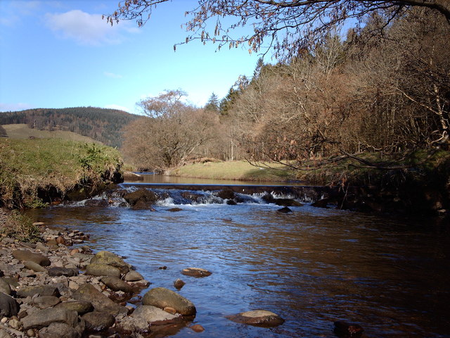
Kip Water, Inverclyde

Kip Water, also known as the River Kip, is a short river in Inverclyde, Scotland which gives the village of Inverkip its name (Inverkip = mouth of the...

Inverkip power station

Inverkip power station was an oil-fired power station in Inverclyde, on the west coast of Scotland. It was closer to Wemyss Bay than Inverkip, and dominated...
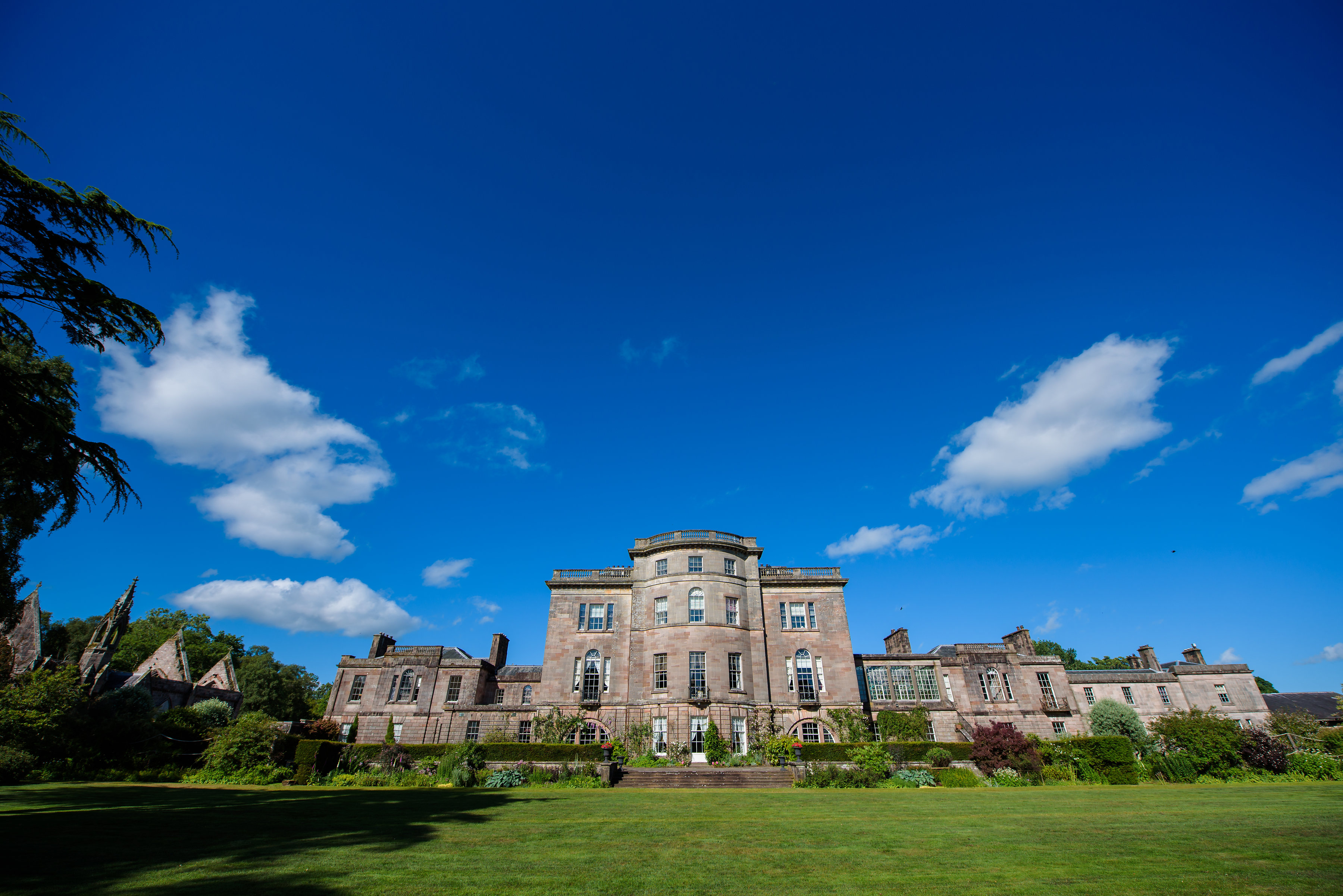
Ardgowan House

Ardgowan House, Castle & Gardens is a Privately owned late 18th-century mansion on the Firth of Clyde near Inverkip, Scotland. Ardgowan is located in Inverclyde...

Ardgowan Castle

Ardgowan Castle, originally called Inverkip Castle, is located in the Private Garden of "Ardgowan House, Castle & Gardens" near Inverkip, Scotland. It...

Wemyss Bay

Wemyss Bay ( ) is a village on the coast of the Firth of Clyde in Inverclyde in the west central Lowlands of Scotland. It is in the traditional county...

Castle Wemyss

Castle Wemyss was a large mansion in Wemyss Bay, Scotland. It stood on the southern shore of the Firth of Clyde at Wemyss Point, where the firth turns...

Nearby Amenities

Located within 500m of 55.897156,-4.8448551
The data included in this document is from www.openstreetmap.org. The data is made available under ODbL.

Have you been to Leapmoor Forest?

Leave your review of Leapmoor Forest below (or comments, questions and feedback).