Baldie's Plantation

Wood, Forest in Ayrshire

Scotland

Baldie's Plantation

View towards the Memorial of the Battle of Largs 1263 The Largs Pencil commemorates the Battle of Largs in 1263, between the Scots King Alexander the third and the Viking King Håkon Håkonsson.

For more details see:
<span class="nowrap"><a title="http://en.wikipedia.org/wiki/Battle_of_Largs" rel="nofollow ugc noopener" href="http://en.wikipedia.org/wiki/Battle_of_Largs">Link</a><img style="margin-left:2px;" alt="External link" title="External link - shift click to open in new window" src="https://s1.geograph.org.uk/img/external.png" width="10" height="10"/></span>

In the distance further North is the town of Largs
View towards the Memorial of the Battle of Largs 1263 Credit: Michael Jagger

Baldie's Plantation is a picturesque woodland located in Ayrshire, Scotland. Covering an area of approximately 100 acres, this enchanting forest is a haven for nature enthusiasts and outdoor adventurers alike. The plantation is situated just a few miles away from the charming town of Ayr, making it easily accessible for visitors.

As you step into Baldie's Plantation, you are greeted by a diverse range of tree species, including oak, beech, and birch. The towering trees form a dense canopy overhead, creating a serene and tranquil atmosphere within the woodland. The forest floor is adorned with a rich carpet of moss, ferns, and wildflowers, adding to the natural beauty and biodiversity of the area.

Several well-maintained walking trails wind their way through Baldie's Plantation, offering visitors the opportunity to explore the woodland at their own pace. These paths lead you deeper into the forest, where you can discover hidden streams, small waterfalls, and even a charming pond teeming with wildlife.

The plantation is home to a wide variety of bird species, making it a popular destination for birdwatchers. Visitors may be lucky enough to spot woodpeckers, owls, and other elusive woodland birds. Mammals such as deer, foxes, and squirrels also inhabit the area, adding to the natural charm and diversity of the plantation.

Baldie's Plantation provides a peaceful retreat from the hustle and bustle of everyday life, allowing visitors to reconnect with nature and appreciate the beauty of Scotland's woodlands. Whether you are seeking a leisurely walk, a birdwatching adventure, or simply a place to unwind, this enchanting forest is sure to captivate and inspire.

If you have any feedback on the listing, please let us know in the comments section below.

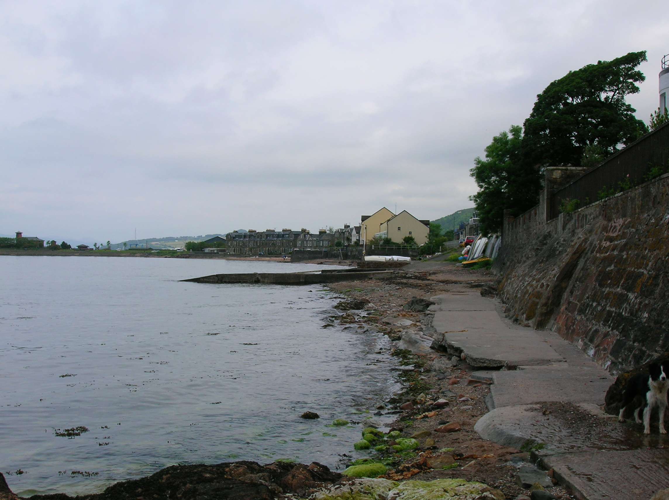
Baldie's Plantation Images

Images are sourced within 2km of 55.768609/-4.8357018 or Grid Reference NS2256. Thanks to Geograph Open Source API. All images are credited.

View towards the Memorial of the Battle of Largs 1263 The Largs Pencil commemorates the Battle of Largs in 1263, between the Scots King Alexander the third and the Viking King Håkon Håkonsson.

For more details see:
<span class="nowrap"><a title="http://en.wikipedia.org/wiki/Battle_of_Largs" rel="nofollow ugc noopener" href="http://en.wikipedia.org/wiki/Battle_of_Largs">Link</a><img style="margin-left:2px;" alt="External link" title="External link - shift click to open in new window" src="https://s1.geograph.org.uk/img/external.png" width="10" height="10"/></span>

In the distance further North is the town of Largs
View towards the Memorial of the Battle of Largs 1263
The Largs Pencil commemorates the Battle of Largs in 1263, between the Scots King Alexander the third and the Viking King Håkon Håkonsson. For more details see: LinkExternal link In the distance further North is the town of Largs
Coastal view towards Hunterston Terminal near Fairlie In the distance is the terminal where bulk carriers can unload their cargoes, it was originally built for Iron Ore, but is now mainly used for Coal.

For more details see:
<span class="nowrap"><a title="http://en.wikipedia.org/wiki/Hunterston_Terminal" rel="nofollow ugc noopener" href="http://en.wikipedia.org/wiki/Hunterston_Terminal">Link</a><img style="margin-left:2px;" alt="External link" title="External link - shift click to open in new window" src="https://s1.geograph.org.uk/img/external.png" width="10" height="10"/></span>

To the far left is Largs Yacht haven, the breakwaters can be seen that protect the marina, a yacht is just about to enter the marina.

For more details see:
<span class="nowrap"><a title="http://www.yachthavens.com/largs" rel="nofollow ugc noopener" href="http://www.yachthavens.com/largs">Link</a><img style="margin-left:2px;" alt="External link" title="External link - shift click to open in new window" src="https://s1.geograph.org.uk/img/external.png" width="10" height="10"/></span>
Coastal view towards Hunterston Terminal near Fairlie
In the distance is the terminal where bulk carriers can unload their cargoes, it was originally built for Iron Ore, but is now mainly used for Coal. For more details see: LinkExternal link To the far left is Largs Yacht haven, the breakwaters can be seen that protect the marina, a yacht is just about to enter the marina. For more details see: LinkExternal link
View looking North towards Largs on the Clyde Coast Largs is a holiday resort on the shores of the Firth of Clyde, a short trip from Glasgow. It became a fashionable resort in the 19th Century, for more details see:
<span class="nowrap"><a title="http://en.wikipedia.org/wiki/Largs" rel="nofollow ugc noopener" href="http://en.wikipedia.org/wiki/Largs">Link</a><img style="margin-left:2px;" alt="External link" title="External link - shift click to open in new window" src="https://s1.geograph.org.uk/img/external.png" width="10" height="10"/></span>
View looking North towards Largs on the Clyde Coast
Largs is a holiday resort on the shores of the Firth of Clyde, a short trip from Glasgow. It became a fashionable resort in the 19th Century, for more details see: LinkExternal link
View towards Largs Yacht Haven The Yacht Haven (Marina) is to the left of the picture.
In the foreground the local Red Sandstone can be seen, from which many of the local Largs buildings have been built, including the Church.

For more details about the local Geology see:
<span class="nowrap"><a title="www.dailymail.co.uk/.../Kelburn-Castle-How-landslide-provided-geologists-unique-look-ancient-landscape.html" rel="nofollow ugc noopener" href="http://www.dailymail.co.uk/.../Kelburn-Castle-How-landslide-provided-geologists-unique-look-ancient-landscape.html">Link</a><img style="margin-left:2px;" alt="External link" title="External link - shift click to open in new window" src="https://s1.geograph.org.uk/img/external.png" width="10" height="10"/></span>
View towards Largs Yacht Haven
The Yacht Haven (Marina) is to the left of the picture. In the foreground the local Red Sandstone can be seen, from which many of the local Largs buildings have been built, including the Church. For more details about the local Geology see: LinkExternal link
View North west from Haylie Brae In the distance can be seen Cowal Peninsula
View North west from Haylie Brae
In the distance can be seen Cowal Peninsula
Track leading to A760 at Haylie Brae A760 road can be seen a bottom of hill
Track leading to A760 at Haylie Brae
A760 road can be seen a bottom of hill
Haylie Reservoir seen from Haylie Brae
Haylie Brae view towards Great Cumbrae
Exit track from car park at Haylie Brae
Marina, Largs On a very hazy day looking through the masts to Hunterston Ore Terminal jetty and cranes.
Marina, Largs
On a very hazy day looking through the masts to Hunterston Ore Terminal jetty and cranes.
Big tree, little pond A fine specimen of a sycamore in a Fairlie garden.
Big tree, little pond
A fine specimen of a sycamore in a Fairlie garden.
Sea wall At Fairlie beach.
Sea wall
At Fairlie beach.
Reception building At Largs marina.
Reception building
At Largs marina.
Launching the RIB A rigid inflatable boat being launched from the Marina slipway at Largs Marina. The Largs 'Pencil' monument features in the background.
Launching the RIB
A rigid inflatable boat being launched from the Marina slipway at Largs Marina. The Largs 'Pencil' monument features in the background.
Through the centre of Fairlie
A78 approaching church at Fairlie
Junction for Kelburn Country Centre
A78 entering Largs
A78 entering Largs
Show me another place!

Baldie's Plantation is located at Grid Ref: NS2256 (Lat: 55.768609, Lng: -4.8357018)

Unitary Authority: North Ayrshire

Police Authority: Ayrshire

What 3 Words

///owners.passively.cheeses. Near Fairlie, North Ayrshire

Related Wikis

Kelburn Castle

Kelburn Castle is a large house near Fairlie, North Ayrshire, Scotland. It is the seat of the Earl of Glasgow. Originally built in the thirteenth century...

Fairlie, North Ayrshire

Fairlie is a village in North Ayrshire, Scotland. == Location and status == Fairlie sits on the eastern shore of the Firth of Clyde and looks across to...

Fairlie Pier railway station

Fairlie Pier railway station was a railway station serving the village of Fairlie, North Ayrshire, Scotland. The station allowed train passengers to link...
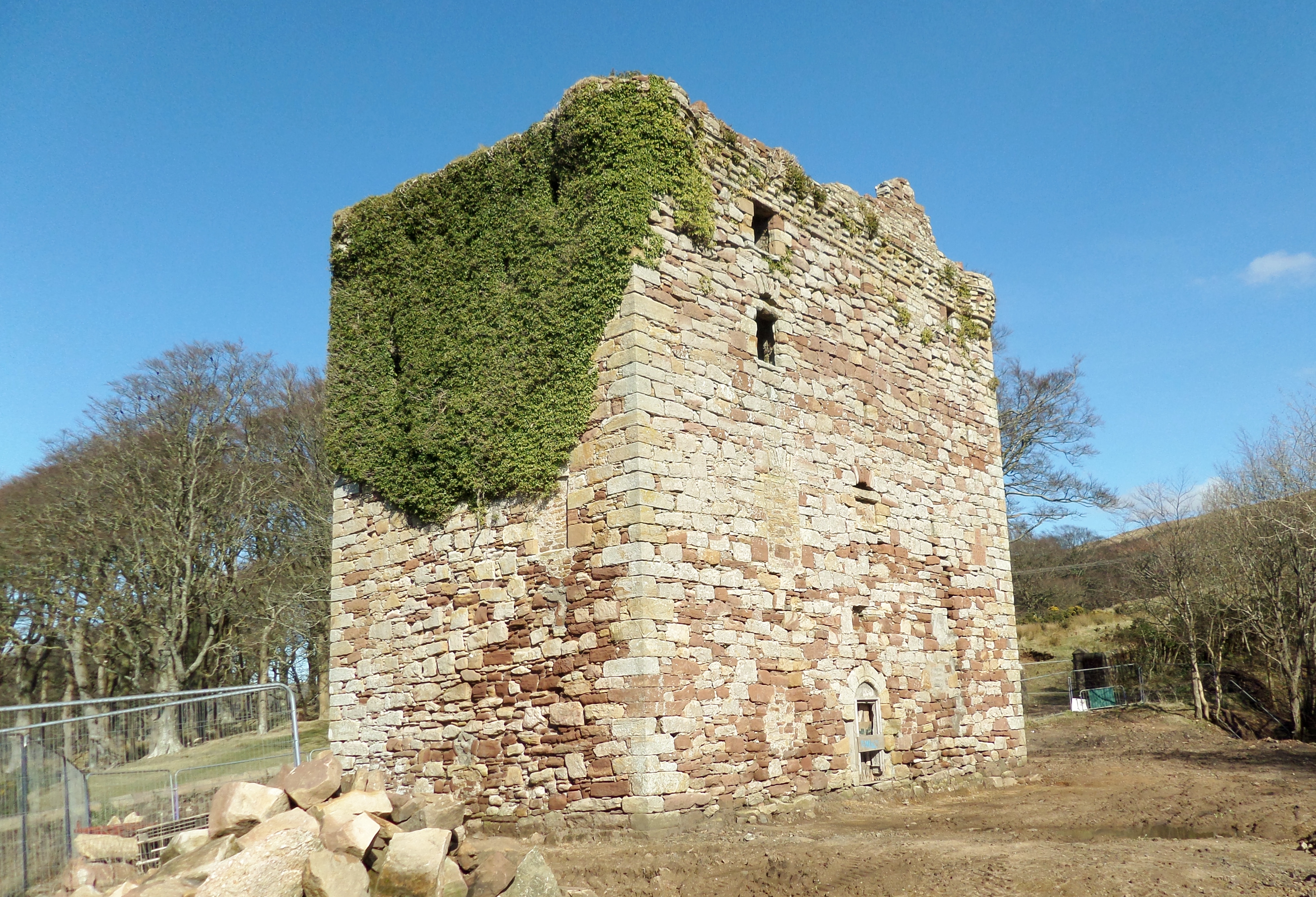
Fairlie Castle

Fairlie Castle is a restored oblong tower castle located on a natural rounded knoll situated above a precipitous section of the Fairlie Glen near the town...

Nearby Amenities

Located within 500m of 55.768609,-4.8357018
Power: pole
Lat/Long: 55.7678696/-4.8323557
Power: pole
Lat/Long: 55.7673885/-4.8335494
Power: pole
Lat/Long: 55.7668413/-4.8348698
Power: pole
Lat/Long: 55.7696338/-4.8279795
Power: pole
Lat/Long: 55.7661351/-4.8351522
Power: pole
Lat/Long: 55.7692845/-4.8288454
Power: pole
Lat/Long: 55.7654468/-4.835422
Power: pole
Lat/Long: 55.7688754/-4.8298602
Power: pole
Lat/Long: 55.7683775/-4.8310957
Power: pole
Lat/Long: 55.7647436/-4.835722
The Waterfall
Natural: yes
Lat/Long: 55.7703787/-4.8424597
Tourism: viewpoint
Lat/Long: 55.7663564/-4.8413485
Power: pole
Lat/Long: 55.7706957/-4.829738
The data included in this document is from www.openstreetmap.org. The data is made available under ODbL.

Have you been to Baldie's Plantation?

Leave your review of Baldie's Plantation below (or comments, questions and feedback).