Killoup Wood

Wood, Forest in Ayrshire

Scotland

Killoup Wood

Grant’s distillery at Grangestone 2021 This updated view looking towards Grangestone shows how the distillery has expanded. There’s still more building going on. Viewed from the next square. For a 1975 view, see <a href="https://www.geograph.org.uk/photo/6993413">NX2099 : Grant’s distillery at Grangestone 1975</a>
Grant’s distillery at Grangestone 2021 Credit: Mary and Angus Hogg

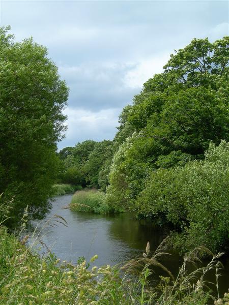
Killoup Wood is a picturesque forest located in the region of Ayrshire, Scotland. Covering an area of approximately 200 acres, this woodland is renowned for its natural beauty and diverse flora and fauna. The woodland is situated near the village of Crosshill, just a few miles from the bustling town of Maybole.

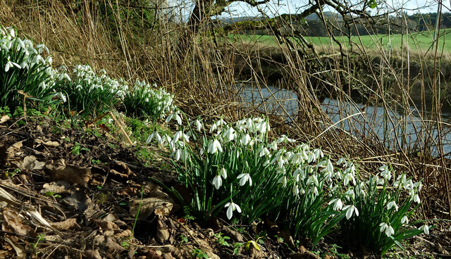
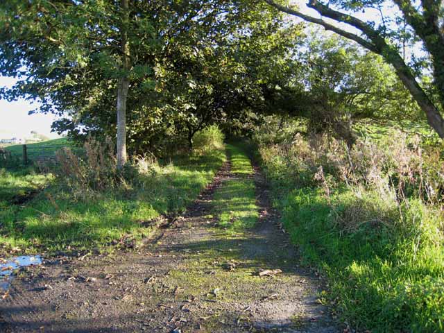
Killoup Wood boasts a variety of tree species, including oak, birch, beech, and conifers. These towering trees create a dense canopy, providing shade and shelter for a rich undergrowth of ferns, brambles, and wildflowers. The forest floor is carpeted with moss and fallen leaves, creating a serene and peaceful atmosphere.

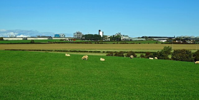
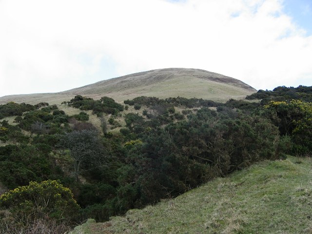
The wood is intersected by several winding paths, making it a popular destination for walkers, hikers, and nature enthusiasts. These paths offer breathtaking views of the surrounding countryside, with rolling hills and farmland stretching as far as the eye can see.

Wildlife thrives in Killoup Wood, with an abundance of bird species such as woodpeckers, owls, and thrushes. Squirrels can often be seen scurrying through the trees, while deer and rabbits occasionally make an appearance.

Visitors can explore the wood at their own pace, immersing themselves in the tranquil surroundings and enjoying the sounds of nature. Whether it's a leisurely stroll, a family picnic, or birdwatching, Killoup Wood offers a perfect retreat from the hustle and bustle of everyday life.

If you have any feedback on the listing, please let us know in the comments section below.

Killoup Wood Images

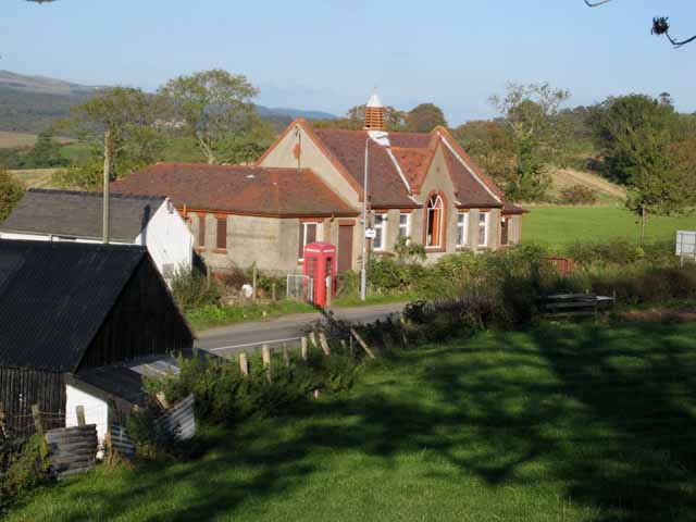
Images are sourced within 2km of 55.24971/-4.8134842 or Grid Reference NX2198. Thanks to Geograph Open Source API. All images are credited.

Grant’s distillery at Grangestone 2021 This updated view looking towards Grangestone shows how the distillery has expanded. There’s still more building going on. Viewed from the next square. For a 1975 view, see <a href="https://www.geograph.org.uk/photo/6993413">NX2099 : Grant’s distillery at Grangestone 1975</a>
Grant’s distillery at Grangestone 2021
This updated view looking towards Grangestone shows how the distillery has expanded. There’s still more building going on. Viewed from the next square. For a 1975 view, see NX2099 : Grant’s distillery at Grangestone 1975
Grant’s distillery at Grangestone 1975 Viewed from an adjoining square, this old scanned slide shows early development at the distillery outside Girvan. For a 2021 view, see <a href="https://www.geograph.org.uk/photo/6993412">NX2099 : Grant’s distillery at Grangestone 2021</a>
Grant’s distillery at Grangestone 1975
Viewed from an adjoining square, this old scanned slide shows early development at the distillery outside Girvan. For a 2021 view, see NX2099 : Grant’s distillery at Grangestone 2021
Snowdrops beside the Water of Girvan Occasional patches of snowdrops enjoy the sunshine alongside the Water of Girvan at Killochan Estate. The flowers have to fight their way through the previous year’s brambles and nettles.
Snowdrops beside the Water of Girvan
Occasional patches of snowdrops enjoy the sunshine alongside the Water of Girvan at Killochan Estate. The flowers have to fight their way through the previous year’s brambles and nettles.
On Saugh Hill Taken from the summit. Ailsa Craig a long way out.
On Saugh Hill
Taken from the summit. Ailsa Craig a long way out.
Slopes of Saugh Hill Saugh hill rises above a whin filled ravine at NX202972
Slopes of Saugh Hill
Saugh hill rises above a whin filled ravine at NX202972
Old Dailly Church Built on the site of a 13th century chapel, this is known as the "Covenanter's Church" as it contains the graves of five 17th century Covenanters. <span class="nowrap"><a title="http://www.ayrshirepaths.org.uk/histdailly.htm" rel="nofollow ugc noopener" href="http://www.ayrshirepaths.org.uk/histdailly.htm">Link</a><img style="margin-left:2px;" alt="External link" title="External link - shift click to open in new window" src="https://s1.geograph.org.uk/img/external.png" width="10" height="10"/></span>
Old Dailly Church
Built on the site of a 13th century chapel, this is known as the "Covenanter's Church" as it contains the graves of five 17th century Covenanters. LinkExternal link
Grant's Distillery, Girvan This enormous distillery, more reminiscent of a chemical works, was built in 1963 to manufacture grain whisky for Grant's blended products. <span class="nowrap"><a title="http://www.scotchwhisky.net/distilleries/girvan.htm" rel="nofollow ugc noopener" href="http://www.scotchwhisky.net/distilleries/girvan.htm">Link</a><img style="margin-left:2px;" alt="External link" title="External link - shift click to open in new window" src="https://s1.geograph.org.uk/img/external.png" width="10" height="10"/></span>
Grant's Distillery, Girvan
This enormous distillery, more reminiscent of a chemical works, was built in 1963 to manufacture grain whisky for Grant's blended products. LinkExternal link
Girvan Early Growers The operational base for a consortium of six local producers of early potatoes. <span class="nowrap"><a title="http://www.saos.co.uk/girvan.htm" rel="nofollow ugc noopener" href="http://www.saos.co.uk/girvan.htm">Link</a><img style="margin-left:2px;" alt="External link" title="External link - shift click to open in new window" src="https://s1.geograph.org.uk/img/external.png" width="10" height="10"/></span>
Girvan Early Growers
The operational base for a consortium of six local producers of early potatoes. LinkExternal link
Farm road at Macrindlestone, near Girvan Leading under the Ayr to Girvan railway.
Farm road at Macrindlestone, near Girvan
Leading under the Ayr to Girvan railway.
Back lane in the Girvan valley
Old school at Old Dailly
Penkill, near Old Dailly
Lodge to Penkill Castle
Water of Girvan Looking downstream in mid-June, after a night of heavy rain.
Water of Girvan
Looking downstream in mid-June, after a night of heavy rain.
Brae Farm At the foot of Saugh Hill. Seen from the B734 Barr to Girvan road.
Brae Farm
At the foot of Saugh Hill. Seen from the B734 Barr to Girvan road.
Brae Farm At the foot of Saugh Hill. Seen from the B734 Barr to Girvan road.
Brae Farm
At the foot of Saugh Hill. Seen from the B734 Barr to Girvan road.
Laigh Killoup Cottage in the fields seen from the B734 Barr to Girvan road.
Laigh Killoup
Cottage in the fields seen from the B734 Barr to Girvan road.
Laigh Killoup Cottage in the fields, seen from the B734 Barr to Girvan road.
Laigh Killoup
Cottage in the fields, seen from the B734 Barr to Girvan road.
Show me another place!

Killoup Wood is located at Grid Ref: NX2198 (Lat: 55.24971, Lng: -4.8134842)

Unitary Authority: South Ayrshire

Police Authority: Ayrshire

What 3 Words

///bystander.plunge.reform. Near Girvan, South Ayrshire

Related Wikis

Old Dailly

Old Dailly is a hamlet in South Ayrshire, Scotland. It is located west of Dailly (or "New Dailly"). The Charter or Blue stones of Old Dailly in Ayrshire...

Grangeston Halt railway station

The Grangeston Halt railway station was a private station that was not listed in the public timetables, located in a rural part of South Ayrshire, Scotland...

Ladyburn distillery

Ladyburn distillery was a producer of single malt Scotch whisky that operated between 1966 and 1975. == History == The Ladyburn distillery was an expansion...

Girvan distillery

Girvan distillery is a grain whisky distillery located in South Ayrshire, Scotland. The distillery is owned by William Grant & Sons. The Girvan Distillery...

Nearby Amenities

Located within 500m of 55.24971,-4.8134842
Power: pole
Lat/Long: 55.250697/-4.820163
Power: pole
Lat/Long: 55.2499188/-4.8194012
Power: pole
Lat/Long: 55.2491544/-4.8191705
Power: pole
Lat/Long: 55.2483823/-4.8189318
Power: pole
Lat/Long: 55.2476469/-4.8187092
Power: pole
Lat/Long: 55.2475184/-4.8197579
Power: pole
Lat/Long: 55.2535134/-4.8096016
Power: pole
Lat/Long: 55.2530492/-4.8106239
Power: pole
Lat/Long: 55.2525917/-4.8116272
Power: pole
Lat/Long: 55.2522688/-4.8124063
Power: pole
Lat/Long: 55.2517978/-4.8131594
Power: pole
Lat/Long: 55.2512898/-4.8140329
The data included in this document is from www.openstreetmap.org. The data is made available under ODbL.

Have you been to Killoup Wood?

Leave your review of Killoup Wood below (or comments, questions and feedback).